- Mallacoota, Victoria
-
Mallacoota
Victoria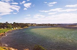
Mallacoota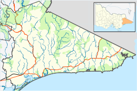
 Mallacoota
Population: 972(2006)[1] Postcode: 3892 Coordinates: 37°33′S 149°45′E / 37.55°S 149.75°ECoordinates: 37°33′S 149°45′E / 37.55°S 149.75°E Elevation: 22 m (72 ft) Location: LGA: Shire of East Gippsland State District: Gippsland East Federal Division: Gippsland Mean max temp Mean min temp Annual rainfall 19.3 °C
67 °F10.7 °C
51 °F939.4 mm
37 in Mallacoota Camping Park
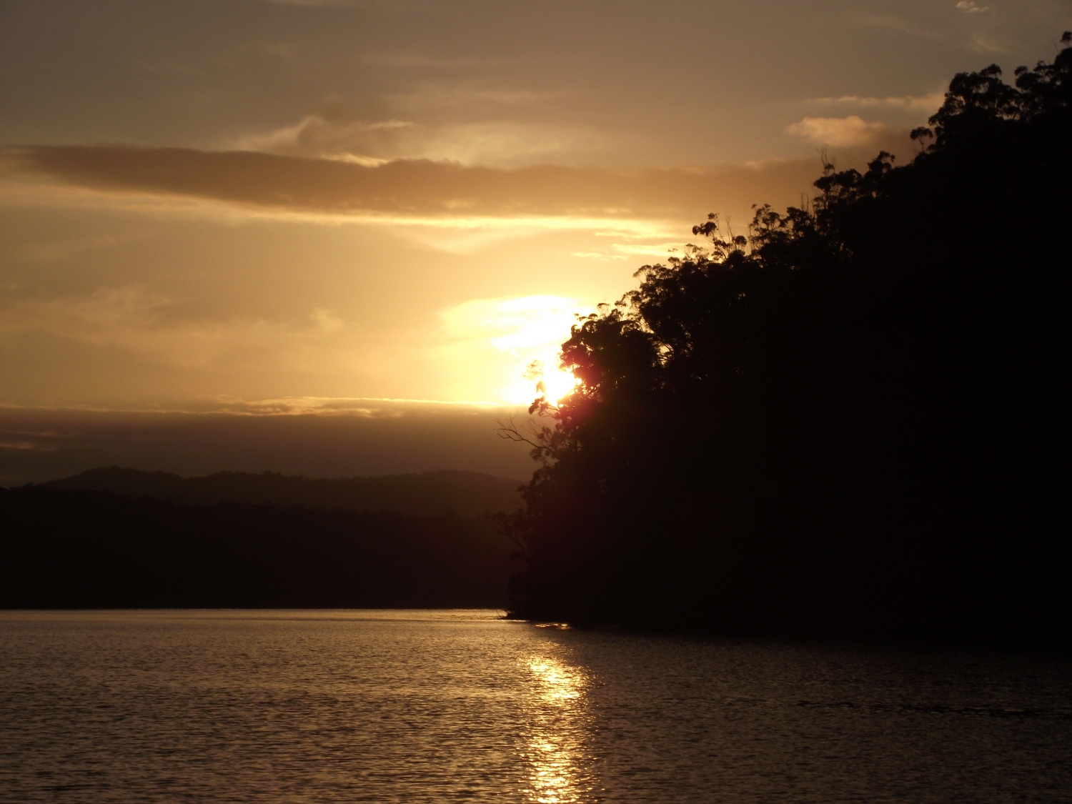
 Mallacoota Lake Sunset
Mallacoota is a small town in the East Gippsland region of Victoria, Australia. At the 2006 census, Mallacoota had a population of 972. At holiday times, particularly Easter and Christmas, the population increases by about 8,000. It is one of the most isolated towns in the state of Victoria, 25 kilometres off the Princes Highway and 523 kilometres (325 mi) from Melbourne. It is 526 kilometres (327 mi) from Sydney, New South Wales. It is halfway between Melbourne and Sydney when travelling via Princes Highway, though that is a long route between Australia's two main cities. It is the last official township on Victoria's east coast before the border with New South Wales. Mallacoota has a regional airport (Mallacoota Airport) YMCO (XMC) consisting of a grassed field for private light planes.
It is known for its wild flowers, abalone industry, the inlet estuary consisting of Top Lake and Bottom Lake, and Croajingolong National Park that surround it. It is a popular and beautiful holiday spot for boating, fishing, walking the wilderness coast, swimming, birdwatching, and surfing. The Mallacoota Arts Council runs events throughout each year. Mallacoota Inlet is one of the main villages along the wilderness coast walk from NSW to Victoria, Australia.
Mallacoota's main surfing beach, Bastion Point, has one of its best learning breaks and natural beauty under threat.[2] There is some dissension and protest about this plan.
The closest large town, that locals go to for things like shopping, banking, hiring[clarification needed] and many other things is Eden in New South Wales.[citation needed]
Contents
History
Prehistory the area was part of the territory of the Bidawal people. Settlers started to arrive in the 1830s. A small timber lighthouse was installed on nearby Gabo Island in 1854, and the existing granite lighthouse was completed in 1862. By the 1880s commercial fishing was well established, with some catch being shipped south to Melbourne. At the same time the first tourists started to arrive. Gold was discovered in 1894, after which the Spotted Dog Mine operated for three years. Mallacoota Post Office opened on 7 May 1894 and Mallacoota West in 1901. In 1928 Mallacoota West was renamed Mallacoota, and Mallacoota became Mallacoota East (closing in 1940).[3] A satellite airfield was constructed during World War II for the purpose of coastal defence. During the 20th century the logging, farming and fishing industries in the area declined, and the tourism and abalone industries grew. The town's largest employer, the abalone co-operative, was formed in 1967.
Sport
Golfers play at the course of the Mallacoota Golf and Country Club on Nelson Drive.[4]
The Sydney Swans' 2005 premiership winning defender and current St Kilda player Sean Dempster hails from Mallacoota.[5]
Climate
Climate data for Mallacoota Month Jan Feb Mar Apr May Jun Jul Aug Sep Oct Nov Dec Year Average high °C (°F) 24.0
(75.2)23.9
(75.0)22.2
(72.0)19.8
(67.6)17.4
(63.3)15.4
(59.7)14.8
(58.6)15.7
(60.3)17.4
(63.3)18.8
(65.8)20.2
(68.4)21.8
(71.2)19.3 Average low °C (°F) 15.4
(59.7)15.5
(59.9)13.8
(56.8)11.4
(52.5)9.4
(48.9)7.4
(45.3)6.3
(43.3)6.4
(43.5)8.1
(46.6)9.6
(49.3)11.7
(53.1)13.3
(55.9)10.7 Precipitation mm (inches) 64.4
(2.535)61.2
(2.409)69.6
(2.74)92.4
(3.638)84.6
(3.331)87.6
(3.449)85.8
(3.378)66.5
(2.618)82.7
(3.256)79.1
(3.114)91.5
(3.602)73.2
(2.882)937.8
(36.921)Source: [6] References
- ^ Australian Bureau of Statistics (25 October 2007). "Mallacoota (State Suburb)". 2006 Census QuickStats. http://www.censusdata.abs.gov.au/ABSNavigation/prenav/LocationSearch?collection=Census&period=2006&areacode=SSC26083&producttype=QuickStats&breadcrumb=PL&action=401. Retrieved 2007-10-01.
- ^ ACF - East Gippsland Council proposal bad for Bastion Point.
- ^ Premier Postal History, Post Office List, https://www.premierpostal.com/cgi-bin/wsProd.sh/Viewpocdwrapper.p?SortBy=VIC&country=, retrieved 2008-04-11
- ^ Golf Select, Mallacoota, http://www.golfselect.com.au/armchair/courseView.aspx?course_id=1018, retrieved 2009-05-11
- ^ http://www.abc.net.au/news/stories/2005/09/23/1466816.htm
- ^ "Climate Statistics For Mallacoota". Australian Bureau of Meteorology. May 2011. http://www.bom.gov.au/climate/averages/tables/cw_084084.shtml.
External links
- Mallacoota District Health and Support Service
- Local community radio station, 3MGB
- Mallacoota Arts Council
Towns in East Gippsland Shire Anglers Rest · Bairnsdale · Bellbird Creek · Bemm River · Benambra · Bendoc · Buchan · Bruthen · Cabbage Tree Creek · Cann River · Cape Conran · Cassilis · Club Terrace · Deddick · Eagle Point · Ensay · Gelantipy · Genoa · Gipsy Point · Goongerah · Johnsonville · Lakes Entrance · Lake Tyers Beach · Lindenow · Mallacoota · Marlo · Metung · Mossiface · Nicholson · Nowa Nowa · Nungurner · Omeo · Orbost · Paynesville · Raymond Island · Swan Reach · Swifts Creek · Tambo Crossing · Tambo Upper · Twin Rivers · W Tree · Woodglen · Wulgulmerang
Categories:- Towns in Victoria (Australia)
- Coastal towns in Victoria (Australia)
- East Gippsland
- Australian Aboriginal placenames


Wikimedia Foundation. 2010.