- Mahanadi River
-
River Mahanadi River  The Mahanadi
Name origin: From Sanskrit "Maha" (great) and "Nadi" (river) Country India Parts Chhattisgarh, Madhya Pradesh, Orissa Regions Dandakaranya, Kosal, Coastal Plains Administrative
areasBetul, Raipur, Janjgir, Bilaspur, Sambalpur, Subarnapur, Boudh, Anugul, Cuttack, Kendrapada Tributaries - left Seonath, Telen, Ib Cities Sambalpur, Cuttack, Sonepur, Birmaharajpur, Subalaya, Boudh Landmarks Satkosia Gorge, Sonapur Lanka, Hookitola Falls Source - location Sihawa, Dhamtari, Dandakaranya, Chhattisgarh, India - elevation 877 m (2,877 ft) - coordinates 20°07′N 81°55′E / 20.11°N 81.91°E Mouth - location False Point, Kendrapada, Delta, Orissa, India - elevation 0 m (0 ft) Length 900 km (559 mi) Basin 132,100 km2 (51,004 sq mi) Discharge for False Point, Orissa - average 2,013 m3/s (71,088 cu ft/s) - max 56,700 m3/s (2,002,342 cu ft/s) The Mahanadi (lit.: Great River) (OR - ମହାନଦୀ) in East Central India. It drains an area of around 132,100 km2 and has a total course of 858 km.[1] The river flows through the states of Chhattisgarh and Orissa.
Contents
Source
Like many other seasonal Indian rivers, the Mahanadi too is a combination of many mountain streams and thus its precise source is impossible to pinpoint. However its farthest headwaters lie 6 km from Pharisiya village 442 m above sea level south of Nagri town in Dhamtari district of Chhattisgarh.[2][3] The hills here are an extension of the Eastern Ghats and are a source of many other streams which then go on to join the Mahanadi.
For the first 80 km of its course, the Mahanadi flows in a northerly direction and drains the Raipur district and touches eastern portions of Raipur city. It is a rather narrow river at this stage, the total length of its valley not exceeding 500–600 metres. It then enters the old Bilaspur district where it is joined by its first major tributary, the Seonath.[2]
Middle Course
After being joined by the Seonath, the river flows in an easterly direction through the remaining part of its journey. It is joined by the Jonk and Hasdeo rivers here before entering into Orissa after covering about half of its total length. Near the city of Sambalpur, it is dammed by the largest earthen dam in the world, the Hirakud Dam. A composite structure of earth, concrete and masonry, the dam measures 24 km including dykes. It spans two hills; the Lamdungri on the left and the Chandili Dunguri on the right. It also forms the biggest artificial lake in Asia, with a reservoir holding 743 km² at full capacity, with a shoreline of over 640 km.[4]
Before the construction of the dam in 1953, the Mahanadi was about a mile wide at Sambalpur and carried massive amounts of silt, especially during the monsoon. Today, it is a rather tame river after the dam and is joined by the Ib, Ong, Tel and other minor streams. It then skirts the boundaries of the Baudh district and forces a tortuous way between ridges and ledges in a series of rapids until it reaches Dholpur, Orissa. The rapids end here and the river rolls towards the Eastern Ghats, forcing its way through them via the 64 km long Satkosia Gorge.The satakosia Gorge ends at badamul of nayagarh Dense forests cover the hills flanking the river here. The river enters the Orissa plains at Naraj, about 11 km from Cuttack, where it pours down between two hills a mile apart. A barrage has been constructed here to regulate the river's flow into Cuttack.
Mouth
 The Mahanadi after Sambalpur. Also shown is the Brahmani
 The Mahanadi River Delta at False Point. North is on the left hand side
The river traverses Cuttack district in an east-west direction. Just before entering Cuttack city, it gives off a large distributary called the Kathjori. The city of Cuttack stands on the spit separating the two channels. The Kathjori then throws off many streams like the Kuakhai, Devi and Surua which fall into the Bay of Bengal after entering Puri district. The Kathjori itself falls into the sea as the Jotdar. Other distributaries of Mahanadi include the Paika, Birupa, Chitartala, Genguti and Nun. The Birupa then goes on to join the Brahmani River at Krushnanagar and enters the Bay of Bengal at Dhamra. The Mahanadi proper enters the sea via several channels near Paradeep at False Point, Jagatsinghpur. The combined Delta of the Mahanadi's numerous distributaries and the Brahmani is one of the largest in India.[4]
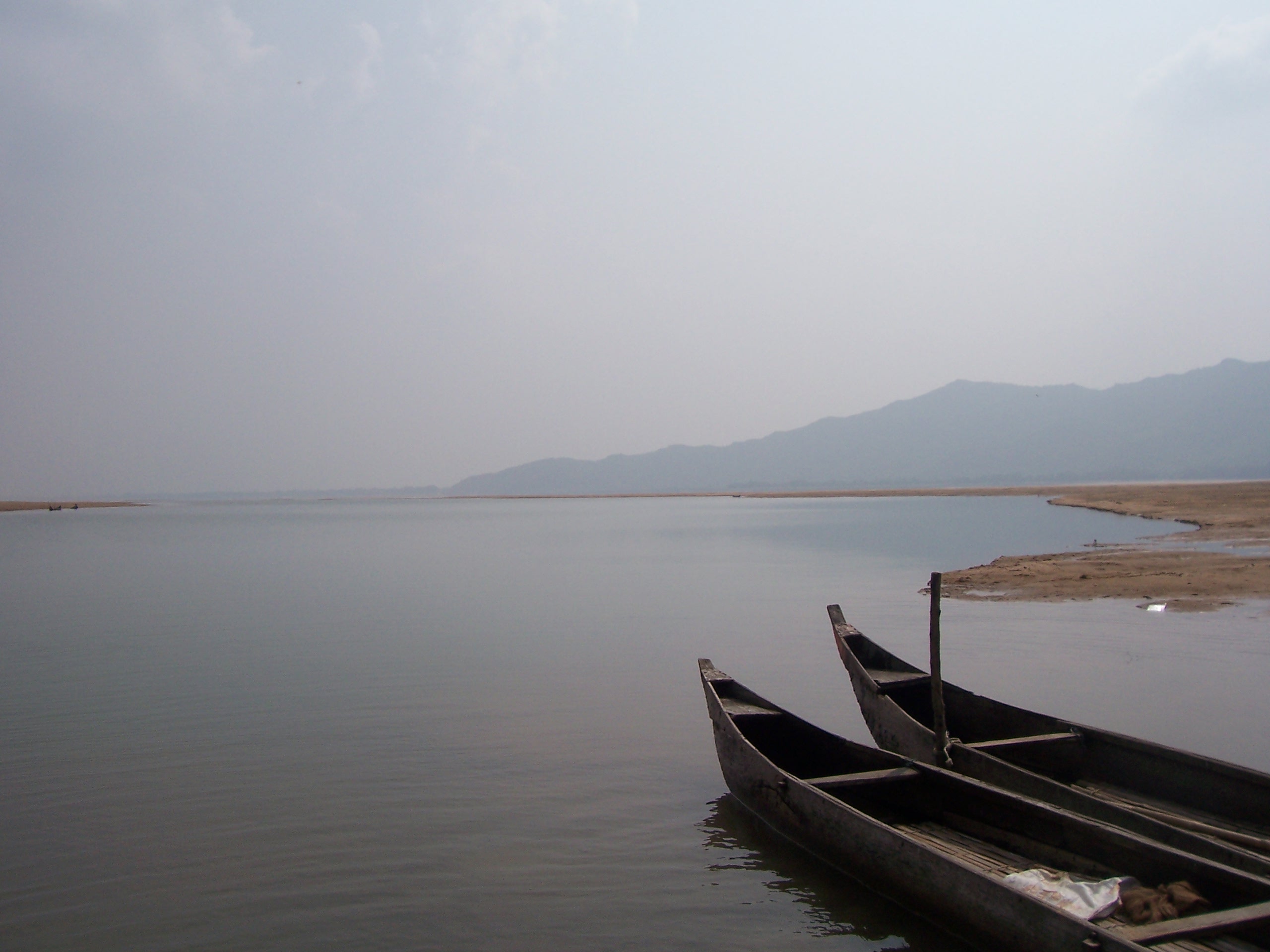
Prior to the construction of the Hirakud Dam, the Mahanadi was navigable from its mouth up to Arrang , about a 150 km from its source. However numerous barrages apart from the Hirakud have put an end to that. Today, boats are restricted to the delta region and the Hirakud reservoir.[5]
Trade and Agriculture
 Mahanadi River
The city of Sambalpur was a prominent trading place for diamonds in the ancient world and the river itself has been referred to as the Manada in Ptolemy's works. However today the Mahanadi valley is best known for its fertile soil and flourishing agriculture. Prior to the Hirakud dam, the river carried more silt than any other river in the Indian subcontinent.[6] As a result its delta had one of the highest yield per acre in the whole of India. Today agriculture primarily depends on a network of canals that arise from the river. Rice, oilseeds and sugarcane are the principal crops here. An equally fertile though smaller valley also exists near Raipurd in the river's early course.
Water
An average annual surface water potential of 66.9 km³ has been assessed in this basin. Out of this, 50.0 km³ is utilisable water. Culturable area in the basin is about 80,000 km², which is 4% of the total culturable area of the country.
Present use of surface water in the basin is 17.0 km³. Live storage capacity in the basin has increased significantly since independence. From just about 0.8 km³ in the pre-plan period, the total live storage capacity of the completed projects has increased to 8.5 km³. In addition, a substantial storage quantity of over 5.4 km³ would be created on completion of projects under construction. Additional storage to the tune of over 11.0 km³ would become available on execution of projects under consideration. The hydropower potential of the basin has been assessed as 627 MW at 60% load factor.
At its peak during the monsoon, the Mahanadi has a discharge rate of 2 million cubic ft. per second,[2] almost as much as the much largerGanges. However owing to its seasonal nature the river is mostly a narrow channel flanked by wide sand banks for most of the year.
Floods
The Mahanadi was notorious for its devastating floods for much of recorded history. However the construction of the Hirakud Dam has greatly altered the situation. Today a network of canals, barrages and check dams keep the river well in control. However heavy rain can still cause large scale flooding as evidenced in September, 2008 when 16 people died as the river breached its banks.
In 2011, September heavy down pour of rain caused flash flood and many mud dwellings in more than 25 villages above Hirakud Dam which were never got affected before; both in Chhattisgarh and Orissa have melted down due to back water, which could not pass through the river.
See also
- List of rivers of Madhya Pradesh
Notes
- ^ http://www.britannica.com/EBchecked/topic/357908/Mahanadi-River
- ^ a b c [1]
- ^ and Water Resources of India by Sharad K. Jain, Pushpendra K. Agarwal, Vijay P. Singh
- ^ a b http://sambalpur.nic.in/hirakud%20dam.htm
- ^ http://dsal.uchicago.edu/reference/gazetteer/pager.html?objectid=DS405.1.I34_V16_438.gif
- ^ http://www.questia.com/library/encyclopedia/mahanadi.jsp
References
The Imperial Gazetteer of India-William Hunter, 1901
The Encyclopædia Britannica-1911 Ed.
The Columbus EncyclopediaExternal links
- Bargarh district topography
- Burnt paddy and dead fish
- Orissa Govt. blamed for declining quality of river water
- Mahanadi River
Hydrology of South Asia Inland Indus · Ganges · Yamuna · Chenab · Jhelum · Bhagirathi River · Brahmaputra · Godavari · Narmada · Tapti · Ravi · Beas · Sutlej · Padma · Sarasvati · Sharda · Krishna · Kaveri · Kali River · Meghna · Gandaki River · Mahanadi · Mahaweli · Son · Ghaghara · Betwa · Chambal · Kosi · Sankosh · Ganges Basin · Ganges Delta · Indus Delta · Dal Lake · Pookode Lake · Skeleton Lake · Chilka Lake · Lake Powai · Borith Lake · Saiful Muluk · Gosaikunda · Nizam Sagar · Red Hills Lake · Malampuzha · Kerala Backwaters · Damodar · LuniCoastal Categories Lakes of India / Nepal / Pakistan · Reservoirs and dams in India · Rivers of Bangladesh / Bhutan / India / Nepal / PakistanHydrology of Orissa Rivers Bhargavi • Baitarani • Brahmani • Budhabalanga • Daya • Devi • Kadua • Kharkai • Koina • Kushabhadra • Mahanadi • Malguni • Nagavali • Ong • Rushikulya • Sankh • South Karo • South Koel • Subarnarekha • Surubalijora • Tel • Telen • VamsadharaLakes Anshupa • ChilkaWaterfalls Hot springs Beaches Dams Bridges Second Mahanadi Rail BridgeHarbours/Ports/Proposed Ports Hydrology of surrounding areas Andhra Pradesh • Chhattisgarh • Jharkhand • BengalHydrology of Chhattishgarh Rivers Waterfalls Chitrakoot • TeerathgarhDams Hydrology of surrounding areas Orissa • Jharkhand • Uttar Pradesh • Madhya Pradesh • Maharashtra • Andhra PradeshMahanadi-Brahmani-Baitarani Basin Rivers Dams, barrages Geographical features Dandakaranya • Dakshina Kosala Kingdom • Chota Nagpur Plateau • Western Orissa • Mahanadi River Delta • Bhitarkanika MangrovesRiparian districts Chhattisgarh Dhamtari • Kanker • Raipur • Janjgir-Champa • Raigarh • Jashpur • Korba • Koriya • Surguja Madhya Pradesh Anuppur Jharkhand Gumla • Khunti • Ranchi • West Singhbhum Orissa Jharsuguda • Kendujhar • Mayurbhanj • Sundergarh • Boudh • Angul • Jajpur • Cuttack • Kendrapara • Khordha • Jagatsinghpur • PuriLanguages/ people Coalfields Industries Korba Super Thermal Power PlantTransport Related topics Hydrology of Chhattisgarh • Hydrology of Jharkhand • Hydrology of OrissaCategories:- Mahanadi River
- Rivers of India
- Rivers of Kosal


![[1]](http://dsal.uchicago.edu/reference/gazetteer/pager.html?objectid=DS405.1.I34_V16_437.gif)
Wikimedia Foundation. 2010.