- Baláže
Geobox | Settlement
name = Baláže
native_name =
other_name =
category = Village
image_caption =
symbol =
etymology =
official_name =
motto =
nickname =
country = Slovakia
country_
state =
region = Banská Bystrica
district = Banská Bystrica
municipality =
parent =
parent_type =
part =
river =
location =
elevation = 550
lat_d = 48
lat_m = 49
lat_NS = N
long_d = 19
long_m = 12
long_EW = E
coordinates_type = region:SK_type:city
highest =
highest_elevation =
highest_lat_d =
highest_long_d =
lowest =
lowest_elevation =
lowest_lat_d =
lowest_long_d =
area = 14.22
area_round = 2
population = 193
population_date = 1 January 2005
population_density = auto
established =1529
established_type = First mentioned
mayor = Jozef Kubiš
timezone =
timezone_DST =
postal_code = 976 11
area_code = +421-48
code = BB
code_type = Car plate
free =
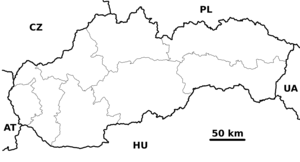
map_background = Slovakia - background map.png
map_locator = Slovakia
commons =
statistics = [http://www.statistics.sk/mosmis/eng/prvav2.jsp?txtUroven430601&lstObec508471&Okruhzaklad MOŠ/MIS]
website = [http://www.balaze.wz.cz www.balaze.wz.cz]
footnotes =Baláže ( _de. Lipscherseifen; _hu. Balázs) is a
village andmunicipality of theBanská Bystrica District in theBanská Bystrica Region ofSlovakia .History
In historical records, the
village was first mentioned in1529 (1529 "Huttae Lyptyczae", 1531 "Lyptzcicz", 1540 "Lypschersaifen"), when it belonged to a certain citizen Kolmann fromBanská Bystrica . Later, it was sold to Lang, Glocknitzer, Petermann and Königsberger. From1469 to1546 it belonged to the noble family ofThurzo and the rich merchantsFugger s.


Wikimedia Foundation. 2010.