- Nesluša
-
Nesluša Village 
Country Slovakia Region Žilina District Kysucké Nové Mesto Elevation 410 m (1,345 ft) Coordinates 49°19′N 18°45′E / 49.317°N 18.75°E Area 25.48 km2 (9.84 sq mi) Population 3,205 (2004-12-31) Density 126 / km2 (326 / sq mi) First mentioned 1367 Postal code 023 41 Area code +421-41 Car plate KM 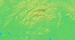

 Location of Nesluša in Slovakia
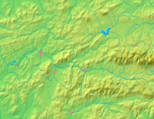
 Location of Nesluša in the Žilina Region
Statistics: MOŠ/MIS Website: www.neslusa.sk Nesluša is a village and municipality in the Kysucké Nové Mesto District in the Zilina Region of northern Slovakia.
Contents
History
In historical records the village was first mentioned in 1367.
Historical variants of the name
- Nezlusa (1367)
- Neszlusa (1438)
- Valachorum (1593)
- Neslussa (1598)
- Nesluša (1883)
- Neszlény, Nesluša (1920)
- Nesluša (1991)
Geography
The municipality lies at an altitude of 439 metres and covers an area of 25.472km². The highest hill in village is Jakubovský vrch 875 m. The second highest hill in village is Žiar 869 m. Least place is Nádolie 370 m. Village has many mineral springs. Nesluša is situated between green hills. The main creek is Neslušanka. The Village is adjacent to the municipalities of Kysucké Nové Mesto, Ochodnica, Zákopčie, Dlhá nad Kysucou, Rudinská and Rudina.
Culture
Žiarinka
Ensemble was established in of the year 1995. Main instrument of the ensemble is mandolin. Children indeed play also on guitar, accordion, keyboards, flute and drums. Repertory is rather rich, includes sequences from operas, extravaganzas, waltzes, polkas, movie melodies and marches. Till we are graduation above 200 recitals. Performance are in various towns homesters commonwealth, as well as abroad: Germany, Yugoslavia, Poland and Czech Republic. Program, as well as whole appearance, be in useful to performance in balneal towns, frame : within the frame musical grain, too near opening and finished show and buying market, as well as celebrate various jubilee spoil and commune. Records in chronicle and response in media sit of it, that our appearance myself tickle sincere interests wide public.
Demography
Nesluša has a population of about 3,205 people.
Historical demography
 Nesluša's music ensemble Žiarinka
- 1715 - 792 inhabitants
- 1828 - 2498 inhabitants
- 1869 - 2032 inhabitants
- 1880 - 1746 inhabitants
- 1890 - 1912 inhabitants
- 1900 - 1997 inhabitants
- 1910 - 2288 inhabitants
- 1921 - 2483 inhabitants
- 1930 - 2746 inhabitants
- 1940 - 3153 inhabitants
- 1948 - 3155 inhabitants
- 1961 - 4045 inhabitants
- 1970 - 4045 inhabitants
- 1975 - 3412 inhabitants
- 1980 - 3645 inhabitants
- 1990 - 3263 inhabitants
- 2006 - 3205 inhabitants
Parts of the village
 Nesluša
- u Adamkov
- u Burďakov
- Červené
- Drndovce
- Guckovce
- Halúskovce
- Holovce
- Homoľovce
- Chovancovce
- Janáčovce
- Jancovce
- Juríčkovce
- Klimkovce
- Kozí vŕšok
- Krúpovce
- Kutiny
- Na Kavuli
- Na Lane
- Na Vyšnej ceste
- Na pastovníku
- Pri Mlyne
- Na Žrebíkoch
- Parišovce
- Paukovce
- Platkovce
- Puškátka
- Skokanovce
- Sucháňovce
- Štrbavovce
- Tabakovce
- Vlkovce
List parts of village in highland
 Bielovce
- Balošákovce
- Čulákovce
- Grešákovce
- Horná Suchá
- U Hutyrov
- U Jurdov
- Kantorovce
- Kubalovce
- Liskovce
- U Bielych
- U Haľamov
- Majtánky
- Mičekovce
- Ondruškovci
- Ostré
- Petránky
- Rapaňovce
- Stredná Suchá
- Šindelná
- Škorvanovce
- Tabačkovce
- U Samuhlích
Sport
Hockeyball
- Pivní skauti is a hockeyball team playing the Nesluša hockeyball league.
Accommodation
- Hotel Les
- Centrum
Politics
The mayor is Marian Chovaňák.
External links
Kysucké Nové Mesto
Dolný Vadičov · Horný Vadičov · Kysucký Lieskovec · Lodno · Lopušné Pažite · Nesluša · Ochodnica · Povina · Radoľa · Rudina · Rudinka · Rudinská · Snežnica Categories:
- Villages and municipalities in Kysucké Nové Mesto District


Wikimedia Foundation. 2010.