- Horná Štubňa
Geobox | Settlement
name = Horná Štubňa
other_name =
category = Village

image_caption =
symbol =
etymology =
official_name =
motto =
nickname =
country = Slovakia
country_
state =
region = Žilina
district = Turčianske Teplice
municipality =
part =
river =
location =
elevation = 627
lat_d = 48.82493
lat_NS = N
long_d = 18.88423
long_EW = E
coordinates_type = region:SK_type:city
coordinates_format = dms
highest =
highest_elevation =
highest_lat_d =
highest_long_d =
lowest =
lowest_elevation =
lowest_lat_d =
lowest_long_d =
area = 31.388
area_round = 2
population = 1621
population_date = 2005-12-31
population_density = auto
established = 1390
established_type = First mentioned
mayor =
timezone =
timezone_DST =
postal_code = 038 46
area_code = +421-43
code = TR
code_type = Car plate
free =
map_background = Slovakia - background map.png
map_locator = Slovakia
map1 = Žilina Region - outline map.svg
map1_background = Žilina Region - background map.png
map1_locator = Žilina Region
commons =
statistics = [http://www.statistics.sk/mosmis/eng/prvav2.jsp?txtUroven430509&lstObec512273&Okruhzaklad MOŠ/MIS]
website =
footnotes =Horná Štubňa is a
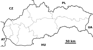
village andmunicipality inTurčianske Teplice District in theŽilina Region of northern centralSlovakia .History
In historical records the village was first mentioned in
1390 .Geography
The
municipality lies at analtitude of 627metres and covers anarea of 31.388km². It has apopulation of about 1,610 people.Famous people
*
Emília Vášáryová , actress


Wikimedia Foundation. 2010.