- Kláštor pod Znievom
Geobox|Settlement
name = Kláštor pod Znievom
native_name =
other_name =
category = Village
etymology =
official_name =
motto =
nickname =
image_caption =
symbol =
symbol_type =
country = Slovakia
country_
state =
region = Žilina
district = Martin
municipality =
landmark =
river =
location =
elevation = 500
prominence =
lat_d =48 | lat_m =58 | lat_s =20 | lat_NS =N
long_d =18 | long_m =48 | long_s =30 | long_EW =E
highest =
highest_location = | highest_region = | highest_state =
highest_elevation =
highest_lat_d = | highest_lat_m = | highest_lat_s = | highest_lat_NS =
highest_long_d = | highest_long_m = | highest_long_s = | highest_long_EW =
lowest =
lowest_location = | lowest_region = | lowest_state =
lowest_elevation =
lowest_lat_d = | lowest_lat_m = | lowest_lat_s = | lowest_lat_NS =
lowest_long_d = | lowest_long_m = | lowest_long_s = | lowest_long_EW =
length = | length_orientation =
width = | width_orientation =
area = 39.029
area_land =
area_water =
area_urban =
area_metro =
population =1499 | population_date =2005-12-31
population_urban =
population_metro =
population_density = auto
population_density_urban =
population_density_metro =
established =1113
established_type = First mentioned
date =
government =
government_location = | government_region = | government_state =
government_elevation =
government_lat_d = | government_lat_m = | government_lat_s = | government_lat_NS =
government_long_d = | government_long_m = | government_long_s = | government_long_EW =
mayor =
leader =
timezone =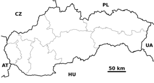
map_caption = Location of Kláštor pod Znievom within Slovakia
map_background = Slovakia - background map.png
map1 = Žilina Region - outline map.svg
map1_caption = Location of Kláštor pod Znievom within the Žilina Region
map1_background = Žilina Region - background map.png
website = [http://www.obecklastor.sk www.obecklastor.sk]
commons =
footnotes =Source: http://www.statistics.sk/mosmis/eng/run.html Municipal Statistics from the Statistical Office of the Slovak republic]Kláštor pod Znievom is a
village andmunicipality inMartin District in theŽilina Region of northernSlovakia , south west from Martin, near theMalá Fatra mountains.History
In historical records the
village was first mentioned in1113 as a settlement under theZniev castle. From 1242 to 1249 the castle was the seat of kingBéla IV of Hungary . Around the half of the 13th century, the settlement got town privileges as the first one in theTuriec region, but it lost them in 1666 during at the times ofreformation andcounter-reformation .In the second half of the 19th century, Kláštor pod Znievom became one of the centres of Slovak national movement, as one of three Slovak high schools was opened here in 1869, but was closed down in 1874 as a result of theMagyarization policy.Geography
The
municipality lies at analtitude of 500metres and covers anarea of 39.029km². It has apopulation of about 1481 people.People
*
Alexander Moyzes , composerReferences
External links
* [http://www.obecklastor.sk Official website] sk icon


Wikimedia Foundation. 2010.