- Liathach
-
Spidean a' Choire Léith 
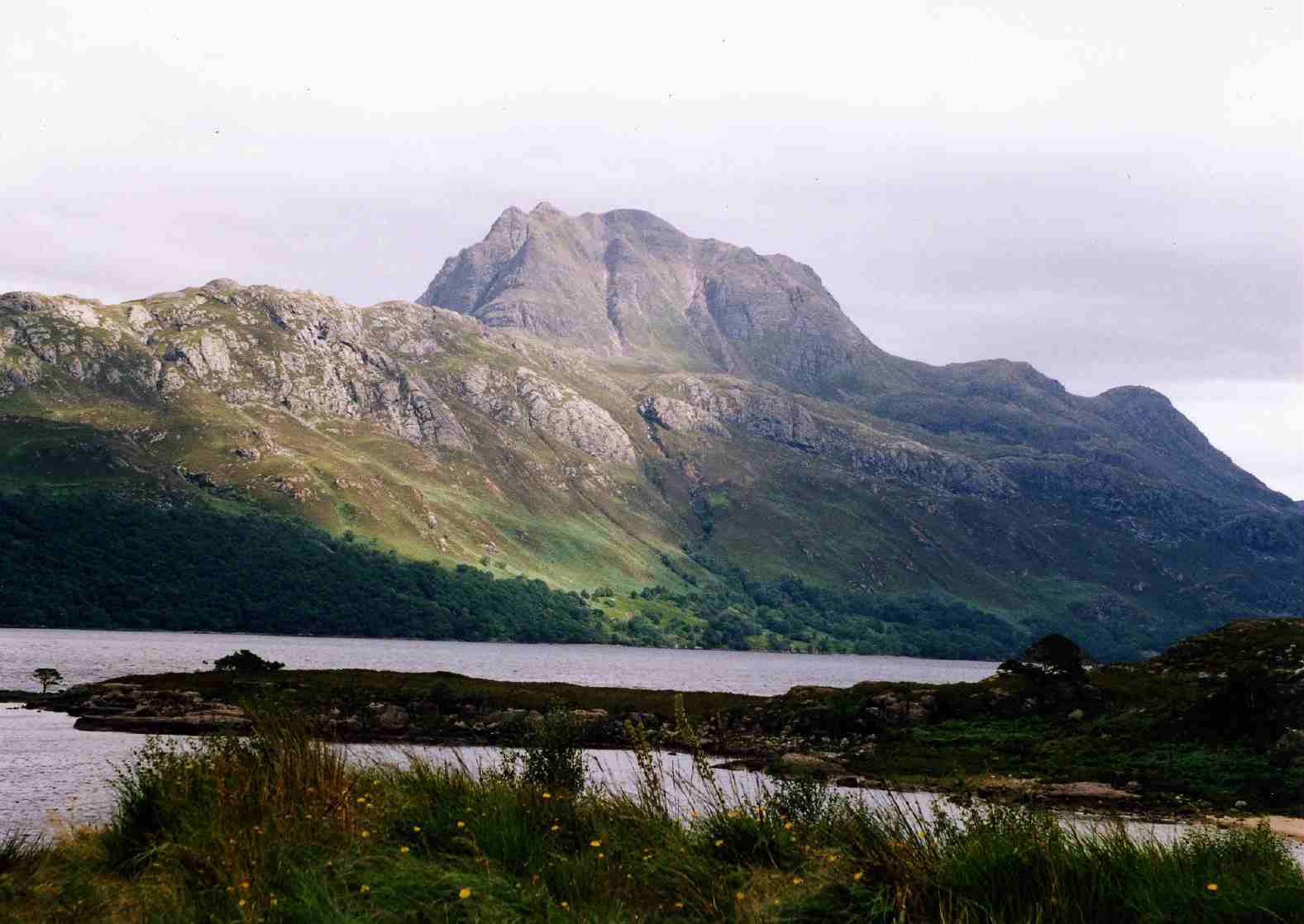
Looking west along LiathachElevation 1,055 m (3,461 ft) Prominence 957 m (3,140 ft) Ranked 8th in British Isles Parent peak Càrn Eige Listing Marilyn, Munro Translation Peak of the Grey Corries (Gaelic) Pronunciation Scottish Gaelic: [ˈs̪pitʲan ə ˈxɔɾʲə ˈʎeː] Location Location Torridon, Scotland Topo map OS Landranger 25 OS grid NG929579 Listed summits of Liathach Name Grid ref Height Status Mullach an Rathain NG912577 1023 m (3,356 ft) Marilyn, Munro Meall Dearg NG913579 955 m (3133 ft) Munro Top Stob a' Choire Liath Mhòr NG932581 983 m (3225 ft) Munro Top Am Fasarinen NG923574 927 m (3041 ft) Munro Top Stuc a' Choire Dhuibh Bhig NG942582 915 m (3002 ft) Munro Top  Liathach seen from Beinn Eighe. With the Munro “Top“ of Stuc a' Choire Dhuibh Bhig (915 metres) in the foreground and the two Munro summits in the background.
Liathach is one of the most famous of the Torridon Hills. It lies to the north of the A896 road, in the Northwest Highlands of Scotland, and has two peaks of Munro status: Spidean a' Choire Leith at the east of the main ridge, and Mullach an Rathain at the western end of the mountain. The name Liathach is pronounced [ˈʎiə.əx] in Scottish Gaelic, and means 'The grey one'. Liathach conveys an aura of impregnability when seen from the roadside below, as the slopes appear to rise up in a series of near vertical rocky terraces
Contents
Geology
The mountain is composed of Torridonian sandstone which forms massive near-horizontal strata. They form the numerous terraces that are obvious from afar. The rocks are mainly red and chocolate sandstones, arkoses, flagstones and shales with coarse conglomerates locally at the base. Some of the materials of these rocks were derived from the underlying Lewisian gneiss, upon the uneven surface of which they rest, but the bulk of the material was obtained from rocks that are nowhere now exposed. Upon this ancient denuded land surface the Torridonian strata rest horizontally or with gentle inclination. Some of the peaks, such as Beinn Eighe, are capped with white quartzite, giving them a distinctive appearance when seen from afar. Some of the quartzite contains fossilized worm burrows and is known as pipe rock. It is circa 500 million years old. The Torridon landscape is itself highly denuded by glacial and alluvial action, and represents the remnants of an ancient peneplain.
Challenging Traverse
The traverse of the hill including both of the above peaks is a challenging expedition; the intervening ridge is for the most part a series of rocky pinnacles known as Am Fasarinen (The Teeth), which reaches a height of 927 metres at the western end and is considered a Munro "top". A head for heights is needed to cross these obstacles, which provide an exhilarating scramble for the experienced hillwalker or mountaineer. There are few places on the ridge for descent, so once committed, the walker has little choice but to complete the entire ridge walk. The pinnacles can however be avoided by means of a narrow path that traverses the ridge on the south side. This should not be regarded as an easy option however; the path is exceedingly exposed, and there is much erosion at points where it crosses any of a series of gullies. In winter the traverse of Liathach becomes an even more serious expedition, and should not be undertaken lightly. Its traverse is comparable with that of An Teallach or the Aonach Eagach in similar conditions.
Tops
Liathach has four listed "Tops" in the Munro Tables, Meall Dearg (955 m) is particularly awkwardly placed as it stands off the main ridge at the end of the Northern Pinnacles which run north from Mullach an Rathain. The route along the Northern Pinnacles is considered a rock climb and the other route to the top from Coire na Caime involves difficult scrambling in steep gullies. Irvine Butterfield considers Meall Dearg "The most difficult top in the British Isles challenged only by the Inaccessible Pinnacle of Sgurr Dearg".[1][2] The Northern Pinnacles were first climbed in 1894 by Hinxman, Rennie and Douglas.[3]
Routes
There are few obvious routes up or down. Routes to each of the two Munro summits exist, following the course of two small burns to give a steep ascent or descent from the ridge. The western end of Liathach, beyond Mullach an Rathain, drops more gently to sea level than any of the burns.
See also
- Highlands of Scotland
- North-West Highlands
References
- The Munros and Tops, Chris Townsend, ISBN 1 84018 727 1
- The High Mountains of Britain and Ireland, Irvine Butterfield, ISBN 0 906371 30 9
Footnotes
- ^ "The Munros and Tops" Page 174 Gives details of Meall Dearg.
- ^ "The High Mountains of Britain and Ireland" Page 223 Gives quote from Butterfield and route from Coire na Caime.
- ^ Douglas, W. (1894). "The Northern pinnacles of Leagach". Scottish Mountaineering Club Journal 3. http://gdl.cdlr.strath.ac.uk/smcj/smcj015/smcj01504.htm.
External links
- Liathach is at coordinates 57°33′52″N 5°27′44″W / 57.564329°N 5.462121°WCoordinates: 57°33′52″N 5°27′44″W / 57.564329°N 5.462121°W
 Beinn Alligin: Sgurr Mhòr and Tom na Gruagaich · Beinn Eighe: Ruadh-stac Mòr and Spidean Coire nan Clach
Beinn Liath Mhòr · Liathach: Spidean a' Choire Leith and Mullach an Rathain
Maol Cheann-dearg · Sgorr Ruadh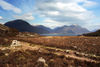 Categories:
- Munros
- Marilyns of Scotland
- Mountains and hills of the Northwest Highlands
- Torridon
- Climbing areas of Scotland


Wikimedia Foundation. 2010.