- New York State Route 12B
-
NYS Route 12B
Route information Auxiliary route of NY 12 Maintained by NYSDOT Length: 35.53 mi[2] (57.18 km) Existed: 1930[1] – present Major junctions South end:  NY 12 in Sherburne
 US 20 / NY 26 in Madison
North end:  NY 5 in New Hartford
Location Counties: Chenango, Madison, Oneida Highway system Numbered highways in New York
Interstate • U.S. • N.Y. (former) • Reference • County← NY 12NY 12C  →
→New York State Route 12B (NY 12B) is a state highway in the central part of New York, United States. NY 12B is a north–south highway connecting Oneida County in the north to Chenango County in the south, passing through Madison County in between. The southern terminus of NY 12B is at NY 12 in the village of Sherburne. The northern terminus is at NY 5 in the town of New Hartford. In Madison County, Route 12B directly abuts the campus of Colgate University in the village of Hamilton.
Contents
History
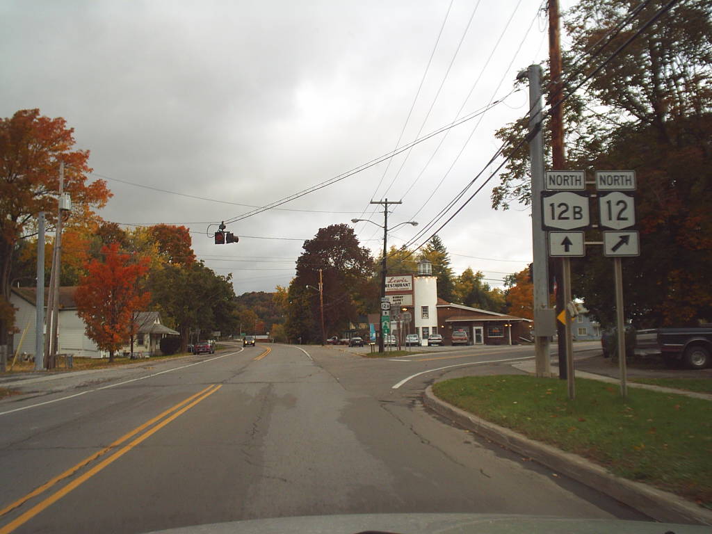
 Southern terminus of NY 12B
In 1908, the New York State Legislature created Route 8, an unsigned legislative route extending from the city of Binghamton to Kirkland.[3][4] When the first set of posted routes in New York were assigned in 1924, all of Route 8 between Chenango Forks and Clinton became part of NY 12, which continued northeast through Clinton to Utica.[5] The portion of NY 12 between Sherburne and Utica was realigned in the late 1920s to follow a new, more direct alignment to the east. The former routing of NY 12 between the two locations was redesignated as NY 12A. In the 1930 renumbering of state highways in New York, NY 12A was renumbered to NY 12B.[1][6]
The section of NY 12B between Earlville and Hamilton has historically been susceptible to accidents. According to a study by the New York State Department of Transportation (NYSDOT), 93 accidents occurred along this portion of NY 12B from November 2006 to October 2009. Of those, 50 were the result of striking an animal while 15 others were cases where a motorist crashed into a fixed object. Area residents and officials had asked NYSDOT to lower the speed limit on the highway from 55 miles per hour (89 km/h) to 45 miles per hour (72 km/h); however, this request was denied in July 2010. Instead, NYSDOT will look into improving specific areas along the highway where accidents are more common.[7]
Major intersections
County Location Mile[2] Destinations Notes Chenango Village of Sherburne 0.00 NY 12Madison Eaton 14.06  NY 46
NY 46Southern terminus of NY 46 Town of Madison 16.52 US 20 west / NY 26 southWestern terminus of US 20 / NY 12B and NY 12B / NY 26 overlaps 19.52 US 20 eastEastern terminus of US 20 / NY 12B overlap Oneida Oriskany Falls 22.07 NY 26 northEastern terminus of NY 12B / NY 26 overlap Marshall 26.33  NY 315
Northern terminus of NY 315 Kirkland 29.34  NY 233
Southern terminus of NY 233 Clinton 31.14  NY 412
Eastern terminus of NY 412 Kirkland 33.54  NY 5B west
Western terminus of NY 5B / NY 12B overlap 33.63 NY 5B eastEastern terminus of NY 5B / NY 12B overlap Town of New Hartford 35.53 NY 51.000 mi = 1.609 km; 1.000 km = 0.621 mi References
- ^ a b Dickinson, Leon A. (January 12, 1930). "New Signs for State Highways". The New York Times: p. 136.
- ^ a b "2008 Traffic Volume Report for New York State" (PDF). New York State Department of Transportation. June 16, 2009. pp. 42, 79. https://www.nysdot.gov/divisions/engineering/technical-services/hds-respository/NYSDOT%20TVR%202008%20by%20Route.pdf. Retrieved January 31, 2010.
- ^ State of New York Department of Highways (1909). The Highway Law. Albany, New York: J. B. Lyon Company. p. 57. http://books.google.com/books?id=jZ0AAAAAMAAJ&printsec=frontcover#PPA57,M1. Retrieved May 24, 2009.
- ^ New York State Department of Highways (1920). Report of the State Commissioner of Highways. Albany, New York: J. B. Lyon Company. p. 516. http://books.google.com/books?id=Sj4CAAAAYAAJ&printsec=titlepage#PPA516,M1. Retrieved May 24, 2009.
- ^ "New York's Main Highways Designated by Numbers". The New York Times: p. XX9. December 21, 1924.
- ^ Rand McNally and Company (1926). Rand McNally Auto Road Atlas (eastern New York) (Map). http://www.broermapsonline.org/members/NorthAmerica/UnitedStates/Midatlantic/NewYork/unitedstates1926ra_009.html. Retrieved May 24, 2009.
- ^ Traynor, Caitlin (July 30, 2010). "State won’t lower Route 12B speed limit". Oneida Daily Dispatch. http://oneidadispatch.com/articles/2010/07/30/news/doc4c539129316ea493653542.txt. Retrieved July 31, 2010.
External links
Categories:- State highways in New York
- Transportation in Chenango County, New York
- Transportation in Madison County, New York
- Transportation in Oneida County, New York

Wikimedia Foundation. 2010.