- Michaelston-super-Ely
-
Coordinates: 51°28′18″N 3°15′40″W / 51.47167°N 3.26117°W
Michaelston-super-Ely Welsh: Llanfihangel-ar-Elai 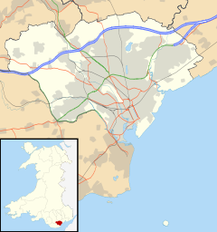
 Michaelston-super-Ely
Michaelston-super-Ely shown within CardiffPrincipal area Cardiff Ceremonial county South Glamorgan Country Wales Sovereign state United Kingdom Post town CARDIFF Dialling code 029 Police South Wales Fire South Wales Ambulance Welsh EU Parliament Wales UK Parliament Cardiff West Welsh Assembly Cardiff West List of places: UK • Wales • Cardiff Michaelston-super-Ely is a village, to the west of the city of Cardiff, Wales.
Its Welsh name is Llanfihangel-ar-Elai where llan church + Mihangel Saint Michael + Elai River Ely). The historic church was decommissioned in 2010. It is approximately half a mile from the boundary with the Vale of Glamorgan. To the north lies the village of St Fagans, and to the east the Ely estate.
External links
- GENUKI(tm) page
- Map sources for Michaelston-super-Ely
Coordinates: 51°28′18″N 3°15′40″W / 51.47167°N 3.26117°W
Categories:- Villages in Cardiff
- Glamorgan geography stubs

Wikimedia Foundation. 2010.