- Milton Clevedon
-
Coordinates: 51°08′09″N 2°28′49″W / 51.13578°N 2.48018°W
Milton Clevedon 
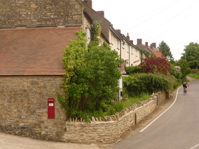
Houses and post box
 Milton Clevedon
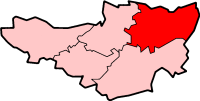
Milton Clevedon shown within SomersetPopulation 89 [1] OS grid reference ST665375 District Mendip Shire county Somerset Region South West Country England Sovereign state United Kingdom Post town SHEPTON MALLET Postcode district BA4 Dialling code 01749 Police Avon and Somerset Fire Devon and Somerset Ambulance South Western EU Parliament South West England UK Parliament Somerton and Frome List of places: UK • England • Somerset Milton Clevedon is a village and civil parish 1 mile (1.6 km) south of Evercreech in the Mendip district of Somerset, England.
Contents
History
The name of the village means the middle settlement, possibly because it is half way between Evercreech and Bruton.[2]
An early Iron Age earthwork, probably a stock enclosure but known as Fox Covert,[3][4] occupies a spur of Creech Hill overlooking the River Alham valley. The site includes a possible barrow on the west.
In the late 12th century the manor was held under the Lovels of Castle Cary by William de Clevedon who gave the church to Bruton Abbey who held it until the dissolution of the monasteries.[2]
The Mendip Hospital was built in 1845–47 as the County Lunatic Asylum, by Sir George Gilbert Scott and W. B. Moffatt, supervised by Richard Carver. It is Grade II listed.[5] The hospital chapel is also listed.[6]
Governance
The parish council has responsibility for local issues, including setting an annual precept (local rate) to cover the council’s operating costs and producing annual accounts for public scrutiny. The parish council evaluates local planning applications and works with the local police, district council officers, and neighbourhood watch groups on matters of crime, security, and traffic. The parish council's role also includes initiating projects for the maintenance and repair of parish facilities, as well as consulting with the district council on the maintenance, repair, and improvement of highways, drainage, footpaths, public transport, and street cleaning. Conservation matters (including trees and listed buildings) and environmental issues are also the responsibility of the council.
The village falls within the Non-metropolitan district of Mendip, which was formed on 1 April 1974 under the Local Government Act 1972, having previously been part of Shepton Mallet Rural District,[7] who are responsible for local planning and building control, local roads, council housing, environmental health, markets and fairs, refuse collection and recycling, cemeteries and crematoria, leisure services, parks, and tourism.
Somerset County Council are responsible for running the largest and most expensive local services such as education, social services, libraries, main roads, public transport, policing and fire services, trading standards, waste disposal and strategic planning.
It is also part of the Somerton and Frome county constituency represented in the House of Commons of the Parliament of the United Kingdom. It elects one Member of Parliament (MP) by the first past the post system of election, and part of the South West England constituency of the European Parliament which elects seven MEPs using the d'Hondt method of party-list proportional representation.
Religious sites
The Church of St James was rebuilt in 1790 and is a Grade II* listed building.[8]
References
- ^ "Parish Population Statistics". ONS Census 2001. Somerset County Council. http://www.webcitation.org/5lRyC5ccr. Retrieved 2009-12-14.
- ^ a b Bush, Robin (1994). Somerset: The complete guide. Wimborne: The Dovecote Press Ltd. pp. 144. ISBN 1874336261.
- ^ "Hillfort at Fox Covert, Milton Clevedon". Somerset Historic Environment Record. Somerset County Council. http://webapp1.somerset.gov.uk/her/details.asp?prn=23860. Retrieved 16 January 2011.
- ^ "Fox Covert". Fortified England. http://www.fortifiedengland.com/Home/Categories/ViewItem/tabid/61/Default.aspx?IID=1431. Retrieved 16 January 2011.
- ^ "Mendip Hospital (main building)". Images of England. http://www.imagesofengland.org.uk/details/default.aspx?id=416635. Retrieved 2006-11-25.
- ^ "Chapel with covered approach to Mendip Hospital". Images of England. English Heritage. http://www.imagesofengland.org.uk/Details/Default.aspx?id=416636. Retrieved 2009-01-26.
- ^ A Vision of Britain Through Time : Shepton Mallet Rural District
- ^ "Church of St. James". Images of England. http://www.imagesofengland.org.uk/details/default.aspx?id=268463. Retrieved 2006-11-25.
External links
 Media related to Milton Clevedon at Wikimedia Commons
Towns, villages and hamlets in the Mendip district of Somerset, England 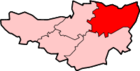 Ashwick · Baltonsborough · Batcombe · Beckington · Berkley · Binegar · Buckland Dinham · Chewton Mendip · Chilcompton · Coleford · Cranmore · Croscombe · Ditcheat · Doulting · Downhead · East Lydford · East Pennard · Emborough · Evercreech · Frome · Glastonbury · Godney · Great Elm · Hemington · Holcombe · Kilmersdon · Lamyat · Leigh-on-Mendip · Litton · Lullington · Lydford-on-Fosse · Meare · Mells · Milton Clevedon · North Wootton · Norton St Philip · Nunney · Pilton · Priddy · Pylle · Rode · Rodney Stoke · Rudge · Selwood · Sharpham · Shepton Mallet · St Cuthbert Out · Stoke St Michael · Ston Easton · Stratton-on-the-Fosse · Street · Tellisford · Trudoxhill · Upton Noble · Walton · Wanstrow · Wells · West Bradley · West Lydford · West Pennard · Westbury-sub-Mendip · Whatley · Witham Friary · Wookey · Wookey HoleCategories:
- Villages in Mendip
- Civil parishes in Somerset

Wikimedia Foundation. 2010.