- Carson City, Nevada
-
"Carson City" redirects here. For other uses, see Carson City (disambiguation).
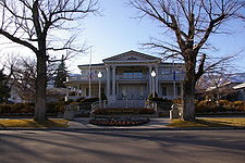
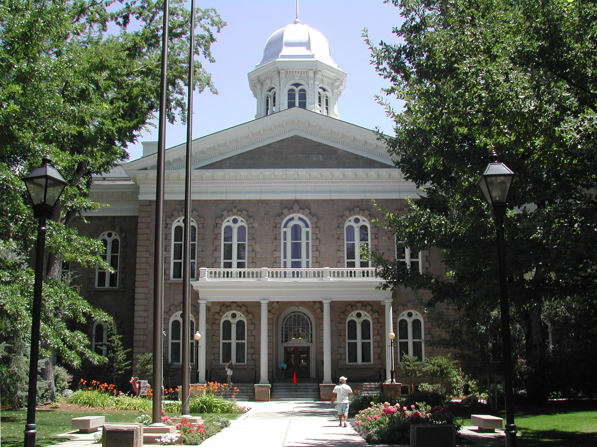
Carson City — Independent city — Consolidated Municipality of Carson City Capitol Building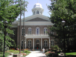
SealMotto: Proud of its Past...Confident of its Future Location in Nevada
Coordinates: 39°9′39″N 119°45′14″W / 39.16083°N 119.75389°WCoordinates: 39°9′39″N 119°45′14″W / 39.16083°N 119.75389°W Country United States State Nevada Founded 1858 Government – Mayor Bob Crowell (2008 - ) – State Senator James Settelmeyer (R) – State Assemblyman Pete Livermore (R) – U.S. Representative Mark Amodei (R) Area – Total 168 sq mi (435 km2) – Land 156 sq mi (403 km2) – Water 12 sq mi (32 km2) 7.91% Elevation 4,802 ft (1,463 m) Population (2010) – Total 55,274 – Density 365.2/sq mi (141/km2) Time zone Pacific (UTC−8) – Summer (DST) Pacific (UTC−7) ZIP code 89701-89706, 89711-89714, 89721 Area code(s) 775 Website www.carson-city.nv.us The Consolidated Municipality of Carson City is the capital of the state of Nevada. The words Consolidated Municipality refer to a series of changes in 1969 which abolished Ormsby County and merged all the settlements contained within its borders into Carson City. Since that time Carson City has been an independent city.[1] The population was 55,274 at the 2010 census.
Contents
History
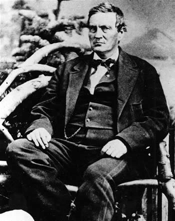
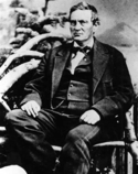 Abraham Curry
 Illustration of Carson City in 1877.
The first European Americans to arrive in what is known as Eagle Valley were John C. Fremont and his exploration party in January 1843.[2] Fremont named the river flowing through the valley Carson River in honor of Christopher "Kit" Carson, the mountain man and scout he had hired for his expedition. Prior to the Fremont expedition, the Washoe people inhabited the valley and surrounding areas. Settlers named the area Washoe in reference to the tribe.[3]
By 1851 the Eagle Station ranch located along the Carson River served as a trading post and stopover for travelers on the California Trail's Carson Branch which ran through Eagle Valley. The valley and trading post received their name from a bald eagle that was hunted and killed by one of the early settlers and was featured on a wall inside the post.
As the area was part of the Utah Territory, it was governed from Salt Lake City, where the territorial government was headquartered. Early settlers bristled at the control exterted by Mormon-influenced officials and desired the creation of the Nevada territory. A vigilante group of influential settlers, headed by Abraham Curry, sought a site for a capital city for the envisioned territory.[4] In 1858, Abraham Curry bought Eagle Station and thereafter renamed the settlement Carson City.[5] As Curry and several other partners had Eagle Valley surveyed for development. Curry had decided for himself that Carson City would someday serve as the capital city and left a 10-acre (40,000 m2) plot open in the center of town for a future capitol building.
Following the discovery of gold and silver in 1859 on the nearby Comstock Lode, Carson City's population began to rise. Curry built the Warm Springs Hotel a mile to the east of the center of town. As predicted, Carson City was selected as the territorial capital, besting Virginia City and American Flat. Curry loaned the Warm Springs Hotel to the territorial Legislature as a meeting hall. The Legislature named Carson City to be the seat of Ormsby County and selected the hotel as the territorial prison with Curry serving as its first warden. Today the property still serves as part of the state prison.
When Nevada became a state in 1864 during the Civil War, Carson City was confirmed as Nevada's permanent capital. Carson City's development was no longer dependent on the mining industry and instead became a thriving commercial center. The Virginia & Truckee Railroad was built between Virginia City and Carson City. A wooden flume was also built from the Sierra Nevadas into Carson City. The current capitol building was constructed from 1870–71. The United States Mint operated a branch mint in Carson City between the years 1870 and 1893, which struck gold and silver coins. People came from China during that time, many of them to work on the railroad. Some of them owned businesses and taught school. By 1880, almost a thousand Chinese people, "one for every five Caucasians," lived in Carson City.[6]
Carson City's population and transportation traffic decreased when the Southern Pacific Railroad built a line through Donner Pass, too far to the north to benefit Carson City. The city was slightly revitalized with the mining booms in Tonopah and Goldfield. The US federal building (now renamed the Paul Laxalt Building) was completed in 1890 as was the Stewart Indian School. Carson City resigned itself to small city status, advertising itself as "America's smallest capital."
20th-century revitalization and growth
The city slowly grew; by 1960 it had reached its 1880, boom-time population. Portions of Ormsby County had been given over to neighboring counties and by this time the county was not much larger than the city itself. In 1969, Ormsby County was officially dissolved and Carson City took over all municipal services with an independent city status. With this consolidation, Carson City absorbed former town sites such as Empire City, which had grown up in the 1860s as a milling center along the Carson River and current US 50. Carson City could now advertise itself as one of America's largest state capitals with its 146 square miles (380 km2) of city limits.[7]
In 1991, the city adopted a downtown master plan, specifying that no building within 500 feet (152 m) of the capitol would surpass it in height. This plan prohibited future high-rise development in the center of downtown.[8] The Ormsby House is currently the tallest building in downtown Carson City, at a height of 117 feet. The structure was completed in 1972.[9]
Demographics
Carson City is the smallest of the United States' 363 Metropolitan Statistical Areas.
Historical populations Census Pop. %± 1860 714 — 1870 3,042 326.1% 1880 4,229 39.0% 1890 3,950 −6.6% 1900 2,100 −46.8% 1910 2,466 17.4% 1920 1,685 −31.7% 1930 1,596 −5.3% 1940 2,478 55.3% 1950 3,082 24.4% 1960 5,163 67.5% 1970 15,468 199.6% 1980 32,022 107.0% 1990 40,443 26.3% 2000 52,547 29.9% 2010 55,274 5.2% source:[10][11] As of the 2010 census there are 55,274 people, 20,171 households, and 13,252 families residing in the city. The population density is 366 people per square mile (141/km²). There are 21,283 housing units at an average density of 148/sq mi (57/km²). The racial makeup of the city is 81.1% White, 1.9% Black or African American, 2.4% Native American, 2.1% Asian, 0.2% Pacific Islander, 9.4% from other races, and 2.9% from two or more races. 21% of the population are Hispanic or Latino of any race.
As of the 2000 census, there are 20,171 households, out of which 29.8% have children under the age of 18 living with them, 50.0% are married couples living together, 11.0% have a female householder with no husband present, and 34.3% are non-families. 27.8% of all households are made up of individuals and 11.00% have someone living alone who is 65 years of age or older. The average household size is 2.44 and the average family size is 2.97. The city's age distribution is: 23.4% under the age of 18, 7.9% from 18 to 24, 28.9% from 25 to 44, 24.9% from 45 to 64, and 14.9% who are 65 years of age or older. The median age is 39 years. For every 100 females there are 106.90 males. For every 100 females age 18 and over, there are 108.20 males.[12]
Data from the 2000 census indicates that the median income for a household in the city is $41,809, and the median income for a family is $49,570. Males have a median income of $35,296 versus $27,418 for females. The per capita income for the city is $20,943. 10.0% of the population and 6.9% of families are below the poverty line. Out of the total population, 13.7% of those under the age of 18 and 5.8% of those 65 and older are living below the poverty line.
Economy
The following is a list of the top employers in Carson City:[13][14]
- State of Nevada
- Department of Transportation
- Department of Corrections
- Department of Motor Vehicles
- Department of Defense
- Carson City School District
- Carson-Tahoe Hospital
- Carson City
- Western Nevada College
- Chromalloy Nevada
- Wal-Mart
- Casino Fandango
- Legislative Counsel Bureau
- Carson Nugget
- Click Bond, Inc.
- Gold Dust West
Government and politics
Carson City is governed via the mayor-council system. The mayor is elected in a citywide vote to a four year term. The city council is called the Board of Supervisors and has four members. Members are elected from single member wards. Nevada's capital is generally considered a Republican stronghold, often voting for Republicans by wide margins. In 2004, George Bush defeated John Kerry 57-40%. In 2008 however Barack Obama became the first Democrat since 1964 to win Carson City, defeating John McCain 49% to 48%, by 204 votes, a margin of under 1%.[15]
Climate
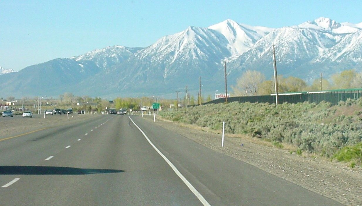
Carson City features a semiarid climate (Köppen Bsk)[16] with cool but not inordinately cold winters and hot summers. The city is situated in a high desert river valley approximately 4,730 feet (1,440 m) above sea level. There are four fairly distinct seasons, all of which are relatively mild compared to many parts of the country and to what one may expect given its elevation. Winters see typically light to moderate snowfall, with a median of 8.9 inches (23 cm).[17] Most precipitation occurs in winter and spring, with summer and fall being fairly dry, drier than neighboring California. Mid-summer highs typically top out in the 90s, doing so 36 times per year,[17] but temperatures of 100 °F (38 °C) and above do occur on occasion.
The Carson River flows from Douglas County through the southwestern edge of Carson City.
Climate data for Carson City, Nevada Month Jan Feb Mar Apr May Jun Jul Aug Sep Oct Nov Dec Year Record high °F (°C) 72
(22)76
(24)81
(27)88
(31)93
(34)101
(38)105
(41)103
(39)103
(39)91
(33)78
(26)75
(24)105
(41)Average high °F (°C) 45.6
(7.6)50.7
(10.4)56.6
(13.7)63.2
(17.3)71.6
(22.0)81.2
(27.3)89.2
(31.8)87.8
(31.0)80.2
(26.8)68.8
(20.4)54.7
(12.6)46.2
(7.9)66.3 Average low °F (°C) 21.7
(−5.7)25.4
(−3.7)29.5
(−1.4)33.0
(0.6)39.7
(4.3)46.1
(7.8)50.7
(10.4)49.1
(9.5)42.4
(5.8)33.4
(0.8)26.4
(−3.1)20.8
(−6.2)34.9 Record low °F (°C) −20
(−29)−22
(−30)−5
(−21)12
(−11)18
(−8)27
(−3)33
(1)26
(−3)20
(−7)6
(−14)−4
(−20)−19
(−28)−22
(−30)Precipitation inches (mm) 1.82
(46.2)1.66
(42.2)1.26
(32)0.42
(10.7)0.52
(13.2)0.40
(10.2)0.22
(5.6)0.32
(8.1)0.51
(13)0.69
(17.5)1.26
(32)1.28
(32.5)10.36
(263.1)Snowfall inches (cm) 5.0
(12.7)3.5
(8.9)2.1
(5.3)0.4
(1)0
(0)0
(0)0
(0)0
(0)0
(0)0.2
(0.5)0.8
(2)2.2
(5.6)14.3
(36.3)Avg. precipitation days (≥ 0.01 in) 6.3 5.6 5.6 3.1 3.4 2.4 1.4 1.8 2.4 3.4 4.5 4.9 44.8 Avg. snowy days (≥ 0.1 in) 1.8 1.6 0.8 0.4 0 0 0 0 0 0 0.5 1.1 6.2 Source: The Weather Channel (records),[18] NOAA (normals)[17] Education
The Carson City School District operates ten schools in Carson City. The six elementary schools are Bordewich-Bray Elementary School, Empire Elementary School, Fremont Elementary School, Fritsch Elementary School, Mark Twain Elementary School, and Al Seeliger Elementary School. The two middle schools are Carson Middle School and Eagle Valley Middle School. Carson High School and the alternative Pioneer High School serve high school students. Carson High is on Saliman Road.[19]
Western Nevada College (WNC) is a regionally accredited, two year and four year institution which is part of the Nevada System of Higher Education. It has an education program. The school also offers associate of arts, associate of science.[20]
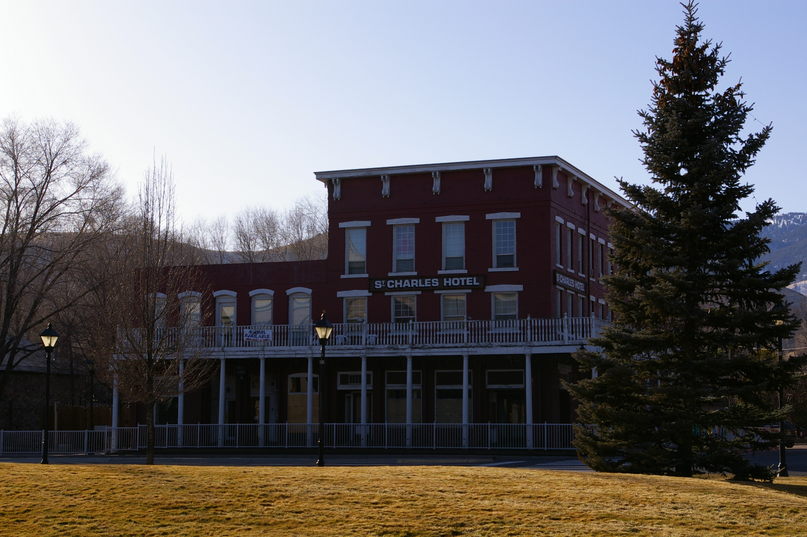
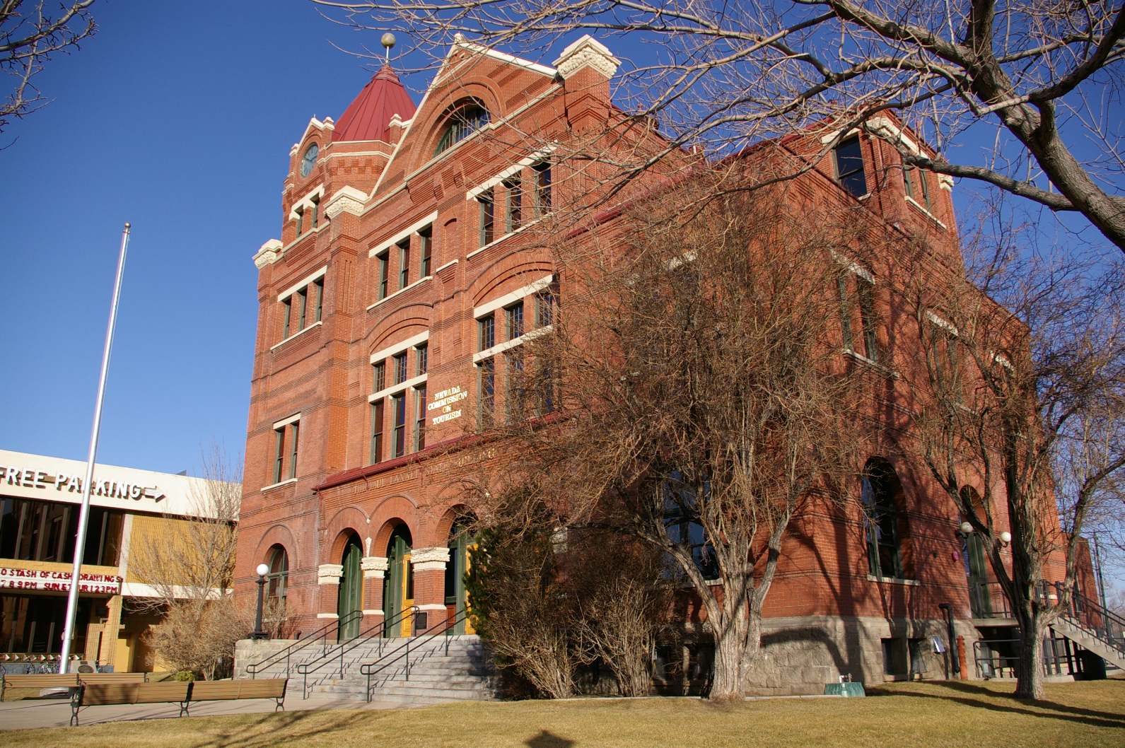
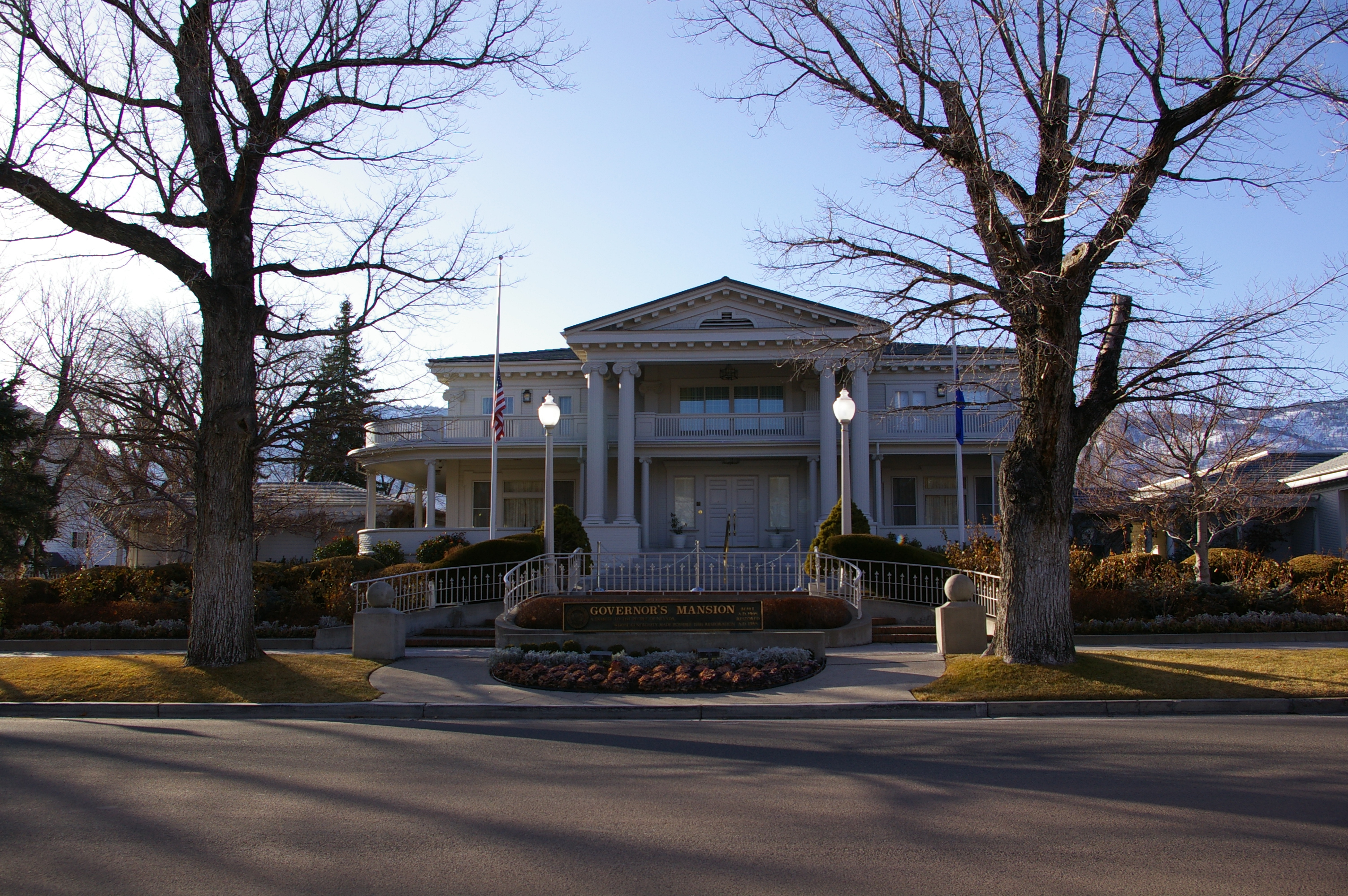
Photos of Carson City
-

Historic St Charles Hotel in Carson City -
Former Carson City Post Office -
The Governor's Mansion in Carson City
Sports and recreation
Carson City has never hosted any professional team sports. However, a variety of sports are offered a parks and recreation.[21] Many neighborhood parks offers a wide variety of features, including picnic tables, beaches, restrooms, fishing, softball, basketball, pond, tennis, and volleyball. The largest park is Mills Park, which has a total of 51 acres (0.21 km2) of land.[22] While there are no ski slopes within Carson City, the city is located close to Heavenly Mountain Resort, Diamond Peak and Mount Rose skiing areas.[23]
Points of interest
Museums
- Nevada State Capitol – original capitol still housing the governor's offices with museum exhibits
- Nevada State Museum – former state mint featuring rock, mining and prehistoric exhibits, and a recreated Wild West village
- Nevada State Railroad Museum – featuring the Inyo locomotive and relocated Wabuska Railroad Station
- Stewart Indian School – museum collection includes items from former faculty, students and school[24]
- Foreman-Roberts House Museum[25] – Gothic Revival architecture, tours available.
- Sears-Ferris House[26] (not open to public) - home of George Ferris, inventor of the Ferris wheel
 Secret Harbor Beach, Lake Tahoe
Open land
- Silver Saddle Ranch
- Mexican Dam – 1860's stone dam across the Carson River
- Prison Hill – California Trail historic markers, location of the Stewart "S"
- Carson Aquatic Trail
- Humboldt-Toiyabe National Forest (Carson Ranger District)
- Kings Canyon Falls
- Snow Valley Peak – 9,214 ft (2,808 m) – highest point within Carson City
- Tahoe Rim Trail
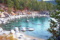
- Lake Tahoe – Nevada State Park – three beaches lie within or near the city limits
- Chimney Beach
- Secret Harbor
- Skunk Harbor
- Washoe Lake State Park – borders city to the north
- "C Hill" – hill featuring the Carson City "C" and giant American Flag
Popular culture
Films
The following is a list of movies with scenes filmed in Carson City[27][28]
- The Shootist – John Wayne’s last film that was shot on location at the Krebbs-Peterson House
- Bonanza
- Honkytonk Man
- Pink Cadillac
- Misery
The following is a list of films with scenes set in Carson City but filmed elsewhere
Events
Notable Natives and residents
Carson City has served as one of the state’s centers for politics and business. Every state governor since Denver S. Dickerson has resided in the Governor's Mansion located in Carson City.[29] See also: List of Governors of Nevada. The following personalities took up a residence in Carson City at some point in their lives.[30]
- Duane L. Bliss, timber businessman
- Orion Clemens, Secretary of Nevada Territory
- Abraham Curry, founding father of Carson City and early politician
- Dat-So-La-Lee, Native American basket weaver and artist
- George Ferris, creator of the Ferris Wheel
- Paul Laxalt, former Govenor and U.S. Senator
- Hank Monk, stagecoach driver
- William Ormsby, soldier and namesake of Ormsby County and Ormsby House
- Mark Twain, author (lived with his brother Orion)[31]
- Sarah Winnemucca, Native American author
- Adam Jones, (Minden, Nevada) Red Bull X-Fighters Moto X Rider, X-Games Gold Medal winner 2007, Winner of X-Fighters event in Giza, Egypt, 2010. 8th in World Championship rankings for 2011.
Transportation
There are two highways in the city US Route 395 and US Route 50.[32] Carson City is home to one under-construction freeway Interstate 580. Phase 1 of the Carson City Freeway Project from US 395, just north of the city, to US 50 was completed in February 2006 and Phase 2A, extending from Rt. 50 to Fairview Drive, was officially opened on September 24, 2009. Phase 2B, Fairview Drive to Rt. 50, awaits funding.[33]
Carson City's first modern bus system, Jump Around Carson, or JAC, opened to the public. JAC uses a smaller urban bus that is ideal for Carson City.[34] However, there is virtually no ground public transportation to other destinations. Passenger trains haven't served Carson City since 1948, Greyhound Lines stopped their bus services to the town in 2006 and Amtrak discontinued their connecting thruway bus to Sacramento in 2008. There is now only a limited Monday – Friday RTC bus service to Reno which is still served by both Greyhound and Amtrak.
Carson City is also served by the Carson Airport, which is a regional airport in the northern part of the city. Reno-Tahoe International Airport, which is 28 miles (45 km) away, handles international and domestic commercial flights.[35]
References
- ^ "About Carson City". Carson City. 2006-05-29. http://www.carson.org/Index.aspx?page=2.
- ^ "National Park Service: Three Historic Cities". Travel Nevada.com. http://www.nps.gov/history/nr/travel/nevada/carson.htm. Retrieved 6=2-2010.
- ^ Bayer, C.W. (1995). Profits, plots & lynching; the creation of Nevada Territory. Carson, City NV: Purple Mountain Press. pp. 2. ISBN 0962889032.
- ^ Oldham, Willa (1991). Carson City: Nevada’s Capital City. Carson City, NV: Nevada State Museum. pp. 5. ISBN B0006QSL8Q.
- ^ Carson City website. "Carson City Living History". http://www.visitcarsoncity.com/history/.
- ^ Kelli Du Fresne. "Dedicated to Carson's Chinese history". http://www.nevadaappeal.com/article/20030925/OPINION/309250201/. Retrieved 07 September 2011.
- ^ Carson City Government. "Carson City: History". http://www.carson-city.nv.us/Index.aspx?page=140. Retrieved 6-2-2010.
- ^ Staff Writer. "About Carson City". Emporis. http://www.emporis.com/en/wm/ci/?id=carsoncity-nv-usa. Retrieved 6-2-2010.
- ^ Carson City High Rise Buildings
- ^ Moffatt, Riley. Scarecrow (1996). 155.
- ^ "Subcounty population estimates: Nevada 2000–2007" (CSV). United States Census Bureau, Population Division. March 18, 2009. http://www.census.gov/popest/cities/files/SUB-EST2007-32.csv. Retrieved May 9, 2009.
- ^ Staff Writer. "Carson City Demographics". City-Data.com. http://www.city-data.com/city/Carson-City-Nevada.html. Retrieved 6-3-10.
- ^ Nevada Workforce
- ^ Regional Data Center
- ^ "Carson City Politics". www.carson-city.nv.us. p. 95. http://www.carson-city.nv.us/Index.aspx?page=95.
- ^ Updated North American Map of the Köppen climate classification system.
- ^ a b c "Climatography of the United States No. 20: CARSON CITY, NV 1971–2000" (PDF). National Oceanic and Atmospheric Administration. 2004. http://cdo.ncdc.noaa.gov/climatenormals/clim20/nv/261485.pdf. Retrieved June 8, 2010.
- ^ "Monthly Averages for Carson City, NV – Temperature and Precipitation". The Weather Channel. http://www.weather.com/outlook/driving/interstate/wxclimatology/monthly/graph/USNV0014. Retrieved February 11, 2010.
- ^ Staff Writer. "Carson City School District". Carson City School District. http://www.carsoncityschools.com/index2.asp. Retrieved 6-3-2010.
- ^ Staff Writer. "Western Nevada College Website". Western Nevada College. http://www.wnc.edu/about/. Retrieved June 3, 2010.
- ^ Staff Writer (5-14-2010). "Carson City Recreation". Carson City. http://www.carson-city.nv.us/Index.aspx?page=1248. Retrieved 6-3-2010.
- ^ Staff Writer. "Parks in Carson City". Carson City. http://www.carson-city.nv.us/Modules/ShowDocument.aspx?documentid=23413. Retrieved 6-3-2010.
- ^ Staff Writer. "Ski resort near Carson Ctiy". Google. http://maps.google.com/maps?oe=utf-8&rls=org.mozilla:en-US:official&client=firefox-a&um=1&ie=UTF-8&q=Ski+resorts+near+Carson+City,+Nevada&fb=1&gl=us&hq=Ski+resorts&hnear=Carson+City,+NV&view=text&ei=tC4HTKGSHpPUM4H-wC0&sa=X&oi=local_group&ct=more-results&resnum=1&ved=0CC8QtQMwAA. Retrieved 6-3-2010.
- ^ http://www.nps.gov/nr/travel/nevada/ste.htm
- ^ http://www.cchistorical.org/historicrobertshouse.htm
- ^ http://nevadaculture.org/nsla/index.php?option=com_content&task=view&id=725&Itemid=95
- ^ www.imdb.com
- ^ Carson City.com
- ^ Ballew, Susan J.; Dolan, L. Trent (2010). Early Carson City. Arcadia Publishing. p. 60. ISBN 9780738571584. http://books.google.com/books?id=uRuaIrzRP2cC&pg=PA60&dq=dickerson. Retrieved November 20, 2010.
- ^ Historic Personalities
- ^ Mark Twain (Samuel Clemens) - Carson City
- ^ "Getting here". Carson City Convention and Visitors Bureau. http://www.visitcarsoncity.com/aboutus/gettinghere.php. Retrieved 23 August 2011.
- ^ Staff Writer. "Carson City Freeway". Carson City Freeway. http://www.ccfreeway.com.
- ^ Staff Writer. "Jump Around Carson". Jump Around Carson. http://www.carson-city.nv.us/Index.aspx?page=1436.
- ^ Staff Writer. "Carson City Airport". Carson City Airport. http://www.carsoncity-airport.com/Home.shtml. Retrieved 6-3-2010.
External links
- City of Carson City – official site.
- Reno-Tahoe CVB – Carson City pages
- Carson City Convention and Visitors Bureau
- Virginia & Truckee Railroad: Information about the historical railroad.

Washoe County Storey County Placer County, California 
Lyon County  Carson City, Nevada

Douglas County, Nevada  State of NevadaCarson City (capital)
Topics - Delegations
- Geography
- Government
- History
- People
- Transportation
- Visitor attractions
Society - Crime
- Demographics
- Economy
- Education
- Politics
Regions - Black Rock Desert
- Eagle Valley
- Great Basin
- Lake Mead
- Lake Tahoe
- Las Vegas Valley
- Mojave Desert
- Pahranagat Valley
- Sierra Nevada
Metro areas - Las Vegas-Paradise
- Reno-Sparks
- Carson City
Counties Cities and
communities- Alamo
- Amargosa Valley
- Austin
- Baker
- Battle Mountain
- Beatty
- Boulder City
- Caliente
- Carlin
- Carson City
- Elko
- Ely
- Enterprise
- Eureka
- Fallon
- Fernley
- Gardnerville Ranchos
- Gerlach
- Goldfield
- Hawthorne
- Henderson
- Incline Village
- Las Vegas
- Laughlin
- Lovelock
- Mesquite
- Minden
- North Las Vegas
- Pahrump
- Paradise
- Pioche
- Primm
- Rachel
- Reno
- Spanish Springs
- Sparks
- Spring Creek
- Spring Valley
- Stateline
- Summerlin South
- Sun Valley
- Sunrise Manor
- Tonopah
- Virginia City
- West Wendover
- Winnemucca
- Whitney
- Winchester
- Yerington
Former counties State capitals of the United States AL Montgomery AK Juneau AZ Phoenix AR Little Rock CA Sacramento CO Denver CT Hartford DE Dover FL Tallahassee GA Atlanta HI Honolulu ID Boise IL Springfield IN Indianapolis IA Des Moines KS Topeka KY Frankfort LA Baton Rouge ME Augusta MD Annapolis MA Boston MI Lansing MN Saint Paul MS Jackson MO Jefferson City MT Helena NE Lincoln NV Carson City NH Concord NJ Trenton NM Santa Fe NY Albany NC Raleigh ND Bismarck OH Columbus OK Oklahoma City OR Salem PA Harrisburg RI Providence SC Columbia SD Pierre TN Nashville TX Austin UT Salt Lake City VT Montpelier VA Richmond WA Olympia WV Charleston WI Madison WY Cheyenne DC Washington1
Territories:AS Pago Pago GU Hagåtña MP Saipan PR San Juan VI Charlotte Amalie American Old West Towns- Carson City
- Virginia City
- Reno
OthersProminent figuresLawmenOutlaws- Billy the Kid
- Black Bart
- Butch Cassidy
- Jesse James and the James-Younger Gang
- Tom Ketchum
- Joaquin Murrieta
- Soapy Smith
- Sundance Kid
- Wild Bunch
Native AmericansOthersTransport and trails Native Americans Folklore - Alma Massacre
- Battle of Fort Tularosa
- Boot Hill
- Dead man's hand
- Frisco Shootout
- Gunfight at the O.K. Corral
- Long Tom's treasure
- Montezuma's treasure
- One-room schoolhouse
- Pecos Bill
- Skeleton Canyon
- Western saloon
- Wild West Shows
Gold rushes Range wars and feuds Lists - Cowboys and cowgirls
- Gangs
- Gunfights
- Lawmen
- Mountain men
- Outlaws
Categories:- Carson City, Nevada
- Cities in Nevada
- Independent cities in the United States
- History of Carson City, Nevada
- Populated places established in 1858
- Nevada counties
- State of Nevada


Wikimedia Foundation. 2010.