- Clarkefield, Victoria
-
Clarkefield
Victoria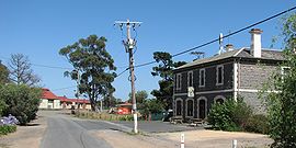
Station Street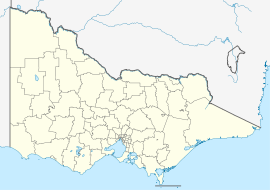
 Clarkefield
Population: 633 (2001 census) Postcode: 3430[1] Elevation: 308 m (1,010 ft) Location: LGA: Shire of Macedon Ranges, City of Hume County: Bourke State District: Macedon Federal Division: Calwell Localities around Clarkefield: Riddells Creek Bolinda Chintin Gisborne Clarkefield Kalkallo Sunbury Wildwood Mickleham Clarkefield (pronounced /ˈklɑrkfiːld/, locally [ˈklaːkfiːld]) is a town in Victoria, Australia, 46 kilometres (29 mi) northwest of Melbourne's central business district. Its Local Government Area is the Shire of Macedon Ranges and City of Hume.[1]
The Post Office opened on 1 January 1862 and was known as Lancefield Road until 1881, Lancefield Junction until 1926 and closed in 1982. [2]
 Jacksons Creek, a tributary of the Maribyrnong river at Clarkefield
See also
References
- ^ a b "Postcodes within Hume City Council". Hume City Council. http://www.hume.vic.gov.au/Page/page.asp?Page_Id=749&h=1. Retrieved 2008-01-13.
- ^ Premier Postal History. "Post Office List". https://www.premierpostal.com/cgi-bin/wsProd.sh/Viewpocdwrapper.p?SortBy=VIC&country=. Retrieved 2008-04-11.
Coordinates: 37°29′20″S 144°45′25″E / 37.489°S 144.757°E
Suburbs of the City of Hume | Melbourne | Victoria Attwood · Broadmeadows · Bulla · Campbellfield · Clarkefield · Coolaroo · Craigieburn · Dallas · Diggers Rest · Gladstone Park · Greenvale · Jacana · Kalkallo · Keilor · Meadow Heights · Melbourne Airport · Mickleham · Oaklands Junction · Roxburgh Park · Somerton · Sunbury · Tullamarine · Westmeadows · Wildwood · Yuroke
Towns and localities in the Shire of Macedon Ranges
(major towns in bold)Ashbourne · Baynton · Bolinda · Bullengarook · Carlsruhe · Cherokee · Clarkefield · Cobaw · Darraweit Guim · Gisborne · Gisborne South · Hesket · Kerrie · Kyneton · Lancefield · Lauriston · Macedon · Malmsbury · Monegeetta · Monegeetta North · Mount Macedon · New Gisborne · Newham · Riddells Creek · Rochford · Romsey · Springfield · Tylden · Woodend · Woodend North
Categories:- Towns in Victoria (Australia)
- Macedon Ranges


Wikimedia Foundation. 2010.