- Nittany Valley
-
 Aerial photo of Nittany Valley looking east. from Milesburg. Bald Eagle Mountain is on the left and Mount Nittany is at the upper right.
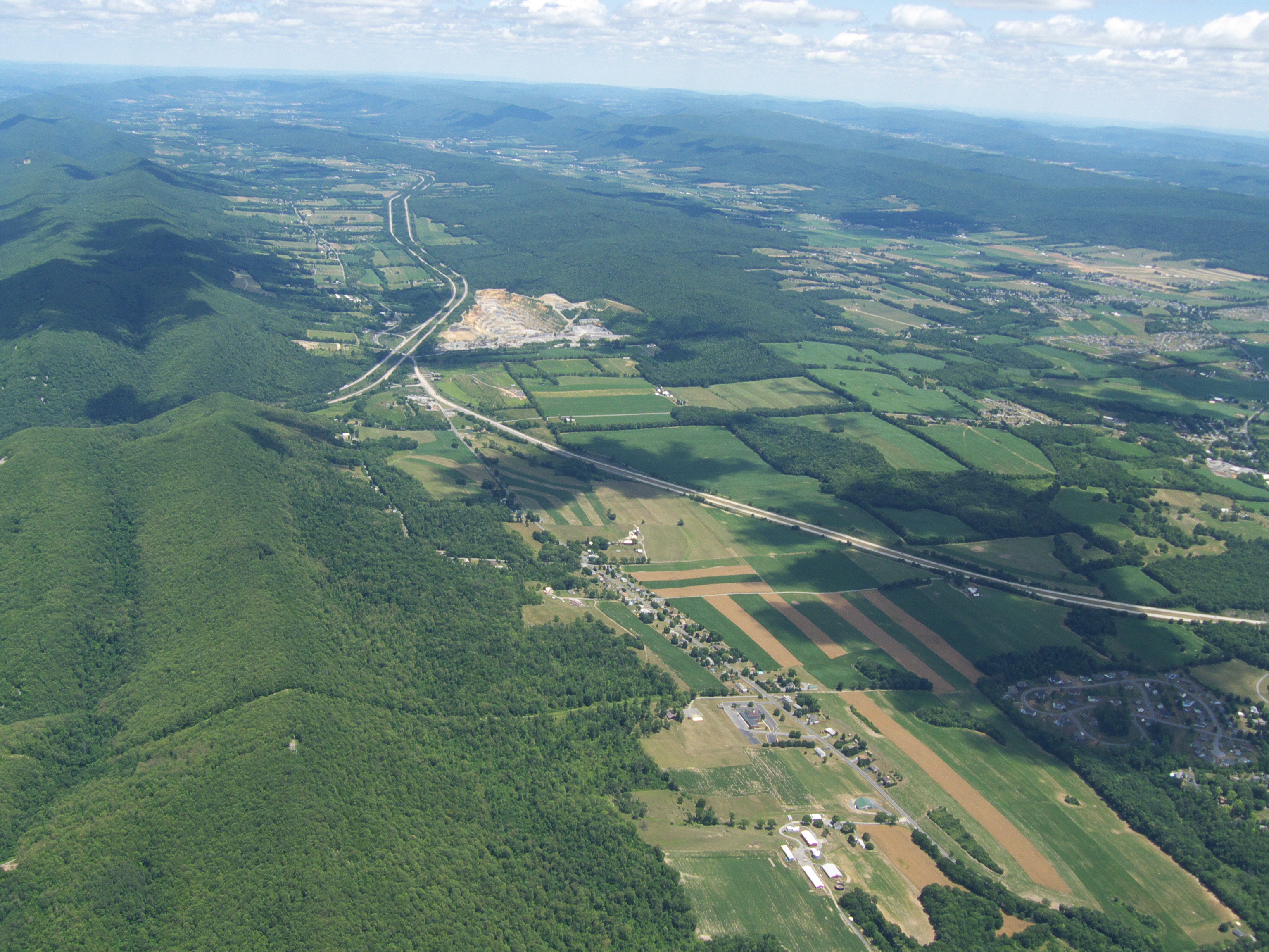
 The Little Nittany Valley, looking north from Bellefonte. Sand Ridge is to the right, Bald Eagle Mountain is on the left, and Interstate 80 is in-between.
The Nittany Valley is an eroded anticlinal valley[1] in the central portion of Centre County, Pennsylvania in the United States. It is separated from the Bald Eagle Valley by Bald Eagle Mountain and from Penns Valley by Mount Nittany. The valley is closed to the north by a high plateau that joins these two mountain ridges, but is open to the south at the southern terminus of Mount Nittany. The valley drains to the Bald Eagle Creek through water gaps in Bald Eagle Mountain formed by Spring Creek, and Fishing Creek, along with smaller streams running through Curtain Gap and Howard Gap. The Northwest side of the valley between the Bald Eagle Mountain ridge and the lower Sand Ridge is also known as the "Little Nittany Valley".
The valley has a mixture of farmland, woodlots, and a number of working and abandoned quarries. Bellefonte, the county seat of Centre County, is the largest municipality completely within the valley. The Pennsylvania State Correctional Institution - Rockview, the Nittany Mall, the Pennsylvania Transportation Institute and University Park Airport are large facilities located in the valley. State College, Pennsylvania and the Pennsylvania State University main University Park campus lie at the southern end of the Nittany and Penn's Valleys, and this area is also known as "Happy Valley".
Transportation
The Keystone Shortway, now Interstate 80, runs diagonally across the Nittany Valley on a west to east line, from Curtin Gap east of Milesburg, Pennsylvania, to a natural gap in Mount Nittany and then via a deep rock cut along the Long Run stream. The Nittany and Bald Eagle Railroad short line spur that enters the valley from Milesburg, then runs along Spring Creek to Bellefonte, splits, with a track going northeast to Pleasant Gap and another going southwest to Lemont and State College. The spur to Bellefonte follows Pennsylvania Route 144 and the line from Lemont to Pleasant Gap follows Pennsylvania Route 26. Route 26 is the primary north to south route through the valley, and the Interstate 99 extension will also run along its new alignment to I 80.
Geology of Nittany Valley
Nittany Valley is in the western part of the Ridge and Valley province of the Appalachian Mountains. During the Appalachian orogeny, the sedimentary rock layers folded up into the Nittany Arch anticline. The arch was an ancient Himalayan scale mountain that towered above what is now the valley. The oldest rock layers from deep within the eroded mountain are now exposed on Sand Ridge in the middle of the valley. Younger rocks from the outer layers of the arch are exposed on the West side of the Bald Eagle ridge in the Bald Eagle Valley, with the youngest across that valley at the foot of the Allegheny Front. The Nittany Valley, formed in the area where the mountain once stood, is an example of inverse topography.[1]
See also: Geology of Mount Nittany and Geology of Bald Eagle Mountain
References
- ^ a b Kempler, Steve (2007-01-19). "Geomorphology : Chapter 2 Plate T-12 : Folded Appalachians". NASA, Goddard Earth Sciences (GES), Data and Information Services Center (DISC). http://daac.gsfc.nasa.gov/geomorphology/GEO_2/GEO_PLATE_T-12.shtml. Retrieved 2008-03-16. "Nittany Valley and Morrison Cove, eroded anticlinal valleys (coves), near the western edge of the fold belt shown here … are examples of inverse topography, which is common in this geomorphic province."
Categories:- Regions of Pennsylvania
- Valleys of Pennsylvania
- Nittany Valley
- Geography of Centre County, Pennsylvania
- Pennsylvania geography stubs

Wikimedia Foundation. 2010.