- Peggys Cove, Nova Scotia
Infobox Settlement
name = Peggys Cove
official_name =
other_name =
native_name =
nickname =
settlement_type =
total_type =
motto =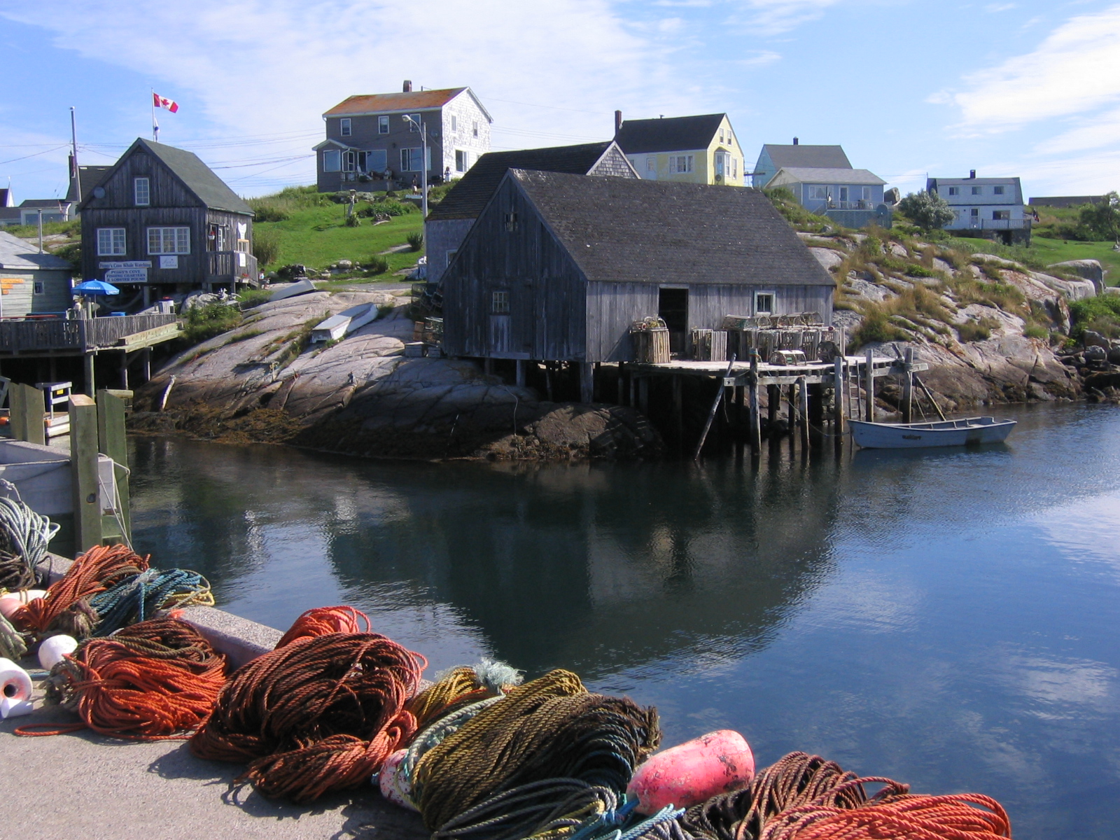
imagesize =
image_caption = Peggys Cove
flag_size =
image_
seal_size =
image_shield =
shield_size =
image_blank_emblem =
blank_emblem_type =
blank_emblem_size =
mapsize =
map_caption =
mapsize1 =
map_caption1 =
image_dot_
dot_mapsize =
dot_map_caption =
dot_x = |dot_y =
pushpin_
pushpin_label_position =
pushpin_map_caption = Location of Peggys Cove inNova Scotia
pushpin_mapsize = 220
subdivision_type = Country
subdivision_name = flag|Canada
subdivision_type1 = Province
subdivision_name1 = flag|Nova Scotia
subdivision_type2 = Region
subdivision_name2 = Halifax
subdivision_type3 = Administrative district
subdivision_name3 = St. Margarets Bay
government_footnotes =
government_type =
leader_title = Governing body
leader_name =Halifax Regional Community Council
leader_title1 =
leader_name1 =
established_title = Founded
established_date = 1811
area_magnitude =
unit_pref =
area_footnotes =
area_total_km2 =
area_land_km2 =
area_water_km2 =
area_total_sq_mi =
area_land_sq_mi =
area_water_sq_mi =
area_water_percent =
elevation_footnotes =
elevation_m = 10
elevation_max_m = 15
elevation_min_m = 0
population_as_of = 2001
population_footnotes =
population_note =
population_total = 50
population_density_km2 =
population_density_sq_mi =
timezone = ATS
utc_offset = -4
timezone_DST = Atlantic Daylight Saving Time
utc_offset_DST = -3
latd= 44|latm= 29|lats=34 |latNS=N
longd= 63|longm= 55|longs= 03|longEW=W
postal_code_type =
postal_code =
area_code =
website =
footnotes = Peggys Cove (2001 population: approx. 50), also known as Peggy's Cove from 1961 to 1976, is a small rural community located on the eastern shore of St. Margarets Bay inNova Scotia 's Halifax Regional Municipality.Geography
Peggys Cove is 43 kilometres southwest of
downtown Halifax and comprises one of the numerous small fishing communities located around the perimeter of theChebucto Peninsula .The community is named after the
cove of the same name. Peggy is a nickname for Margaret, and the village may have taken its name from St. Margarets Bay upon which it is situated. Localfolklore has several alternative origins for the name. Some people claim Peggy was an early settler. Others say she was a young survivor from a shipwreck who remembered nothing of her life before her rescue; not even her name but was given the name Peggy by the family who adopted her.History of Peggys Cove
The village was founded in 1811 when the Province of Nova Scotia issued a land grant of more than convert|800|acre|km2 to six families of German descent. The settlers relied on fishing as the mainstay of their economy but also farmed where the soil was fertile. They used surrounding lands to pasture cattle. In the early 1900s the population peaked at about 300. The community supported a schoolhouse, church, general store, lobster cannery and boats of all sizes that were nestled in the Cove.
Many artists and photographers flocked to Peggys Cove. As roads improved, the number of tourists increased. Today the population is smaller but Peggys Cove remains an active fishing village and a favourite tourist destination.
Lighthouse
Infobox_Lighthouse
name = Peggys Point

caption = Peggys Point Lighthouse
location = Peggys Cove, Nova Scotia
coordinates =
yearbuilt = 1914 (station est. in 1868)
yearlit = 1915
automated =
yeardeactivated =
foundation =
construction = Concrete, steel
shape = Octagonal pyramidal
marking = White tower with red lantern
height = convert|15|m|0|ft
elevation = convert|22|m|0|ft
lens =
currentlens =
intensity =
range =
characteristic = F green
fogsignal =
admiralty =H3660
NGA =10040
ARLHS =CAN-369Peggys Cove is one of the busiest
tourist attraction s in Nova Scotia and is a prime attraction on the Lighthouse Trail scenic drive. The community's famouslighthouse marks the eastern entrance of St. Margarets Bay and is officially known as the Peggys Point Lighthouse.Peggys Cove has a classic red-and-white
lighthouse still operated by theCanadian Coast Guard . The light station is situated on an extensivegranite outcrop at Peggys Point, immediately south of the village and its cove. This lighthouse is one of the most-photographed structures inAtlantic Canada Fact|date=February 2007 and one of the most recognizable lighthouses in the world.cite web|url=http://www.unc.edu/~rowlett/lighthouse/ns3.htm|author=Rowlett, Russ|title=The Lighthouse Directory|accessdate=8 September|accessyear=2008]Visitors may explore the granite outcrop on Peggys Point around the lighthouse; despite numerous signs warning of unpredictable surf (including one on a bronze plaque on the lighthouse itself), several incautious visitors each year are swept off the rocks by waves, sometimes
drowning .Fact|date=February 2007The first lighthouse at Peggys Cove was built in 1868 and was a wooden house with a beacon on the roof. Every evening the keeper lit a kerosene oil lamp magnified by a catoptric reflector (a silver-plated mirror) creating the red beacon light marking the eastern entrance to St. Margarets Bay. It was replaced by the current structure, an octagonal lighthouse was built in 1914. It is made of concrete and reinforced steel but retains the eight side shape of earlier generations of wooden light towers. It stands almost 15 metres (50 ft) high. The old wooden lighthouse became the keeper’s dwelling and remained near to the current lighthouse until it was damaged by
Hurricane Edna in 1954 and removed. The lighthouse was automated in 1958. Since then, the red light was changed to white light, then to a green light in the late 1970s.The lighthouse now contains a small
Canada Post office in the lower level. During the summer months it serves as the village post office from where visitors can send postcards and letters. Each piece of mail receives a special cancellation mark in the shape of the lighthouse.Tourism
, and the community maintains a rustic undeveloped appearance. The regional municipality and the provincial government have very strict land-use regulations in the vicinity of Peggys Cove, with most property development being prohibited. Similarly there are restrictions on who can and cannot live in the community to prevent inflation of property values for year-round residents.
The historic
Carpenter Gothic style St. John's Anglican Church, the only church in Peggys Cove, is a municipally designatedheritage site . [ [http://www.historicplaces.ca/visit-visite/com-ful_e.aspx?id=3320 Canada's Historic Places: St. John's Anglican Church] ]Geology
More than 400 million years ago, in the
Devonian Period , theplate tectonics movement of the earth's crust allowed molten material to bubble up from the earth's interior. This formed the rocks we see today and are part of the Great Nova Scotiabatholith . The unique landscape of Peggys Cove and surrounding areas was subsequently carved by the migration of glaciers and the ocean tides. About 20,000 years ago, an ice ridge moved south from Canada’s Arctic region covering much of North America. Along with the ebb and flow of the glaciers, the ice ridge eventually melted and shifted and in the process scooped away and scoured large sections of rock, vegetation, and topsoil. As melted land glaciers flowed back to the oceans the changing tidal flows and rising sea levels filled the scarred areas with water, forming coves and inlets. Large boulders composed of 415-million-year-old Devonian granite, calledglacial erratic s, were lifted by the ice and carried for long distances before being deposited upon the landscape as the ice receded, leaving rugged barrens. The movement of the glacial ice and rocks left scouring marks in the bedrock that can still be seen today.Peggys Cove has been declared a preservation area to preserve its rugged beauty. The Peggys Cove Commission Act, passed in 1962, prohibits development in and around the surrounding village and restricts development within Peggys Cove. The area comprised about convert|2000|acre|km2 stretching from Indian Harbour to West Dover and includes barrens, bogs, inland ponds, and rocky coastline.
The Atlantic Ocean
The Atlantic tide varies between 1.5 and 2 meters (4 to 6 feet). The ocean temperature ranges between 10 and 15 degrees Celsius (50 to 60 degrees Fahrenheit) in the summer and falls to between 0.5 and 4.5 degrees Celsius (33 to 40 degrees Fahrenheit) in the winter. The ocean moderates temperatures on land year round.
The shape of the ocean floor and the numerous ocean currents facilitates a rich diversity of marine life along the Atlantic coastline. The
Labrador Current flowing south from the Arctic cools the ocean during the summer months. Offshore, theGulf Stream , travelling northwest from the Caribbean to the northern Europe warms the ocean waters. The confluence of currents off Nova Scotia brings unusual Arctic and tropical species to St. Margarets Bay. Marine life includesnorthern bluefin tuna , white-sided and white-beaked dolphins, andpinniped s. Endangered Atlantic leatherback sea turtles are seen in the waters near shore. Endangeredright whale s and many other species are found in the waters.William deGarthe
Sculptor and painter
William E. deGarthe lived in Peggys Cove. A gallery exhibiting his work is open to the public between May 1 and October 31 each year. Outside the gallery, deGarthe carved a granite outcropping into "a lasting monument to Nova Scotian fishermen" depicting 32 fishermen, their wives, and children enveloped by the wings of a guardian angel. The William E. deGarthe Provincial Park is also located in the village, providing a picnic space.wissair Flight 111
The Swissair Flight 111 Memorial is located at The Whalesback, a
promontory approximately 1 km northwest of Peggys Cove. It is one of two memorials built to commemorate the victims of theSwissair Flight 111 disaster, which saw the aircraft crash into St. Margarets Bay on September 2, 1998. The crash site is roughly equidistant between the Whalesback Memorial and another memorial at Bayswater, Nova Scotia, located on theAspotogan Peninsula on the western shore of the bay, opposite Peggys Cove.The monument reads in English and French: "In memory of the 229 men, women and children aboard Swissair Flight 111 who perished off these shores September 2nd, 1998, They have been joined to the sea, and the sky. May they rest in peace."
The site of the crash and the two monuments form a triangle. The three notches on the monument at Whalesback represent the numerals 111. The sight line from the three grooves in the stone points to the crash site; while the markings on the facing stone point to the memorial at Bayswater. The memorial wall at Bayswater contains the names of the 229 passengers and crew of flight 111. The facing stone points to the crash site.
External links
* http://www.nslps.com/lights/lighthouse_page_01.asp?ID=295 Peggys Cove Lighthouse page - Nova Scotia Lighthouse Preservation Society
* [http://ns1763.ca/hfxrm/swisswhale.html Photographs of the Whalesback memorial to Swissair Flight 111]
* [http://ns1763.ca/lunenco/swissbaysw.html Photographs of the Bayswater memorial to Swissair Flight 111]
* [http://www.peggyscovewebcam.ca Live Webcam of Peggys Cove Lighthouse]References
*reflist
* "List of Lights" 1870-1998 Canadian Coast Guard
* "Peggys Cove Geological Guide" Nova Scotia Department of Natural Resources
* [http://halifax.ca/civicaddress/documents/Peggys_Cove.pdf HRM Civic Address Map]

Wikimedia Foundation. 2010.