- Brighton Council
-
Brighton Council
Tasmania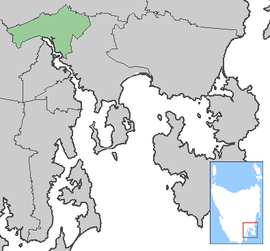
Brighton CouncilPopulation: 16,358[1] Established: 1863 Coordinates: 42°43′14″S 147°17′40″E / 42.72056°S 147.29444°ECoordinates: 42°43′14″S 147°17′40″E / 42.72056°S 147.29444°E Area: 168 km² (64.9 sq mi) Mayor: Tony Foster Council Seat: Brighton Region: Brighton/Bridgewater State District: Lyons Federal Division: Lyons LGAs around Brighton Council: Southern Midlands Southern Midlands Southern Midlands Derwent Valley Brighton Council Clarence Derwent Valley Glenorchy Clarence The Brighton Council or Municipality of Brighton is a Local Government Area of Tasmania. It in based in the town of Brighton, and covers the towns of Pontville and Tea Tree. It also covers the far northern Hobart suburbs of Bridgewater, Gagebrook, Honeywood and Old Beach.
Brighton Council has one of the highest birth rate in all of Australia. The Total Fertility Rate was 2.64 in 2001 and 2.60 in 2006 according to the birth rate and fertility rate in Australia site.
References
- ^ Australian Bureau of Statistics (31 March 2011). "3218.0 - Regional Population Growth, Australia, 2009-10". http://www.abs.gov.au/AUSSTATS/abs@.nsf/DetailsPage/3218.02009-10?OpenDocument. Retrieved 23 August 2011. Estimated resident population (ERP) at 30 June 2010.
External links
Local Government Areas of Tasmania grouped by areas Central 
Hobart area Launceston area North-east area North-west and west coast South-east area Categories:- Populated places established in 1863
- 1863 establishments in Australia
- Local Government Areas of Tasmania
- Tasmania geography stubs

Wikimedia Foundation. 2010.