- Cranbourne West, Victoria
-
Cranbourne West
Melbourne, Victoria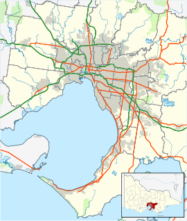
 Cranbourne West
Population: 7,277 (2006) [1] Postcode: 3977 Area: 3.5 km² (1.4 sq mi) Location: - 49 km (30 mi) from Melbourne
- 2 km (1 mi) from Cranbourne
LGA: City of Casey State District: Cranbourne Federal Division: Holt Suburbs around Cranbourne West: Lyndhurst Cranbourne North Skye Cranbourne West Cranbourne Langwarrin Cranbourne Cranbourne South Cranbourne West is a suburb in Melbourne, Victoria, Australia, 41 km south-east from Melbourne's central business district. Its Local Government Area is the City of Casey. At the 2006 Census, Cranbourne West had a population of 7277.
Cranbourne West has developed since the 1990s, and in 2006 had a new shopping centre opened called 'The Sandhurst Centre', on the corner of Duff Street and Monahans Road.
The Year 7-12 private Catholic School, St Peters College, is situated on Sladen Street in the far south of the suburb.
The Cranbourne West Development Plan was released in 2008 by the City of Casey and includes a large parcel of land bounded by Thompson Road to the North, Evans Road to the East, Western Port Highway to the West, and the proposed Ballarto Road and the Urban Growth Boundary to the south. When developed, the new development will have a large industrial area, housing, a network of parks and pathways, a primary school, and a secondary college. Low-density housing will be provided for at the far south of the parcel just north of the Urban Growth Boundary.[2][3]
References
- ^ Australian Bureau of Statistics (25 October 2007). "Cranbourne West (State Suburb)". 2006 Census QuickStats. http://www.censusdata.abs.gov.au/ABSNavigation/prenav/LocationSearch?collection=Census&period=2006&areacode=SSC21197&producttype=QuickStats&breadcrumb=PL&action=401. Retrieved 2007-09-15.
- ^ City Of Casey
- ^ Growth Areas Authority
Coordinates: 38°06′11″S 145°16′01″E / 38.103°S 145.267°E
Suburbs and Rural Townships of the City of Casey | Victoria Berwick · Blind Bight · Cannons Creek · Clyde · Clyde North · Cranbourne · Cranbourne East · Cranbourne North · Cranbourne South · Cranbourne West · Devon Meadows · Doveton · Endeavour Hills · Eumemmerring · Hallam · Hampton Park · Harkaway · Junction Village · Lynbrook · Lysterfield South · Narre Warren · Narre Warren North · Narre Warren South · Pearcedale · Tooradin · Warneet
Categories:- Suburbs of Melbourne
- Melbourne geography stubs

Wikimedia Foundation. 2010.