- Waltham, Massachusetts
Infobox Settlement
official_name = Waltham, Massachusetts
nickname = The Watch City
motto =
imagesize = 250px
image_caption = Waltham on the banks of the Charles River
image_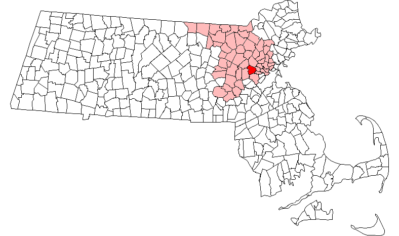
mapsize = 250px
map_caption = Location in Middlesex County in Massachusetts
mapsize1 =
map_caption1 =
subdivision_type = Country
subdivision_name =United States
subdivision_type1 = State
subdivision_name1 =Massachusetts
subdivision_type2 = County
subdivision_name2 = Middlesex
established_title = Settled
established_date = 1634
established_title2 = Incorporated
established_date2 = 1738
established_title3 =
established_date3 =
government_type = Mayor-council city
leader_title =Mayor
leader_name = Jeannette A. McCarthy
leader_title1 =
leader_name1 =
area_magnitude =
area_total_km2 = 35.2
area_total_sq_mi = 13.6
area_land_km2 = 32.9
area_land_sq_mi = 12.7
area_water_km2 = 2.4
area_water_sq_mi = 0.9
population_as_of = 2007
settlement_type =City
population_total = 59,758
population_density_km2 = 1,816.4
population_density_sq_mi = 4,705.4
elevation_m = 15
elevation_ft = 50
timezone = Eastern
utc_offset = -5
timezone_DST = Eastern
utc_offset_DST = -4
latd = 42 |latm = 22 |lats = 35 |latNS = N
longd = 71 |longm = 14 |longs = 10 |longEW = W
blank_name = FIPS code
blank_info = 25-72600
blank1_name = GNIS feature ID
blank1_info = 0612400
footnotes =
website = http://www.city.waltham.ma.us/
postal_code_type = ZIP code
postal_code = 02451-02454
area_code = 339 / 781One of the early centers of theIndustrial Revolution in northern America, Waltham is a city in Middlesex County,Massachusetts ,United States . The population was 59,226 at the 2000census . The name "Waltham" means 'home in the woods'.Waltham is home to The Sports Authority Training Center, which serves a dual role as practice facility/offices of the
Boston Celtics .Waltham is commonly referred to as Watch City because of its association with the watch industry. This is due to
Waltham Watch Company , which opened its factory in Waltham in 1854. It was the first company to make watches on an assembly line. It won the gold medal in 1876 at the PhiladelphiaCentennial Exposition . Over 40 million watches, clocks and instruments were produced byWaltham Watch Company until it closed in 1957.Pronunciation
The name of the city is pronounced with the primary stress on the first syllable and secondary stress on the second syllable, although the name of the Waltham watch was pronounced with accent only on the first syllable. The second vowel is pronounced properly ("Wall-tham", to rhyme with tall-ham, IPAEng|ˈwɔlθæm), and not elided into a
schwa ("Wall-thumb", IPA IPA|*/ˈwɔlθəm/) as might be expected inAmerican English .History
Waltham was first settled in 1634 as part of Watertown and was officially incorporated as a separate town in 1738.
In the early 19th century, Francis Cabot Lowell and his friends and colleagues established in Waltham the
Boston Manufacturing Company - the first integrated textile mill in the United States.The city is home to
Gore Place , a mansion built in 1806 for formerMassachusetts GovernorChristopher Gore ; TheRobert Treat Paine Estate , a residence designed in collaboration between architectHenry Hobson Richardson and landscape architectFrederick Law Olmsted for philanthropist Robert Treat Paine, Jr. (1810-1905); and theLyman Estate , a convert|400|acre|km2|sing=on estate established in 1793 by Boston merchantTheodore Lyman .Early in the twentieth century, Waltham was home to the
brass era automobile manufacturer Metz.National Register of Historic Places
Geography
Waltham is located at coor dms|42|22|50|N|71|14|6|W|city (42.380596, -71.235005),GR|1 about 10 miles (16.09 km) north-west of downtown
Boston ,Massachusetts .The city stretches along the
Charles River and contains severaldam s. These dams were used to power textile mills and other such endeavors, accounting for its early industrial activity.According to the
United States Census Bureau , the city has a total area of 13.6 square miles (35.2km² ), of which, 12.7 square miles (32.9 km²) of it is land and 0.9 square miles (2.4 km²) of it (6.69%) is water.Neighborhoods
Waltham has several neighborhoods or villages, including: [http://www.waltham-community.org/neighborhoods.html]
* Angleside
* Banks Square
* The Bleachery
* Cedarwood
* The Chemistry
* The Highlands
* The Island (formerly Morse Meadow Island)
* Kendal Green (mostly in Weston)
* Lakeview
* The Lanes
* Piety Corner
* Prospectville (defunct in 1894, now under Cambridge Reservoir)
* Ravenswood
* Robert's
* Rock Alley
* Southside
* WarrendaleAdjacent towns
It is bordered to the west by Weston and Lincoln, to the south by Newton, to the east by Belmont and Watertown, and to the north by Lexington.
Demographics
As of the
census GR|2 of 2000, there were 59,226 people, 23,207 households, and 12,462 families residing in the city. Thepopulation density was 4,663.4 people per square mile (1,800.6/km²). There were 23,880 housing units at an average density of 1,880.3/sq mi (726.0/km²). The racial makeup of the city was 82.98% White, 4.41% African American, 0.16% Native American, 7.29% Asian, 0.06% Pacific Islander, 3.20% from other races, and 1.89% from two or more races. Hispanic or Latino of any race were 8.49% of the population. In recent years, Guatemalans have surpassed Puerto Ricans as the dominant Latino population. Guatemalan businesses and establishments have increased noticeably and line Moody St. and other parts of the city.There were 23,207 households, of which 20.3% included children under the age of 18, 41.3% were married couples living together, 8.9% were headed by a single mother, and 46.3% were non-families. 34.2% of all households were made up of individuals and 10.0% had someone living alone who was 65 or older. The average household size was 2.29 and the average family size was 3.01.
The population of the city was divided as follows: 15.5% under 18, 16.8% from 18 to 24, 34.4% from 25 to 44, 20.2% from 45 to 64, and 13.1% 65 or older. The median age was 34. For every 100 females there were 97.2 males. For every 100 females 18 and over, there were 95.6 males.
The median income for a household in the city was $54,010, and the median income for a family was $64,595. Males had a median income of $42,324 versus $33,931 for females. The
per capita income for the city was $26,364. 7% of the population and 3.6% of families lived below thepoverty line . 4.8% of those under 18 and 8.4% of those 65 and older lived below the poverty line.Government
Waltham is governed by a mayor and a city council. The current mayor is Jeanette A. McCarthy. There are 15 members of the city council, each elected to two-year terms in non-partisan elections. The current president of the city council is Thomas J. Curtin.
The city is in
Massachusetts's 7th congressional district and is currently represented in theUnited States House of Representatives byEdward J. Markey .Education
Public schools
The Waltham public school system includes eight elementary schools, two middle schools, and one senior high school. Waltham High School's sports teams used to be referred to as the Watchmen and the Crimson, before becoming known as the Hawks.
Private schools
* [http://www.chch.org/Default.asp?bhcp=1 Chapel Hill-Chauncy Hall School]
*Gann Academy
*Our Lady Comforter of the Afflicted School (Pre-K through 8)
*Saint Jude School (K through 8)Higher education
Waltham is home to:
*Brandeis University
*Bentley University
*Center for Digital Imaging Arts at Boston University (Waltham Campus) Transportation
The city of Waltham is convert|10|mi|km west of
Boston ,Massachusetts on theCharles River , but only about 10- to 15-minute drive from the closest neighborhood of Boston, which isBrighton, Massachusetts .Waltham is near several important U.S. Interstate highways. Interstate 95 (which is also Route 128) runs through the western part of the city,
Interstate 90 (also theMassachusetts Turnpike ) is just to south inNewton, Massachusetts , and Route 2 runs just to the north throughLexington, Massachusetts .Waltham is partly surrounded by Interstate 95 (I-95), also called Route 128; hence Waltham is in the heart of Boston's Route 128 High Technology Corridor.
The
MBTA commuter rail has two stops in Waltham as part of the Fitchburg-Boston Line: one in Central Square Waltham across from the City Hall and one near Brandeis University.MBTA bus service also covers the city, notably route 70, between Central Square, Cambridge, and Cedarwood (a community in western Waltham), as well as a subsidiary route (70A) in northwest Waltham. Numerous bus lines stop at Carter Street on the south side of the Waltham Common, very close to the MBTA commuter rail station.
Media
Waltham is home to a daily newspaper, the [http://www.dailynewstribune.com Daily News Tribune] . [http://www.wcac.org WCAC-TV] provides local-interest television programming. Waltham news sometimes appears in the
Boston Globe 's GlobeWest section, as well.Culture
Waltham is some distance from Boston proper and the surrounding cities, and maintains a distinctly different flavor. A number of high-tech companies have taken advantage of the lower cost of real estate to set up shop in the ring of office parks that dot the highway exits in Waltham, and swank restaurants and business-class hotels have sprung up to serve their needs.
Downtown Waltham's Moody Street offers its own brand of entertainment with a colorful assortment of shops, restaurants, and bars, including the Watch City Brewing Co., The Skellig, Jake's Dixie Roadhouse, The Lincoln (L), and the Embassy Cinema. Moody Street's booming nightlife, convenience to the commuter rail and lower rents have attracted younger professionals to Waltham in growing numbers in recent years. Moody Street is also referred to as "Restaurant Row" because of the number, variety and quality of its restaurants.
For over 25 years, the Waltham Arts Council has sponsored "Concerts On Waltham Common", featuring a different musical act each week of the summer, free of charge to attendees. "Concerts On Waltham Common" was created and organized by Stephen Kilgore until his death in 2004.
Open space in the city is protected by theWaltham Land Trust .Points of interest
*
Gore Place
*Lyman Estate
*Robert Treat Paine Estate
* [http://www.crmi.org/ Charles River Museum of Industry]
* Waverly Oaks - great for walking dogs
* Prospect Hill - second highest point in the region after Blue Hills
*Charles River - Riverwalk on Moody St.
* [http://www.landmarktheatres.com/Market/Boston/EmbassyCinemaB.htm Embassy Theater]
*A. Wherehouse Notable residents
*
Keith Aucoin -- Current forward on theNHL 'sCarolina Hurricanes who starred atNorwich University , where he graduated in 2001 as the school's all-time leading scorer in ice hockey, was named U.S. College Hockey Online National Player of the Year in 1998-1999, helped Norwich win the NCAA Division III National Championship in 1999-2000 and was named ECAC East Player of the Year and First-Team All-American; Waltham native
*John A. Bailey –- Inventor of the drink through container lid andinjection molding pioneer. Waltham native
*F. Lee Bailey -- lawyer
*Gerard V. Beaudoin, Jr . -- Jazz guitarist. Has recorded withDuke Robillard ,J. Geils andDavid Grisman . Waltham native and current resident.
*Mackenzy Bernadeau , Waltham native, rookie guard for the Carolina Panthers of the National Football League.
*Gretchen Dutschke-Klotz former wife of german student leaderRudi Dutschke
*Annie Payson Call -- author.
*Arthur A. Carey -- co-founder of Sea Scouting in the United States.
*Ryan Gallant -- Professional Skateboarder
*Gerald Green --Boston Celtics Guard/Forward. 2005 First Round Draft Pick. Winner of the 2007 NBA Slam Dunk Contest.
*James N. Hallock -- Scientist, known for his work on theCAIB .
*C.D. Howe -- WWII and Postwar Canadian politician; Waltham native
*Jeff Lazaro -- FormerBoston Bruins forward notched 14 goals and 23 assists in 3-yearNHL career with the Bruins andOttawa Senators ; 1986 Waltham High School graduate
*Noelle LeBlanc -- lead singer/guitarist of Island/Def Jam Records'hard rock /power pop quartetDamone ; Waltham native and current resident
*John Lynch -- CurrentGovernor of New Hampshire ; Waltham native, attended Waltham public schools
*Tony Massarotti --Boston Herald sportswriter, book author and part-time co-host on SportsradioWEEI 850AM inBoston graduate of Waltham High School
*Mark Blount -- Former Boston Celtic
*Walter McCarty -- Former Boston Celtic
*Shawn McEachern --Boston Bruins forward has tallied 254 goals and 317 assists during 13-yearNHL career with the Bruins,Pittsburgh Penguins ,Los Angeles Kings ,Ottawa Senators andAtlanta Thrashers ; Waltham native
*Pat Metheny -- jazz guitar player was a former resident
*Paul Pierce --Boston Celtics captain who is a 6-time NBA All-Star as a guard/forward
*Ida Annah Ryan -- First woman to earn a masters degree in architecture (from M.I.T.)
*Carroll Spinney -- voice of "Big Bird" and "Oscar the Grouch" onSesame Street .
*Fred Smerlas -- 5-timeNFL Pro-Bowl selection during 14-year career as a nose tackle withBuffalo Bills ,San Francisco 49ers , andNew England Patriots , currently a part-time co-host on SportsradioWEEI 850AM inBoston ; 1975 Waltham High School graduate, native and former resident
*Antoine Walker -- 3-time NBA All-Star forward currently with theMinnesota Timberwolves , was captain of theBoston Celtics and has also played with theDallas Mavericks ,Atlanta Hawks andMiami Heat ; former resident
*Jeanne Meserve -- Television announcer onCNN , formerly on ABC, former resident
*Robert Meserve -- former American Bar Association President, announced ABA's disbarment ofRichard M Nixon , former resident, father of Jeanne Meserve, now deceased.
*Frank Pino member of the band Waltham and star of MTV's reality show "Made" and his wifeKaren Bellini Pino drummer for the band The Andwutz
*Dan Blackburn -- former NHL goaltender for theNew York Rangers from 2001-2005 Fact|date=August 2008
*Delonte West -- Former Boston Celtic and current Cleveland Cavalieree also
*
Greater Boston
*Mayor-council government References
Further reading
* [http://www.salemdeeds.com/atlases_results.asp?ImageType=index&atlastype=MassWorld&atlastown=&atlas=MASSACHUSETTS+1871&atlas_desc=MASSACHUSETTS+1871 "1871 Atlas of Massachusetts".] by Wall & Gray. [http://www.salemdeeds.com/atlases_pages.asp?ImageName=PAGE_0010_0011.jpg&atlastype=MassWorld&atlastown=&atlas=MASSACHUSETTS+1871&atlas_desc=MASSACHUSETTS+1871&pageprefix= Map of Massachusetts.] [http://www.salemdeeds.com/atlases_pages.asp?ImageName=PAGE_0044_0045.jpg&atlastype=MassWorld&atlastown=&atlas=MASSACHUSETTS+1871&atlas_desc=MASSACHUSETTS+1871&pageprefix= Map of Middlesex County.]
* "History of Middlesex County, Massachusetts", [http://books.google.com/books?id=QGolOAyd9RMC&dq=intitle:History+intitle:of+intitle:Middlesex+intitle:County+intitle:Massachusetts&lr=&num=50&as_brr=0&source=gbs_other_versions_sidebar_s&cad=5 Volume 1 (A-H)] , [http://books.google.com/books?id=hNaAnwRMedUC&pg=PA506&dq=intitle:History+intitle:of+intitle:Middlesex+intitle:County+intitle:Massachusetts&lr=&num=50&as_brr=0#PPA3,M1 Volume 2 (L-W)] compiled by Samuel Adams Drake, published 1879 and 1880. 572 and 505 pages. [http://books.google.com/books?id=hNaAnwRMedUC&pg=PA506&dq=History+of+Middlesex+County,+Massachusetts#PPA407,M1 Waltham article] by Alexander Starbuck in volume 2 pages 407-433.External links
* [http://www.city.waltham.ma.us/ Waltham official website]
* [http://www.bentley.edu/Waltham Bentley College]
* [http://walthamwatchdog.blogspot.com/ Waltham Watchdog]
* [http://www.waltham-community.org/ Waltham Community website]
* [http://www.waltham-community.org/history.html Key dates in Waltham, Mass., History]
* [http://www.waltham-community.org/images/WalthamNmap-588x621.gifMap of Waltham neighborhoods]
* [http://www.discoverwaltham.com/index.php Discover Waltham]
* [http://www.dailynewstribune.com/ Waltham Daily News Tribune]
* [http://www.walthamarts.org/ Waltham Arts Council]
* [http://www.landmarktheatres.com/Market/Boston/EmbassyCinema.htm Embassy Cinema]
* [http://www.brandeis.edu/ Brandeis University]
* [http://walthamarchives.wikispaces.com/ Waltham Archives Wikispace]
* [http://www.walthammuseum.com/ Waltham Museum]
* [http://www.wcac.org/ Waltham Community Access Corporation]
* [http://www.ourladyschool.org/ Our Lady Comforter of the Afflicted School]
* [http://www.cdiabu.com The Center for Digital Imaging Arts at Boston University]
Wikimedia Foundation. 2010.