- Mekong
-
Mekong River (Mae Nam Khong) Megaung Myit, แม่น้ำโขง (Maenam Khong), Mékôngk, Tonle Thom, Cửu Long, Mê Kông, 湄公 (Méigōng) River 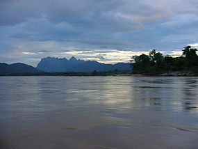 View of the Mekong before sunset.
Countries Burma, Cambodia, Laos, People's Republic of China, Thailand, Vietnam Source Lasagongma Spring - location Mt. Guozongmucha, Zadoi, Yushu Tibetan Autonomous Prefecture, Qinghai, China - elevation 5,224 m (17,139 ft) - coordinates 33°42.5′N 94°41.7′E / 33.7083°N 94.695°E Mouth Mekong Delta - elevation 0 m (0 ft) Length 4,350 km (2,703 mi) Basin 795,000 km2 (307,000 sq mi) Discharge for South China Sea - average 16,000 m3/s (570,000 cu ft/s) - max 39,000 m3/s (1,400,000 cu ft/s) 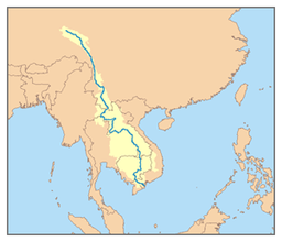
The Mekong is a river that runs through China, Burma, Laos, Thailand, Cambodia and Vietnam. It is the world's 10th-longest river[1] and the 7th-longest in Asia. Its estimated length is 4,909 km (3,050 mi),[1] and it drains an area of 795,000 km2 (307,000 sq mi), discharging 475 km3 (114 cu mi) of water annually.[2]
From the Tibetan Plateau this river runs through China's Yunnan province, Burma, Laos, Thailand, Cambodia and Vietnam. Laos, Thailand, Cambodia and Vietnam established the Mekong River Commission (MRC) in 1995 to assist in the management and coordinated use of the Mekong's resources. In 1996 China and Burma became "dialogue partners" of the MRC and the six countries now work together within a cooperative framework.
The extreme seasonal variations in flow and the presence of rapids and waterfalls in this river have made navigation extremely difficult.
Contents
Names
In English the river is called "the Mekong River", derived from "Mae Nam Khong", a term of both Thai and Lao origin. In the Lao-Thai toponymy, all great rivers are considered "mother rivers" signalled by the prefix "mae", meaning "mother", and "nam" for water. In the Mekong's case, Mae Nam Khong means Khong, Mother of Water.[3] "Khong" is derived from the Sanskrit "ganga", meaning the Ganges. Many Northern Thai and Laos locals refer to it as the "River Khong". Such is the case with the Mae Nam Ping in Chiang Mai which is known as the "Ping River". The Tonle Sap in Cambodia is a similar example – where Tonle translates as "Great lake or river", making the Tonle Sap River an unnecessary repetition of what is in fact the "Sap River".
In Thai, โขง (pronounced [kʰǒːŋ]) is a species of crocodile; some believe this is tone-shifted from คด [kʰót] or โค้ง [kʰóːŋ], both adjectives to describe curves or meanders of a river or road.[4]
Since the river flows through a number of countries, it has many different names in local languages:
- Burmese: မဲခေါင်မြစ်, IPA: [mɛ́ɡàuɴ mjɪ̰ʔ]
- Chinese: Riverhead: 加果空桑贡玛曲, 扎那曲 and 扎曲 Zā Qū, upper reaches: 澜沧江, 瀾滄江 Láncāng Jiāng ("Turbulent River", "Láncāng" is also same to Lan Xang in Chinese[5]), middle and lower reaches: 湄公河 Méigōng hé.
- Khmer: មេគង្គ Mékôngk [meekoŋ], ទន្លេមេគង្គ Tônlé Mékôngk [tʊənlee meekoŋ], ទន្លេធំ Tônlé Thum [tʊənlee tʰom] ("Great River").
- Lao: ແມ່ນ້ຳຂອງ, [mɛː nâːm kʰɔ̌ːŋ], ນ້ຳຂອງ [nâːm kʰɔ̌ːŋ].
- Thai: แม่น้ำโขง, [mɛ̂ː náːm kʰǒːŋ].
- Tibetan: རྫ་ཆུ་, Wylie: rDza chu, ZYPY: Za qu[6]
- Vietnamese: Sông Mê Kông (pronounced [soŋm mekoŋm]), Sông Lớn ("Great River", [soŋm lə̌ːn]), Sông Cửu Long ("Nine Dragons River", [soŋm kɨ̃w lɔŋ]).
Course
The Mekong rises in the "Three Rivers Area" on the Tibetan Plateau in the Sanjiangyuan National Nature Reserve as the Lancang, together with the Yangtze and Salween Rivers.[2] It flows southwest through Yunnan Province through the Three Rivers Area in the Hengduan Mountains. After leaving China, it flows southwest and forms the border of Burma and Laos for about 100 kilometres (62 mi) then turns southeast to form briefly the border of Laos with Thailand. The Mekong then flows east and south into Laos for some 400 kilometres (250 mi) and defines the Laos-Thailand border again for some 850 kilometres (530 mi) as it flows east, turning south through central Southeast Asia, passing through the capital of Laos, Vientiane. The Mun River's confluence with the Mekong occurs right before it crosses into Cambodia, where it receives the Sap River, flowing by Phnom Penh, the capital of Cambodia. The Mekong slows as it enters Vietnam, where it divides into nine channels of the Mekong Delta (these include: Tiền, Mỹ Tho, Hàm Luông, Cổ Chiên, Ba Lai, Hậu), emptying into the South China Sea.
Drainage basin
 The Mekong from Phou si
From the point where it rises to its mouth, the most precipitous drop in the Mekong occurs in what is referred to as the 'Upper Mekong Basin' (see below), a stretch of some 2,200 km (1,400 mi). Here, it drops 4,500 metres (14,800 ft) before it enters the Lower Basin where the borders of Thailand, Laos, China and Burma come together in the Golden Triangle. Downstream from the Golden Triangle, the river flows for a further 2,600 km (1,600 mi) through Laos, Thailand and Cambodia before entering the South China Sea via a complex delta system in Viet Nam.[7]
In Yunnan province in China, the river and its tributaries are confined by narrow, deep gorges. The tributary river systems in this part of the basin are small. Only 14 have catchment areas that exceed 1,000 km2 (390 sq mi), yet the greatest amount of Loss of forest cover in the entire river system per kilometer has occured in this region due to heavy unchecked demand for natural resources. In the south of Yunnan, in Simao and Xishuangbanna Prefectures, the river changes as the valley opens out, the floodplain becomes wider, and the river becomes wider and slower.[7]
Laos lies almost entirely within the Lower Mekong Basin. Its climate, landscape and land use are the major factors shaping the hydrology of the river. The mountainous landscape means that only 16% of the country is farmed under lowland terrace or upland shifting cultivation.[7] With upland shifting agriculture (slash and burn), soils recover within 10 to 20 years but the vegetation does not. Shifting cultivation is common in the uplands of Northern Laos and is reported to account for as much as 27% of the total land under rice cultivation.[7] As elsewhere in the basin, forest cover has been steadily reduced during the last three decades by shifting agriculture and permanent agriculture. The cumulative impacts of these activities on the river regime have not been measured.
Loss of forest cover in the Thai areas of the Lower Basin has been the highest in all the Lower Mekong countries over the past 60 years. On the Korat Plateau, which includes the Mun and Chi tributary systems, forest cover was reduced from 42% in 1961 to 13% in 1993.[7] Although this part of Northeast Thailand has an annual rainfall of more than 1,000 mm, a high evaporation rate means it is classified as a semi arid region. Consequently, although the Mun and Chi Basins drain 15% of the entire Mekong Basin, they only contribute 6% of the average annual flow.[7] Sandy and saline soils are the most common soil types, which makes much of the land unsuitable for wet rice cultivation. In spite of poor fertility, however, agriculture is intensive. Glutinous rice, maize and cassava are the principal crops.[7] Drought is by far the major hydrological hazard in this region.[7]
In Cambodia, the wet rice is the main crop and is grown on the flood plains of the Tonle Sap, Mekong and Bassac rivers.[7] More than half of Cambodia remains covered with mixed evergreen and deciduous broadleaf forest, but forest cover has decreased from 73% in 1973 to 63% in 1993.[7] Here, the river landscape is flat. Small changes in water level determine the direction of water movement, including the large-scale reversal of flow into and out of the Tonle Sap basin from the Mekong River.[7]
The Mekong Delta in Viet Nam is farmed intensively and has little natural vegetation left. Forest cover is less than 10%. In the Central Highlands of Viet Nam, forest cover was reduced from over 95% in the 1950s to around 50% in the mid 1990s.[7] Agricultural expansion and population pressure are the major reasons for land use and landscape change. Both drought and flood are common hazards in the Delta, which many people believe is the most sensitive to upstream hydrological change.[7]
The Mekong Basin can be divided into two parts: the Upper Basin in Tibet and China, and the Lower Mekong Basin from Yunnan downstream from China to the South China Sea.[7] The Upper Basin makes up 24% of the total area and contributes 15 to 20% of the water that flows into the Mekong River. The catchment here is steep and narrow. Soil erosion has been a major problem and approximately 50% of the sediment in the river comes from the Upper Basin.[7]
Major tributary systems develop in the Lower Basin. These systems can be separated into two groups: tributaries that contribute to the major wet season flows, and tributaries that drain low relief regions of lower rainfall. The first group are left bank tributaries that drain the high-rainfall areas of Lao PDR. The second group are those on the right bank, mainly the Mun and Chi rivers, that drain a large part of Northeast Thailand.
Table 1: Basic data on country share of Mekong Basin territory and water flows[7]
China Myanmar Lao PDR Thailand Cambodia Vietnam Total Area in Basin (km,2) 165,000 24,000 202,000 184,000 155,000 65,000 795,000 Catchment as % of MRB 21 3 25 23 20 8 100 Flow as % of MRB 16 2 35 18 18 11 100 As the Mekong enters Cambodia, over 95% of the flows have already joined the river.[7] From here on downstream the terrain is flat and water levels rather than flow volumes determine the movement of water across the landscape. The seasonal cycle of changing water levels at Phnom Penh results in the unique “flow reversal” of water into and out of the Great Lake via the Tonle Sap River. Phnom Penh also marks the beginning of the delta system of the Mekong River. Here the mainstream begins to break up into an increasing number of branches.[7]
By taking into account hydrological regimes, physiography land use, and existing, planned and potential resource developments, the Mekong is divided into six distinct reaches[7]:
Reach 1: Lancang Jiang or Upper Mekong River in China. In this part of the river, the major source of water flowing into the river comes from melting snow on the Tibetan Plateau. This volume of water is sometimes called the “Yunnan Component” and plays an important role in the low-flow hydrology of the lower mainstream. Even as far downstream as Kratie, the Yunnan Component makes up almost 30% of the average dry season flow. A major concern is that the on-going and planned expansion of dams and reservoirs on the Mekong mainstream in Yunnan could have a significant effect on the low-flow regime of the Lower Mekong Basin system.[7]
Reach 2: Chiang Saen to Vientiane and Nongkhai. This reach is almost entirely mountainous and covered with natural forest, although there has been widespread slash and burn agriculture. Although this reach could hardly be described as “unspoiled”, the hydrological response is perhaps the most natural and undisturbed in all the Lower Basin. Many hydrological aspects of the Lower Basin start to change rapidly at the downstream boundary of this reach.[7]
Reach 3: Vientiane and Nongkhai to Pakse. The boundary between Reach 2 and 3 is where the Mekong hydrology starts to change. Reach 2 is dominated in both wet and dry seasons by the Yunnan Component. Reach 3 is increasingly influenced by contributions from the large left bank tributaries in Laos, namely the Nam Ngum, Nam Theun, Nam Hinboun, Se Bang Fai, Se Bang Hieng and Se Done rivers. The Mun - Chi river system from the right bank in Thailand also enters the mainstream within this reach.[7]
Reach 4: Pakse to Kratie. The main hydrological contributions to the mainstream in this reach come from the Se Kong, Se San and Sre Pok catchments. Together, these rivers make up the largest hydrological subcomponent of the Lower Basin. Over 25% of the mean annual flow volume to the mainstream at Kratie comes from these three river basins. They are the key element in the hydrology of this part of the system, especially to the Tonle Sap flow reversal.[7]
Reach 5: Kratie to Phnom Penh. This reach includes the hydraulic complexities of the Cambodian floodplain, the Tonle Sap and the Great Lake. By this stage, over 95% of the total flow has entered the Mekong system. The focus turns from hydrology and water discharge to the assessment of water level, over- bank storage and flooding and the hydrodynamics that determine the timing, duration and volume of the seasonal flow reversal into and out of the Great Lake.[7]
Reach 6: Phnom Penh to the South China Sea. Here the mainstream divides into a complex and increasingly controlled and artificial system of branches and canals. Key features of flow behaviour are tidal influences and salt water intrusion. Every year, 35 to 50% of this reach is flooded during the rainy season. The impact of road embankments and similar infrastructure developments on the movement of this flood water is an increasingly important consequence of development.[7]
Table 2 summarises the mean annual flows along the mainstream. The mean annual flow entering the lower Mekong from China is equivalent to a relatively modest 450 mm depth of runoff. Downstream of Vientiane this increases to over 600 mm as the principal left bank tributaries enter the mainstream, mainly the Nam Ngum and Nam Theun. The flow level falls again, even with the right bank entry of the Mun-Chi system from Thailand. Although the Mun - Chi basin drains 20% of the lower system, average annual runoff is only 250 mm. Runoff in the mainstream increases again with the entry from the left bank of the Se Kong from southern Laos and Se San and Sre Pok from Vietnam and Cambodia.
Table 2: Lower Mekong Mainstream annual flow (1960 to 2004) at selected sites.[7]
Mainstream site Catchment area (km2) Mean annual flow as as % total Mekong Discharge m³/s Volume km3 Runoff (mm) Chiang Saen 189,000 2,700 85 450 19 Luang Prabang 268,000 3,900 123 460 27 Chiang Khan 292,000 4,200 133 460 29 Vientiane 299,000 4,400 139 460 30 Nongkhai 302,000 4,500 142 470 31 Nakhon Phanom 373,000 7,100 224 600 49 Mukdahan 391,000 7,600 240 610 52 Pakse 545,000 9,700 306 560 67 Stung Treng 635,000 13,100 413 650 90 Kratie 646,000 13,200 416 640 91 Basin Total 760,000 14,500 457 600 100 Flows at Chiang Saen entering the Lower Basin from Yunnan make up about 15% of the wet season flow at Kratie. This rises to 40% during the dry season, even this far downstream. During the wet season, the proportion of average flow coming from Yunnan rapidly decreases downstream of Chiang Saen, from 70% to less than 20% at Kratie. The dry season contribution from Yunnan is much more significant. The major portion of the balance comes from Laos, which points to a major distinction in the low-flow hydrology of the river. One fraction comes from melting snow in China and Tibet and the rest from over-season catchment storage in the Lower Basin. This has implications for the occurrence of drought conditions. For example, if runoff from melting snow in any given year is very low, then flows upstream of Vientiane-Nongkhai would be lower.[7]
In a large river system like the Mekong, seasonal flows can be quite variable from year to year. Although the pattern of the annual hydrograph is fairly predictable, its magnitude is not. The average monthly flows along the mainstream are listed in Table 3, providing an indication of their range and variability from year to year. At Pakse, for example, flood season flows during August would exceed 20,000 cubic metres per second 9 years out of 10, but exceed 34,000 m³/s only 1 year in ten.[7]
Table 3: Mekong Mainstream monthly discharge 1960 to 2004 (m³/s).[7]
Month Chian Saen Luang Prabang Vientiane Nakhon Phanom Mukdahan Pakse Kratie Jan 1,150 1,690 1,760 2,380 2,370 2,800 3,620 Feb 930 1,280 1,370 1,860 1,880 2,170 2,730 Mar 830 1,060 1,170 1,560 1,600 1,840 2,290 Apr 910 1,110 1,190 1,530 1,560 1,800 2,220 May 1,300 1,570 1,720 2,410 2,430 2,920 3,640 Jun 2,460 3,110 3,410 6,610 7,090 8,810 11,200 Jul 4,720 6,400 6,920 12,800 13,600 16,600 22,200 Aug 6,480 9,920 11,000 19,100 20,600 26,200 35,500 Sep 5,510 8,990 10,800 18,500 19,800 26,300 36,700 Oct 3,840 5,750 6,800 10,200 10,900 15,400 22,000 Nov 2,510 3,790 4,230 5,410 5,710 7,780 10,900 Dec 1,590 2,400 2,560 3,340 3,410 4,190 5,710 There is little evidence from the last 45 years of data of any systematic changes in the hydrological regime of the Mekong.[7]
Mekong River modifications
The Mekong is already heavily dammed, with many more dams planned and under construction. See Mekong River Basin Hydropower development for more information.
Environmental concerns
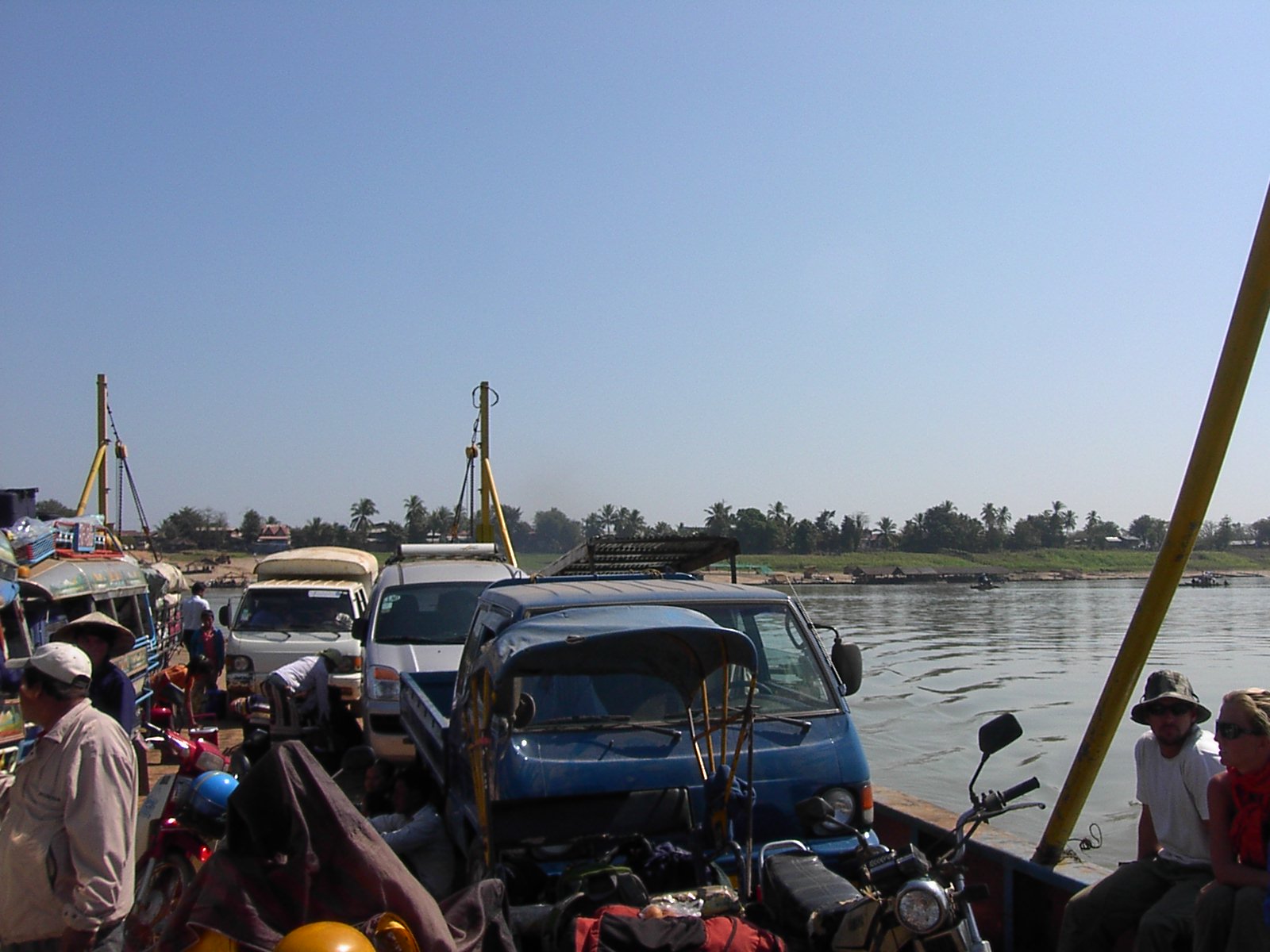
 Crossing the Mekong by ferry, near Champasak, Laos
The two most current issues facing the river are the building of dams and blasting of rapids.
A number of dams have already been built on the river's tributaries, notably the Pak Mun dam in Thailand. This has been criticised on grounds of cost as well as damage to the environment and to the livelihoods of affected villagers, though none have been built on the main part itself.
China is engaged in an extensive program of dam-building on the river itself: it has already completed three, the first called the Manwan dam, another twelve are under consideration.
Poverty stricken Cambodia is one nation that is completely dependent on the river for food and the vast majority of its fledgling economy. The annual floods provide much needed water for crops of the otherwise dry dusty land, and to refresh Tonle Sap, yet its major cities are all vulnerable to flooding. The Tonle Sap Biosphere Reserve has been created to try to protect areas around the Tonle Sap Lake and river, which is connected to the Mekong.[8]
The Mekong River Commission, a panel of the region's nations, has accused China of blatantly disregarding the nations downstream in its plans to dam the river in an effort to stop the dams, but to no avail. Since the building of the first Chinese dam, many species have become endangered, including the Mekong Dolphin and dugong, water levels have dropped as ferries get stuck, fish caught are small and the catch is less than half of before the dam, the turnover at Chiang Rai port is less than one fourth of previous years, and crossings from Chiang Rai to isolated Luang Prabang have lengthened from 8 hours to 2 days due to inadequate water levels.
Despite all these problems, new dams planned will have significantly worse impact if carried out as planned. All nations downstream and the environment will suffer from added pollution (due to development and relatively lax regulation and enforcement in China compared to Thailand, poisoning the food supply from pesticide runoff and heavy industry, as well as promoting algal blooms from organophosphates from agriculture, as well as water hyacinth infestation), river blockage problems as fish cannot swim upstream to spawn, and potentially devastating very low water flow.
Other environmental concerns arise from increased water flow in some parts as China clears rocks and sandbars, blasts gorges, and slows water as it dams and floods other sections, and relocates indigenous peoples. Cambodia is by far the most exposed, depending on a fine balance of water flow, fearing scenarios of mass famine and devastating floods, the likes of which destroyed the Angkor kingdom 700 years ago. Laos' biggest cities all hug the Mekong as does Vietnam's largest city and financial hub, Ho Chi Minh City, which would be vulnerable mostly to low flow and pollution.
Natural History of the Mekong River Basin
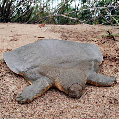
 Extirpated from most of its pan-Asian range, Cantor's giant softshell turtle can still be found along a certain stretch of the Mekong in Cambodia
The Mekong basin is one of the richest areas of biodiversity in the world. Only the Amazon boasts a higher level of biodiversity.[9] Biota estimates for the Greater Mekong Subregion (GMS) include 20,000 plant species, 430 mammals, 1,200 birds, 800 reptiles and amphibians [10] and an estimated 850 fish species.[11] In 2009, 145 new species were described from the Mekong Region, comprising 29 fish species previously unknown to science, two new bird species, ten reptiles, five mammals, 96 plants and six new amphibians[12] The Mekong Region contains 16 WWF Global 200 ecoregions, the greatest concentration of ecoregions in mainland Asia[13]
No other river is home to so many species of very large fish. The biggest include the giant river carp (Probarbus jullieni), which can grow up to 1.5 metres (4 ft 11 in) and weigh 70 kilograms (150 lb), the Mekong Freshwater Stingray (Himantura chaophraya), which can have a wingspan of up to 4.3 metres (14 ft), the giant pangasius (Pangasius sanitwongsei), Siamese giant carp (Catlocarpio siamensis) and the endemic Mekong giant catfish (Pangasianodon gigas), all three of which can grow up to about 3 metres (9 ft 10 in) in length and weigh 300 kilograms (660 lb). All of these are in serious decline, both because of dams and flood control and overfishing.[14]
One species of freshwater dolphin, the Irrawaddy Dolphin (Orcaella brevirostris), was once common in the whole of the Lower Mekong but is now very rare.[15]
Among other wetland mammals that have been living in and around the river are the smooth-coated otter (Lutra perspicillata) and fishing cat (Felis viverrina).
The endangered Siamese crocodile (Crocodylus siamensis) occurs in small isolated pockets within the northern Cambodian and Laotian portions of the Mekong River. The Saltwater crocodile (Crocodylus porosus) once ranged from the Mekong Delta up the river into Tonle Sap and beyond but is now extinct in the river, along with being extinct in all of Vietnam and possibly even Cambodia.
Geology of the Mekong River Basin
The internal drainage patterns of the Mekong are unusual when compared to those of other large rivers[2] Most large river systems that drain the interiors of continents, such as the Amazon, Congo, and Mississippi, have relatively simple dendritic tributary networks that resemble a branching tree.[16] Typically, such patterns develop in basins with gentle slopes where the underlying geological structure is fairly homogenous and stable, exerting little or no control on river morphology.[17] In marked contrast, the tributary networks of the Salween, Yangtze, and particularly the Mekong, are complex with different sub-basins often exhibiting different, and distinct, drainage patterns. These complex drainage systems have developed in a setting where the underlying geological structure is heterogeneous and active, and is the major factor controlling the course of rivers and the landscapes they carve out [18]
The elevation of the Tibetan Plateau during the Tertiary period was an important factor in the genesis of the south-west monsoon,[19] which is the dominant climatic control influencing the hydrology of the Mekong Basin. Understanding the nature and timing of the elevation of Tibet (and the Central Highlands of Viet Nam) therefore helps explain the provenance of sediment reaching the delta and the Tonle Sap Great Lake today. Studies of the provenance of sediments in the Mekong Delta reveal a major switch in the source of sediments about eight million years ago (Ma).[20] From 36 to 8 Ma the bulk (76%) of the sediments deposited in the delta came from erosion of the bedrock in the Three Rivers Area. From 8 Ma to the present, however, the contribution from the Three Rivers Area fell to 40%, while that from the Central Highlands rose from 11 to 51%. One of the most striking conclusions of provenance studies is the small contribution of sediment from the other parts of the Mekong Basin, notably the Khorat Plateau, the uplands of northern Lao PDR and northern Thailand, and the mountain ranges south of the Three Rivers Area.
The last glacial period came to an abrupt end about 19,000 years ago (ka) when sea levels rose rapidly, reaching a maximum of about 4.5 m above present levels in the early Holocene at about 8 ka.[21] At this time the shoreline of the South China Sea almost reached Phnom Penh and cores recovered from near Angkor Borei contained sediments deposited under the influence of tides, and salt marsh and mangrove swamp deposits.[22] Sediments deposited in the Tonle Sap Great Lake about this time (7.9–7.3 ka) also show indications of marine influence, suggesting a connection to the South China Sea.[23] Although the hydraulic relationships between the Mekong and the Tonle Sap Great Lake systems during the Holocene are not well understood, it is clear that between 9,000 and 7,500 years ago the confluence of the Tonle Sap and the Mekong was in close proximity to the South China Sea.
The present river morphology of the Mekong Delta developed over the last 6,000 years.[2] During this period, the delta advanced 200 km over the continental shelf of the South China Sea, covering an area of more than 62,500 km2. From 5.3 to 3.5 ka the delta advanced across a broad embayment formed between higher ground near the Cambodian border and uplands north of Ho Chi Minh City. During this phase of its development the delta was sheltered from the wave action of long-shore currents and was constructed largely through fluvial and tidal processes.[24] At this time the delta was advancing at a rate of 17–18 m per year. After 3.5 ka, however, the delta had built out beyond the embayment and became subject to wave action and marine currents. These deflected deposition south-eastwards in the direction of the Cà Mau Peninsula, which is one of the most recent features of the delta.
For much of its length the Mekong flows through bedrock channels, i.e. channels that are confined or constrained by bedrock or old alluvium in the bed and riverbanks.[2] Geomorphologic features normally associated with the alluvial stretches of mature rivers, such as meanders, oxbow lakes, cut-offs, and extensive floodplains are restricted to a short stretch of the mainstream around Vientiane and downstream of Kratie where the river develops alluvial channels that are free of control exerted by the underlying bedrock.
The Mekong Basin is not normally considered a seismically active area as much of the basin is underlain by the relatively stable continental block. Nonetheless, the parts of the basin in northern Laos, northern Thailand, Myanmar and China do experience frequent earthquakes and tremors. The magnitude of these earthquakes rarely exceeds 6.5 on the Richter scale and is unlikely to cause material damage.[25]
History
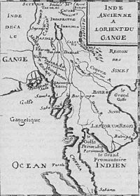 A map of 1715, incorrectly showing the Chao Praya river as a branch of the Mekong
 The members of the French Mekong Expedition of 1866
The difficulty of navigating the river has meant that it has divided, rather than united, the people who live near it. The earliest known settlements date to 2100 BC, with Ban Chiang being an excellent example of that early Iron Age culture. The earliest recorded civilization was the 1st century Indianised-Khmer culture of Funan, in the Mekong Delta. Excavations at Oc Eo, near modern An Giang, have found coins from as far away as the Roman Empire. This was succeeded by the Khmer culture Chenla state by around the 5th century. The Khmer empire of Angkor was the last great Indianized state in the region. From around the time of the fall of the Khmer empire, the Mekong was the frontline between the emergent states of Siam and Tonkin (North Vietnam), with Laos and Cambodia, then situated on the coast, torn between their influence.
The first European to encounter the Mekong was the Portuguese Antonio de Faria in 1540; a European map of 1563 depicts the river, although even by then little was known of the river upstream of the delta. European interest was sporadic: the Spaniards and Portuguese mounted some missionary and trade expeditions, while the Dutch Gerrit van Wuysthoff led an expedition up the river as far as Vientiane in 1641–42.
The French took a serious interest in the region in the mid-19th century, capturing Saigon in 1861, and establishing a protectorate over Cambodia in 1863.
The first systematic exploration began with the French Mekong Expedition led by Ernest Doudard de Lagrée and Francis Garnier, which ascended the river from its mouth to Yunnan between 1866 to 1868. Their chief finding was that the Mekong had too many falls and rapids to ever be useful for navigation. The river's source was located by Pyotr Kuzmich Kozlov in 1900.
From 1893, the French extended their control of the river into Laos, establishing French Indochina by the first decade of the 20th century. This lasted until the First and Second Indochina Wars ended French and American involvement in the region began.
After the Vietnam War, the tensions between the U.S.-backed Thai government and the new Communist governments in the other countries prevented cooperation on use of the river.
Bridges
The Thai–Lao Friendship Bridge (Thai: สะพาน มิตรภาพ ไทย-ลาว Saphan Mittaphap Thai-lao) connects Nong Khai city with Vientiane in Laos. The 1,170-metre (3,840 ft)-long bridge has two 3.5-metre (11 ft)-wide lanes with a single railway line in the middle. On March 20, 2004, the Thai and Lao governments agreed to extend the railway to Tha Nalaeng in Laos, this extension has since been completed.
The Second Thai–Lao Friendship Bridge connects Mukdahan to Savannakhet. The two-lane, 12-metre (39 ft)-wide, 1,600-metre (5,200 ft)-long bridge opened to the general public on January 9, 2007.
There are only three bridges, located in Champasak province, in Laos. Unlike the Friendship bridges, this bridge is not a border crossing. It is 1,380 metres (4,528 ft) long, and was completed in 2000 (Pakxe bridge 15°6′19.95″N 105°48′49.51″E / 15.1055417°N 105.8137528°E).
A new bridge over the Mekong is to be completed by 2011, connecting the border towns of Chiang Khong (Thailand) and Ban Houayxay (Laos), as part of Asian Highway 3. The Chinese and Thai governments agreed to build the bridge and share the estimated $33USD million dollar cost of the project.
Another new bridge is to be built at [Neak Leung] on the Phnom Penh to Ho Chi Minh highway with Japanese government assistance, anticipated to be opened in 2014.
Cambodia has one two-lane bridge, the Kizuna bridge in the city of Kompong Cham, on the road linking Phnom Penh with the remote provinces of Ratanakiri and Mondolkiri, and further away Laos.
The Prek Tamak Bridge, 40 km north of Phnom Penh will provide another link in 2011.
Phnom Penh itself has no bridge under construction yet, although two new bridges have recently opened on the Tonle Sap, and the main bridge on the highway to Ho Chi Minh was duplicated in 2010.
In Vietnam, since the year 2000 My Thuan Bridge (Mỹ Thuận), crosses the first channel a dozen km ahead of Vinh Long (Vĩnh Long) and since 2008 Rach Mieu Bridge (Rạch Miễu) crosses it a dozen km ahead of de My Tho (Mỹ Tho), between the provinces de Tien Giang (Tiền Giang) and Ben Tre (Bến Tre).
Can Tho Bridge (Cần Thơ), cross the second channel, inaugurated in 2010, is the longest main span cable-stayed bridge in Southeast Asia.
Protected areas
- The headwaters of the Mekong in Zadoi County, Qinghai, China, are protected in Sanjiangyuan National Nature Reserve. The name Sanjiangyuan means "the Sources of the Three Rivers"; the reserve also includes the headwaters of the Yellow River and the Yangtze.
- The section of the river flowing through deep gorges in Yunnan province is part of the Three Parallel Rivers of Yunnan Protected Areas; a UNESCO World Heritage Site.
- The Tonle Sap Biosphere Reserve in Cambodia contains the largest lake in Southeast Asia. It is a UNESCO Biosphere reserve.
Miscellany
- Balls of light are observable from time to time rising from the water's surface in the stretch of the river near Vientiane or Nong Khai. These are sometimes referred to as Naga fireballs. The locals attribute the phenomenon to Phaya Naga, Mekong Dragons.
- The low tide level of the river in Cambodia is lower than the high tide level out at sea, and the flow of the Mekong inverts with the tides throughout its stretch in Vietnam and up to Phnom Penh. The very flat Mekong Delta area in Vietnam is thus prone to flooding, especially in the provinces of An Giang and Dong Thap (Đồng Tháp), near the Cambodian border.
- A South- and Southeast Asian regional association, the Mekong-Ganga Cooperation, is named after both this river and the Ganges river.
See also
- Mekong Delta
- Stung Sen River
- Mekong River Basin Hydropower
- Sekong River
- Tonle Sap
- Mekong River Commission
- Greater Mekong Sub-region Academic and Research Network
- GMS Environment Operations Center
References
Notes
- ^ a b Liu, S., Lu, P., Liu, D., Jin, P. and Wang, W. 2009. Pinpointing source and measuring the lengths of the principal rivers of the world. International Journal of Digital Earth 2 (1): 80-87.
- ^ a b c d e Mekong River Commission, 2010. State of the Basin Report, 2010. Vientiane, Lao PDR, Mekong River Commission.
- ^ See, for example, Thi Dieu Nguyen, 1999. The Mekong River and the Struggle for Indochina: Water, War, and Peace New York, Praeger Publishers.
- ^ Thai folk: The knowledge of Thai life-style
- ^ The Chinese name of Lan Xang is both Nanzhang and Láncāng
- ^ [1]
- ^ a b c d e f g h i j k l m n o p q r s t u v w x y z aa ab ac ad Mekong River Commission, 2005. Overview of the Hydrology of the Mekong Basin. Vientiane, Lao PDR, Mekong River Commission.
- ^ http://www.tsbr-ed.org
- ^ www.mrcmekong.org/download/.../Mekong_Development_No2.pdf
- ^ Thompson, C. 2008. First Contact in the Greater Mekong. WWF Greater Mekong Program, December 15, 2008.
- ^ Hortle, K.G. 2009. Fishes of the Mekong - how many species are there? Catch and Culture 15 (2009): 4-12.
- ^ Gephart, N., Blate, G., McQuistan, C. and Thompson, C. 2010. New Blood: Greater Mekong New Species Discoveries, 2009. WWF Report. Gland, Switzerland, World Wildlife Fund
- ^ Mekong River Commission, 2010, op.cit.
- ^ ASEAN Regional Centre for Biodiversity Conservation
- ^ IUCN Red list
- ^ Clark M., Schoenbohm L., Royden L., Whipple K., Burchfiel B., Zhang W. et al. 2004. Surface uplift, tectonics, and erosion of eastern Tibet from large-scale drainage patterns. Tectonics 23 TC1006, doi:10.1029/2002TC001402.
- ^ Twidale C. 2004. River patterns and their meanings. Earth Science Reviews 67 (3–4), 159–218.
- ^ Twidale C. 2004. River patterns and their meanings. Earth Science Reviews 67 (3–4), 159–218; Tandon S.K. and Sinha R. 2007. Geology of large river systems. In: Gupta, A. (ed) Large rivers: geomorphology and management. John Wiley & Sons Ltd, London, pp. 7–28.
- ^ Clift P.D. and Plumb A.R. 2008. The Asian monsoon: causes, history, and effects. Cambridge University Press, Cambridge, UK.
- ^ Clift P., Carter A., Campbell H., Pringle M., Nguyen V., Allen C., et al. 2006. Thermochronology of mineral grains in the Red and Mekong Rivers, Viet Nam: Provenance and exhumation implications for Southeast Asia. Geochemisty, Geophysics, Geosystems 7, 1–28; Clift P.D., Layne G. and Blusztajn J. 2004. Marine sedimentary evidence for monsoon strengthening, Tibetan uplift, and drainage evolution in East Asia. Geophysical Monograph Series, 149, 255–281.
- ^ Tamura T., Saito Y., Sotham S., Bunnarin B., Meng K., Im S., et al. 2009. Initiation of the Mekong River Delta at 8 ka: Evidence from the sedimentary succession in the Cambodian lowland. Quaternary Science Reviews 28, 327–344.
- ^ Tamura T., Saito Y., Sotham S., Bunnarin B., Meng K., Im S., et al. 2009. Initiation of the Mekong River Delta at 8 ka: Evidence from the sedimentary succession in the Cambodian lowland. Quaternary Science Reviews 28, 327–344.
- ^ Penny D. 2006. The Holocene history and development of the Tonle Sap, Cambodia. Quaternary Science Reviews 25, 310–322.
- ^ Ta T.K, Nguyen V.L., Tateishi M., Kobayashi I., Tanabe S. and Saito Y. 2002. Holocene delta evolution and sediment discharge of the Mekong River, southern Viet Nam. Quaternary Science Reviews 21, 1807–1819.
- ^ Fenton C.H., Charusiri P. and Wood S.H. 2003. Recent paleoseismic investigations in northern and western Thailand. Annals of Geophysics 46, 957–981.
Bibliography
- Backer, E.B. 2006. Paper tiger meets white elephant? An analysis of the effectiveness of the Mekong River Regime. FNI Report 15/2006. Oslo (Norway), The Fridtof Nansen Institute.
- Backer, E.B. 2007. The Mekong River Commission: does it work, and how does the Mekong Basin’s geography influence its effectiveness? Südosasian actuell 4 (2007): 31-55.
- Badenoch, N. 2002. Transboundary environmental governance: principles and practice in mainland Southeast Asia. Report; Washington DC (USA), World Resources Institute.
- Badenoch, N. and Dupar, M. (eds) 2001. Mekong Regional Environmental Governance: Perspectives on Opportunities and Challenges. Papers from the Mekong Regional Environmental Governance Research and Dialogue Group. Edited report.
- Bakker, K. 1999. The politics of hydropower: developing the Mekong. Political Geography 18 (1999): 209–232.
- Baran E., P. Starr, and Y. Kura. 2007. Influence of built structures on Tonle Sap fisheries. Cambodia National Mekong Committee and the WorldFish Center. Phnom Penh, Cambodia.
- Biggs, D. 2003. Problematic progress: reading environmental and social change in the Mekong Delta. Journal of Southeast Asian Studies 34 (1): 77-96.
- Bowder, G. and Ortolano, L. 2000. The evolution of an international water resources management regime in the Mekong River Basin. Natural Resources Journal 40 (2000): 499–531.
- Browder, G. 2000. An Analysis of the Negotiations for the 1995 Mekong Agreement. International Negotiation 5 (2000): 237–261.
- Bush, S. 2003. “Give a man a fish…” Contextualising Living Aquatic Resources Development in the Lower Mekong Basin. Australian Mekong Resource Centre Working Papers No. 8.
- Bush, S. 2004. Scales and sales: changing social and spatial fish trading networks in the Siiphandone fishery, Lao PDR. Singapore Journal of Tropical Geography 25 (1): 32-50. [LAO 21]
- Bush, S.R. 2007. The social science of sustainable bioenergy production in Southeast Asia. Biofuels, Bioprod. Bioref. 2 (2007):126–132.
- Bush, S. R. 2008. Contextualising fisheries policy in the Lower Mekong Basin. Journal of Southeast Asian Studies, 39 (3): 329–353.
- Bush, S.R. and Hirsch, P. 2005. Framing fishery decline. Aquatic Resources, Culture and Development 1 (2): 79-90.
- Campbell. I.C. 2007. Perceptions, data, and river management: lessons from the Mekong River. Water Resources Research 43 (2007): 1-13.
- Chenoweth, J.L., Malano, H.M. and Brid, J.F. 2001. Integrated River Basin Management in the Multi-jurisdictional River Basins: The Case of the Mekong River Basin. Water Resources Development 17 (3): 365–377.
- Cheong, G. 1998. Resource Management in the Lao Mekong Basin. Australian Mekong Resource Centre Working Paper No. 73.
- Cornford, J. and Matthews, N. 2007. Hidden costs: the underside of economic transformation in the Greater Mekong Subregion. An Oxfam Australia Report. Oxfam Australia, Victoria, Australia.
- Cronin, R. 2009. Mekong dams and the perils of peace. Survival: Global Politics and Strategy 51 (6): 147-160.
- Cronin, R.P. and Hamlin, T. 2010. Mekong tipping point: hydropower dams, human security and regional stability. Henry L. Stimson Center, Washington DC, USA.
- Dosch, J. and Hensengerth, O. 2005. Sub-regional cooperation in Southeast Asia: the Mekong Basin. European Journal of East Asian Studies 4 (2): 263-285.
- Evers, H.‐D. and Benedikter, S. 2009. Hydraulic bureaucracy in a modern hydraulic society – Strategic group formation in the Mekong delta, Vietnam. Water Alternatives 2 (3): 416‐439.
- Fox, C. and Sneddon, C. 2005. Flood Pulses, International Watercourse Law, and Common Property Resources: A Case Study of the Mekong Lowlands. WIDER Research Paper No. 2005/20. World Institute for Development Economics Research, Helsinki (Finland).
- Frappart, F., Do Minh, K., ‘Hermitte, J.L., Cazenave, A., Ramillien, G., Le Toan, T. and Mognard-Campbell, N. 2006. Water volume change in the Lower Mekong from satellite altimetry and imagery data. Geophys. J. Int. 2006: 1-15.
- Friend, R.M. and Blake, D.J.H, 2009. Negotiating trade-offs in water resources development in the Mekong Basin: implications for fisheries and fishery-based livelihoods. Water Policy Supplement I (2009): 13-30.
- Fujii, H., Garsdal, H., Ward, P., Ishii, M., Morishita, K. and Boivin, T. 2003. Hydrological roles of the Cambodian floodplain of the Mekong River. Intl. J. River Basin Management 1 (3): 1–14.
- Goh, E. 2004. China in the Mekong river basin: the regional security implications of resource development on the Lancang Jiang. IDSS Working Paper No. 69. Singapore, Institute of Defence and Strategic Studies.
- Halls, A.S. and Kshatriya, M. 2009. Modeling the Cumulative barrier and passage effects of mainstream hydropower dams on migratory fish populations in the Lower Mekong Basin. MRC Technical Paper No. 25. Vientiane, Mekong River Commission.
- Hensengerth, O. 2009. Transboundary river cooperation and the regional public good: the case of the Mekong River. Contemporary Southeast Asia 31 (2): 326-349.
- Hensengerth, O. 2010. Sustainable dam development in China between global norms and local practices. German Development Institute Discussion Paper 4/2101. Deutsches Institut für Entwicklungspolitik gGmbH, Bonn, Germany.
- Hirsch, P. 2001. Globalisation, regionalisation and local voices: the Asian Development Bank and re-scaled politics of the environment in the Mekong Region. Singapore Journal of Tropical Geography 22 (3): 237-251.
- Hirsch, P. 2006. Water governance reform and catchment management in the Mekong Region. The Journal of Environment and Development 15 (2): 184-201. [MEK 74]
- Hirsch, P. and Wyatt, A. 2002. Negotiating local livelihoods: Scales of conflict in the Se San River Basin. Asia Pacific Viewpoint 45 (1): 51-68. [VN 7]
- Hogan, Z.S., Moyle, P.B., May, B., Jake Vander Zanden, M., and Baird, I.G. 2004. The Imperiled Giants of the Mekong: Ecologists struggle to understand — and protect — Southeast Asia’s large migratory catfish American Scientist, 92 (2004): 228–237.
- Hong, W. and Li Xin, Y. 2000. Soil and water loss in the Lancang River – Mekong River watershed (in Yunnan section, China) and its control measures. Journal of Environmental Sciences 12 (1): 90-97.
- Jacobs, J.W. 1996. Planning for change and sustainability in water development in Lao PDR and the Mekong River basin. Natural Resources Forum 20 (3): 175-187.
- Jacobs, J.W. 1998. The United States and the Mekong Project. Water Policy 1 (1998): 587-603. [MEK 49]
- Jacobs, J.W. 2002. The Mekong River Commission: Transboundary water resources planning and regional security. The Geographical Journal 168 (4): 354-364.
- Keskinen, M. 2008. Water Resources Development and impact assessment in the Mekong Basin: which way to go? AMBIO 37 (3): 193-198.
- Kirby, M. and Mainuddin, M. 2009. Water and agricultural productivity in the Lower Mekong Basin: trends and future prospects. Water International 34 (1): 134-143.
- Kite, G. 2001. Modelling the Mekong: hydrological simulation for environmental impact studies. Journal of Hydrology 253 (2001): 1–13.
- Kummu, M., Keskinen, M. and Varis, O. (Eds), 2008. Modern Myths of the Mekong: A critical review of water and development concepts, principles and policies. Water and Development Publications – Helsinki University of Technology TKK-WD-01.
- Kummu, M., Lu, X.X., Wang, J.J. and Varis, O. 2010. Basin-wide sediment trapping efficiency of emerging reservoirs along the Mekong. Geomorphology 119 (2010): 181-197.
- Kummu, M. and Sarkkula, J. 2008. Impact of the Mekong River flow alteration on the Tonle Sap flood pulse. AMBIO 37 (3): 185-192.
- Kummu, M., Penny, D., Sarkkula, J. and Koponen, J. 2008. Sediment: a curse of blessing for Tonle Sap Lake? AMBIO 37 (3): 158-163.
- Lebel, L., Garden, P. and Imamura, M. 2005. The politics of scale, position, and place in the governance of water resources in the Mekong Region. Ecology and Society 10 (2): 18-36.
- Mainuddin, M. and Kirby, M. 2009. Agricultural water productivity in the lower Mekong Basin: trends and future prospects for food security. Food Security 1 (1): 71-82.
- Mainuddin, M., Kirby, M. and Chen, Y. 2009. Fisheries Productivity and its Contribution to Overall Agricultural Production in the Lower Mekong River Basin. Report prepared as part of the Mekong Basin Focal Project of the Challenge Program for Water and Food. Canberra, Australia, Commonwealth Scientific and Industrial Research Organisation.
- Makim, A. 2002. The Changing Face of Mekong Resource Politics in the Post-Cold War Era: re-negotiating arrangements for water resource management in the Lower Mekong River Basin (1991–1995). Australian Mekong Resource Centre Working Paper No. 6. AMRC, University of Sydney.
- Makkonen, K. 2003. China’s role in integrated water resources management (IWRM) in South and Southeast Asia. Unpublished Master’s Thesis, Helsinki University of Technology, Helsinki (Finland).
- Malhotra, K. 1999. Resource conflict in the Lower Mekong. Peace Review 11 (3): 387-391.
- Masviriyakul, S. 2004. Sino-Thai Strategic Economic Development in the Greater Mekong Subregion (1992–2003). Contemporary Southeast Asia 26, (2): 302–319.
- McCormack, G. 2000. Water Margins: Development and Sustainability in China. Australian Mekong Resource Centre Working Paper Series: Working Paper No. 2.
- Mekong River Commission, 2005. Overview of the Hydrology of the Mekong Basin. Vientiane, Lao PDR, MRC.
- Mekong River Commission, 2010. State of the Basin Report, 2010. Vientiane, Lao PDR, Mekong River Commission.
- Menniken, T. 2007. China’s performance in international resource politics: lessons from the Mekong. Contemporary Southeast Asia 29 (1): 97-120.
- Molle, F. 2005. Irrigation and Water Policies in the Mekong Region Current Discourses and Practices. IWMI Research Report 95. Colombo (Sri Lanka), International Water Research Institute.
- Molle, F. and Floch, P. 2008. Mega projects and social and environmental changes: the case of the Thai ‘water grid’. AMBIO 37 (3): 199-204.
- Molle, F., Foran, F. and Käkönen, M. (eds) 2009. Contested Waterscapes in the Mekong Region: Hydropower, Livelihoods and Governance. London and Sterling, Virginia, Earthscan.
- Nakayama, M. 1999. Aspects Behind Differences in Two Agreements Adopted by Riparian Countries of the Lower Mekong River Basin. Journal of Comparative Policy Analysis: Research and Practice 1: 293–308.
- Oanh Taa, T.K., Nguyen, V.L., Tateishi, M., Kobayashi, I., Tanabe, S. and Saito, Y. 2001. Holocene delta evolution and sediment discharge of the Mekong River, southern Vietnam. Quaternary Science Reviews 21 (2002): 1807–1819.
- Öjendal, J., Mathur, V. and Sithirith, M. 2002. Environmental governance in the Mekong: Hydropower site selection processes in the Se San and Sre Pok Basins. SEI/REPSI Report Series No. 4. Stockholm (Sweden), Stockholm Environment Institute.
- Osborne, M., 1976. River Road to China: The Mekong River Expedition 1866–1873. George Allen & Unwin.
- Osborne, M. 2000. The strategic significance of the Mekong. Contemporary Southeast Asia: A Journal of International & Strategic Affairs, 22 (3): 429-444.
- Osborne, M., 2000. The Mekong, Turbulent Past, Uncertain Future Atlantic Monthly Press, New York. ISBN 0-87113-806-9
- Osborne, M. 2004. River At Risk: the Mekong, the Environment and the Water Politics of China and Southeast Asia. Lowy Institute Paper 02. Double Bay, NSW, Australia, Lowy Institute for International Policy.
- Osborne, M. 2009. The Mekong: river under threat. Lowy Institute Paper 27. Double Bay, NSW, Australia, Lowy Institute for International Policy.
- Penny, D. 2008: The Mekong at the Climatic Crossroads: lessons from the geological past. AMBIO 37 (3): 164-169.
- Ratner, B. D. 2003. The Politics of Regional Governance in the Mekong River Basin. Global Change 15 (1): 59–76.
- Ringler, C. 2001 Optimal water allocation in the Mekong River Basin ZEF Discussions on Development Policy No. 38. Bonn, Centre for Development Research.
- Rowcroft, P. 2008. Frontiers of change: the reasons behind land-use change in the Mekong Basin. AMBIO 37 (3): 213-218.
- Rutherford, J., Lazarus, K. and Kelley, S. 2008. Rethinking Investments in Natural Resources: China’s Emerging Role in the Mekong Region. Heinrich Böll Stiftung Cambodia, WWF Denmark and International Institute for Sustainable Development.
- Sneddon, C. and Fox, C. 2006. Rethinking transboundary waters: a critical hydropolitics of the Mekong basin. Political Geography 25 (2006): 181-202.
- Sneddon, C. and Fox, C. 2007. Power, development, and institutional change: participatory governance in the Lower Mekong Basin. World Development 35 (12): 2161-2181.
- Sokhem, P. and Sunada, K. 2008. Population growth and natural-resources pressures in the Mekong River Basin. AMBIO 37 (3): 219-224.
- Walling, D.E. 2008. The changing sediment load of the Mekong River. AMBIO 37 (3): 150-157.
- Wang, J.J., Lu, X.X. and Kummu, M. 2009. Sediment load estimates and variations in the Lower Mekong River. River Research and Applications. Published online, December 22, 2009.
- Weatherbee, D.E. 1997. Cooperation and conflict in the Mekong River Basin. "Studies in Conflict and Terrorism" 20 (1997): 167-184.
External links


Wikimedia Foundation. 2010.