- Shire of Biggenden
Infobox Australian Place | type = lga
name = Shire of Biggenden
state = qld
imagesize= 135
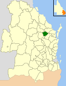
caption = Location withinQueensland
pop = 1,506
pop_footnotes = (2006 census) [Census 2006 AUS | id = LGA30700 | name = Biggenden (S) (Local Government Area) | accessdate=2008-03-18|quick = on]
area = 1314.5
est = 1905

logosize = 100
url = http://www.biggenden.qld.gov.au/
near-nw = Perry
near-n = Kolan
near-ne = Isis
near-w = Gayndah
near-e = Woocoo
near-sw = Gayndah
near-s = Gayndah
near-se = WoocooThe Shire of Biggenden was a Local Government Area located in the northern catchment of the
Burnett River ,Queensland ,Australia , convert|100|km|mi|0 south-southwest of the regional city of Bundaberg. The shire covered an area of convert|1314.5|km2|sqmi|1, and existed as a local government entity from 1905 until 2008, when it amalgamated with several other councils in the region to become theNorth Burnett Regional Council .Primary production is the most significant industry in the region with
beef anddairy cattle being predominant. Other agricultural pursuits include grain crops,pig geries,peanut s,citrus andtimber . The area is also rich in minerals. Biggenden Mine is located convert|8|km|mi|0 from Biggenden along theIsis Highway .Gold ,bismuth and more recentlymagnetite have been extracted from the mine.The biggest landmarks in the region are Mount Walsh, whick can be seen prominently over much of the shire and
Paradise Dam , a largereservoir formed by the damming of theBurnett River .History
Biggenden was originally part of the Burrum Division. On 3 June 1905, Biggenden was granted a separate shire council known as Degilbo Shire. It was renamed Biggenden on 12 July 1941.
On 15 March 2008, under the "Local Government (Reform Implementation) Act 2007" passed by the
Parliament of Queensland on 10 August 2007, the Shire of Biggenden merged with the Shires of Eidsvold, Gayndah, Monto, Mundubbera and Perry to form theNorth Burnett Regional Council .Towns and Localities
* Biggenden
* Coalstoun Lakes
* Dallarnil
* Didcot
* DegilboPopulation
Mayors
* Betty Johnson (2004–2008)
References
Wikimedia Foundation. 2010.