- Darlaston
-
Coordinates: 52°34′15″N 2°02′45″W / 52.5708°N 2.0457°W
Darlaston 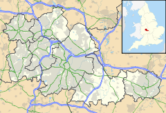
 Darlaston
Darlaston shown within the West MidlandsOS grid reference SO9797 Metropolitan borough Walsall Metropolitan county West Midlands Region West Midlands Country England Sovereign state United Kingdom Post town WEDNESBURY Postcode district WS10 Police West Midlands Fire West Midlands Ambulance West Midlands EU Parliament West Midlands List of places: UK • England • West Midlands Darlaston is a town in the Metropolitan Borough of Walsall in the West Midlands of England.
Contents
History
Archaeological evidence of the history of Darlaston has been destroyed by The de Darlaston family owned Darlaston and lived in the manor between the 12th century and 15th century. When the de Darlaston family died out, the manor was taken over by the Hayes family and renamed Great Croft. The exact location of the manor is not known. It is believed that the site is covered by the new Asda car park, slightly south west of the original parish church, which is now the location for St Lawrence's Church.[1]
Due to being located on the South Staffordshire Coalfield, Darlaston became industrialised very early in its history. The first industries were cottage industries and anyone wishing to mine the coal had to apply for a copyhold from the lord of the manor. In 1698, Timothy Woodhouse was manager of the coal mines belonging to Mrs Mary Offley, who was the lady of the manor. In the first year he sold 3,000 sacks of coal and later went into partnership in his own business. Darlaston also had a windmill which is mentioned in a map of 1695. The mill continued to be in use until about 1860.[2]
The town grew in the 19th century around the nut, bolt and gun lock manufacturing and coal mining industries. It was highly industrialised with a population of 6,000 in 1841. Large areas of land were owned by the Birmingham Coal Company and the area was accessed by the Birmingham Canal Navigations and Grand Junction Railway.[3] In December 1839, the rector of the parish reported that there were approximately 1,500 homes in the parish of Darlaston, most of which were in poor condition and owned by working class people. The Rose family were identified as a wealthy family in the area during the 19th century as a result of Richard Rose's acquisitions of unenclosed land. Upon his death in 1870, his estate was valued at over £877. He bequeathed the land to his wife Hannah. His brother was identified as James Rose in an 1871 census and was listed as a latch, bolt and nut maker, employing 39 people, including 19 children. At the time of the 1881 census, James Rose was 55 and his business had expanded to employ 90 people.[4] James Rose died in 1901.[5] Construction of Darlaston Town Hall commenced on June 21, 1887 and it was completed in 1888.[6]
On January 1, 1895, Darlaston became an urban district, and the local board became Darlaston Urban District Council. In 1965, Darlaston became part of Walsall and in 1974, it became part of the metropolitan county of the West Midlands.[6]
Darlaston was subject to bombing raids in World War II. One such bombing raid targeted the Guest Keen & Nettlefolds' Atlas works on July 31, 1942 and completely destroyed All Saints Church. It was the only church in the Diocese of Lichfield to be destroyed by enemy action. A newly built church reopened in 1952.[7]
A Luftwaffe bombing on 5 June 1941 wrecked several houses in Lowe Avenue, Rough Hay, and killed 11 people. The bomb had been aimed at Rubery Owen's factory but missed by some distance.[8]
By the end of the 1980s, most of the industry in the town had closed and the town is now considered a ghost town, with an increasing high level of unemployment.
Many Victorian terraced houses were demolished during the second half of the 20th century, and the Urban District Council of Darlaston built thousands of houses and flats to replace them with. Since 1966, Darlaston has been part of the Walsall borough and is now in the WS10 postal district which also included neighbouring Wednesbury.
Bentley Old Hall stood in the north of Darlaston until the early 20th century. Its grounds were redeveloped as a housing estate in the 1950s.
Mining subsidence, which has taken its toll on many buildings across central England, has also made its mark in Darlaston. In 1999, a council house on the New Moxley housing estate collapsed down a disused mineshaft while its occupants were on holiday. The adjoining house also had to be knocked down. Since then, the council owned housing stock in Darlaston has broken away from Walsall Metropolitan Borough Council and is now controlled by Darlaston Housing Trust. In 2001, two of the town's four multi-storey blocks of flats were demolished, and the remaining two where demolished 2004. Local elderly residents were deprived of their car parking facilities in Wesleys fold because of the demolition due to an oversight by Walsall council. Some of the town's council owned low rise homes have already been flattened by bulldozers, mostly because of subsidence, while many more are expected to be cleared.
The town is served by one large secondary school - Darlaston Community School - which has specialist Science College status. The school was later taken over by businessman Bob Edminson and was turned into Grace Academy in 2009 and is the third Grace Academy.
Since the early 1970s, the town centre has been by-passed by St Lawrence's Way, which runs between The Green and Bull Stake.
Crime
Darlaston has been the scene of high profile crimes which have attracted massive media attention in the local press.
On 8 November 1992, a speeding drunk-driver at the wheel of a BMW ran over and killed two young girls in Herberts Park Road. He was remanded in custody for his own safety following threats of reprisal attacks on him by angry local residents. The driver, Janson Cartwright (20), was found guilty of causing death by dangerous driving at Stafford Crown Court on 2 April 1993. He was jailed for two-and-a-half years and banned from driving for five years. Ironically, Cartwright had received an award in 1987 for saving the life of an elderly woman who fell into a local canal.[9]
Earlier in 1992, the disused Kings Hill Primary School building on Joynson Street was destroyed by fire just weeks before it was due to be demolished. The school had recently relocated to a building on Old Park Road that had previously been part of Kings Hill Secondary School.
On 21 May 1993, divorcee Christine Reece (54) was found dead in a ground floor council flat on Glynne Avenue. The woman's fiancée was later found dead from an overdose. It was established that the woman had been murdered several days earlier by her fiancée Kenneth Gear, whose death was believed to have been suicide. The three-storey block of flats in which Mrs Reece lived was demolished in the early 2000s.
On 16 August 2000, Phillip Woods (19) was stabbed to death in George Rose Park during a funfair. Three men were later charged with murder but found not guilty.
On 9 October 2007, Bangladeshi-born Kalif Ahmed (31) was gaoled for life after being found guilty of murdering his 21-year-old wife Laily Begum, who was last seen alive in January 2006. Her body has never been found, but police were able to make a successful prosecution against Ahmed due to the blood stains found at his council house on Simmonds Place. The trial judge recommended that Ahmed should serve at least 20 years before being considered for parole, effectively meaning he will remain in prison until at least 2026 and the age of 50.
Geography and geology
Darlaston is situated between Wednesbury and Walsall. No motorway runs through the town, but a section of the M6 between J9 and J10 may be considered to be in Darlaston. The town also no longer has a railway station as it was closed and demolished in the 1960s. The Walsall Canal and Tame Valley canal run through the town. The town has a few small open spaces including Broadwaters road playing field, Kings Hill Park, George Rose Park and Victoria Park.
The geology of Darlaston and the rest of Black Country is very complex. There are underlying coal reserves, most likley deposited in the Carboniferous Period. The geology of Darlaston provided the fuel for the industrial revolution of the town. Disused coal mines are found near Queen Street in Moxley, behind Pinfold street JMI School, near Hewitt Street and Wolverhampton Street, in George Rose Park and behind the police station in Victoria Park.
Enterprise Zone
In 2011, a total of 15 derelict sites in the town were designated as enterprise zones, offering tax breaks and relaxed planning laws to any businesses interested in setting up bases in the selected areas. It is expected to create thousands of jobs in the town by 2015 and ease the town's long running unemployment crisis, which has deepened since 2008 as a result of the recession.[10]
Public transport
Darlaston town centre was served by a Darlaston railway station until 1916, when it closed. Since 1999, there has been a Midland Metro stop on Bradley Lane in the Moxley area of the town.
Buses which serve Darlaston Town Centre are stop at Darlaston Town Bus Interchange. These services are listed below.
Route Destination / Description Bus Company Stand A 9 Lodge Farm Via Bentley Choice Travel 327 Willenhall Via Rough Hay Diamond Bus 333 Wolverhampton Via Lodge Farm & Willenhall National Express West Midlands 334 Bilston Via The Lunt National Express West Midlands/Finesse Coaches/Golden Line/Sandwell Travel 339 Bilston Via Herberts Park & Moxley National Express West Midlands Stand B 9 Walsall Via Pleck Choice Travel 333 Walsall Via Pleck National Express West Midlands 334 Walsall Via Pleck National Express West Midlands/Sandwell Travel/Finesse Coaches/Golden Line 337 Walsall Via Pleck National Express West Midlands 339 Walsall Via Pleck National Express West Midlands/Midland Bus Company Stand C 79 Wolverhampton Via Bilston National Express West Midlands 339 Bilston Via Moxley Midland Bus Company Stand D 79 Birmingham Via West Bromwich National Express West Midlands 327 Wednesbury Via Kings Hill Diamond Bus 645 Woods Estate Via Kings Hill Diamond Bus Additional services which briefly enter Darlaston are the Banga Buses & Choice Travel 530, between the Rocket Pool and Wolverhampton via Bilston and the 575 between Ettingshall and Wolverhampton, the 680 between Moxley and Bilston via Lower Bradley & the 523 between Wednesbury and Stowlawn all operated by Choice Travel.
Famous residents
- Jimmy McIntyre, football manager was born in Darlaston in 1881 and started his playing career with the local football team.
- Graham Hawkins ex footballer and manager of Wolverhampton Wanderers was born here on 5th March 1946
- Netan Sansara, first Asian to play for the England U-18 team, and also plays regularly for League One Walsall FC, is also a Darlaston native. Netan also attended Darlaston Comprehensive School. Sansara's Grandfather Ram Sansara also owned two pubs in Darlaston "The Three Horse Shoes" on Pinfold Street and "The Duke Of York" on Dangerfield Lane.
- The athlete Mark Lewis-Francis was born at Darlaston in 1981.
- The town was also the home of footballer Billy Annis (1878–1944) who played 143 games in defence for Wolverhampton Wanderers between 1898 and 1905.
- Mark Rhodes, runner-up in ITV's Pop Idol 2003 contest, and children's television presenter, is also from Darlaston.
- Darlaston is the home town of the professional boxer and former Midlands Welterweight Champion Stuart Elwell.
- Stephen C Page, actor who appeared on Lost in 2006.
- Anna Connell the founder of St Marks football team that later became Manchester City Football Club. She died in 1924 in Darlaston.
- West Bromwich Albion and England footballer Derek Statham owned a house in Sandwell Avenue before moving to neighbouring town Walsall.
Neighbourhoods
- Rough Hay: a predominantly interwar council housing area in the north of the town close to the border with Willenhall.
- Moxley: an established private and council residential area in the west of the town close to the border with Bilston.
- Kings Hill: a mixed residential area near the town centre which includes many types of housing as well as several factories and business units.
- Woods Bank: a predominantly interwar council housing area in the south of the town close to the border with Wednesbury.
- Bentley: the most northernly area in Darlaston which was mostly developed after 1945 but is now included in the Walsall postal district.
References
- ^ Bev Parker. "Beginnings". A Brief History of Darlaston. University of Wolverhampton. http://www.localhistory.scit.wlv.ac.uk/articles/Darlaston/Beginnings.htm. Retrieved 2008-03-30.
- ^ Bev Parker. "Early Growth". A Brief History of Darlaston. University of Wolverhampton. http://www.localhistory.scit.wlv.ac.uk/articles/Darlaston/EarlyGrowth.htm. Retrieved 2008-03-30.
- ^ William Foot; Geraldine Beech, Rose Mitchell (2004). Maps for Family and Local History: The Records of the Tithe, Valuation Office and National Farm Surveys of England and Wales, 1836 - 1943. Dundurn Press Ltd.. pp. 101. ISBN 1550025066.
- ^ William Foot; Geraldine Beech, Rose Mitchell (2004). Maps for Family and Local History: The Records of the Tithe, Valuation Office and National Farm Surveys of England and Wales, 1836 - 1943. Dundurn Press Ltd.. pp. 102. ISBN 1550025066.
- ^ William Foot; Geraldine Beech, Rose Mitchell (2004). Maps for Family and Local History: The Records of the Tithe, Valuation Office and National Farm Surveys of England and Wales, 1836 - 1943. Dundurn Press Ltd.. pp. 103. ISBN 1550025066.
- ^ a b Bev Parker. "A New Town Hall". A Brief History of Darlaston. University of Wolverhampton. http://www.localhistory.scit.wlv.ac.uk/articles/Darlaston/TownHall.htm. Retrieved 2008-03-30.
- ^ Bev Parker. "Churches & Chapels". A Brief History of Darlaston. University of Wolverhampton. http://www.localhistory.scit.wlv.ac.uk/articles/Darlaston/ChurchesChapels.htm. Retrieved 2008-03-30.
- ^ http://www.localhistory.scit.wlv.ac.uk/articles/Darlaston/War.htm
- ^ "Today's The Day - April 3rd". Blogspot. 2006-04-03. http://quiztimeuk.blogspot.com/2006/04/todays-day-april-3rd.html. Retrieved 2008-03-20.
- ^ [1]
External links
Ceremonial county of West Midlands Metropolitan districts Major settlements Aldridge · Bilston · Birmingham · Blackheath · Bloxwich · Brierley Hill · Brownhills · Coseley · Coventry · Cradley Heath · Darlaston · Dudley · Fordbridge · Halesowen · Oldbury · Rowley Regis · Smethwick · Solihull · Stourbridge · Sutton Coldfield · Tipton · Walsall · Wednesbury · Wednesfield · West Bromwich · Willenhall · Wolverhampton
See also: West MidlandsRivers River Blythe · River Cole · River Penk · River Rea · Smestow Brook · River Sherbourne · River Sow · River Sowe · River Stour · River TameCanals Topics Black Country · Centro · Conservation areas · Coventry/Bedworth Urban Area · History of West Midlands County · Museums · West Midlands conurbationCategories:- Towns in the West Midlands (county)
- Walsall

Wikimedia Foundation. 2010.