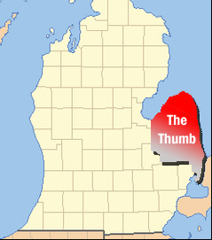
- The Thumb
-
This article is about a geographical region in Michigan. For the body part, see Thumb. For other uses, see Thumb (disambiguation).
The Thumb Mid-Michigan Country United States State Michigan  The Thumb makes up the far eastern portion of the Lower Peninsula of Michigan.
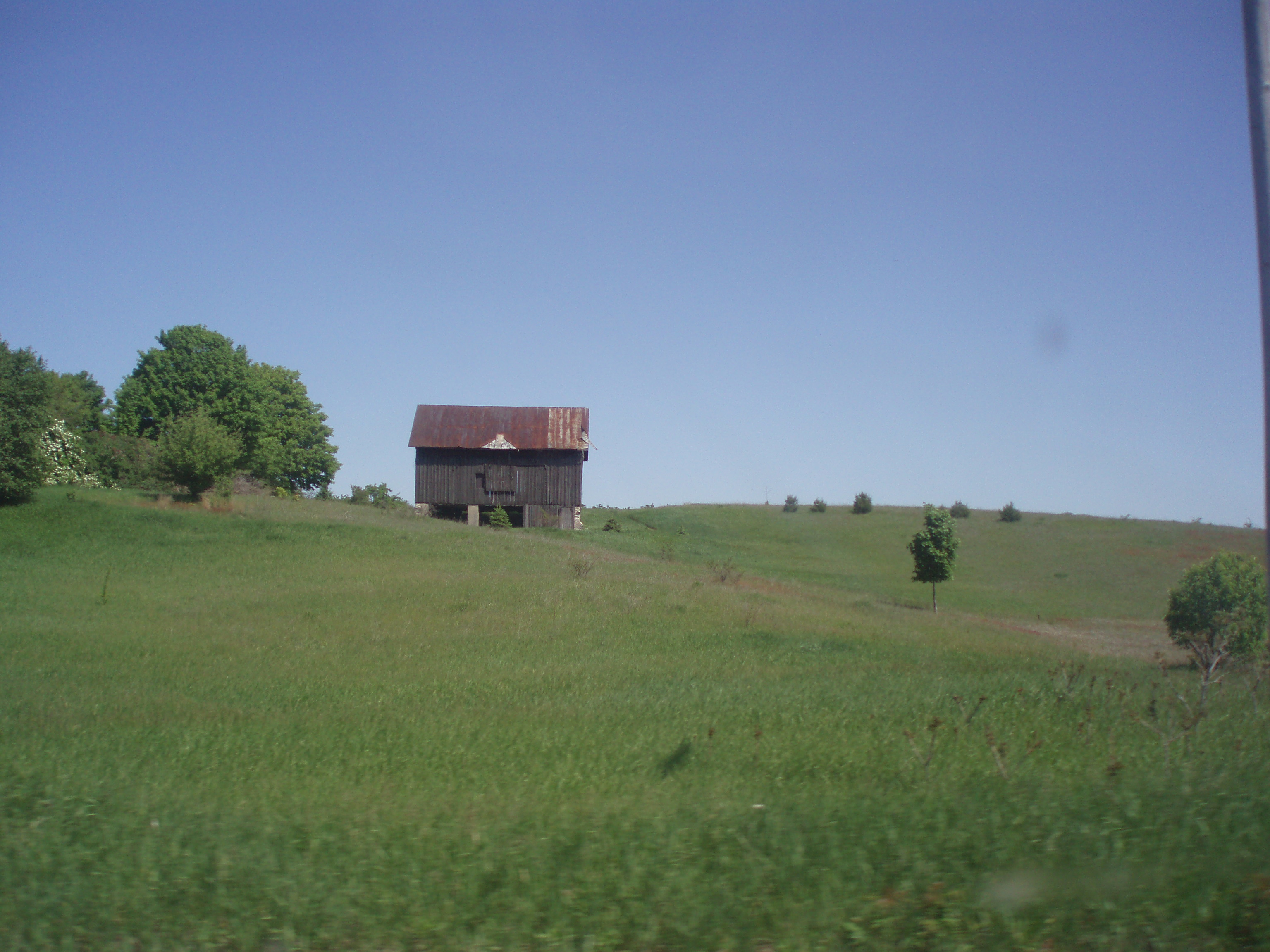
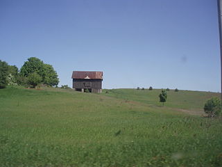 Much of the Thumb is characterized by rolling farmland such as this
The Thumb is a region and a peninsula of Michigan, so named because the Lower Peninsula is shaped like a mitten; thus the Thumb is the area that looks like the thumb of the mitten. The Thumb is generally considered to be in the Mid-Michigan area of the state, located east of Flint/Tri-Cities region, and north of Southeast Michigan. The thumb is also branded as the Blue Water Area of Michigan.
The counties which constitute the Thumb are those forming the extended peninsula that stretches northward into Lake Huron and Saginaw Bay. There is no formal declaration for which of these counties are part of the Thumb. However, virtually all common definitions include Huron, Tuscola, and Sanilac counties. This definition is almost always extended to include Lapeer and St. Clair counties as well.
Economy
The Thumb region is very flat with fertile soil, the reason for its historical role as a chiefly agricultural area. Major agricultural products are sugar beets, navy beans,[1] corn, fruits, and fish from the Saginaw Bay and Lake Huron. Few of the residents commute for work to Metropolitan Detroit or Flint or the Tri-Cities. Large cities in the Thumb area are Port Huron, Lapeer, Marysville, St. Clair, Sandusky, Bad Axe, and Caro. The majority of these cities are in the southern portion of the Thumb.
Industry
See also: List of companies based in Michigan
The Thumb has many notable businesses, many linked to agriculture.
- Intertape Polymer Group, Inc. has a major factory in Marysville.
- Cargill Salt operates a large salt mine and factory in St. Clair. This is the only plant in the U.S.A. that produces Alberger salt, which is especially prized in the fast food industry because of its higher volume (due to its unique shape) and lower sodium content (for a given volume, not weight). This is part of Michigan's large salt-mining industry.
- Cooperative Elevator Company has been named the top Michigan Agriculture Exporter by the Michigan Department of Agriculture.[2] Its headquarters are in Pigeon, and it has branch elevators in Deckerville, Akron, Gagetown, Sebewaing, Elkton, and Bad Axe.
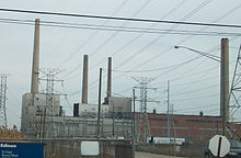 Detroit Edison's St. Clair Power Plant, once the largest in the world.
- Detroit Edison is the operator of five power plants in the Thumb area: St. Clair and Belle River Power Plants in East China Township, Marysville Power Plant in Marysville , Harbor Beach Powerplant, and Greenwood Energy Center in Greenwood Township.
- Dow AgroSciences Harbor Beach manufactures agricultural chemicals: weed killer, fungicides, fertilizers and plant nutrients and herbicides.[3]
- Mueller Industries owns and operates Mueller Brass in Port Huron.[4]
- Grand Trunk Western Railway has a major rail yard in Port Huron Township.
- Marysville Hydrocarbons is an ethanol plant in Marysville.
- Michigan Ethanol, a partner of Broin Companies, operates a corn ethanol production facility in southwest Caro.
- Michigan Sugar Company, an agricultural cooperative owned by 1200 farmers, operates four plants in the area. It is the successor to the 100-year-old "Big Chief" and "Pioneer" Sugar companies.[5] Local plants are located in Caro, Sebewaing, Croswell, and headquarters in Bay City.
- Domtar operates a paper mill in Port Huron.
- Sensient Technologies Corporation, Harbor Beach, makes food flavors and colors, yeast dehydrated products and vegetable protein extract.[6]
- Star of the West Milling Co.[7] which has grain elevators in Vassar and Cass City, joined with Eastern Michigan Grain in Emmett.[8]
Tourism
 The Pointe aux Barques Light, near the tip of the Thumb.
Some towns, such as Bay Port, Caseville, Harbor Beach, Lakeport, Lexington, Port Austin, Port Hope, Port Huron, Port Sanilac, Sebewaing, and St. Clair enjoy seasonal tourism, due to their locations on Lake Huron, Saginaw Bay, or St. Clair River. The Thumb lies within the east-central tourism region of the state[9]
The Tip of The Thumb Heritage Water Trail is a nonprofit citizens organization working with the Huron County Parks to establish and maintain a water trail along Michigan’s Lake Huron’s shoreline.[10]
Unique to the Thumb
Unique features in the area include the following:
- Algonac, known as the Venice of Michigan because of its many canals, is a part of the largest freshwater delta in the world, that of the St. Clair River into Lake St. Clair.
- Bad Axe was named after a broken axe found lodged in the knot of a tree at the clearing of the settlement's chief crossroads.[11]
- Bay Port, is the world's largest freshwater fishing port.[citation needed]
- Harbor Beach is the home of the largest man-made harbor and the Harbor Beach Light.
- Harvest Wind Farm, an electrical generation project of John Deere Wind Energy and Wolverine Power Supply Cooperative.
- Huron County Nature Center includes a 120-acre (0.49 km2) wilderness arboretum that has been under the care of the Huron County Women's Clubs for more than 50 years.[12]
- Kernan Memorial Nature Sanctuary is a 45-acre (180,000 m2) refuge with 4,000 feet (1,200 m) of shoreline acquired October 30, 1989 on Lake Huron, in Huron County. On the western coast of Whiskey Harbor, this area is a great place to see migratory birds in early March and November.[13]
- Kinde was once the bean capital of the world. Michigan Bean soup has been a staple for over a hundred years in the U.S. Senate dining room.[14]
- Pigeon is the home of the Cooperative Elevator Company, one of the largest grain elevators in the state.
- Port Huron is the maritime capital of the Great Lakes, where Lake Huron flows into the St. Clair River. This is the largest city in the Thumb area. It was the boyhood home of Thomas Edison.
- The Sanilac Petroglyphs were discovered after massive fires swept the Lower Peninsula in 1881. Native Americans created this unusual artwork 300 to 1,000 years ago. The petroglyphs provide a glimpse into the lives of an ancient woodland people who occupied Michigan's Thumb area.
- Sebewaing is the sugar beet capital of the world, and home to one of the four Michigan Sugar Company factories in the Thumb region. The sugar companies were organized with money from lumber barons such as Rasmus Hanson.[15]
- St. Clair boasts the world's largest boardwalk along freshwater, the St. Clair River.
- Michigan Underwater Preserves are protected areas of the Great Lakes on Michigan's coast. There are nineteen major shipwrecks in the 276 square miles (710 km2) of the Thumb Area Bottomland Preserve and the Sanilac Shores Underwater Preserve which expands a total of 163 square miles (420 km2) of Lake Huron.
- Caseville is the home of the annual Cheeseburger in Caseville festival, a hometown festival devoted to Jimmy Buffett's song "Cheeseburger in Paradise".
Traveling around the Thumb
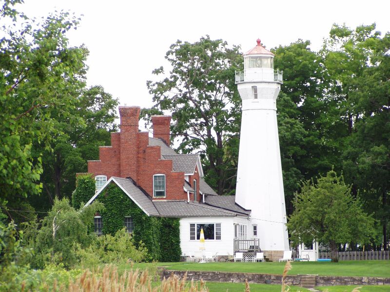
A favorite of tourists who visit this area is traveling the Lake Huron and Saginaw Bay shoreline via M-25 (formerly US 25 until 1973). M-25 starts at the end of I-69/I-94 in Port Huron at the foot of the Blue Water Bridge and ends in Bay City. The whole route is about 160 miles (260 km), and passes through quaint cities and villages. Along M-25 you can see five lighthouses: Fort Gratiot Lighthouse, Port Sanilac lighthouse, Pointe aux Barques Lighthouse, Harbor Beach Light, and the Port Austin Lighthouse.
The Great Lakes Circle Tour is a designated scenic road system connecting all of the Great Lakes and the St. Lawrence River.[16] Port Huron in eastern Michigan is a good starting point for the circle tour of Lake Huron. M-25 winds around the Thumb and along the Saginaw Bay to Saginaw and Bay City. Do not forget to go to the beach and walk the boardwalks in Lexington and Port Austin.
 Lighthouse at Port Sanilac on Lake Huron
Lighthouse Tour
In order from east to west:
- Huron Lightship -- Lake Huron / St. Clair River -- Port Huron
- Fort Gratiot Light -- Lake Huron / St. Clair River—Port Huron
- Port Sanilac Light -- Lake Huron-- Port Sanilac -- Private
- White Rock Memorial Light -- Lake Huron -- White Rock -- Private
- Harbor Beach Light -- Lake Huron -- Harbor Beach
- Pointe aux Barques Light -- Lake Huron—near Port Hope
- Port Austin Light -- Lake Huron -- Port Austin
- Charity Island Light -- Saginaw Bay
- Saginaw River Light -- Saginaw River
Area festivals and events
- Antique and Yard Sale Trail 2nd weekend in August, (Algonac to Sebewaing)
- Art on the River, third week in June, St. Clair.
- Art on the Avenue, downtown Port Huron, 3rd week in August.
- "Arts and Crafts shows calendar". http://www.netstreetfair.com/MI_Events.html. around the state.
- Bay Port Fish Sandwich Festival (Bay Port)
- Blue Water Ramble (St. Clair) Annual International Bicycling Event along the St. Clair River in Michigan and Ontario, Canada, involving two ferry boat crossings, first weekend in October.[17]
- Boat Night[18] & Port Huron to Mackinac Boat Race[19] (Port Huron to Mackinac Island)[20]
- Cheeseburger in Caseville Festival (Caseville)[21][22]
- Croswell Agricultural Society Fair (Croswell) celebrating its 125th year in 2009
- Croswell Swinging Bridge Festival (Croswell)
- Feast of the Sainte Claire sponsored by the Port Huron Museum of Arts and History, a large living reenactment of 18th century life—Memorial Day weekend, (Port Huron).
- Harbor Beach Maritime Festival(Harbor Beach)
- Huron County Fair (Bad Axe)[23]
- Michigan Bean Festival Labor Day weekend (Fairgrove)
- Michigan Farmer's Festival (Pigeon)[24]
- Michigan Sugar Festival (Sebewaing)
- "The Original" Country Christmas Lighted Farm Implement Parade (Sandusky)
- Tuscola County Pumpkin Festival (Caro)
- Sanilac County 4-H Fair (Sandusky)
- St. Clair County 4-H Fair (Goodells County Park)
- Thumbfest (Lexington)
- Yale Bologna Festival (Yale)
Thumb counties
 A broad definition of the Thumb of Michigan.
Huron
Huron County is located at the tip of the thumb. The county is surrounded on three sides by water – Saginaw Bay and Lake Huron, and has over 90 miles (140 km) of shoreline, from White Rock on Lake Huron to Sebewaing on Saginaw Bay, and more shoreline parks than any other county in the state.
The county's economy relies on agriculture and ranks as one of the top agricultural counties in Michigan. Rich farmland inland produces beans, sugar beets and grain, including most of the world's supply of navy beans.[25] Tourism is also important to Huron County with bay front and lakefront towns such as Sebewaing, Caseville, Port Austin, Port Hope, and Harbor Beach, attracting tourists from all over. Huron County borders the Saginaw Bay and Lake Huron. There are two state parks – Sleeper State Park and Port Crescent State Park. Three roadside parks – Jenks Park, Brown Park, and White Rock Park. Also, Huron County maintains nine county parks along the shoreline, which are Caseville Park, Lighthouse Park, Stafford Park, McGraw Park, Philp Park, Port Austin Bird Creek Park, Wagener Park, Oak Beach Park, and Sebewaing Park.
The county seat is Bad Axe, located in the center of the county.Sanilac
The County of Sanilac has the largest area of land in The Thumb. Like other counties, Sanilac has fertile and flat land, great for growing crops. Towns like Lexington and Port Sanilac bring in many tourists from the Detroit Area. Sandusky is the county seat and largest city.
Tuscola
Like Huron County, Tuscola is mostly dependent on agriculture. Industries such as sugar refining and ethanol processing, as well as growing various grains and beans, make up most of the economy. Caro, one of the largest cities in The Thumb (the largest if you exclude St. Clair and Lapeer Counties), is named after Cairo, Egypt and is the county seat. Tuscola County only has 18 miles (29 km) of shoreline along Saginaw Bay, so it is not as dependent on tourism as the other counties in the area. Tuscola County is economically tied to the surrounding region as well as to the Saginaw, Bay City, and Flint areas.
Lapeer
Lapeer County is economically attached to Flint and Detroit. Lapeer derives from the French word for Flint, la pierre. Lapeer's economy depends on manufacturing more than agriculture. Although it is landlocked, Lapeer County has many inland bodies of water such as Lake Pleasant, Lake Metamora, Nepessing Lake, Bronson Lake and Barnes Lake. These lakes bring in many campers and tourists. Lapeer County's geography is very different than any other county in The Thumb.
St. Clair
St. Clair County has the largest population in The Thumb. Many residents farther north in The Thumb, especially Sanilac County, travel to Port Huron for shopping and work. It is the farthest county to the east in Michigan, and most of the eastern border is the St. Clair River, which separates Michigan from Ontario. For the most part, St. Clair County is flat and agriculturally dominating in the north and west, but also has steep hills and small canyons near the Black River, although manufacturing dominates in and around Port Huron.
Borderline regions
Some areas of the thumb are debatable, but nearly all definitions will include Huron, Sanilac, and Tuscola Counties, known as the tri-county region. Disputed areas include:
- St. Clair County, especially the southern portion.
- Lapeer County
- Richmond and Northern Macomb County.
- Genesee County, although it has a more urban setting, may be seen as part of the thumb peninsula.
The Blue Water Area
 Map depicting the Blue Water Area.
The Blue Water Area is a subregion of the thumb, describing St. Clair County, parts of Sanilac County, Northern Macomb County, and Eastern Lapeer County. It is so named because of the Blue Water Bridge and the area's many bodies of water. Sometimes the definition is extended to include all of the Thumb and even Eastern Michigan. A simple definition of the Blue Water Area is the area surrounding Port Huron where residents regularly travel to Port Huron for shopping and work.
Discover the Blue
Discover the Blue is a promotion by the Blue Water Area Convention and Visitor's Bureau[26] to attract visitors to the shoreline of eastern Michigan. Communities participating in Discover the Blue range from Algonac (at the southern end of the Thumb) to Port Austin (at the tip of the Thumb).
Geography
Land features
See also List of Michigan state parks and geography of Michigan.
- The Thumb's landscape ranges from a flat sandy plain, that hugs the shores of Lake Huron and Saginaw Bay, to a gently rolling topography, which is fertile and well suited for agriculture. Perhaps, the most unusual geographic formation, however, is a rugged glacial ridge, known collectively, as the Hadley Hills, which extends in a northeasterly direction through the center of The Thumb, from the southwestern portion of the peninsula.
- All counties except for Lapeer border the Saginaw Bay or Lake Huron.
- The places with the highest elevation are all associated with the Hadley Hills, and are located in Lapeer County, they are: Pinnacle Point, at 1,262 feet (385 m), Kerr (Cemetery) Hill, at 1,258 feet (383 m), both in Hadley Township, Mt Christie, at 1,251 feet (381 m), in Metamora Township, and a point near Mayville, reaching up to 1,050 feet (320 m) above sea level.
- The lowest place in the Thumb region is in the Saginaw Valley, the far western part of the thumb, at a low 585 feet (178 m) above sea level.
- Huron County is very flat and is home to wind turbines and large fields.
- The "tip of the Thumb" is Pointe Aux Barques, between Port Austin and Grindstone City.
- Marlette is also called the "heart of the Thumb" because of its central position on the peninsula.
Major rivers
The Thumb has many waterways.
- Cass River has many branches, one of which flows into the Shiawassee River in the Shiawassee National Wildlife Refuge at 43°22′42″N 83°59′04″W / 43.37833°N 83.98444°W less than 1 mile (2 km) from where the Shiawassee merges with the Tittabawassee River to form the Saginaw River
- The Pinnebog, Shebahyonk, and Pigeon Rivers all rise in the center of Huron County and empty into the Saginaw Bay.
- St. Clair River, connects Lake Huron to Lake St. Clair, and is the farthest east border in Michigan. It forms a low impression in eastern St. Clair County, and has a delta at its mouth (North America's largest freshwater delta), which includes Harsens Island and Walpole Island, Ontario. Ferries cross the river at Algonac and Marine City, these being international border crossings.
- Black River rises near Minden City and flows into the St. Clair River at Port Huron. The Black River forms a basin in Sanilac County, and northern St. Clair County.
- The north branch of the Flint River lies in northern Lapeer County. It rises near North Branch. The southern branch flows through the central and southern portion of Lapeer County, and merges with the North Branch just north of the Holloway Reservoir.
History and local culture
See also: Timeline of Michigan history and history of Michigan
Naming and founding of the Thumb
The earliest name for the Thumb of Michigan was Skenchioe, which is shown on early maps in the late 17th century and is of Iroquois origin. Skenchioe was the early home of the Native people called the Fox. There is no definite documentation on the meaning of the name Schenchioe although the name red fox is implied. The Onondaga word for a champain or large plain is uchwuntschios and "ganhuntios" while sgechnaxen means red fox.
Maps from the early 18th century, show the Thumb of Michigan as Le Pays Plat, which is French and means the Flat Country. The British used this name in maps of the late-18th century calling the Thumb of Michigan in English the Flat Country.
The Thumb of Michigan county name Tuscola is probably of Chippewa/Ottawa origin and likely means shelf, dish, or plate like land—Flat Country. The Chippewa and Ottawa often used bark from a tree or a shell as a plate. Their words tessi aki means plateau, tableland, or flat country. Esse in Chippewa/Ottawa means shell, and "essimig" means a breast-plate.
Culture
Persons of European ancestry have formed the overwhelming majority of the population since the late 19th century. The land was settled mostly by English and Scots-Irish immigrants, many of whom arrived from Canada. Other settlers of the same ancestry migrated from eastern states such as New York, Pennsylvania and New England. Later 19th and 20th century residents included Polish and German immigrants who migrated from Europe through the Detroit area. Many of the customs, much of the regional lifestyle, and even the local accent, strongly reflect these origins. Examples are polka shows on local radio stations and the Kinde, Michigan Polkafest. These European latecomers, arriving many years after the initial waves of arrivals to the Atlantic coast region from Europe, encountered aboriginal peoples for whom many sites in the Thumb were named. The name of Tuscola County was derived from a native word, Saginaw (both the city and county) is taken from an Ojibwe term, and Sanilac, which is the name of a county, is believed to be a Wyandotte name derivation, as well. Among other Thumb place names, Sebewaing is another location with a name derived from the Ojibwe. These tribally-influenced place names greatly outnumber those of any Thumb sites which may have been named with strictly European-influenced words.
Historical events
- The great Thumb Fire took place on September 5, 1881 in the Thumb area of Michigan. The fire, which burned over a million acres (4,000 km²) in less than a day, was the consequence of drought, hurricane-force winds, heat, the after-effects of the Port Huron Fire of 1871 and the ecological damage wrought by the era's logging techniques.
- The Great Lakes Storm of 1913 was a November blizzard with hurricane-force winds which devastated the Great Lakes Basin in the United States Midwest and the Canadian province of Ontario. The storm battered and overturned ships on four of the five Great Lakes, particularly Lake Huron.
- The Port Huron area is one of oldest settlements in the state of Michigan.
- Colonial forts such as Fort Gratiot (north of Port Huron) and Fort Sinclair (near present day St. Clair) were built along the St. Clair River.
- Bad Axe was named so because Captain Rudolph Papst found an old axe in 1861, when he was clearing land for the present-day Huron County seat.
Notable people (by town)
More comprehensive lists are available at individual cities, villages, etc. See local towns of interest at the bottom of the page for links.
Cass City
- Brewster H. Shaw - retired United States Air Force colonel and former NASA astronaut.
Harbor Beach
- Frank Murphy - Detroit mayor, Michigan governor, U.S. Attorney General and Justice of the United States Supreme Court.
Lapeer
- Marguerite de Angeli, children's book author, Newbery Award winner
- Danelle Gay, Miss Michigan USA 2006
- Terry Knight, singer, DJ, manager, Terry Knight and the Pack, Grand Funk Railroad
- Jake Long, offensive lineman, Miami Dolphins
- Terry Nichols, accomplice in the Oklahoma City bombing
- Jim Slater, hockey player Atlanta Thrashers
Port Huron
- Thomas Edison - Inventor and entrepreneur settled in Port Huron from 1854 to 1863.
- Obadiah Gardner - US Senator for Maine
- Terry McMillan - Award-winning author of Waiting to Exhale, and How Stella Got Her Groove Back
Local elected officials
Local politicians in Washington and Lansing are listed below.
United States Congress
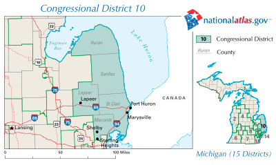
District 10 - Northern Macomb, and all of St Clair, Lapeer, Sanilac, and Huron County.
- Candice S. Miller, Republican
District 5 - Saginaw/Bay City Area, and all of Genesse and Tuscola.
Michigan House
32nd District - Northern Macomb and two townships in St Clair County.
- Daniel Acciavatti, Republican
81st District - Most of St Clair County, except Port Huron.
- Jud Gilbert, - Republican
82nd District - All of Lapeer County.
- John Stahl, Republican
83rd District - City of Port Huron, Fort Gratiot, and all of Sanilac County.
- John Espinoza, Democrat
84th District - Huron and Tuscola County.
- Terry Brown, Democrat
Michigan Senate
Colleges and universities
- St. Clair County Community College, with the main campus in Port Huron, and learning centers in Huron, Sanilac, and Lapeer Counties.
- Baker College, with a campus in Cass City, Sandusky, and Port Huron.
- University of Michigan - Flint, Saginaw Valley State University, and Delta College, while not in the Thumb, are universities and colleges that attract many residents from the Thumb.
Museums
See also: List of museums in Michigan
Harbor Beach
- Frank Murphy Memorial Museum and home.[27]
- Grice House Museum - Harbor Beach[28]
Marysville
- Marysville Historical Museum - Marysville
- Wills Ste. Claire Auto Museum - Marysville
Port Huron
 Huron Light Ship Museum in the St. Clair River, Port Huron, Michigan
* Port Huron Museum - a series of five museums - Port Huron[29]
- Carnegie Center - Port Huron
- Huron Lightship - Port Huron
- Thomas Edison Depot Museum - Port Huron
- USCGC Bramble (WLB-392) - Port Huron
- Fort Gratiot Lighthouse - Port Huron
Elsewhere in the Thumb
- Sanilac County Historical Museum - Port Sanilac
- Bad Axe Historical Society Museum - Bad Axe
- Capac Historical Museum - Capac
- Pointe aux Barques Lighthouse near Port Hope
- St. Clair County Farm Museum - Goodells
Media
Radio
The Thumb Area Radio Region lies between the Detroit Radio Market, the Tri-Cities Radio Market and the Flint Market, with stations in Port Huron and Sarnia, Ontario also serving the region.
Powerful local stations include; WMIC AM 660, WBGV FM 92.5, WTGV FM 97.7 of Sandusky; WPHM AM 1380 of Port Huron; WIDL FM 92.1 of Caro;WLEW FM 102.1 of Bad Axe; and WLCO AM 1530 in Lapeer. Other radio stations broadcasting to the thumb area include WJR, WWJ, and WXYT of Detroit; WSGW, WKCQ and WHNN of Saginaw; and CFCO of Chatham, Ontario.
- Local Radio Stations in the Thumb Area
Radio stations in the Thumb area By FM frequency By AM frequency By callsign plus Radio stations in Southwestern OntarioMichigan Radio Markets: Ann Arbor • Battle Creek • Detroit • Flint • Grand Rapids • Kalamazoo • Lansing-East Lansing • Muskegon • Saginaw-Bay City-Midland • Traverse City-Petoskey
Other Michigan Radio Regions: Alpena • Houghton • Iron Mountain • Jackson • Marquette • Sault Ste. Marie • The Thumb Area
See also: List of radio stations in MichiganNewspaper
- Daily editions of the Detroit Free Press and The Detroit News are available throughout the area.
- The Bay City Times[30] and Saginaw News[31] are available in northern and western portions of the area, while the Flint Journal is available in Lapeer County.
- Huron County newspapers
- Harbor Beach Times
- Huron County Press
- Huron Daily Tribune [1]
- News Weekly, The
- The Lakeshore Guardian
- Thumb Blanket
- Lapeer County newspapers
- Buyer's Guide
- County Press, The [2]
- LA View
- Webco Press
- Sanilac County newspapers
- Brown City Banner
- Buyers Guide
- Camden Publications
- Deckerville Recorder
- Marlette Leader
- Sandusky Tribune
- Sanilac County News [3]
- St. Clair County newspapers
- Blue Water Shopper
- Port Huron Times Herald-USA Today [4]
- Thumb Print News, The
- Voice, The
- Yale Expositor, The
- Tuscola County Newspapers
- Tuscola County Advertiser [5]
- Cass City Chronicle
- Cass River Trader
- Reese Reporter
- Vassar Pioneer Times
Broadcast television
The Lapeer County, St. Clair County and Sanilac County area lies in the Detroit Television Market. The far northern and western areas lie inside the Flint/Tri-Cities Television Market. The only broadcast TV station licensed to the Thumb region is WDCQ-TV, the PBS station licensed to Bad Axe.
- Sarnia/Windsor Ontario
- CBET-DT, CBC 9
- CBLN-TV-2, CBC 34
- CIII-TV, Global 22/29
- CICO-DT, TVO 32/59
- CKCO-TV, CTV 42
- CBLFT-17, Radio-Canada 68
- Alpena area
- WBKB-TV, CBS / Fox / MyTV 11
Transportation
 Port Huron's two Blue Water Bridges, taken during the Port Huron to Mackinac Yacht Race.
Borders
The border between Port Huron, Michigan and Sarnia, Ontario is one of the busiest connections between Canada and the US. Crossings include the two Blue Water Bridges and the two St. Clair River Railway Tunnels. Ferries also connect to Canada at Marine City and Algonac.
Major highways
(organized by numbers)
 I-69 begins at the Blue Water Bridge, proceeds west through Flint, then Lansing, and then turns south to Angola, Indiana.
 I-94 is the only precisely east-west U.S. interstate that has a terminus in a foreign country.[32] It has its eastern terminus at the U.S. side of the Blue Water Bridge in Port Huron, Michigan, at the Sarnia, Ontario, Canada border, where together with I-69 it meets
  Ontario Highway 402.
 M-15
M-15 M-19
M-19- old
 M-21 (largely replaced by I-69)
  M-24
M-24 M-25 is a highway of an arc-like shape closely following the outline of the Thumb along the Lake Huron/Saginaw Bay shoreline between Port Huron and Bay City. It is generally a scenic drive.
 M-29
M-29 M-46 is a cross peninsular road, running across the mitten and the Thumb—from Port Sanilac on the Lake Huron shore; through Saginaw near Saginaw Bay; and then on to Muskegon on the Lake Michigan shore.[33] This east-west surface route nearly bisects the Lower Peninsula of Michigan latitudinally.
 M-53 (Van Dyke Road) is a gateway route to The Thumb of Michigan, carrying vacationers to the resorts and cottages on Saginaw Bay and Lake Huron in the vicinity of Caseville and Port Austin. It goes up the middle of the Thumb, and directly connects in Macomb County, Michigan to the M-53 expressway. It is an important route for agricultural and manufactured goods.
 M-81
M-81 M-90
M-90 M-136
M-136 M-138
M-138 M-142
M-142
Rail
- Main article: Michigan Services
Area Amtrak stations are in Lapeer, Port Huron, and Flint. Local railroads are the Grand Trunk Western Railroad, CSX Transportation, Canadian National Railway, and the Huron and Eastern Railway. Pere Marquette Railway was a railroad that had lines throughout the Thumb; its lines are now either abandoned or in use by CSX, or Huron and Eastern.
Major railroad centers are Vassar, Bad Axe and Port Huron.
Airports
The only international airport in the Thumb is St. Clair County International Airport about 6 miles (9.7 km) outside Port Huron. City airports include: Caro Municipal, Dupont-Lapeer Airport, Huron County Memorial Airport, Marine City Airport, Marlette Municipal, Sandusky City, and Yale Airport. Scheduled airline service is available from MBS International Airport[34] in Freeland, Michigan and Flint Bishop International Airport.[35] While neither of these airports is in the Thumb, both are relatively close by.
Area codes
Area code 989 covers about half of the Thumb: Huron, Tuscola, and far northern Sanilac County (and the Marlette, Michigan area). The Thumb's other half is covered by area code 810, which takes in most of Sanilac, Lapeer, Genesee and Saint Clair Counties. All of Macomb County is served by area code 586, as is a small part of south-western Saint Clair County.
See also
State
Regional
- Flint/Tri-Cities and Tri-Cities
- Lake Huron
- Metro Detroit
Local cities and villages of interest
- Akron (Tuscola)
- Algonac (St. Clair)
- Applegate (Sanilac)
- Almont (Lapeer)
- Bad Axe (Huron)
- Brown City (Sanilac/Lapeer)
- Capac (St. Clair)
- Caro (Tuscola)
- Carsonville (Sanilac)
- Caseville (Huron)
- Cass City (Tuscola)
- Clifford (Lapeer)
- Columbiaville (Lapeer)
- Croswell (Sanilac)
- Deckerville (Sanilac)
- Dryden (Lapeer)
- Elkton (Huron)
- Emmett (St. Clair)
- Fairgrove (Tuscola)
- Forestville (Sanilac)
- Gagetown (Tuscola)
- Harbor Beach (Huron)
- Imlay City (Lapeer)
- Kinde (Huron)
- Kingston (Tuscola)
- Lapeer (Lapeer)
- Lexington (Sanilac)
- Marine City (St. Clair)
- Marlette (Sanilac)
- Marysville (St. Clair)
- Mayville (Tuscola)
- Melvin (Sanilac)
- Memphis (St. Clair/Macomb)
- Metamora (Lapeer)
- Millington (Tuscola)
- Minden City (Sanilac)
- North Branch (Lapeer)
- Otter Lake (Lapeer/Genesee)
- Owendale (Huron)
- Peck (Sanilac)
- Pigeon (Huron)
- Port Austin (Huron)
- Port Hope (Huron)
- Port Huron (St. Clair)
- Port Sanilac (Sanilac)
Subjects
Notes
- ^ Saginaw Valley Dry Bean and Sugar Beet Research Farm, Michigan State University.
- ^ "Co-Op Elevator Co.". http://www.coopelev.com/index.cfm?show=10&mid=72.
- ^ "Macraes Blue Book". http://www.macraesbluebook.com/search/company.cfm?company=466118.
- ^ "Mueller Industries". http://www.muellerindustries.com/.
- ^ "Michigan Sugar Company". http://www.michigansugar.com/.
- ^ "Macraes Blue Book". http://www.macraesbluebook.com/search/company.cfm?company=465398.
- ^ "Star of the West Milling Co.". http://www.starofthewest.com/index.cfm?show=10&mid=5.
- ^ "Eastern Michigan Grain". http://www.emggrain.com/.
- ^ "Michigan.org East-Central tourism". http://www.michigan.org/Places-to-Go/Locations/East-Central/Default.aspx.
- ^ Tip of The Thumb Heritage Water Trail
- ^ "Bad Axe Historical Society, origin of Bad Axe's name.". http://www.thehchs.org/badaxe/ba_history.htm.
- ^ "The Huron County Nature Center". http://www.huronnaturecenter.org/.
- ^ "Kernan Memorial Nature Sanctuary". http://www.michigannature.org/Sanctuaries/114.shtml.
- ^ Michigan Bean Soup recipe and history, the Honorable and Mrs. John D. Rockefeller IV, U.S. Senator.
- ^ "Rasmus Hanson biography". http://www.graylingfishhatchery.com/hanson.htm.
- ^ Great Lakes Circle Tour.
- ^ "Blue Water Ramble/Clinton River Riders". http://www.lmb.org/crr/.
- ^ Family Night a/k/a Boat Night.
- ^ Port Huron to Mackinac Island, Michigan Yacht Race
- ^ Morris, Julie The Port Huron to Mackinac race, May 1, 2001 Detroit News
- ^ Cheesburger in Caseville at Pure Michigan.
- ^ Campbell, Ron. August 13, 2010 Cheeseburger in Caseville festival turns town into 'Fun, wacky, tasteful and tacky' place Bay City Times.
- ^ Pure Michigan, Huron County Fair.
- ^ Pigeon Festival.
- ^ Michigan Bean Commission.
- ^ "Blue Water Area Convention and Visitor's Bureau.". http://www.bluewater.org.
- ^ "Harbor Beach attractions". http://harborbeachchamber.com/attraction.html.
- ^ Harbor Beach, Yesterday and Today, Compiled by the Harbor Beach Woman’s Club. First Printing 1976, Revised Edition 1996.
- ^ "Port Huron Museum". http://www.phmuseum.org/.
- ^ "Bay City Times". http://www.mlive.com/bctimes/.
- ^ "Saginaw News". http://www.mlive.com/saginawnews/.
- ^ "Michigan highway ends, photos and text". http://www.state-ends.com/michigan/i94/.
- ^ Garnell, Dan. "M-46". Michigan Highway Ends. http://www.state-ends.com/michigan/m46/.
- ^ "MBS International Airport". http://www.mbsairport.org/.
- ^ "Flint Bishop International Airport". http://www.bishopairport.org/.
Further reading
- Ackerman, Emma J. Thumb Fires of 1871 and 1881. CMU Term Paper, 1968.
- DuMond, Neva. Thumb diggings; adventures into Michigan's Thumb area. Lexington, Mich, 1962.
- The Great Fire of 1881: A Collection of Stories. Caro, MI: Tuscola County Advertiser, 1981.
- Hatt, R. T. --The petroglyphs, by D. J. Richards.--An archeological survey of the petroglyph site, by M. Papworth (republished from the Michigan archeologist, Dec. 1957) The Sanilac petroglyphs. Bloomfield Hills, Michigan: Cranbrook Institute of Science, 1958
- House Party: Reminiscences by Traditional Musicians and Square Dance Callers in Michigan's Thumb Area. Port Huron, MI: Museum of Arts and History, 1982.
- Schultz, Gerard. A History of Michigan's Thumb.
- Smith, Dee. Treks into the Past: Historical Sketches of Michigan's Thumb. Decatur, MI: Heritage Valley Publishing, 1989.
- Southgate, Jerry D. Thumb's Forest Fire of 1881. Central Michigan University Term Paper, 1967.
External links
- Blue Water Convention and Visitors Bureau.
- Clarke Historical Library, Central Michigan University, Bibliography on Michigan (arranged by counties and regions).
- Great Lakes Coast Watch
- Huron County economic development corporation/Community calendars, webcams and more.
- List of Museums, other attractions compiled by state government.
- Michigan Geology -- Clarke Historical Library, Central Michigan University.
- Michigan Historical Markers
- Michigan Department of Natural Resources website, harbors, hunting, resources and more.
- Information about Michigan's Thumb
- Michigan's Official Economic Development and Travel Site, including interactive map, information on attractions, museums, etc.
- Interactive map of lighthouses in area.
- Seeing the Light: Terry Pepper on lighthouses of the Western Great Lakes.
- Info Michigan
Categories:- Regions of Michigan
- Peninsulas of Michigan


Wikimedia Foundation. 2010.