- Downtown Seattle Transit Tunnel
-
"DSTT" redirects here. For the Nintendo DS storage device, see Nintendo DS storage devices#DSTT. For the Division of Signal Transduction Therapy at the University of Dundee, see Division of Signal Transduction Therapy.
Downtown Seattle Transit Tunnel 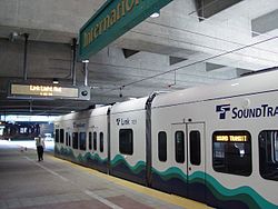
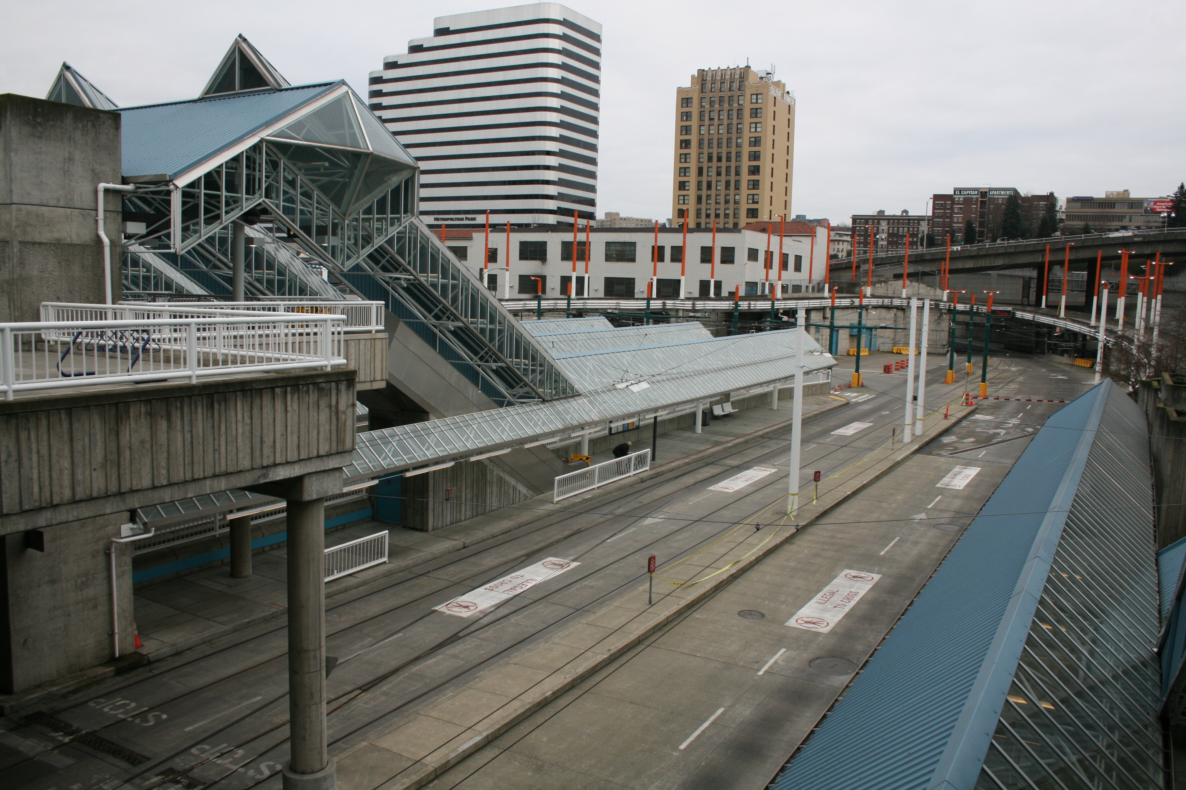
The first Central Link Light Rail trains are test-run in the tunnel Overview Line Central Link, Metro 41, 71, 72, 73, 74, 76, 77E, 101, 102, 106, 150, 212, 216, 217, 218, 255, 301, 316, STE 550 Location Downtown Seattle Coordinates 47°35′56″N 122°19′41″W / 47.599°N 122.328°WCoordinates: 47°35′56″N 122°19′41″W / 47.599°N 122.328°W System King County Metro bus and Sound Transit Central Link light rail Start 9th Avenue and Pike Street End 5th Avenue S. and S. Jackson Street No. of stations 5 Operation Work begun March 6, 1987[1] Opened 1990 Rebuilt September 24, 2007 Owner King County Metro Transit[2] Operator King County Metro, Sound Transit Traffic Bus, light rail Technical Length 1.3-mile (2.1 km) The Downtown Seattle Transit Tunnel, also referred to as the Metro Bus Tunnel, is a 1.3-mile (2.1 km) public transit tunnel that runs the length of downtown Seattle, from 9th Avenue and Pike Street to 5th Avenue S. and S. Jackson Street. Approved by Metro Transit in 1983,[3] construction began in 1987.[4] It was completed and service began in 1990, at a total cost of $455 million.[4] In May 2000, the King County Council transferred ownership to Sound Transit[5] but ownership was transferred back to King County Metro in 2002.[2]
The tunnel was closed on September 24, 2005 for modification to accommodate both buses and Sound Transit's Central Link light rail trains on a shared alignment. Prior to closure, around two dozen bus routes ran through the tunnel. The buses were dual-powered, using electricity in the tunnel from an above wire connection and diesel on city streets. It reopened on Monday, September 24, 2007.[6] The two-year closure included retrofits for light rail as well as other operating system upgrades. Also, a stub tunnel, branching from the main tunnel, was constructed under Pine Street between 7th and Boren Avenues to allow light rail trains to stop and reverse direction and for future extension of Central Link.[7]
Due to the conversion to light rail, the dual-mode buses that are powered by the above electric connection can no longer operate in the tunnel. Those buses have already been replaced by Metro's current new fleet of hybrid buses. While these buses produce significantly more emissions than electric trolley buses that use overhead wires, they produce fewer emissions than standard diesel buses, and require no connection to overhead wires.[8]
Since the floor of the tunnel was lowered for the light rail, there have been concerns that the bus mirrors are now at head height and may strike those who are waiting on the platform. To prevent this, the mirrors are equipped with flashing lights. As well, the buses' speed limit as they approach and leave stations has been lowered from 15 miles per hour (24 km/h) to 10 miles per hour (16 km/h).[9]
The tunnel is entirely within the Ride Free Area, so no fare is required on buses at any station during hours when the policy is in effect. Due to Sound Transit's different fare structure, fares are required on Central Link light rail trains.
Contents
Service
In addition to Central Link Light Rail, the Downtown Seattle Transit Tunnel currently serves the following bus routes during tunnel operating hours: King County Metro 41 (Northgate, Lake City), 71 (U-District, Wedgwood), 72 (U-District, Lake City), 73 (U-District, Jackson Park), 74 Express (U-District, Sand Point), 76 (Green Lake P&R, Wedgwood), 77 (Maple Leaf, Jackson Park, North City), 101 (Renton), 102 (South Renton, Fairwood), 106 (Rainier Beach, Renton), 150 (Southcenter, Kent), 212 (Eastgate), 216 (Sammamish, Bear Creek P&R), 217 (Eastgate, N Issaquah), 218 (Eastgate Freeway Station, Issaquah Highlands P&R), 255 (Kirkland, Brickyard P&R), 301 (Richmond Beach, Aurora Village), 316 (Green Lake P&R, NSCC, Meridian Park) and Sound Transit Express 550 (Bellevue).[10]
The tunnel is open for light rail and bus service Monday through Saturday, 5:00 am to 1:00 am, and Sunday, 6:00 am to 12:00 midnight. Buses running after tunnel operating hours are rerouted to nearby surface streets.
Route
The north portal is located near 9th Avenue and Olive Way, with dual entry/exit ramps onto the Interstate 5 express lanes. From this point, the tunnel runs southwest-northeast under Pine Street, then turns left and runs northwest-southeast under 3rd Avenue for most of its length. The tunnel passes four feet below the Great Northern Tunnel.[11] The south portal of the tunnel is located near 4th Avenue and Royal Brougham Way, where buses have dual entry/exit onto the Interstate 90 express lanes, or the SoDo E-3 Busway. At the south portal, the light rail tracks split from the shared alignment onto their own right-of-way, which runs parallel to the SoDo Busway until just south of Lander Street.
Stations
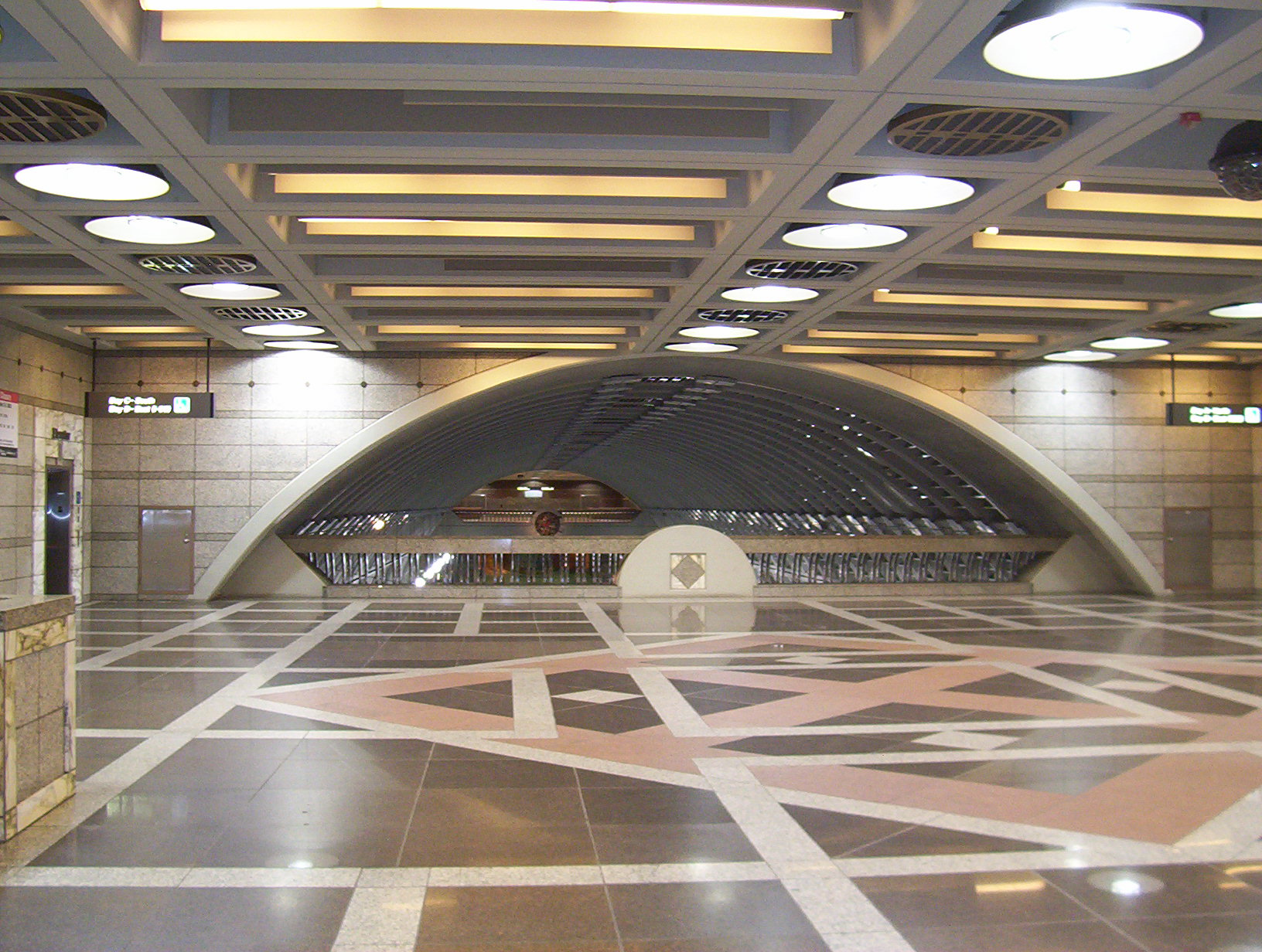
The Downtown Seattle Transit Tunnel has five stations, listed below from north to south:[12]
Station Location Notes Convention Place 9th Avenue and Pine Street Serves Washington State Convention Center, Paramount Theatre, Greyhound Lines terminal, Federal Courthouse. Transfer to surface bus or cross Interstate 5 to Capitol Hill. Bus routes from south of the tunnel have their terminus and layover here. This station is a future transit-oriented development site.[13]
This station is served only by buses.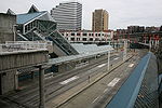
Westlake Pine Street between 3rd and 6th Avenues Serves Westlake Center, Seattle Center Monorail, South Lake Union Streetcar, Nordstrom, Macy's, Pike Place Market. Transfer to surface buses toward Belltown, Queen Anne Hill, Magnolia, Fremont, Shoreline, Green Lake, and Redmond.
Transit information and passes can be obtained from the Metro Customer Stop on the mezzanine level.
This is the northern terminus of the Central Link light rail.
At this point, the tunnel makes a left, and follows Third Avenue.
University Street 3rd Avenue between Union and Seneca Streets Serves Benaroya Hall, Seattle Art Museum, Seattle Central Library, Main Post Office, Washington Mutual Tower. Transfer to surface buses toward First Hill 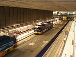
Pioneer Square 3rd Avenue between Cherry Street and Yesler Way Serves Pioneer Square, King County Courthouse, King County and City of Seattle government offices, King County Jail, Washington State Ferries Colman Dock 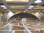
International District/Chinatown 5th Avenue S. and S. Jackson Street Serves International District, King Street Station, Uwajimaya, Waterfront Streetcar, Metro and Sound Transit offices. Transfer to surface buses toward Rainier Valley, Beacon Hill, Industrial District, SoDo, and the Eastside. Bus routes from north of the tunnel have their terminus and layover here. 
References
- ^ "Metro transit begins excavating downtown Seattle transit tunnel on March 6, 1987.". 2000-10-01. http://www.historylink.org/index.cfm?DisplayPage=output.cfm&file_id=2700. Retrieved 2011-04-17.
- ^ a b [1]
- ^ Gough, William (1983-11-04). "Metro Council OK's downtown transit tunnel". The Seattle Times, p. B1.
- ^ a b Crowley, Walt (2000-10-01). "Metro transit begins excavating downtown Seattle transit tunnel on March 6, 1987". HistoryLink.org. http://www.historylink.org/index.cfm?DisplayPage=output.cfm&file_id=2700. Retrieved 2009-05-30.
- ^ "Council Agrees to Joint Operation of Transit Tunnel". 2003-02-06. Archived from the original on 2005-02-11. http://web.archive.org/web/20050211200527/http://www.metrokc.gov/MKCC/news/2002/0602/tunnel_ops.htm.
- ^ "Seattle bus tunnel set to reopen". KOMO News. 2007-09-18. http://www.komotv.com/news/local/9862296.html. Retrieved 2009-05-30.
- ^ "Pine Street Stub Tunnel". Sound Transit. http://www.soundtransit.org/x1184.xml. Retrieved 2009-05-30.
- ^ "Downtown Seattle Transit Tunnel and Changing Bus Technology". King County Metro. 2007-12-14. http://metro.kingcounty.gov/am/vehicles/bustech.html. Retrieved 2009-05-30.
- ^ Brown, Charles E. (2007-09-28). "The Bumper Connection: Tunnel Vision". The Seattle Times. http://blog.seattletimes.nwsource.com/bumperconnection/2007/09. Retrieved 2009-05-30.
- ^ "Metro Bus Tunnel". March 26, 2008. http://metro.kingcounty.gov/tops/tunnel/tunnel.html#intunnel. Retrieved 2009-10-28.
- ^ "Pioneer Square Station-the Pioneering Spirit". King County Metro. 2008-03-15. http://metro.kingcounty.gov/tops/tunnel/ts-pioneer.html. Retrieved 2009-05-30.
- ^ "Metro Bus Tunnel Stations". King County Metro. 2008-07-18. http://metro.kingcounty.gov/tops/tunnel/tunnel-stations.html. Retrieved 2009-05-30.
- ^ "TOD projects and sites in King County". King County Department of Transportation. 2007-11-19. http://your.kingcounty.gov/kcdot/tod/projects.stm. Retrieved 2009-05-30.[dead link]
External links
Mass transit in the Puget Sound region Local and Express bus - Community Transit list of routes)
- Everett Transit
- Intercity Transit
- Island Transit
- King County Metro (list of routes)
- Kitsap Transit
- Pierce Transit
- Skagit Transit
- Sound Transit (ST Express) (list of routes)
- Trolleybuses in Seattle
Light rail - Link Light Rail (list of stations): Central Link
- University Link
- North Link
- South Link
- East Link
Streetcar - Seattle Streetcar Network: South Lake Union Streetcar
- First Hill Streetcar
- Waterfront Streetcar
- Tacoma: Tacoma Link
- Tacoma Streetcar
Commuter rail Bus rapid transit - Swift
- RapidRide
Ferry - Guemes Island ferry
- Kitsap Transit
- Washington State Ferries
- King County Ferry District: West Seattle Water Taxi
- Port of Kingston Soundrunner
- Steilacoom-Anderson Island Ferry
Monorail Other - Satellite Transit System
- Downtown Seattle Transit Tunnel
- ORCA Card
Italics denote lines or services which are planned, under construction, or otherwise not operating at the present time.Bridges and tunnels in and around Seattle Road bridges: Alaskan Way Viaduct | Ballard Bridge | Cowen Park Bridge | East Channel Bridge | Evergreen Point Floating Bridge | First Avenue South Bridge | Fremont Bridge | George Washington Memorial Bridge (Aurora Bridge) | Homer M. Hadley Memorial Bridge (Third Lake Washington Floating Bridge) | Jose Rizal Bridge | Lacey V. Murrow Memorial Bridge (I-90 Floating Bridge) | Magnolia Bridge | Montlake Bridge | North Queen Anne Drive Bridge | Schmitz Park Bridge | Ship Canal Bridge | South Park Bridge | Spokane Street Bridge | 20th Avenue NE Bridge | University Bridge | West Seattle BridgeRail bridges/trestles: Tunnels: Battery Street Tunnel | Great Northern Tunnel | Mercer Island Lid | Downtown Seattle Transit Tunnel | Mount Baker Tunnel | Convention Center-Freeway Park Lid | Beacon Hill TunnelCategories:- ST Express
- Link Light Rail
- Transportation in Seattle, Washington
- Railroad tunnels in Washington (state)
- Bus rapid transit in Washington (state)
- Busways
- Underground rapid transit in the United States
- Buildings and structures in Seattle, Washington
- Tunnels completed in 1990


Wikimedia Foundation. 2010.