- Oatman, Arizona
-
Oatman, Arizona — Unincorporated community — Oatman Highway/Old US 66. The Oatman Hotel is the adobe building center left.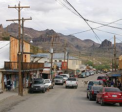
 Oatman, Arizona
Coordinates: 35°01′35″N 114°23′01″W / 35.02639°N 114.38361°WCoordinates: 35°01′35″N 114°23′01″W / 35.02639°N 114.38361°W Country United States State Arizona County Mohave Elevation[1] 2,710 ft (826 m) Time zone MST (no DST) (UTC-7) Oatman is a former mining town in the Black Mountains of Mohave County, Arizona, United States. Located at an elevation of 2,710 feet (830 m), it began as a tent camp soon after two prospectors struck a $10 million gold find in 1915, though the area had been already settled for a number of years. Oatman's population grew to more than 3,500 in the course of a year.
Oatman has the ZIP code of 86433.[2] The 86433 ZIP Code Tabulation Area had a population of 128 at the 2000 census.[3]
Contents
Name
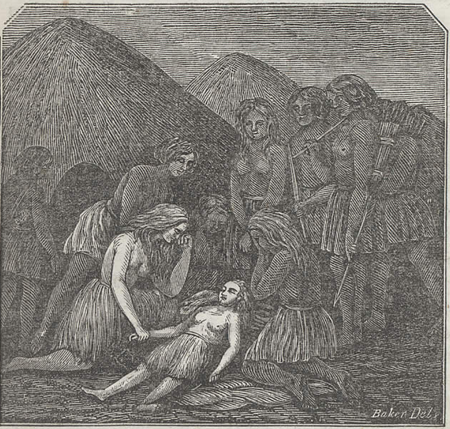
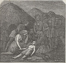 The Oatman girls, captives of the Indians, 1857
After a few other names, Oatman was named in the posthumous honor of Olive Oatman, a young Illinois girl who was kidnapped by (presumably) Yavapai Indians and forced to work as a slave. She was later traded to Mohave Indians who adopted her as a daughter and had her face tattooed in the custom of the tribe. She was released in 1855 near the current site of the town.
Early history
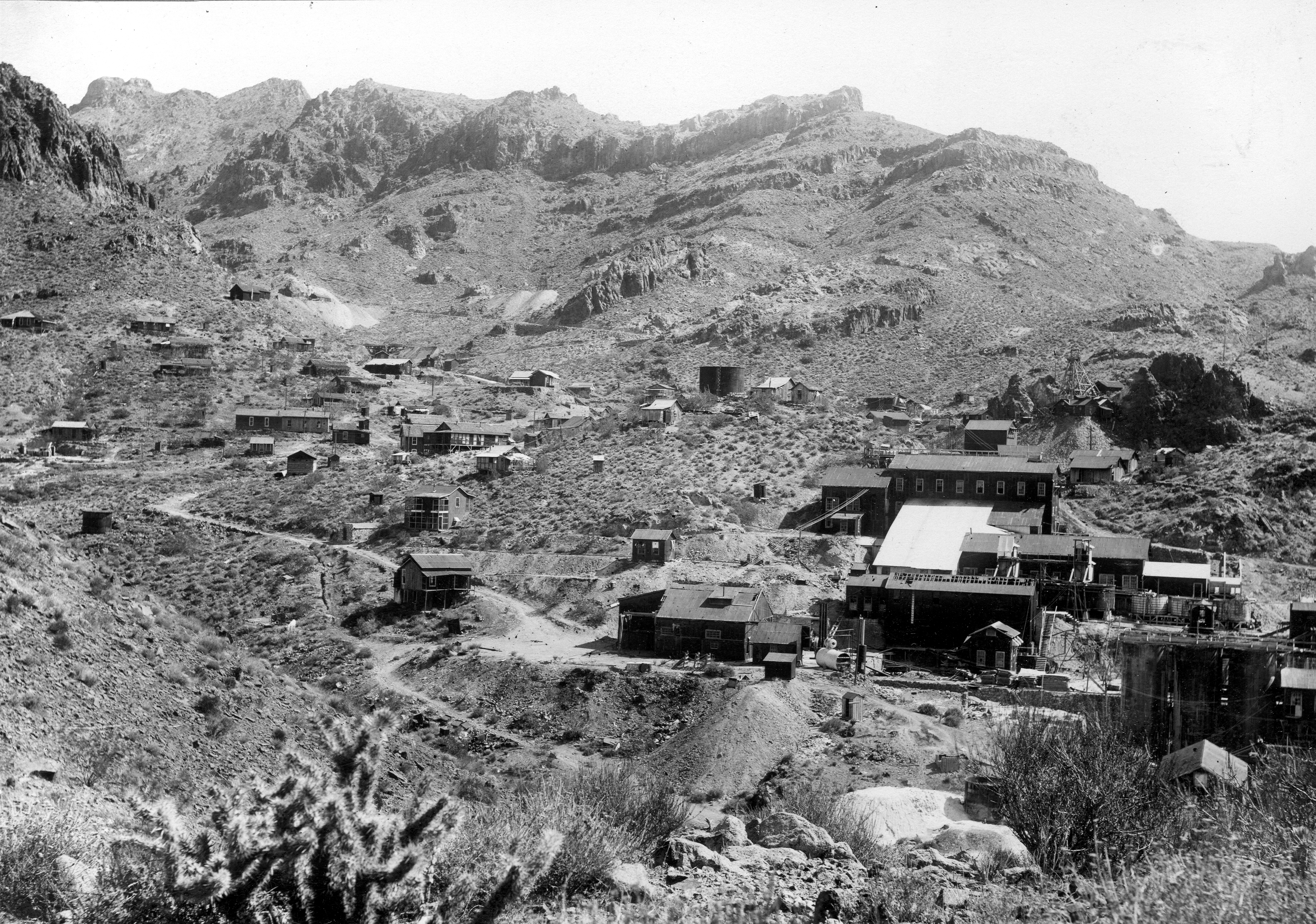
 Mines and mills of the Oatman district, circa 1921.
In 1921, a fire burned down many of Oatman's smaller buildings, but spared the Oatman Hotel. Built in 1902, the now-Oatman Hotel is the oldest two-story adobe structure in Mohave County, a Mohave County historical landmark and is especially famous as the honeymoon stop of Clark Gable and Carole Lombard[4] after their wedding in Kingman on March 18, 1939. Gable fell in love with the area and returned often to play poker with the miners. The Gable/Lombard honeymoon suite is one of the hotel's major attractions. The other is "Oatie the Ghost." "Oatie," actively promoted by the hotel's current owners, is a friendly poltergeist whose identity is believed to be that of William Ray Flour, an Irish miner who died behind the hotel, presumably from excessive alcohol consumption. Flour's body wasn't discovered until two days after his death and it was hastily buried in a shallow grave near where he was found.
From gold mining to tourism
1924 would see United Eastern Mines, the town's main employer permanently shut down operations. By 1941, the remainder of the town's gold mining operations were ordered shut down by the US Government as part of the country's war effort since metals other than gold were needed. Oatman was fortunate insofar as it was located on busy U.S. Route 66 and was able to cater to travelers driving between Kingman and Needles, California. Even that advantage was short-lived as the town was completely bypassed in 1953 when a new route between Kingman and Needles was built. By the 1960s, Oatman was all but abandoned.
Oatman today
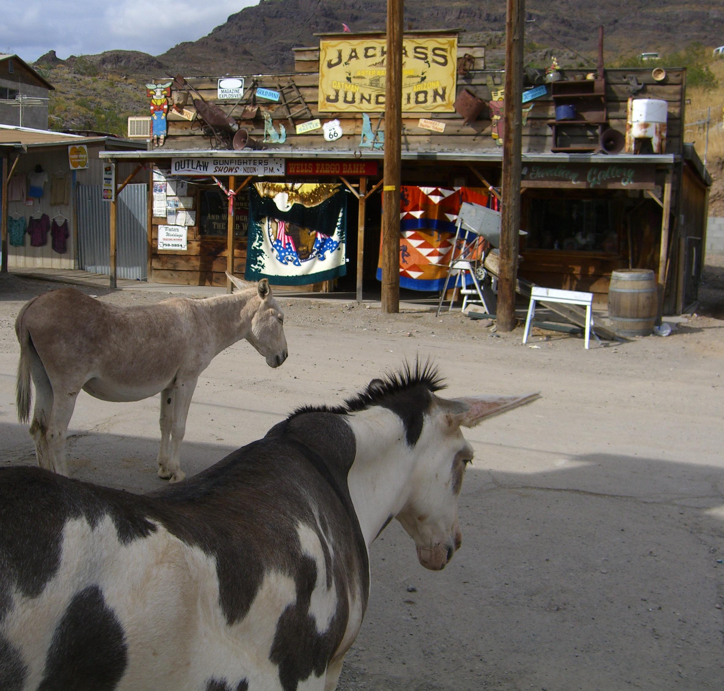
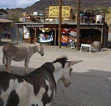 Burros roam downtown Oatman.
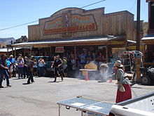 Street Theatre in Oatman
Oatman has undergone a renaissance of sorts in recent years thanks to burgeoning worldwide interest in Route 66 and the explosive growth of the nearby gaming town of Laughlin, Nevada, which promotes visits to the town. Wild burros freely roam the town and can be hand-fed carrots and "burro chow," both readily available in practically every store in town. Though normally gentle, the burros are in fact wild and signs posted throughout Oatman advise visitors to exercise caution. The burros are descended from pack animals turned loose by early prospectors, and are protected by the US Department of the Interior. Weekends in Oatman can see anything from classic car rallies to mock "Wild West" shootouts right down the middle of old 66. Independence Day celebrations include a contest where participants attempt to cook an egg on the sidewalk with the aid of solar devices. Along with the rest of Arizona's US 66 towns, Oatman is fiercely proud of its Route 66 heritage and replicas of 66's black-on-white US highway shield are posted all over the town. Route 66 souvenirs abound and many tourists have pasted autographed one-dollar bills on the walls and ceiling of the Oatman Hotel's bar and restaurant. Estimates of the number of bills run into the thousands.
From Laughlin, Needles or Bullhead City, Arizona, Oatman is a short drive on State Route 95 to its intersection with Boundary Cone Road in Fort Mohave. About 10 miles (16 km) east of SR 95, Boundary Cone Road meets with old 66, now named the "Oatman Highway." Oatman is only about four miles (6.5 km) from there.
See also
- Bullhead City, Arizona
- Fort Mohave, Arizona
- Mohave Valley, Arizona
References
- ^ U.S. Geological Survey Geographic Names Information System: Oatman
- ^ Zip Code Lookup
- ^ "American FactFinder". United States Census Bureau. http://factfinder.census.gov. Retrieved 2008-01-31.
- ^ Varney, Philip (April, 2005). "Mohave Ghosts". In Stieve, Robert. Arizona Ghost Towns and Mining Camps: A Travel Guide to History (10th ed.). Phoenix, Arizona: Arizona Highways Books. pp. 39. ISBN 1932082468.
External links
- Oatman and Gold Road Chamber of Commerce - Information and events
- Oatman at Western Mining History
Municipalities and communities of Mohave County, Arizona Cities 
Town CDPs Arizona Village | Desert Hills | Dolan Springs | Fort Mohave | Golden Valley | Kaibab‡ | Mesquite Creek | Mohave Valley | Mojave Ranch Estates | New Kingman-Butler | Peach Springs | Willow Valley
Unincorporated
communitiesBeaver Dam | Chloride | Hackberry | Littlefield | Meadview | Nothing | Oatman | Scenic | Topock | Valentine | Walapai | White Hills | Wikieup | Yucca
Indian reservations Ghost towns Alamo Crossing | Aubrey Landing | Cedar | Cerbat | Mohave City | Santa Claus | Wolf Hole
Footnotes ‡This populated place also has portions in an adjacent county or counties
Categories:- Communities on U.S. Route 66
- Populated places in Mohave County, Arizona
- Ghost towns in Arizona


Wikimedia Foundation. 2010.