- Malvern Link
-
Coordinates: 52°07′32″N 2°18′58″W / 52.12553°N 2.3161°W
Malvern Link 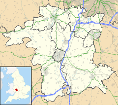
 Malvern Link
Malvern Link shown within WorcestershireDistrict Malvern Hills Shire county Worcestershire Region West Midlands Country England Sovereign state United Kingdom Post town MALVERN Postcode district WR14 Dialling code 01684 Police West Mercia Fire Hereford and Worcester Ambulance West Midlands EU Parliament West Midlands UK Parliament West Worcestershire List of places: UK • England • Worcestershire  St Matthias Churchyard and the Link Stone.
 The Link Stone.
 Malvern Link crossroads.
 Malvern Link railway station.
Malvern Link is an area of Malvern, Worcestershire, England to the north and east of Great Malvern. The centres of Malvern Link and Great Malvern are separated by Malvern Link Common, an area of open land that is statutorily protected by the Malvern Hills Conservators. In 1900 Malvern Link Urban District, which had been formed only five years earlier, merged with Great Malvern to become Malvern Town.
Contents
Location
The main urban area is to the north of the Worcester Road and the Link Common that marks a sharply defined boundary on the south of the settlement between the railway station and the area's western limit at Newtown Road in Link Top. The urban development takes a gentle transition through the neighbourhoods of Upper Howsell and Lower Howsell to the farms and communities of Leigh Sinton in the north and Newland and Madresfield in the west. To the south along the main axis of Pickersleigh Road, an unbroken built up area merges seamlesly into Barnards Green, a suburb of the former independent town of Great Malvern.
History
The name Malvern Link seems to have been in use for some time: "The many local placenames ... which first appear in thirteenth century records were probably current a full century earlier. ... By 1276 ... there was, therefore, a probable population of at least 200 scattered in the old hamlets of Baldenhall, Guarlford, Poolbrook and the Link ..." [1] Malvern Link was the key site of the Romano-British pottery industry that produced Severn Valley Ware. There are several kilns in the Malvern Link-Newland area and numerous water-filled clay pits, now lined with trees.[2]
Several theories exist on the origin of the name "Malvern Link" . It may have got its name because the Victorians used to link up more horses to the carriages so that they could be pulled up the hill on the A449, which runs through the centre of Malvern Link to the small urban centre of Link Top at its western end before arriving in the town centre of Great Malvern. At the point where the A449 road passes through Malvern Link it is called Worcester Road, as it leads directly into the centre of the city of Worcester about eight miles to the east.
However, "Malvern Link" may also refer to a ridge in the slope of the Malvern Hills on which it is situated, from the Middle English "hlinc" meaning a ridge of land,[3] or a hill. The word "link" can also mean "Rising ground; a ridge, a bank."[4](compare with "helling" meaning "slope" in Dutch, and in German the more specialised "slipway"[5])
The Link Stone
A perambulation of the boundaries of the Malvern Chase in 1584 describes "a great Stone in a Tufte of bushes" at Link Top which was recorded on a Stuart map as the "Whore Stone" (meaning hoar or ancient stone). In 1744 the Link Stone was located at the beginning of Pickersleigh road. It has since been relocated to the St Matthias churchyard.[6]
An inscription on a plaque near the stone reads:-
This stone originally marked the boundary between the Manors of Leigh and Powick. It was already old in 1584 when a breathless Elizabethan gentleman noted it during "beating the bounds". In the Stuart period it was marked on an estate map as the "Old Stone". The central recess is a receptacle for coins perpetuating the very old custom of receiving payment for the right of passage through the parish. This custom was acknowledged by mourners, who would rest a coffin on the Link Stone on it's way top Leigh from the Pickersleigh side of the Link, a practice probably not discontinued until 1846 when St Matthias was consecrated.
Development
Malvern Link is the location of the majority of Malvern's council and private housing estates, and retail parks and factory centres that have emerged since the 1950s. The expansion in the second half of the 19th century began essentially as ribbon development along the Worcester Road, the eastern approach to Malvern, at the same time as Malvern's rise to popularity as a Spa Town. When the railway arrived in the mid 19th century, the settlement had reached sufficient dimensions to justify its own fully featured station although the Great Malvern station is only about mile further down the line. Large villas and small hotels were constructed along the entire length of the northern side of the Worcester Road, from the railway station to Link Top affording them an unhindered view over the Malvern Common and many of them were converted to boarding schools following the decline of the spa industry, and major middle class residential areas developed northwards during the inter-war years of the 1920s and 1930s.
Further development is planned for the second decade of the 21st century with approximately 700 new houses, 10 hectares of employment land, a primary school and community centre destined for former farm land between Malvern Link and Newland.[7][8] This will effectively merge the two villages into the urban sprawl of Malvern Link, creating new neighbourhoods that have yet to be named. Construction began in early 2009 on a new hospital for Malvern on the site of Seaford Court, a former private prep school in Malvern Link, close to the station.
Population
As with the rest of Malvern, the Link owes much of its development to the area's rapid expansion from a cluster of hamlets and manors to a busy spa town during the mid 19th century. In 1942 the population swelled again when the Telecommunications Research Establishment (TRE) relocated to Malvern to occupy a site at Barnards Green,[9] and a further site of the RAF Radio Training School on the location of the former Pale Manor Farm in Leigh Sinton Road in Malvern Link, that came to be known as RRE North Site.[10]
Governance
Malvern Link constitutes the major part of the Link ward of the civil parish governed by Malvern Town Council.[11] . The ward Includes all of Malvern Link from Link Top in the west to the Newland roundabout in the east except a small part of the Malvern Link area in the west that is allocated to Dyson Perrins ward. The area of Malvern Link also includes part of the Pickersleigh ward to the south and also includes the former settlements of Upper Howsell and Lower Howsell.[12]
Industry and Commerce
 Morgan car factory main entrance
Malvern Link is home to the Morgan Motor Company a manufacturer of luxury sports roadsters, and Chance Brothers, the remaining factory of what was once the largest manufacturer of glassware in the United Kingdom.
The main shopping area of Malvern Link stretches along the Worcester Road in from the junction of Spring Lane to the junction of Pickersleigh Road at the Malvern Link railway station. It contains all the retail outlets common to a small town including pharmacies, furniture and dry goods stores, supermarkets, hardware stores, gardening centres, banks, betting shops, groceries, butchers, and cafés and fast-food, and a former cinema that is now a furniture warehouse. A mural on the Pickersleigh Road wall of the Victoria pharmacy depicts many of Malvern's landmarks, including the hills, Edward Elgar and Link Stone, which now resides in the churchyard of nearby St Matthias Church. It also contains the so-called 'Malvern Psalm'.
A retail park (the Malvern Hills Retail Park) has been in constant development of Malvern Link since the mid 1990s, with stores that include the branches of national chains such as Morrisons, Marks and Spencer, Matalan, Next and Halfords. The retail park is an extension of the Spring Lane trading estate, a commercial park of small modern factories, warehouses and service providers, that began its development in the early 1960s.
Education
One of Malvern's two secondary schools, Dyson Perrins CE Sports College, is located in Malvern Link. The school was endowed by and is named after Charles William Dyson Perrins, grandson of the co-founder of Lea and Perrins, the manufacturer of the local product Worcestershire sauce that is sold worldwide. The area also has several primary schools (such as Somers Park Primary School and St. Matthias C of E Primary School). The location of the former boys boarding school Seaford Court, is the site of a new Malvern hospital for which construction commenced in April 2009 and is scheduled for completion in August 2010.
Notable residents
 "Forli', a house in Malvern Link where Elgar lived
Edward Elgar, composer. On returning from London to settle in the Malverns, in 1891 Elgar and his wife leased a semi-detached house at 37 Alexandra Road, Malvern Link, which they named 'Forli'.[13] They lived in the house until 1898, when the Elgars moved to Storridge. It was during the 'Forli' years that Elgar composed many of his works, including, among others, The Black Knight (1892), Sursm Corda (1894), and in 1898 the Variations on an Original Theme that gained him his international reputation.[14]
References
- ^ Brian S Smith (1964) A History of Malvern, pp 84 - 85, Leicester University Press.
- ^ C. Jane Evans, Laurence Jones and Peter Ellis, (2000). Severn Valley Ware Production at Newland Hopfields: Excavation of a Romano-British kiln site at North End Farm, Great Malvern, Worcestershire in 1992 and 1994. Birmingham University Field Archaeology Unit Monograph Series 2
- ^ British Agricultural History Society Retrieved 6 February 2010
- ^ The Shorter Oxford English Dictionary Sixth Edition (2007)
- ^ Bosworth & Toller (1898). "An Anglo-Saxon Dictionary". http://lexicon.ff.cuni.cz/html/oe_bosworthtoller/b0544.html. Retrieved 6 February 2010.
- ^ Brian S Smith (1964) A History of Malvern, pp 84 - 85, Leicester University Press.
- ^ South Worcestershire Development Plan - Malvern Retrieved 25 October 2011
- ^ South Worcestershire Development Plan - Map 1a Great Malvern Retrieved 25 October 2011
- ^ Penley, Bill (13 November 2009). "TRE History". Penley Radar Archives. http://www.purbeckradar.org.uk/penleyradararchives/history/tre_history.htm. Retrieved 3 January 2010.
- ^ Kidderminster Shuttle newspaper archives Retrieved 6 February 2010
- ^ Hembry, Phylis May (Deceased); Cowie, Leonard W; Cowie, Evelyn E (Completing editors) (1997). British spas from 1815 to the present. Madison, N.J: Fairleigh Dickinson University Press. ISBN 0838637485. http://books.google.com/books?id=QvDWk4YMAR8C&lpg=PA197&dq=Malvern%20Link%20%20urban%20district&pg=PA197#v=onepage&q=Malvern%20Link%20%20urban%20district&f=false.
- ^ Hill, Don; Jones, Eric; Lomas, Janet; Mayner, Peter; McCulloch, Rosemary; Skinner, Michael (August 2005). The Guarlford Story. Malvern, UK: Guarlford History Group. pp. 158. ISBN 0955049806.
- ^ Mundy, Simon (1980). Elgar – his life and times. Tunbridge Wells: Midas Books. p. 25. ISBN ISBN 0859361209.
- ^ Collett, Pauline (1981). Elgar lived here. London: Thames Publishing. p. 41. ISBN 090521014X.
External links
- The Parish Churches Where they are and what's on
- Vision of Britain
- Malvern Gazette Local Malvern weekly newspaper
Areas of Malvern, Worcestershire Barnards Green · Cowleigh · Great Malvern · Hall Green · Howsel (Lower) · Howsel (Upper) · Link Top · Little Malvern · Malvern Link · Malvern Wells · Newland · North Malvern · Poolbrook · Pound Bank · Sherrard's Green · West Malvern · Wyche (Lower) · Wyche (Upper)Categories:- Malvern, Worcestershire
- Geography of Worcestershire


Wikimedia Foundation. 2010.