- Prince of Wales Island (Alaska)
Geobox|Island
name = Prince of Wales
native_name =
other_name = Prince of Wales Archipelago
category=Island
image_caption = Prince of Wales Island (Alaska)
official_name =
etymology =
motto =
nickname =
symbol =
country_type=Country
country = USA
country_
state_type=State
state=Alaska
state_
region_type=Borough
region = The "Unorganized Borough"
district_type=Census Area
district = Prince of Wales-Outer Ketchikan (CA)
municipality =
parent =
range =
border=Ketchikan Gateway
border1=
part =
tributary_left =
tributary_right =
child_left =
child_right =
city =
landmark =
building =
river =
location =
elevation =0
elevation_note=
prominence =
lat_d=55 | lat_m=37 | lat_s=55 | lat_NS=N
long_d=132 | long_m=54 | long_s=27 | long_EW=W
coordinates_type=region:US-AK_type:isle_source:GNIS&title=Prince_of_Wales_Island
coordinates_format=dms
coordinates_note=
capital =
capital_location = | capital_region = | capital_country =
capital_elevation_imperial =
capital_lat_d = | capital_lat_m = | capital_lat_s = | capital_lat_NS =
capital_long_d = | capital_long_m = | capital_long_s = | capital_long_EW =| highest =
highest_location=Copper Mountain (Alaska) | highest_region= | highest_state=
highest_elevation_imperial=3760
highest_lat_d = | highest_lat_m = | highest_lat_s = | highest_lat_NS =
highest_long_d = | highest_long_m = | highest_long_s = | highest_long_EW =
lowest =
lowest_location = | lowest_region = | lowest_country =
lowest_elevation_imperial=0
lowest_lat_d = | lowest_lat_m = | lowest_lat_s = | lowest_lat_NS =
lowest_long_d = | lowest_long_m = | lowest_long_s = | lowest_long_EW =
source =
source_location = | source_region = | source_country =
source_elevation_imperial =
source_lat_d = | source_lat_m = | source_lat_s = | source_lat_NS =
source_long_d = | source_long_m = | source_long_s = | source_long_EW =
source1 =
source1_location = | source1_region = | source1_country =
source1_elevation_imperial =
source1_lat_d = | source1_lat_m = | source1_lat_s = | source1_lat_NS =
source1_long_d = | source1_long_m = | source1_long_s = | source1_long_EW =
source_confluence =
source_confluence_location = | source_confluence_region = | source_confluence_state =
source_confluence_elevation_imperial =
source_confluence_lat_d = | source_confluence_lat_m = | source_confluence_lat_s = | source_confluence_lat_NS =
source_confluence_long_d = | source_confluence_long_m = | source_confluence_long_s = | source_confluence_long_EW =
mouth =
mouth_location = | mouth_region = | mouth_country =
mouth_elevation_imperial =
mouth_lat_d = | mouth_lat_m = | mouth_lat_s = | mouth_lat_NS =
mouth_long_d = | mouth_long_m = | mouth_long_s = | mouth_long_EW =
length_imperial=135 | length_orientation =
width_imperial=45 | width_orientation =
height_imperial =
depth_imperial =
volume_imperial =
weight_imperial =
area_imperial=2577
area_land_imperial =
area_water_imperial =
area_urban_imperial =
area_metro_imperial =
discharge_imperial =
discharge_max_imperial =
discharge_min_imperial =
population = | population_date=2000
population_urban =
population_metro =
population_density_imperial =
population_density_urban_imperial =
population_density_metro_imperial =
geology =
orogeny =
period =
biome =
plant =
animal =
author =
style =
material =
established =
date =
management =
management_location = | management_region = | management_country =
management_elevation_imperial =
management_lat_d = | management_lat_m = | management_lat_s = | management_lat_NS =
management_long_d = | management_long_m = | management_long_s = | management_long_EW =
government =
government_location = | government_region = | government_country =
government_elevation_imperial =
government_lat_d = | government_lat_m = | government_lat_s = | government_lat_NS =
government_long_d = | government_long_m = | government_long_s = | government_long_EW =
owner =
mayor =
leader =
public =
visitation = | visitation_date =
access =
ascent = | ascent_date =
discovery = | discovery_date =
timezone=AKST | utc_offset= -9
timezone_DST=AKDT | utc_offset_DST= -8
postal_code_type=ZIP code
postal_code = 99901 ... 99950
area_code_type=Area code
area_code = +1 907
code_type=USGS GNIS
code= [Gnis3|1424651 1424651]
code1_type=
code1=
whs_name =
whs_year =
whs_number =
whs_region =
whs_criteria =
iucn_category =
topo_
topo_maker=USGS
free = | free_type =

map_size =
map_caption=Location of Prince of Wales Island inAlaska
map_background =
map_locator=Alaska
map_locator_x=
map_locator_y=
map1=Map of USA AK.svg
map1_caption=Location ofAlaska in theUnited States
commons =
statistics =
website =
footnotes=Cite gnis|1424651|Prince of Wales Island (Alaska)]:"For other islands named after the Prince of Wales, see
Prince of Wales Island ."Prince of Wales Island is one of the
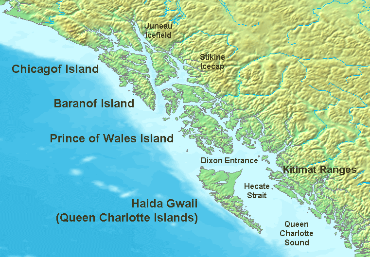
island s of theAlexander Archipelago in theAlaska Panhandle . The island is in the Prince of Wales - Outer Ketchikan Census Area, and is the 4th largest island in the United States (afterHawaii ,Kodiak Island , andPuerto Rico ) and the 97th largest island in the worldGeography and ecology
The island is 135 miles (215 km) long, 45 miles (72 km) wide and has an area of 2,577 sq mi (6,675 km²), slightly larger than the State of
Delaware .On the island is
El Capitan Pit , at 598.3 feet the deepest vertical shaft in the United States.The island is covered by the
Tongass National Forest . It is the main homeland of theKaigani Haida people, and the only home of thePrince of Wales flying squirrel ("Glaucomys sabrinus griseifrons") [http://www.itis.usda.gov:8080/servlet/SingleRpt/SingleRpt?search_topic=TSN&search_value=632536] .Economy
Logging
Logging has historically been a mainstay of the collective Prince of Wales economy, however, recently there has been a decline in the industry leaving only a few small-scale sawmills operating. In 1975, Herbert Zieske, Chuck Zieske, and Alan Stein and the Point Baker Association hired Dick Folta of Haines to sue the US Forest Service to prevent logging convert|400000|acre|km2 on the northern portion of the island.
In December 1975, Judge von der Heydt issued a ruling enjoining clearcutting. In March 1976, Congress responded to the suit by passing the National Forest Management Act which removed the injunction. Subsequently half of the marketable timber was cut on the north end of the island.
Tourism
Recently, tourism, including
sport fishing has gained a strong place in Prince of Wales' economy. Tourism has also increased in part due to the easier accessibility to Prince of Wales Island by the newInter-Island Ferry Authority .Fishing
Commercial fishing provides the foundation of the economy for numerous towns on the island including Craig, Klawock, Hydaburg, Port Protection, and Point Baker. During the summer, trollers and seiners both fish for all five species of Pacific salmon. Longliners bring up halibut and black cod. Dungeness crab and shrimp seasons are open off and on throughout the year. During the winter there are dive fisheries for geoducks, sea cucumbers, and sea urchins.
Government
Since Prince of Wales Island is almost entirely made up of federal National Forest land, the two ranger districts (Craig and Thorne Bay) on the island provide employment for a number of residents.
Transportation
Cargo
A few companies provide scheduled barge service from Pacific coast ports to South-Eastern Alaska ports, including those on Prince of Wales island (primarily Craig).
Public Ferry
Alaska Marine Highway System
Historically, the
Alaska Marine Highway intermittently served the port of Hollis,until the Inter-Island Ferry Authority began regular scheduled service.Inter-Island Ferry Authority
After skimpy AMHS schedules, the communities of Prince of Wales Island banded together to create their own ferry service, the
Inter-Island Ferry Authority which has two Prince of Wales Island-dedicated vessels obtained from the AMHS in its fleet, currently with year-round daily service between Hollis and Ketchikan; and Summer Monday, Friday & Saturday service between Coffman Cove and Wrangell & Petersburg (via Wrangell); and indirect service via connections with the Alaska Marine Highway to many Alaskan ports,Prince Rupert, British Columbia , andBellingham, Washington .Airports
Klawock Airport Airport codes|KLW|PAKW|AKW is the only airport on Prince of Wales island.Three commercial airlines in Ketchikan provide scheduled service to Prince of Wales island.Air taxi or chartered flights are also available from them and other airlines, likeL.A.B. Flying Service (Haines).eaplane Bases
cheduled Airlines
Roads
A road system, much of it originally created by the logging industry, spans much of the island and an increasing amount of it is become paved. Only a number of communities on the northern tip of the island are without road access to other Prince of Wales communities.
Communities
*Coffman Cove
*Craig
*Hollis
*Hydaburg
*Kasaan
*Klawock
*Naukati Bay
*Point Baker
*Port Protection
*Port St. Nicholas
*Thorne Bay
*Waterfall
*Whale PassNotable Residents
*
Holly Madison , American model andHugh Hefner 's girlfriend.References
General references


Wikimedia Foundation. 2010.