- Amund Ringnes Island
Infobox Islands
name = Amund Ringnes Island
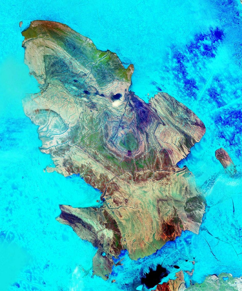
image caption = Amund Ringnes Island from space
image size =
locator
map_custom = no
native name =
native name link = Inuktikut
nickname =
location =Northern Canada
coordinates = coord|77|53|N|95|30|W|display=inline,title
archipelago =Sverdrup Islands Canadian Arctic Archipelago
total islands =
major islands =
area = convert|5255|km2|sqmi|abbr=on
highest mount = Un-named ridge feature northeast inland from Andersen Bay [cite web |url=http://www.oceandots.com/arctic/canada/amund-ringnes.htm |title=Amund Ringnes Island |accessdate=2008-05-28 |last= |first= |coauthors= |date= |work= |publisher=oceandots.com]
elevation = convert|265|m|ft|abbr=on
country = Canada
country admin divisions title = Territory
country admin divisions = flag|Nunavut
country admin divisions title 1 =Qikiqtaaluk Region
country admin divisions 1 =
country admin divisions title 2 =
country admin divisions 2 =
country capital city =
country largest city =
country largest city population =
country leader title =
country leader name =
population = Uninhabited
population as of =
density =
ethnic groups =
additional info =Amund Ringnes Island is one of the
Sverdrup Islands inNunavut between 78 and 79 degrees oflatitude . It lies east ofEllef Ringnes Island , west ofAxel Heiberg Island .Hassel Sound separates Amund Ringnes Island from Ellef Ringnes Island. Hendriksen Strait is to the south, as is Cornwall Island. Norwegian Bay is to the east, as isHaig-Thomas Island . To the north liesPeary Channel .The island has an area of 5,255 km² (2,029
square mile s) in size, making it the 111th largest island in the world, and Canada's 25th largest island.The island was named by
Otto Sverdrup for Oslo brewer Amund Ringnes, one of the sponsors of his expedition. The island was claimed byNorway from 1902 until the claim was relinquished in 1930.References
* [http://www.bartelby.com/69/4/A04604.html Amund Ringnes Island at The Columbia Gazetteer of North America. 2000.]
Further reading
* Atkinson, Nigel. "Late Wisconsinan Glacial and Relative Sea Level History of Amund and Ellef Ringnes Islands, Nunavut, Canada". Ottawa: Library and Archives Canada = Bibliothèque et Archives Canada, 2005. ISBN 0612962342
* Balkwill, H. R. "Geology of Amund Ringnes, Cornwall, and Haig-Thomas Islands, District of Franklin". Ottawa, Ont., Canada: Geological Survey of Canada, 1983. ISBN 0660108550
* Hodgson, D. A. "Surficial Materials and Geomorphological Processes, Western Sverdrup and Adjacent Islands, District of Franklin (Including Amund Ringnes, Southern Ellef Ringnes, Cornwall, Graham and King Christian Islands)". Ottawa: Geological Survey of Canada, 1982. ISBN 0660111160
* Hopkins, W. S. "Some Spores and Pollen from the Christopher Formation (Albian) of Ellef and Amund Ringnes Island, and Northwestern Melville Island, Canadian Arctic Archipelago". [Ottawa] : Dept. of Energy, Mines and Resources, 1974.External sources
* [http://www.arctic.uoguelph.ca/cpe/environments/maps/detailed/islands/ringnes.htm The Ringnes Islands] University of Guelph

Wikimedia Foundation. 2010.