- Trans-Canada Highway
-
For the Boards of Canada record, see Trans Canada Highway (EP).
Trans-Canada Highway

Route information Length: 8,030 km[2] (4,990 mi)
South route:2,960 km (1,840 mi)Existed: 30 July 1962[1] – present Major junctions From: Victoria, British Columbia To: St. John's, Newfoundland and Labrador Location Major cities: Victoria, Vancouver, Calgary, Edmonton, Regina, Saskatoon, Winnipeg, Ottawa, Montreal, Quebec City, Charlottetown, Fredericton, Moncton, St. John's Highway system Trans-Canada Highway The Trans-Canada Highway (French: Route Transcanadienne) is a federal-provincial highway system that joins the ten provinces of Canada. It is, along with the Trans-Siberian Highway and Australia's Highway 1, one of the world's longest national highways, with the main route spanning 8,030 km (4,990 mi). The system was approved by the Trans-Canada Highway Act of 1948,[3] with construction commencing in 1950.[4] The highway officially opened in 1962, and was completed in 1971. The highway system is recognizable by its distinctive white-on-green maple leaf route markers. The Trans-Canada highway is sometimes abbreviated as the TCH[citation needed].
Throughout much of Canada, there are at least two routes designated as part of the Trans-Canada Highway. For example, in the western provinces, both the main Trans-Canada route and the Yellowhead Highway are part of the Trans-Canada system.
Contents
Jurisdiction
Canada does not have a comprehensive national highway system, as decisions about highway and freeway construction are entirely under the jurisdiction of the individual provinces. In 2000 and 2001, the government of Jean Chrétien considered funding an infrastructure project to have the full Trans-Canada system converted to freeway. Although freeway construction funding was made available to some provinces for portions of the system, the government ultimately decided not to pursue a comprehensive highway conversion. Opposition to funding the freeway upgrade was due to low traffic levels on parts of the Trans-Canada. Other provinces preferred the money going towards improving vital trade routes (often not inter-provincial).
There have also been discussions of upgrading the Trans-Labrador Highway (Quebec Route 389/Newfoundland and Labrador Route 500) to Trans-Canada Highway standards (fully paved, two lanes with shoulders, 90 km/h speed limit).
Route numbering on the Trans-Canada Highway is also handled by the provinces. The Western provinces have coordinated their highway numbers so that the main Trans-Canada route is designated Highway 1 and the Yellowhead route is designated Highway 16 throughout; however, from the Manitoba–Ontario border eastwards, the highway numbers change at each provincial boundary. As the Trans-Canada route was composed of sections from pre-existing provincial highways, it is unlikely that the Trans-Canada Highway will ever have a uniform designation across the whole country.
Route details
Victoria–Winnipeg
 The Trans-Canada Highway passing through Glacier National Park (Canada)
 Highway 1 near Winnipeg, Manitoba
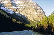 Westbound through the Rockies
The Trans-Canada Highway, uniformly designated as Highway 1 in the four western provinces, begins in Victoria, British Columbia at the intersection of Douglas Street and Dallas Road (where the "Mile 0" plaque stands) and passes northward along the east coast of Vancouver Island for 99 km (62 mi) to Nanaimo. Short freeway segments of the TCH can be found near Victoria and Nanaimo, but the rest of the highway on Vancouver Island operates mostly as a heavily signalized low to limited mobility arterial road that uniquely (for the Trans Canada Highway system) doesn't bypass any of its areas of urban sprawl, particularly Nanaimo and Duncan. It is also the only part of the Trans-Canada system in which the highway is designated as a north-south highway; the Trans-Canada Highway is designated as east-west from Nanaimo to St. John`s. The section of Highway 1 that crosses the Malahat northwest of Victoria has no stoplights yet, but is tightly pinched by rugged terrain that prevents widening to four lanes and sometimes forces closure for hours at a time after a traffic accident. The Departure Bay ferry is the only marine link on the Trans Canada system that has no freeway or other high mobility highway access, instead routing TCH traffic through downtown Nanaimo streets to reach the ferry to Vancouver.
From Departure Bay, a 57 km (35 mi)-long ferry route (see BC Ferries) connects the highway to West Vancouver, whence it passes through the Vancouver metropolitan area as a freeway, heading 170 km (110 mi) east through the Fraser Valley to Hope. The TCH then turns north for 186 km (116 mi) through the Fraser Canyon toward Cache Creek as a mostly high mobility highway with only occasional mandatory stops, then east for 79 km (49 mi) through to Kamloops where it becomes a short freeway. Then it continues 496 km (308 mi) east through Salmon Arm, Revelstoke, Rogers Pass, Golden, and Kicking Horse Pass to Banff, Alberta as a mostly high mobility highway.
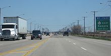
From Banff, there is another 101 km (63 mi) east as a freeway to Calgary where it becomes known as 16th Avenue N, a road with heavy traffic and many traffic lights that is now bypassed by the Highway 201 freeway that runs parallel. After that it is another 293 km (182 mi) east to Medicine Hat as a mostly high mobility divided highway, then 403 km (250 mi) east to Moose Jaw, Saskatchewan and 79 km (49 mi) east to Regina which is bypassed by a short freeway segment. After Regina it is another 372 km (231 mi) east to Brandon, Manitoba, 119 km (74 mi) east to Portage la Prairie, and finally 84 km (52 mi) east to Winnipeg. Winnipeg's Perimeter Highway (the southern half of which, Highway 100, is officially part of the Trans-Canada) has a mix of traffic lights and interchanges, and gives highway drivers a way of bypassing the city completely; however, the Trans-Canada system also has an alignment which passes through the urban core of Winnipeg, incorporating Portage Avenue, Main Street/St. Mary's Road, St. Anne's Road and Fermor Avenue.
Throughout the prairie provinces, the speed limit varies from 100 km/h (62 mph) to 110 km/h (68 mph). Most of Highway 1 through Alberta and Saskatchewan is 110 km/h (68 mph) and 100 km/h (62 mph) in Manitoba. As in all national parks in Canada, when the highway passes through national parks, the speed limit is 90 km/h (55 mph). Speed limits on the British Columbia mainland segment of the Trans Canada range from 80 km/h (50 mph) to 110 km/h (68 mph). A combination of difficult terrain and growing urbanization limits posted speeds on the Vancouver Island section to 50 km/h (31 mph) in urban areas, 80 km/h (50 mph) across the Malahat and through suburban areas, and a maximum of 90 km/h (55 mph) in rural areas.
There is also a route which runs between British Columbia and Alberta known as the Crowsnest Highway (Highway 3 in both provinces); while not officially part of the Trans-Canada Highway, it connects with the main branch of the highway in both Hope and Medicine Hat (the western and eastern termini of the Crowsnest Highway, respectively).
The highway is currently undergoing significant upgrades through the Rocky Mountain sections of British Columbia as it travels west from Banff National Park to Golden, British Columbia. A major piece of this project was completed in 2007 with the new Park Bridge and Ten Mile Hill sections. There are plans for further twinning of the highway from Lake Louise to Kamloops, although a completion date has not been set.
In Alberta, construction is underway from the Banff - Windermere Highway to Lake Louise in which the highway is being twinned to four lanes from two. Completion of this upgrade is scheduled for winter 2010.
For more information, see also:
- Trans Canada (Main) Route
- British Columbia Highway 1 (Trans Canada Highway/Island Highway/Upper Levels Highway)
- Alberta Highway 1
- Saskatchewan Highway 1
- Manitoba Highway 1
- Manitoba Highway 100 (Winnipeg Perimeter Highway)
- Yellowhead Route
- British Columbia Highway 16 (Yellowhead Highway)
- British Columbia Highway 5 (Yellowhead Highway South/Coquihalla Highway)
- Alberta Highway 16 (Yellowhead Highway)
- Saskatchewan Highway 16 (Yellowhead Highway)
- Manitoba Highway 16 (Yellowhead Highway)
Winnipeg–Ottawa
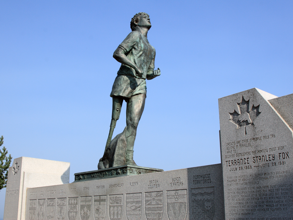
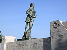 The statue of Terry Fox, which marks the spot where Fox stopped his run
 Highway 17 near Echo Bay, Ontario
 Trans-Canada Highway through Ottawa on Highway 417
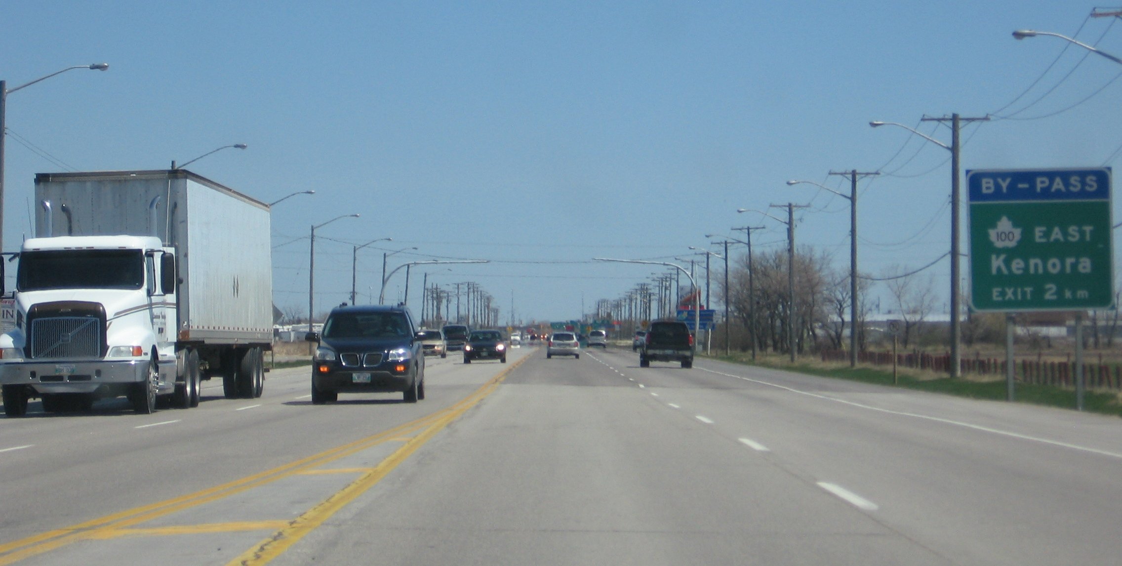
The highway continues east from Winnipeg for another 205 km (127 mi) to Kenora. At the Ontario border, the number designation of the highway changes from 1 to 17.
At Kenora, the Trans-Canada designation includes both the main route through the city's urban core and the 33.6 km (20.9 mi) Highway 17A bypass route. The existing branch from Kenora continues east for 136 km (85 mi) to Dryden. A second branch extends southward along Highway 71 from Kenora to Chapple, a routing of 157 km (98 mi), and then eastward along Highway 11 for 320 km (200 mi) to Shabaqua, where it reunites with the main Highway 17 route.
The united highway proceeds southeast for 65 km (40 mi) to Thunder Bay, then northeast for 115 km (71 mi) to Nipigon, where it once again splits into two routes. The northern route is designated as Highway 11, and the southern branch is designated as Highway 17. From Nipigon, Highway 11 extends through Northern Ontario for 401 km (249 mi) east to Hearst and another 213 km (132 mi) east through Cochrane. The highway proceeds southeast for 218 km (135 mi) to New Liskeard, then south for 153 km (95 mi) to North Bay, where it meets Highway 17. Near Kirkland Lake, a northern spur route of the Trans-Canada extends eastward from Highway 11, following Ontario's Highway 66 (58 km (36 mi)), then Quebec's Route 117 (576 km (358 mi)) and Autoroute 15 (98 km (61 mi)) into Montreal.
A section of the Trans-Canada between Thunder Bay and Nipigon is named the Terry Fox Courage Highway. The 83 km (52 mi) section marks the spot where Fox was forced to end his cross-Canada Marathon of Hope run (which was raising money for cancer research). A bronze statue is located near the spot where he stopped his run.
From Nipigon, Highway 17 proceeds east along the coast of Lake Superior for 581 km (361 mi) through to Sault Ste. Marie and another 291 km (181 mi) east to Sudbury, where the Trans-Canada Highway splits again at the junction of Highways 17 and 69 on Sudbury's Southwest and Southeast Bypasses. The resulting southern branch follows Highways 69 and 400 south for 254 km (158 mi), then follows Highway 12 southeast for 27 km (17 mi) to Orillia, then follows Highway 12 south for 58 km (36 mi) along the shore of Lake Simcoe, then follows Highway 7 east for 70 km (43 mi) to Peterborough. The existing northern branch goes east for 151 km (94 mi) to North Bay, where it meets the Highway 11 route. The highway then goes east for 216 km (134 mi) before arriving at Pembroke. The two branches converge at Ottawa, 244 km (152 mi) east of Peterborough and 123 km (76 mi) east of Pembroke.
Through most of Ontario, the speed limit is generally 90 km/h (55 mph) on the Trans-Canada, though freeway portions, such as the freeway segment in Sudbury and the section from Arnprior through Ottawa to the Ontario/Quebec border, have a higher limit of 100 km/h (62 mph).
It is notable that the Trans-Canada does not go through Canada's most heavily populated region, the Golden Horseshoe area of Southern Ontario, which includes Toronto, Ontario's provincial capital and the country's largest city.
- Highway 17
- Highway 11
- Highway 69
- Highway 12
- Highway 7
- Highway 115
- Highway 71
- Highway 400
- Highway 417
Ottawa–Moncton
 Quebec Autoroute 20 eastbound
From Ottawa, the Trans-Canada Highway proceeds 206 km (128 mi) east to Montreal. Known as Highway 417 in Ontario (and the Queensway in Ottawa) and Autoroute 40 in Quebec, the Trans-Canada also assumes the name "Autoroute Métropolitaine" (also known as "The Met" or "Metropolitan Boulevard") as it traverses Montreal as an elevated highway. At the Décarie Interchange in Montreal, the Abitibi route (Highway 66/Route 117/A-15) rejoins the main TCH line. The TCH then follows Autoroute 25 southbound, crossing the St. Lawrence River through the Louis Hippolyte Lafontaine Bridge-Tunnel, and proceeds northeast on Autoroute 20 for 257 km (160 mi) to Lévis (across from Quebec City).
East of Lévis, the Trans-Canada highway continues on Autoroute 20 following the south bank of the Saint Lawrence River to a junction just south of Rivière-du-Loup, 173 km (107 mi) northeast of Lévis. At that junction, the highway turns southeast and changes designation to Autoroute 85 for 13 km (8.1 mi), and then downgrades to Route 185 until the New Brunswick border. The portion from Autoroute 20 to Edmundston, New Brunswick is 121 km (75 mi) long.
Following the designation of Route 2, from Edmundston, the highway follows the St. John River Valley, running south for 170 km (110 mi) to Woodstock (paralleling the International Boundary) and then east for another 102 km (63 mi) to pass through Fredericton. 40 km (25 mi) east of Fredericton, the St. John River turns south whereby the highway crosses the river at Jemseg and continues heading east to Moncton another 135 km (84 mi) later. On 1 November 2007, New Brunswick completed a 20-year effort to convert its 516 km section of the Trans-Canada highway into a four-lane freeway. The highway has a speed limit of 110 km/h.
Moncton – North Sydney
From Moncton, the highway continues southeast for 54 km (34 mi) to a junction at Aulac on the New Brunswick–Nova Scotia border (near Sackville) where the Trans-Canada Highway splits into the main route continuing to the nearby border with Nova Scotia as Route 2, and a 70 km (43 mi) route designated as Route 16 which runs east to the Confederation Bridge at Cape Jourimain.
Prince Edward Island
After crossing the Northumberland Strait on the 13 km (8.1 mi)-long Confederation Bridge to Borden-Carleton, the Trans-Canada Highway follows a 110 km (68 mi)-long route across southern Prince Edward Island, designated as Route 1. After passing through Charlottetown it ends at Wood Islands where a 26 km (16 mi)-long ferry route (operated by Northumberland Ferries Limited, or NFL) crosses the Northumberland Strait to Caribou, Nova Scotia (near Pictou). From the ferry terminal at Caribou, the highway continues south for another 19 km (12 mi) as Highway 106 to a junction with the direct Trans-Canada Highway route (Highway 104) at Westville (near New Glasgow).
Nova Scotia

From the New Brunswick border, the main Trans-Canada Highway route continues east into Nova Scotia at Amherst, where it follows the designation of provincial Highway 104. The highway then passes by Truro, where it links with provincial Highway 102 to Halifax, 117 km (73 mi) east of the New Brunswick border. Halifax, like Toronto, is a provincial capital not serviced by a Trans-Canada Highway. There is a 30 km (19 mi) stretch of highway with a toll of $4 per automobile (different rates for other vehicles).
From Truro, the highway continues east for 57 km (35 mi) to New Glasgow (where it links with provincial Highway 106—that portion of the Trans-Canada running to the ferry terminal at Caribou), and then northeast for another 112 km (70 mi) to the Canso Causeway which crosses the Strait of Canso to Cape Breton Island near Port Hawkesbury. From the Canso Causeway, the highway continues east for 144 km (89 mi) using the designation of Highway 105 on Cape Breton Island, until reaching the Marine Atlantic ferry terminal at North Sydney.
Port aux Basques – St. John's
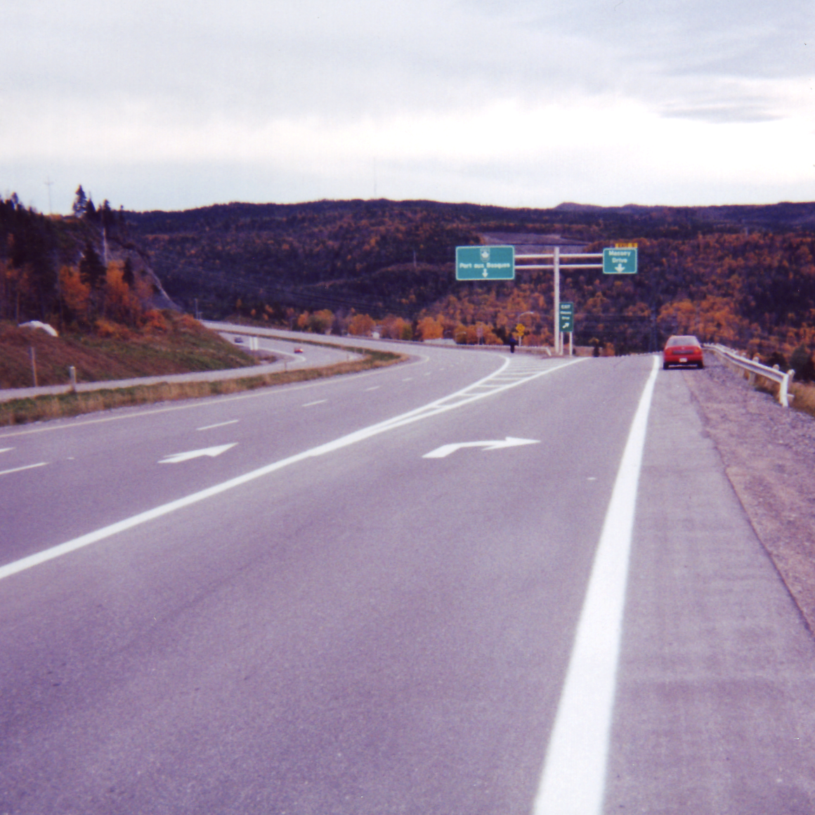
From North Sydney, a 177 km (110 mi)-long ferry route, operated by the Crown corporation Marine Atlantic, continues the highway to Newfoundland, arriving at Channel–Port aux Basques, whereby the Trans-Canada Highway assumes the designation of Highway 1 and runs northeast for 219 km (136 mi) through Corner Brook, east for another 352 km (219 mi) through Gander and finally ends at St. John's, another 334 km (208 mi) southeast, for a total of 905 km crossing the island. The majority of the Trans-Canada Highway in Newfoundland is undivided, though sections in Corner Brook, Grand Falls-Windsor, Glovertown and a 75 km section from Whitbourne to St. John's is divided.
The "mile zero" concept
 The Mile Zero monument at the end of the Trans-Canada Highway in Victoria, British Columbia
 Mile One Centre, St. John's
Although there does not appear to be any nationally sanctioned "starting point" for the entire Trans-Canada Highway system, St. John's appears to have adopted this designation for the section of highway running in the city by using the term "Mile One" for its sports stadium and convention centre complex, Mile One Centre. The Trans-Canada Highway has been posted in kilometres since 1977, when all Canadian roads switched to metric.
The Victoria terminus of the Trans-Canada Highway lies at the foot of Douglas Street and Dallas Road at Beacon Hill Park, and is marked by a "mile zero" monument. This is the official western end of the Trans-Canada Highway.
Although Highway 4 was commissioned in 1953 and is technically not part of the Trans-Canada Highway system, there is also a sign marking the Pacific terminus of the Trans-Canada Highway at Tofino, British Columbia, where Highway 4 terminates in the west, but it was most likely erected before 1953. Tofino was a strong proponent of a Trans-Canada Highway since the 1920s, when the only roads in the area were gravel, recognizing the need for tourism. The community was bypassed by the official Trans-Canada Highway in the 1950s, when government prioritized the connection of major communities in its budgets, choosing instead to connect Nanaimo with Victoria.
 The marker showing the start point in British Columbia
References
- ^ "Trans-Canada Highway". Unpublished Guides. Library and Archives of Canada. http://www.collectionscanada.gc.ca/the-public/005-1142.19-e.html. Retrieved 29 July 2011.
- ^ CBC Digital Archives—Trans-Canada Highway: Bridging the Distance
- ^ Department of Justice Canada—Trans-Canada Highway Act—R.S.C. 1970, c. T-12
- ^ Transport Canada—The Trans-Canada Highway
External links
- Trans-canada highway.com—Detailed province by province description
- Trans-Canada Highway travel guide from Wikitravel
- NFB documentary "The Longest Road"
- Ten Mile Hill Project HD Video
 Portions of the Trans-Canada Highway
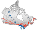 British Columbia: Highway 1 • Highway 5 • Highway 16 | Alberta: Highway 1 • Highway 16
Saskatchewan: Highway 1 • Highway 16 | Manitoba: Highway 1 • Highway 16 • Highway 100
Ontario: Highway 17 • Highway 69 • Highway 400 • Highway 12 • Highway 7 • Highway 71 • Highway 11 • Highway 66 • Highway 417
Quebec: Autoroute 40 • Autoroute 25 • Autoroute 20 • Autoroute 85 • Route 185 • Route 117 • Autoroute 15
New Brunswick: Route 2 • Route 16 | Confederation Bridge | Prince Edward Island: Route 1 | Nova Scotia: Highway 104 • Highway 105 • Highway 106
Newfoundland: Route 1Categories:


Wikimedia Foundation. 2010.