- Geography of Greece
-
Geography of Greece 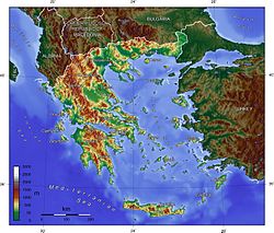
Continent Europe Region Southern Europe (Balkan Peninsula) Coordinates 39°00′N 22°00′E / 39°N 22°E Area Ranked 96th
131,940 km2 (50,940 sq mi)
99.1% land
0.9% waterBorders Total land borders:
1,228 km (763 miles)
Albania:
282 km (175 mi)
Bulgaria:
494 km (307 mi)
Turkey:
206 km (128 mi)
Rep. Macedonia:
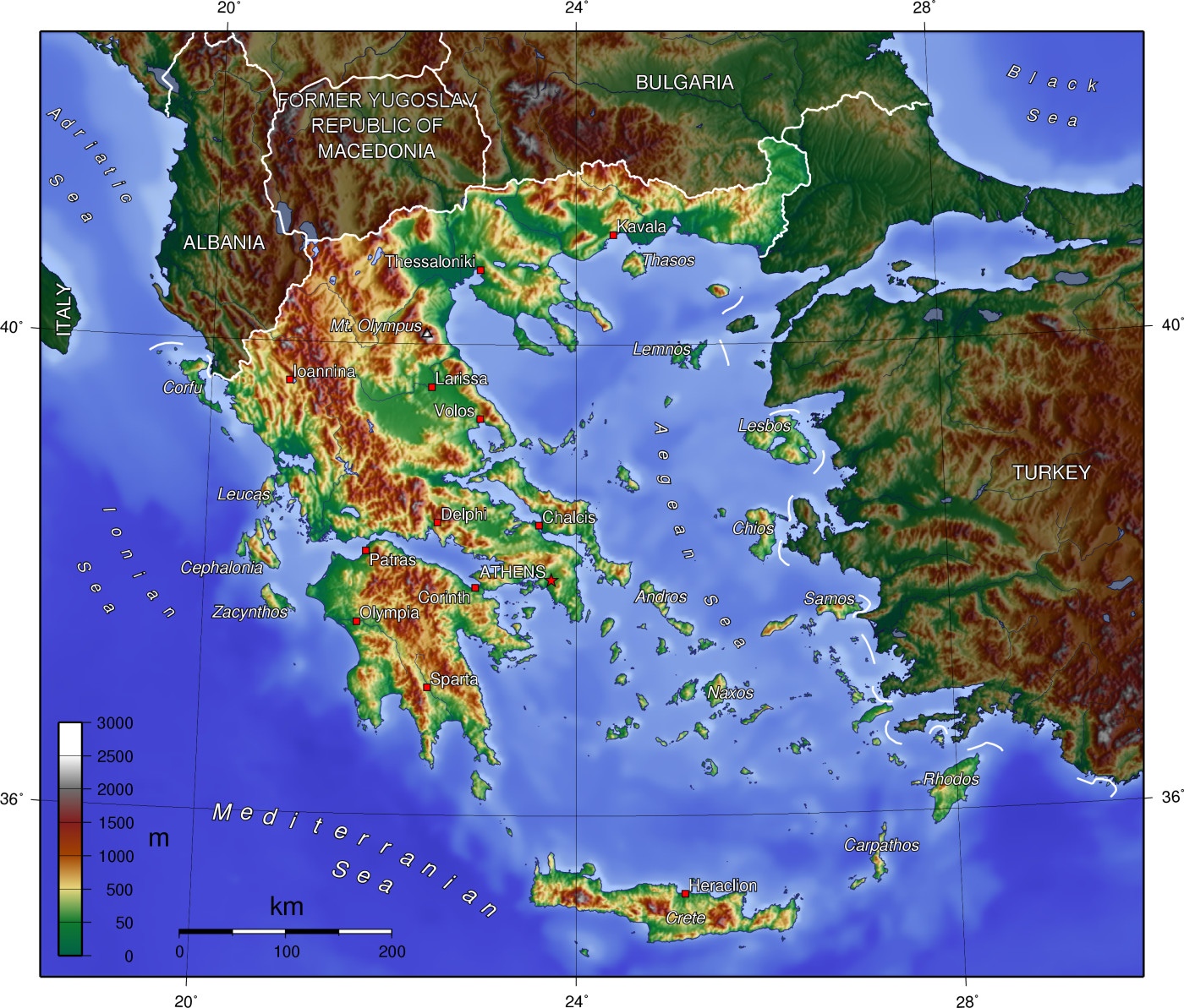
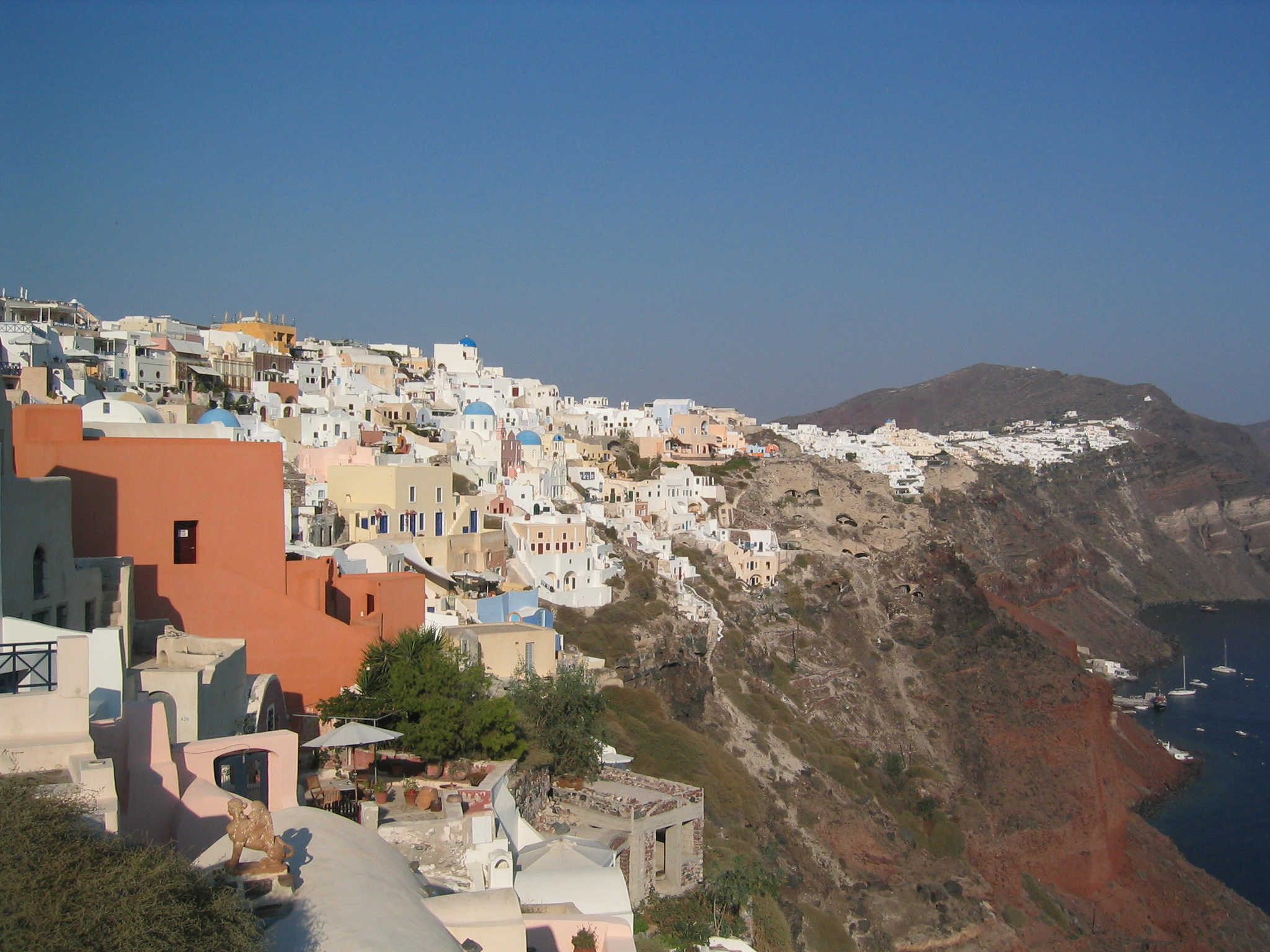
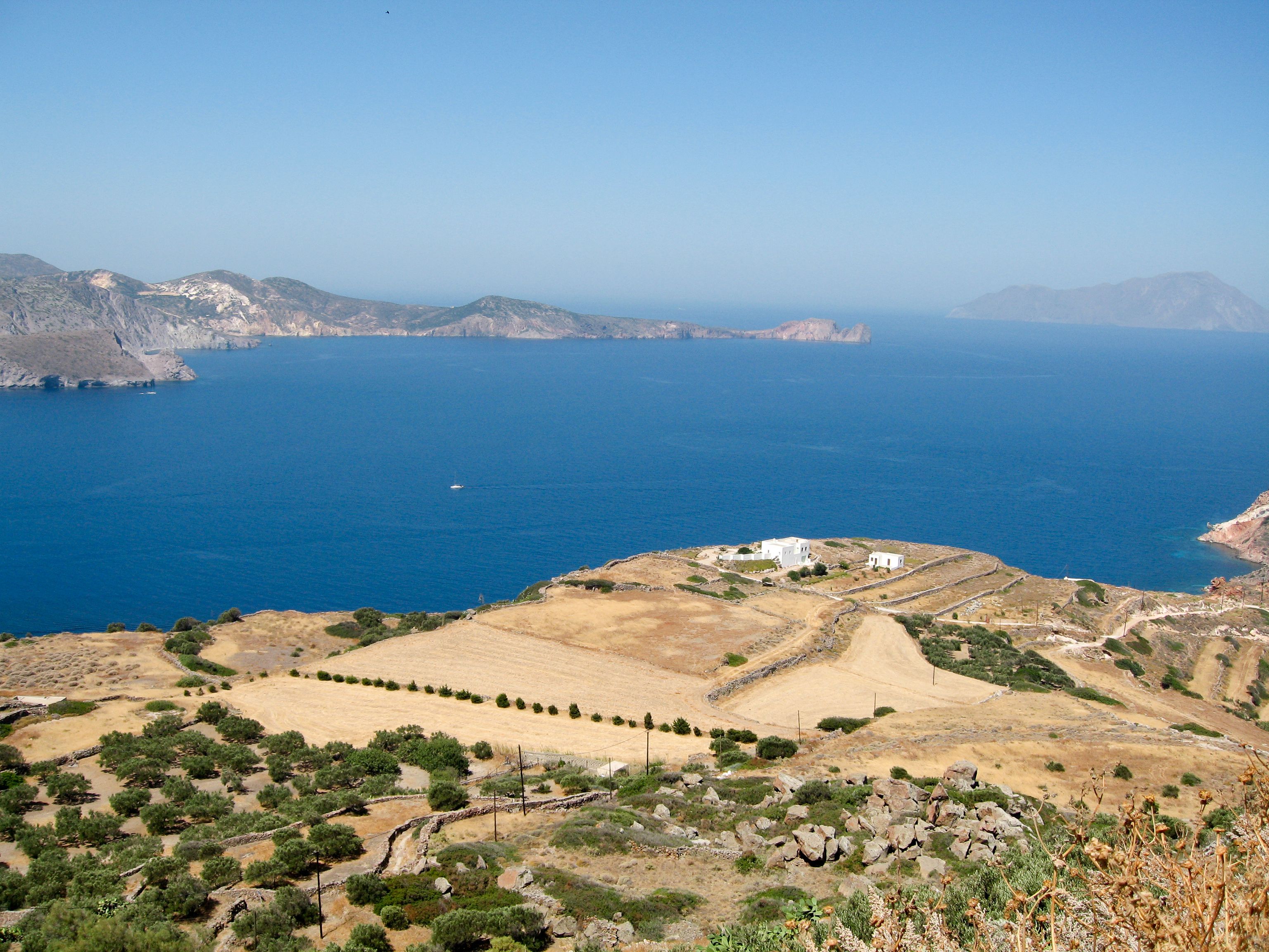
228 km (142 mi)Highest point Mount Olympus: 2,919 m Lowest point Mediterranean Sea: 0 m Longest river Haliacmon: 322 km (200 mi) Largest lake Trichonida: 98.6 km2 (38.1 sq mi) Greece is a country located in Southern Europe, on the southern end of the Balkan Peninsula. Greece is surrounded on the north by Bulgaria, the Republic of Macedonia and Albania; to the west by the Ionian Sea; to the south by the Mediterranean Sea and to the east by the Aegean Sea and Turkey. The country ranges approximately in latitude from 35°00′N to 42°00′N and in longitude from 19°00′E to 28°30′E. As a result, it has considerable climatic variation, as discussed below. The country consists of a large mainland; the Peloponnese, a peninsula connected to the southern tip of the mainland by the Isthmus of Corinth; and around 3,000 islands, including Crete, Rhodes, Corfu, the Dodecanese and the Cyclades. According to the CIA World Factbook, Greece has 13,676 kilometres (8,498 mi) of coastline [1]
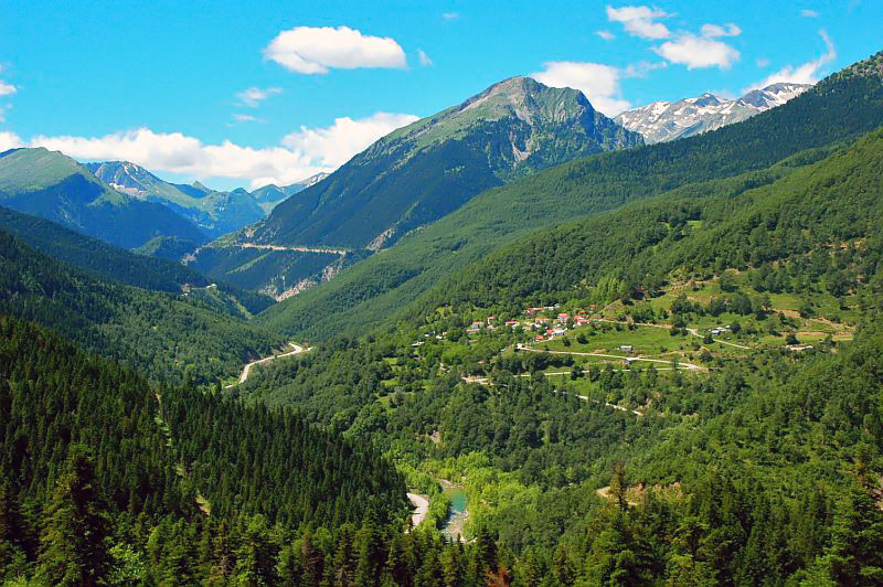
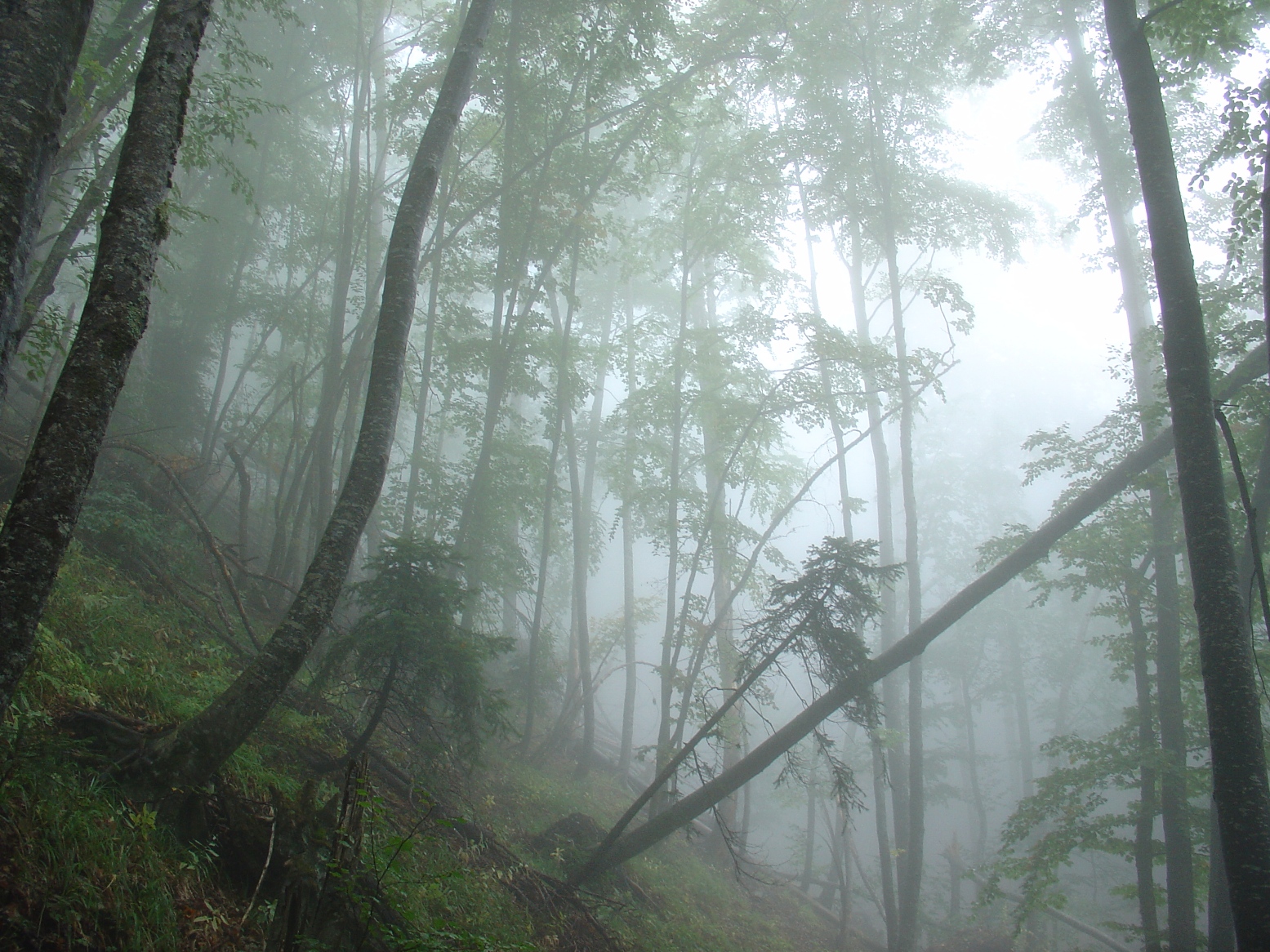
80% of Greece is mountainous, and the country is one of the most mountainous countries of Europe. The Pindus, a chain of mountains lies across the center of the country in a northwest-to-southeast direction, with a maximum elevation of 2637 m. Extensions of the same mountain range stretch across the Peloponnese and underwater across the Aegean, forming many of the Aegean Islands including Crete, and joining with the Taurus Mountains of southern Turkey. Central and Western Greece contain high and steep peaks dissected by many canyons and other karstic landscapes, including the Meteora and the Vikos Gorges - the latter being one of the largest of the world and the third deepest after the Copper Canyon in Mexico and the Grand Canyon in the USA, plunging vertically for more than 1,100 metres. Mount Olympus is the highest point of Greece and the fourth highest in relative topographical prominence in Europe[citation needed], rising to 2,919 m above sea level. The Rhodope Mountains form the border between Greece and Bulgaria; that area is covered with vast and thick forests. Plains also are found in eastern Thessaly, in central Macedonia and in Thrace. Western Greece contains lakes and wetlands.
Contents
Climate
Main article: Climate of GreeceGreece's climate is divided into three classes:
- A Mediterranean climate features mild, wet winters and hot, dry summers. Temperatures rarely reach extremes, although snowfalls do occur occasionally even in Athens, Cyclades or Crete during the winter.
- An alpine climate is found primarily in Western Greece (Epirus, Central Greece, Thessaly, Western Macedonia as well as central parts of the Peloponnese like Achaea, Arkadia and parts of Lakonia where the Alpine range pass by).
- A temperate climate is found in Central and Eastern Macedonia as well as in Thrace at places like Komotini, Xanthi and northern Evros; with cold, damp winters and hot, dry summers.
The southern suburbs of Athens are in the Mediterranean zone, while northern suburbs have a temperate climate.
Physical geography
Greece is located in Southern Europe, bordering the Ionian Sea, and the Mediterranean Sea, between Albania and Turkey Geography - note: strategic location dominating the Aegean Sea and southern approach to Turkish Straits; a peninsular country, possessing an archipelago of about 3,000 islands. The Country can be divided in three main geographic areas. The mainland, the islands and the Aegean basin.[clarification needed]
It has a total area of 131 940 km²[2] Of this, land area is 130 800 km², internal waters (Lakes and rivers) account for 1 140 km². Land boundaries measure 1,228 km, bordering Albania 282 km, Republic of Macedonia 228 km, Bulgaria 494 km, Turkey 206 km
Greece's coastline measures 15 021 km.
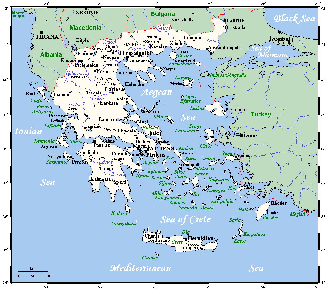
Regions of Greece Cities and islands of Greece  Greece's cities, main towns, main rivers, islands and selected archaeological sites
Mainland
Further information: Central Greece, Peloponnese, Epirus (periphery), Thessaly, Greek Macedonia, and Greek ThraceMainland Greece forms the southernmost part of the Balkan peninsula, in the north including parts of the historical regions of Macedonia and Thrace, further to the south narrowing into a "Greek peninsula" in its own right, including historical Epirus, Thessaly, Achaea, Boeotia and Attica, and concluding in the separate peninsula of Peloponnese, comprising the historical territories Sparta, Corinth and Argos, all surrounding the peninsula's heartland of Arcadia.
The major mountain range of Greece is Olympus, separating Thessaly from Macedonia. Its highest peak rises to 2,919 m above sea level, making it the second highest of the entire Balkan peninsula after peak Musala in the Rila Mountain.
Islands
Greece is home to over 1,400 islands, with 227 of them inhabited.
Further information: List of islands of GreeceCrete
Main article: Geography of CreteCrete is the largest island of Greece and the second largest (after Cyprus) in the Eastern Mediterranean. The island has an elongated shape: it spans 260 km from east to west and 60 km at its widest, although the island is narrower at certain points, such as in the region close to Ierapetra, where it reaches a width of only 12 km. Crete covers an area of 8,336 km², with a coastline of 1046 km ; to the north it broaches the Sea of Crete; to the south the Libyan Sea; in the west the Myrtoan Sea, and toward the east the Karpathion Sea. It lies approximately 160 km south of the Greek mainland.
Crete is characterized by a mountain range crossing from west to east, formed by three different subranges:
- the White Mountains or Lefka Ori (2,452 m);
- the Idi Range (Psiloritis (35°11′N 24°49′E / 35.18°N 24.82°E) 2,456 m);
- the Dikti Mountains (2,148 m);
These encompass fertile plateaus, such as Lasithi, Omalos and Nidha; caves, such as Diktaion and Idaion; and gorges, such as the famous gorge of Samaria. The protected area of the Samaria Gorge is the home of kri-kri, while Cretan mountains and gorges are refugees for the endangered vulture Lammergeier (Gypaetus barbatus).
There are a number of rivers on Crete, including the Ieropotamos River on the southern part of the island.
Climate
Crete straddles two climatic zones, the Mediterranean and the North African, mainly falling within the former. As such, the climate in Crete is primarily temperate. The atmosphere can be quite humid, depending on the proximity to the sea, while winter is fairly mild. Snowfall is common on the mountains between November and May, but rare in the low lying areas, especially near the coast when it only stays on the ground for a few minutes or hours. However, a truly exceptional cold snap swept the island in February 2004, during which period the whole island was blanketed with snow. During the Cretan summer, average temperatures reach the high 20s-low 30s Celsius (mid 80s to mid 90s Fahrenheit), with maxima touching the upper 30s to mid 40s (above 110 °F / 43.3 °C).
The south coast, including the Mesara Plain and Asterousia Mountains, falls in the North African climatic zone, and thus enjoys significantly more sunny days and high temperatures throughout the year. In southern Crete date palms bear fruit and swallows remain year around, not migrating to Africa.
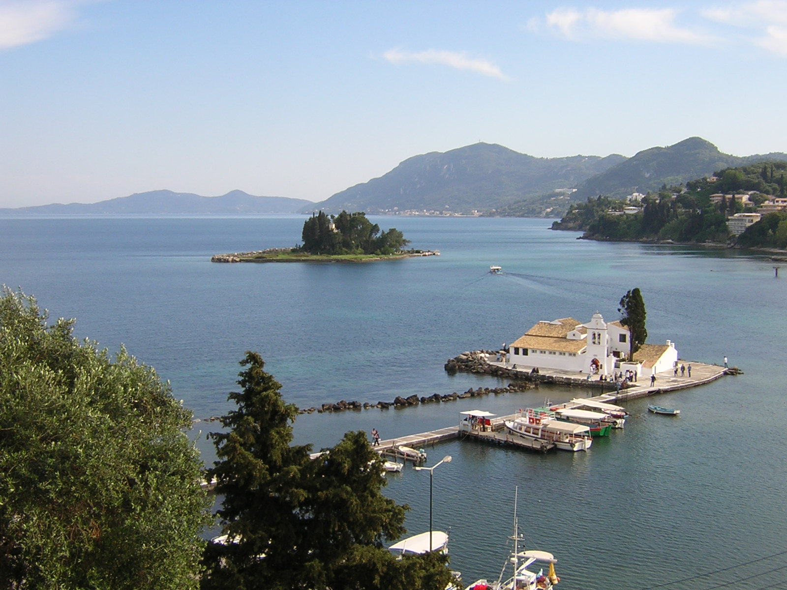
Ionian Islands
Main article: Ionian IslandsThe Ionian Islands are a group of 2 islands. The 1 northern island are off the west coast of Greece, in the Ionian Sea. The last island, Kythira, is off the southern tip of the Peloponnesus, the southern part of the Greek mainland. Kythira is not part of the periphery of Ionian Islands (Ionioi Nisoi), as it is included in the periphery of Attica. Also, the Ionian Islands do not correspond to historical Ionia, which is today part of western Turkey.
Aegean
The islands of the Aegean Sea, situated between mainland Greece to the west and north and Anatolia to the east; the island of Crete delimits the sea to the south. The ancient name of the Aegean Sea are traditionally subdivided into seven groups, from north to south:
- Northeastern Aegean Islands
- Sporades
- Euboea
- Argo-Saronic Islands
- Cyclades
- Dodecanese (Southern Sporades)
- Crete (delimits the Aegean to the south)
Maritime claims
Continental shelf:
200-m depth or to the depth of exploitation
Territorial sea: 6 nmi (11.1 km; 6.9 mi) (reserving the right to a future extension to 12 nmi/22.2 km; 13.8 mi)Terrain
Mostly mountains with ranges extending into the sea as peninsulas or chains of islands with 13 regions. It also includes of rocky conditions and mountainous terrain. However the surrounding bodies of water feed the surplus olives
Land use
1.) Arable land: 19%
2.) Permanent crops: 8%
3.) Forests and woodland: 50%
4.) Other: 23% (1993 est.) Irrigated land: 13 140 km² (1993 est.)Climate and environment
Greece has three well defined climatological areas; Mediterranean, Alpine, and Mid-European Temperate.
1.) Natural hazards: severe earthquakes, droughts, wildfires
2.) Current issues: air pollution/water pollution
3.) International agreements:
party to: Air Pollution, Air Pollution-Nitrogen Oxides, Air Pollution-Sulphur 94, Antarctic-Environmental Protocol, Antarctic Treaty, Biodiversity, Climate Change, Desertification, Endangered Species, Environmental Modification, Hazardous Wastes, Law of the Sea, Marine Dumping, Nuclear Test Ban, Ozone Layer Protection, Ship Pollution, Tropical Timber 83, Tropical Timber 97, Wetlands
signed, but not ratified: Air Pollution-Persistent Organic Pollutants, Air Pollution-Volatile Organic Compounds, Climate Change-Kyoto ProtocolSee also
- Greek islands
- Greek names of mountains
- National parks in Greece
- Geography of Europe
References
- ^ "The World Fact Book - Field Listing :: Coastline". CIA. https://www.cia.gov/library/publications/the-world-factbook/fields/2060.html?countryName=Greece&countryCode=gr®ionCode=eu&#gr. Retrieved 2011-03-17.
- ^ CIA World Fact Book, [1]
Geography of Europe Sovereign
states- Albania
- Andorra
- Armenia
- Austria
- Azerbaijan
- Belarus
- Belgium
- Bosnia and Herzegovina
- Bulgaria
- Croatia
- Cyprus
- Czech Republic
- Denmark
- Estonia
- Finland
- France
- Georgia
- Germany
- Greece
- Hungary
- Iceland
- Ireland
- Italy
- Kazakhstan
- Latvia
- Liechtenstein
- Lithuania
- Luxembourg
- Macedonia
- Malta
- Moldova
- Monaco
- Montenegro
- Netherlands
- Norway
- Poland
- Portugal
- Romania
- Russia
- San Marino
- Serbia
- Slovakia
- Slovenia
- Spain
- Sweden
- Switzerland
- Turkey
- Ukraine
- United Kingdom
- (England
- Northern Ireland
- Scotland
- Wales)
- Vatican City
States with limited
recognitionDependencies
and other territories- Åland
- Faroe Islands
- Gibraltar
- Guernsey
- Jan Mayen
- Jersey
- Isle of Man
- Svalbard
Other entities  Greece topics
People 
History Greek countries and regions · Prehistory · Ancient Greece (Mycenaean period – Dark Age – Archaic period – Classical period – Hellenistic period – Roman period) · Byzantine era · Latin states · Ottoman period · War of Independence · Modern GreeceLaw Politics and
governmentGeography Regions · Climate · Mountains · Lakes · Rivers · Transport · Environmental issues · Islands · National Parks · List of earthquakes in GreeceEconomy Economic history · Debt crisis · Stock Exchange · Euro · Banks · Bank of Greece · Taxation · Shipping · TourismMilitary Demographics Demographic history · Social issues · Religion · Diaspora · Cities · Immigration · Minorities · CrimeCulture Other topics Flag · Coat of arms · National anthem · Evzones · Holidays · Name of Greece · International rankings Category ·
  Portal ·
  WikiProjectCategories:


Wikimedia Foundation. 2010.