- Melville Island (Northern Territory)
Infobox Islands
name = Melville
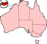
image caption = Tiwi Islands
image size =
locator
Location map|Australia Northern Territory|lat=-11.55|long=130.933333|width=175|caption=Melville Island (Northern Territory of Australia)
map_custom = yes
native name = "Yermalner"
native name link =
nickname =
location =Timor Sea
coordinates = coord|11|33|S|130|56|E|display=inline
archipelago =Tiwi Islands
total islands =
major islands =
area = convert|5786|km2|sqmi
length =
width =
highest mount =
elevation =
country = Australia
country admin divisions title = Territory
country admin divisions = flag|Northern Territory
country admin divisions title 1 =
country admin divisions 1 =
country admin divisions title 2 =
country admin divisions 2 =
country largest city = Milikapiti
country largest city population =
population =
population as of =
density =
ethnic groups =
additional info =Melville Island lies in the eastern
Timor Sea , off the coast of theNorthern Territory ofAustralia . It is west of theCobourg Peninsula inArnhem Land and north of Darwin.The largest community/town on the island is Milikapiti.
At 2,234 mi² (5,786 km²) it is just outside the 100 largest islands in the world, but is the second biggest island in
Australia , afterTasmania (and excluding the continental landmass). It is also known in theTiwi language as Yermalner.Together, Melville Island and Bathurst Island are known as the
Tiwi Islands .It is said that the first European to sight the island was
Abel Tasman in 1644, although this is now disputed. Melville Island's most likely first European discovery was probably made by the Portuguese, as Aboriginals encountered by the explorerPhillip Parker King (son of governor ofNew South Wales Philip Gidley King ) in1818 , were found to know some Portuguese words.Fact|date=May 2007King named it for
Robert Dundas, 2nd Viscount Melville , first lord of theAdmiralty , who is also commemorated by the much larger Melville Island in the Canadianarctic . Shortly after this, the British made the first attempt to settle Australia's north coast, at the short-livedFort Dundas .The climate is tropical.
External links
* [http://www.tiwilandcouncil.net.au/ Tiwi Land Council]
* [http://www.tiwiart.com/ Tiwi Art]
* [http://www.travelnt.com/en/explore/darwin/region/tiwi-islands.htm Tourist Information]
Wikimedia Foundation. 2010.