- Daggett County, Utah
-
Daggett County, Utah 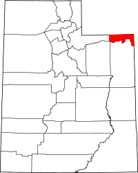
Location in the state of Utah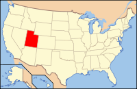
Utah's location in the U.S.Founded 1918 Named for Ellsworth Daggett Seat Manila Largest city Manila Area
- Total
- Land
- Water
723 sq mi (1,873 km²)
698 sq mi (1,809 km²)
24 sq mi (64 km²), 3.42%Population
- (2010)
- Density
1,059
1/sq mi (1/km²)Time zone Mountain (MST) : -7/-6 Website www.daggettcounty.org/ Daggett County is a county located in the northeastern corner of the U.S. state of Utah. The population was 1,059 at the 2010 census. It was named for Ellsworth Daggett, the first surveyor-general of Utah. Its county seat and only municipality is Manila.[1] There is one other small community, Dutch John, which is unincorporated.
Contents
Geography
According to the U.S. Census Bureau, the county has a total area of 723 square miles (1,872.6 km2), of which 698 square miles (1,807.8 km2) is land and 25 square miles (64.7 km2) (3.42%) is water. Over 90% of the land of Daggett County is under federal ownership.
Adjacent counties
- Summit County, Utah - (west)
- Duchesne County, Utah - (southwest)
- Uintah County, Utah - (south)
- Moffat County, Colorado - (east)
- Sweetwater County, Wyoming - (north)
National protected areas
- Ashley National Forest (part)
- Flaming Gorge National Recreation Area (part)
History
Daggett County was formed in 1918. It received its name from Ellworth Daggett, the first surveyor.
Demographics
Historical populations Census Pop. %± 1920 400 — 1930 411 2.8% 1940 564 37.2% 1950 364 −35.5% 1960 1,164 219.8% 1970 666 −42.8% 1980 769 15.5% 1990 690 −10.3% 2000 921 33.5% 2010 1,059 15.0% Source: US Census Bureau As of the census[2] of 2010, there were 1,059 people, 426 households, and 287 families residing in the county. The population density was 1.52 people per square mile (0.59/km²). There were 1,141 housing units at an average density of 1.63 per square mile (0.63/km²). The racial makeup of the county was 95.94% White, 0.38% Black or African American, 0.76% Native American, 0.38% Asian, 0.09% Pacific Islander, 1.42% from other races, and 1.04% from two or more races. 3.12% of the population were Hispanic or Latino of any race.
There were 426 households out of which 25.12% had children under the age of 18 living with them, 67.37% were married couples living together, 4.93% had a female householder with no husband present, and 32.63% were non-families. 29.11% of all households were made up of individuals and 13.62% had someone living alone who was 65 years of age or older. The average household size was 2.34 and the average family size was 2.91.
In the county, the population was spread out with 23.61% under the age of 20, 3.78% from 20 to 24, 24.93% from 25 to 44, 28.71% from 45 to 64, and 18.98% who were 65 years of age or older. The median age was 42.8 years. For every 100 females there were 129.22 males. For every 100 females age 18 and over, there were 135.17 males.
Cities and towns
- Manila
- Dutch John - (unincorporated)
- Linwood (inundated by Flaming Gorge Reservoir)
Government
Daggett County is governed by three commissioners, an auditor/recorder, a clerk/treasurer, an assessor and a sheriff, all elected for four-year terms in partisan elections. Judges stand for non-partisan retention election every four years. Current officeholders and the year his/her current term began:
- Commissioner A: Jerry Steglich(R) 2011
- Commissioner B: Stew Leith(R) 2009(chairman)
- Commissioner C: Warren Blanchard(R) 2011
- Auditor/Recorder: Keri Pallesen(R) 2011
- Clerk/Treasurer: Vicky McKee(R) 2011
- Assessor: Lesa Asay(R) 2011
- Sheriff: Jerry Jorgensen(R) 2011
- Justice Court Judge (Manila): Judge Charlene Hartmann (appointed 2007)
- Justice Court Judge (Dutch John): Judge Anne Steen (appointed 2007)
Commerce and transportation
The few commercial establishments in Daggett County exist to service visitors to the Flaming Gorge National Recreation Area. There are one small general store, three gas stations, five cafes or restaurants, five inns/motels, and a few miscellaneous businesses. The economy is primarily related to recreation, management of government land, and ranching. There are no railroads within Daggett County. Main highways include U.S. Route 191, State Route 43, and State Route 44.
See also
References
- ^ "Find a County". National Association of Counties. http://www.naco.org/Counties/Pages/FindACounty.aspx. Retrieved 2011-06-07.
- ^ "American FactFinder". United States Census Bureau. http://factfinder2.census.gov. Retrieved 2011-05-14.

Uinta County, Wyoming Sweetwater County, Wyoming Summit County 
Moffat County, Colorado  Daggett County, Utah

Duchesne County Uintah County Municipalities and communities of Daggett County, Utah Town 
CDP Ghost towns  State of UtahSalt Lake City (capital)
Topics - Cities
- Congressional districts
- Counties
- Flag
- Geography
- Government
- Governors
- History
- People
- Portal
- Symbols
- Visitor Attractions
Society - Demographics
- Economy
- Politics
Regions Largest cities - American Fork
- Bountiful
- Cedar City
- Clearfield
- Cottonwood Heights
- Draper
- Holladay
- Kaysville
- Layton
- Lehi
- Logan
- Midvale
- Murray
- Ogden
- Orem
- Pleasant Grove
- Provo
- Riverton
- Roy
- St. George
- Salt Lake City
- Sandy
- South Jordan
- South Salt Lake
- Spanish Fork
- Springville
- Taylorsville
- Tooele
- West Jordan
- West Valley City
Counties Attractions Categories:- Utah counties
- Daggett County, Utah
- 1918 establishments in the United States
- Populated places established in 1918


Wikimedia Foundation. 2010.