- List of cartographers
-
Cartography is the study of map making and cartographers are map makers.
Contents
Before 1400
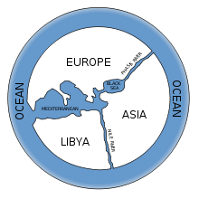 Modern rendering of Anaximander's 6th century BC world map
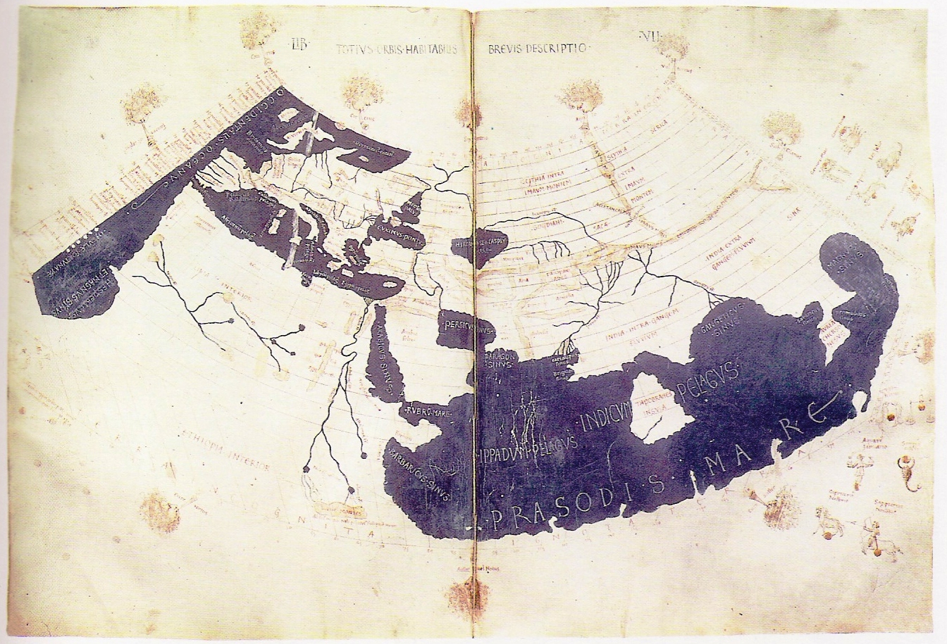
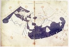 Ptolemy's 150 CE world map (as redrawn in the 15th century)
- Anaximander, Greek Anatolia, (610 BC–546 BC), first to attempt making a map of the known world
- Hecataeus of Miletus, Greek Anatolia (550 BC–476 BC), geographer, cartographer, and early ethnographer
- Dicaearchus, Greece (circa 350 BC–285 BC), philosopher, cartographer, geographer, mathematician, author
- Eratosthenes, Ptolemaic Egypt, (276 BC–194 BC) a Greek scientist, mathematician, geographer, and cartographer
- Hipparchus, Greece, (190 BC–120 BC), astronomer, cartographer, geographer
- Marinus of Tyre, Roman Syria (ca. 70–130 A.D.) Greek[1] geographer, cartographer and mathematician, who founded mathematical geography.
- Ptolemy, Ptolemaic Egypt, (circa 85–165), a Greek astronomer, cartographer, geographer
- Isidore of Seville, Hispania (560–636)
- Al-Idrisi, Sicily (1100–1166), Arab cartographer, geographer and traveller.
- Liu An, China (179 BC–122 BC), geographer, cartographer, author of the Huainanzi
- Petrus Vesconte, Genoese cartographer, author of the oldest signed Portolan chart (1311)
- Shen Kuo, China (1031–1095), a polymath scientist and statesman, author of the Dream Pool Essays, which included a large atlas of China and foreign regions, and also made a three-dimensional raised-relief map.
- Su Song, China (1020–1101), horologist and engineer; as a Song Dynasty diplomat, he used his knowledge of cartography and map-making to solve territorial border disputes with the rival Liao Dynasty
- Angelino Dulcert (14th century) author of the earliest known majorcan portolan charts of the Mediterranean
15th century
 First world map of Piri Reis.
 Martin Behaim's 1492 world map
- Martin Behaim (Germany, 1436–1507)
- Benedetto Bordone (Venetian Republic (1460–1551)
- Sebastian Cabot (1476–1557), Venetian explorer
- Erhard Etzlaub (1460–1532)
- Leonardo da Vinci (Italy, 1452–1519)
- Henricus Martellus Germanus (Germany, fl. 1480–1496)
- Donnus Nicholas Germanus (Germany, fl. 1460–1475)
- Fra Mauro (Venice, c.1459)
- Piri Reis/Hadji Muhammad (Dardanelles, Ottoman Empire, 1465–1554/1555)
- Johannes Ruysch (Netherlands, c 1466–1530) explorer, cartographer, astronomer, manuscript illustrator and painter
- Hartmann Schedel (Germany, 1440–1514)
- Amerigo Vespucci (Republic of Florence, 1454–1512)
- Johannes Werner (Germany, 1466–1528) refined and promoted the Werner map projection
- Martin Waldseemüller (Germany, c.1470–c.1521/1522)
- Gabriel de Valseca (15th century), Majorcan, author of several portolan charts of the Mediterranean
- Grazioso Benincasa (15th century), Venetian (?), author of several portolan charts of the Mediterranean
16th century
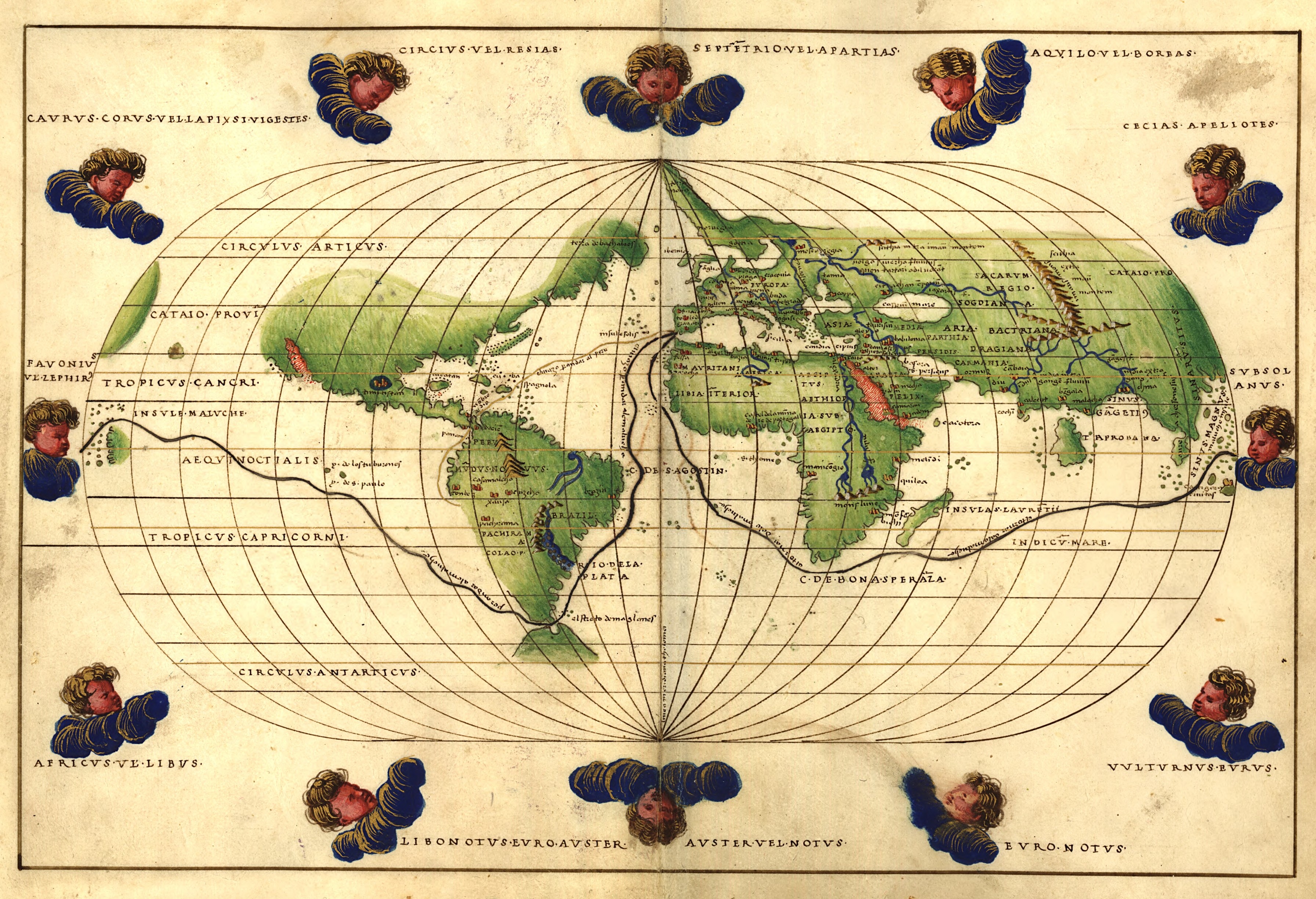
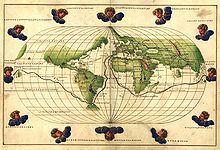 Battista Agnese's 1544 world map
 Jodocus Hondius' Leo Belgicus (1611)
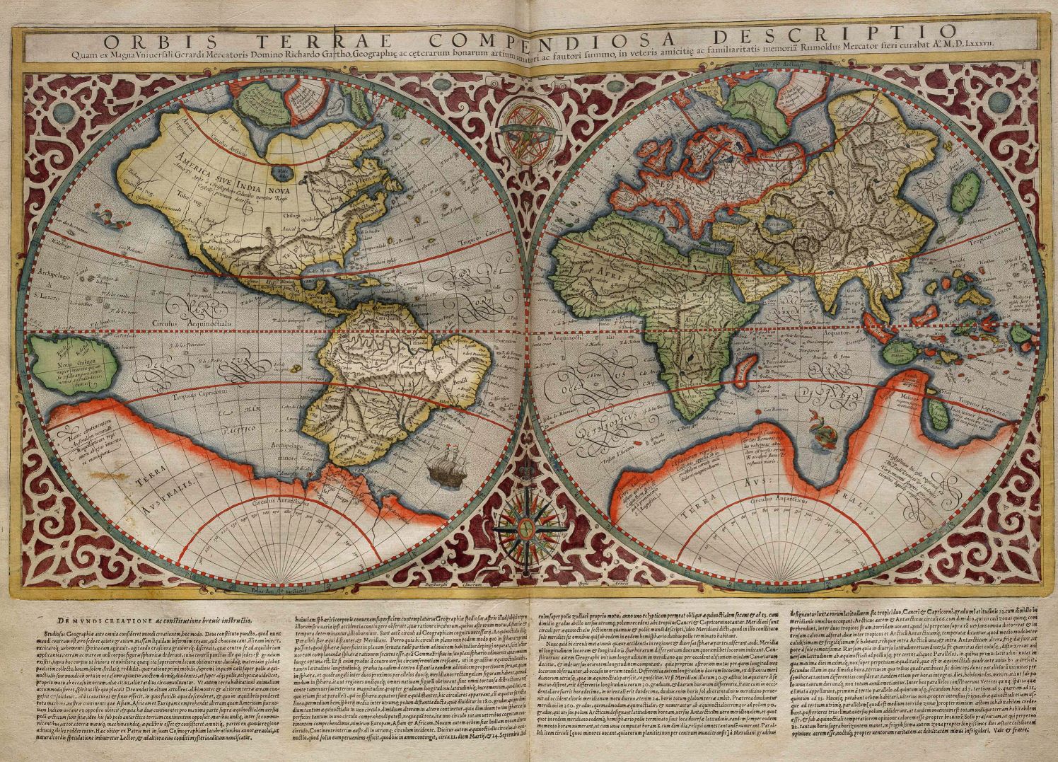
 Gerardus Mercator's 1587 world map
- Giovanni Battista Agnese (c. 1500–1564) Genoese cartographer, author of numerous nautical atlases
- Peter Apian (1495–1552) – Also known as Peter Bienewitz German geographer and astronomer, author of the Apianus projection
- Philipp Apian (1531–1589)
- Joost Janszoon Bilhamer (Netherlands, 1541–1590)
- Willem Janszoon Blaeu (Netherlands, 1571–1638) – Father of Joan Blaeu
- Giovanni Battista Boazio (?–?) – Mapped Sir Francis Drake's voyage to the West Indies and America
- Jacob Roelofs van Deventer, (Netherlands, c 1510/15–1575)
- Fernão Vaz Dourado (India, c. 1520–c. 1580) – Portuguese cartographer of the school initiated by Lopo Homem
- Oronce Finé (France, 1494–1555)
- Gemma Frisius (or Reiner Gemma) (Netherlands, Ned Flanders, 1508–1555)
- Martin Helwig (Germany, 1516–1574)
- Lopo Homem (Portugal?–1565) – Co-author, with the Reinel family, of the well-known Miller Atlas
- Diogo Homem (Portugal 1521–1576) – Cartographer, son of Lopo Homem
- Jodocus Hondius (Flanders, England, Netherlands, 1563–1612)
- Johannes Honterus (Transylvania, 1498–1549)
- Gerard de Jode (Netherlands,Flanders, 1509–1591)
- Jacques le Moyne (France, ca. 1533–1588)
- Guillaume Le Testu (France, ca. 1509–1573)
- Gerardus Mercator (Flanders, Netherlands, 1512–1594)
- Sebastian Münster (Germany, 1488–1552)
- Abraham Ortelius, (Flanders, 1527–1598) – Generally recognized as the creator of the first modern atlas
- Petrus Plancius, (Netherlands, 1552–1622)
- Timothy Pont, (Scotland, 1565–1614)
- Pedro Reinel (Portugal ?–c. 1542) – Author of the oldest signed Portuguese nautical chart
- Jorge Reinel (Portugal c. 1502–c. 1572) – Portuguese cartographer, son of Pedro Reinel
- Diogo Ribeiro (Portugal, ?–Sevilha, 1533) – Author of the first known planisphere with a graduated Equator (1527)
- Sebastião Lopes (Portugal 16th century) – Portuguese cartographer and cosmographer
- Christopher Saxton, (England, born c 1540)
- John Speed, (England, 1542–1629)
- Fernando Álvares Seco (Portugal?–?) – Signed the oldest known map of Portugal, reproduced in various editions of Abraham Ortelius's Theatrum Orbis Terrarum
- Luís Teixeira (Portugal ?–?) – Author of an important Atlas of Brazil
- Bartolomeu Velho (Portugal ?–1568) – cosmographer and cartographer
- Lucas Janszoon Waghenaer (Netherlands, 1533/34–1605/06) – Driver, cartographer
- Edward Wright (mathematician) (England, 1561–1615) – Mathematician and cartographer
17th century
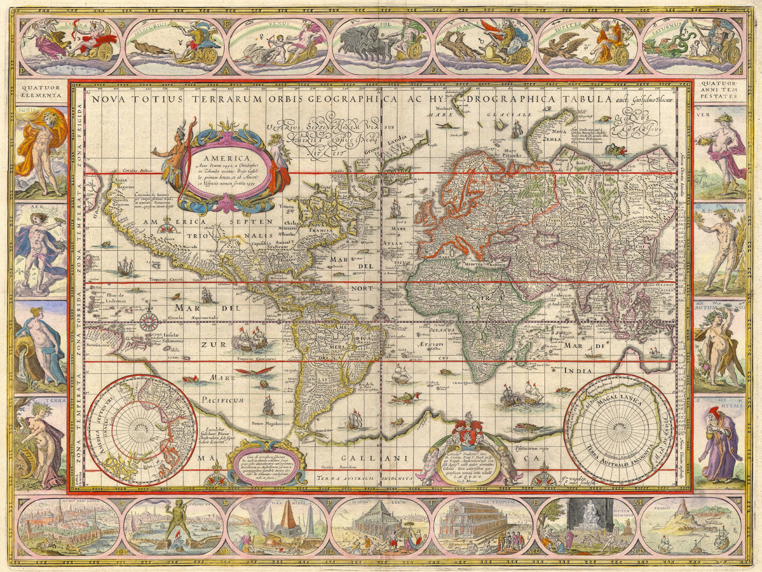
 Willem Blaeu and Johannes Blaeu's 1606–26 world map
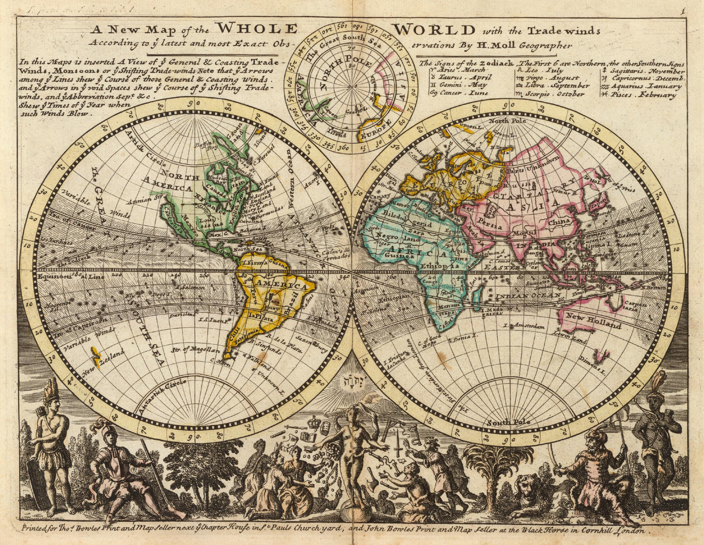
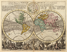 Herman Moll's A new map of the whole world with the trade winds (1736)
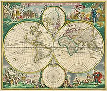 Frederik de Wit's 1670 world map
- Pieter van der Aa (Netherlands, 1659–1733)
- João Teixeira Albernaz I (Portugal ?–c.1664) Prolific cartographer, son of Luís Teixeira
- João Teixeira Albernaz II (Portugal ? — c. 1699), Portuguese cartographer
- Pedro Teixeira Albernaz (Portugal c. 1595–1662) Portuguese cartographer author of an important atlas of the Iberian Peninsula and a map of Portugal (1656
- Johannes Blaeu (Netherlands, 1596–1673)
- Vincenzo Coronelli (Venetian, 1650–1718)
- Guillaume Delisle (French, 1675–1726)
- Petter Gedda (Sweden, 1661–1697)
- Hessel Gerritsz (Netherlands, 1581–1632), cartographer for the VOC
- Isaak de Graaf (Netherlands, 1668–1743), cartographer for the VOC
- Johann Homann (Germany, 1664–1724), geographer
- Henricus Hondius (Netherlands, 1597–1651)
- Willem Hondius (Netherlands, 1598–1652/58)
- Johannes Janssonius (Netherlands, 1588–1664)
- Johannes van Keulen (Netherlands, 1654–1715)
- Joannes de Laet (Netherlands, 1581–1649)
- Michael van Langren (Netherlands, 1600–1675)
- Alain Manesson Mallet (France, 1630–1706)
- Matthäus Merian Sr (Switzerland, 1593–1650) and Jr. ((Switzerland, 1621–1687)
- Herman Moll (Germany?/England, 1654–1732)
- Robert Morden (England, died 1703)
- Dirck Rembrantsz van Nierop (Netherlands, 1610–1682), cartographer, mathematician and astronomist
- John Ogilby (Scotland, 1600–1676)
- Nicolas Sanson (France, 1600–1667)
- Peter Schenk the Elder (Germany, 1660–1718/19)
- Johannes Vingboons (Netherlands, 1616/17–1670) cartographer and aquarellist
- Claes Jansz Visscher (Netherlands, 1587–1652)
- Nicolaes Visscher (Netherlands, 1618–1679)
- Frederik de Wit (Netherlands, 1610/16–1698)
- Nicolaes Witsen (Netherlands, 1641–1717) diplomat, cartographer, writer and mayor of Amsterdam
18th century
 Jacques-Nicolas Bellin: Carte réduite de l'océan septentrional..., from: L'hydrographie françoise, Paris 1766
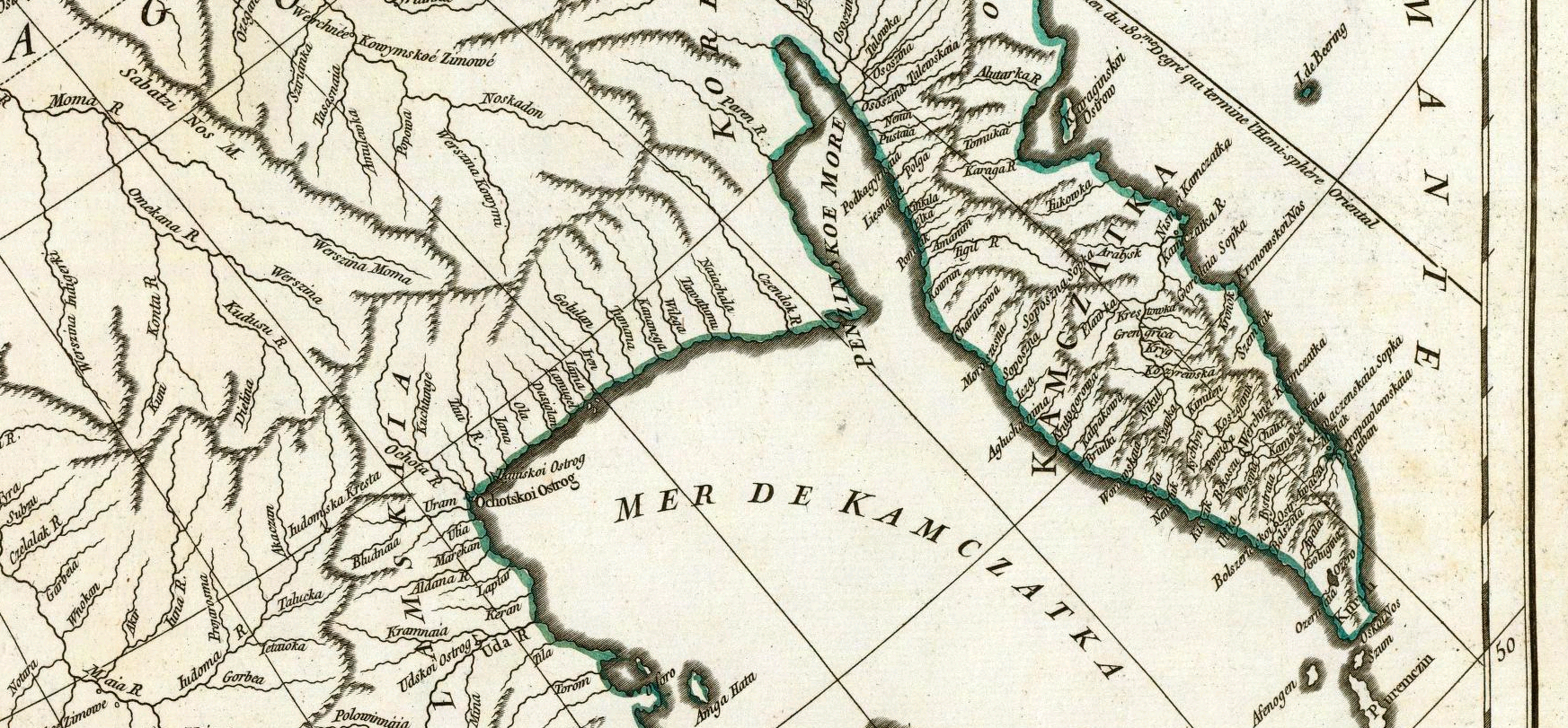
 Jean Baptiste Bourguignon d'Anville: Troisième partie de la carte d'Asie, contenant la Sibérie, et quelques autres parties de la Tartarie, Paris (1753)
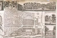 Plan du Jardin & Vue des Maisons de Chiswick, 1736, by John Rocque V&A Museum no. E.352-1944
- John Senex (1690–1740), engraver, publisher, surveyor and geographer to Queen Anne[2]
- John Lodge Cowley, cartographer, mathematician and geographer
- Emanuel Bowen (1693/4–1767), engraver and map maker[3]
- Giambattista (Giovanni Battista) Albrizzi (Venice, 1698 – 1777), publisher of illustrated books and maps
- Sieur le Rouge map c1740[4]
- John Gibson (cartographer), map c1758[5]
- Jacques-Nicolas Bellin (1703–1772) Chief cartographer to the French navy
- William Bligh (England, 1754 – 7 December 1817) – Ships Master during the infamous Bounty mutiny and noted free-hand cartographer
- Rigobert Bonne (France, 1727–1795) – Royal Cartographer to France in the office of the Hydrographer at Depot de la Marine
- Jean Baptiste Bourguignon d'Anville (France, 1697–1782)
- Abel Buell (1742–1822), published the first map of the new United States created by an American
- Dimitrie Cantemir (Moldavia and Russia, 1673–1723)
- César-François Cassini de Thury (France, 1714–1784)
- Jean-Dominique Cassini (France, 1748–1845)
- James Cook (Captain RN) (1728–1779) navigator and naval chart maker
- Simeon De Witt (1756–1834) Successor to Robert Erskine and Surveyor-General of the State of New York
- Johann Friedrich Endersch (Germany, fl. 1755)
- Colonel Robert Erskine (1735–1780) Geographer and Surveyor-General of the Continental Army during the American Revolution.
- Joseph de Ferraris (1726–1814), Austrian cartographer of the Austrian Netherlands
- Louis Feuillée (France, 1660–1732)
- Thomas Jefferys (England, c. 1710–1771) Geographer of King George III of the United Kingdom
- Murdoch McKenzie (Scotland, died 1797)
- John Mitchell (1711–1768) Colonial British American mapmaker.
- Carlton Osgood (United States, †1816)
- Adriaan Reland (Netherlands, 1676–1718), linguist & cartographer
- Thomas Richardson – Scottish
- Dider Robert de Vaugondy (France, 1688–1766)
- John Rocque (England, 1709–1762)
- Matthäus Seutter (Germany, 1678–1757)
- Friedrich Wilhelm Karl von Schmettau (1743–1806)
- Matthias Seutter (Germany, 1678–1757)
- Daniel-Charles Trudaine (France, 1703–1769)
- Philip Johan von Strahlenberg (1676–1747)
- Thomas Kitchin (1718–84) London-based cartographer and engraver of maps of England, greater Europe, and parts of the British Empire. At one time held the titles "Senior Hydrographer to His Majesty" and "Senior Engraver to His Royal Highness the Duke of York".[6]
- Friedrich Christoph Müller (Germany, 1751–1808)
- Alexander Wilbrecht (Russia, 1757–1823) Geographer of The Geographic Department of the Cabinet of Her Imperial Majesty
19th century

 A 1912 map of the Russian Empire by Yuly Shokalsky
- John James Abert (United States, 1788–1863), headed the Corps of Topographical Engineers for 32 years and organized the mapping of the American West.
- Louis Albert Guislain Bacler d'Albe (France, 1761–1824), also artist and longtime strategic advisor to Napoleon
- Henry Peter Bosse (Germany/United States, 1844–1903), also photographer and civil engineer
- George Bradshaw (England, 1801–1853)
- Agostino Codazzi (Italy, 1793–1858)
- J.H. Colton (United States, 1800-1893)
- James Ireland Craig, Craig retroazimuthal projection.
- Carl Diercke (1842–1913)
- Louis Isidore Duperrey (French, 1786–1865)
- Fielding Lucas, Jr. (c. 1781–1854) Lucas Brothers, Baltimore, USA
- Matthew Flinders (British, 1774–1814) – Royal Navy officer; circumnavigated Australia and made exploration of the Australian coastline
- Matthew Fontaine Maury (American, 1806–1873), U.S. Navy officer; also oceanographer, meteorologist, cartographer, author, geologist, and educator.
- Björn Gunnlaugsson (Iceland, 1788–1876)
- Charles F. Hoffmann (Germany/United States, 1838–1913)
- Pierre Jacotin (France, 1765–1829)
- Felix Jones (England, 1813–1878)
- Peter Kozler (Slovenia, 1824–1879), lawyer, geographer, politician, manufacturer.
- Victor Adolphe Malte-Brun (France, 1816–1889)
- Robert Moresby (England, 1794–1863)
- Thomas Moule (England, 1784–1851)
- John Tallis and Company (England, 1838–1851)
- Yuly Shokalsky (Russia, 1856–1940), also oceanographer and geographer
- Nicolas Auguste Tissot (France, 1824–1897), devised Tissot's indicatrix
- Philippe Vandermaelen (Belgium, 1795–1869)
- Edward A. Vincent (England/United States, c. 1825 – November 27, 1856), also cartographer, civil engineer, architect
- James Wilson (American, 1763–1835), first maker of globes in the United States
- Nain Singh Rawat: Indian cartographer.
- Cope, Emmor B: Gettysburg Battlefield cartographer and 1st Gettysburg National Military Park superintendent
20th century

 Arno Peters world map
- Erik Arnberger (1917–1987)
- Jacques Bertin (France, 1918–2010)
- Roger Brunet (1931– )
- Bernard J.S. Cahill (1867–1944) – Inventor of octahedral "Butterfly Map" of the world
- George Comer (1858–1937)
- James Ireland Craig (1868–1952) – Inventor of the Craig retroazimuthal projection, otherwise known as the Mecca projection
- John Paul Goode (1862–1932) – Created the "Evil Mercator" and Goode’s World Atlas
- Max Eckert-Greifendorff (Germany, 1868–1938)
- Hermann Haack (Germany, 1872–1966)
- Günther Hake (1922–2000)
- Richard Edes Harrison (1901–1994)
- Tom Harrisson (1911–1976)
- Eduard Imhof (1895–1986) – Oversaw the Schweizerischer Mittelschulatlas, the atlas used in Swiss high schools from 1932 until 1976
- George F. Jenks (1916–1996)
- Elrey Borge Jeppesen (1907–1996)
- Edgar Lehmann (1905–1990)
- John P. Snyder (1926–1997) – Developed the space oblique mercator projection
- Rudi Ogrissek (1926–1999)
- Rafael Palacios (1905–1993) – prolific map-drawer for major U.S. publishers
- Arno Peters (1916–2002) – Developed the Gall–Peters projection
- Erwin Raisz (1893–1968)
- Arthur H. Robinson (1915–2004) – Wrote the influential textbook Elements of Cartography and developed the Robinson projection
- William R. Shepherd (1871–1934)
- John C. Sherman (1916–1996)
- Jessamine Shumate (1902–1990)
- Marie Tharp (1920–2006) – oceanographic cartographer
- Bradford Washburn (1910–2007)
- David Woodward (1942–2004)
21st century
- Nikolas Schiller (1980– ) – Arabesque maps composed of kaleidoscopic aerial photographs
- Dr. E. Lee Spence, (1947– ) – Pioneer underwater archaeologist, decorative, historical maps showing shipwreck locations
- Daniel N. Stoddart (1967– ) Maps of the Appalachian Mountains
- Waldo R. Tobler (1930– ) – Developed the first law of geography
- Denis Wood (1945– ) – Artist, author, and former professor of Design at North Carolina State University
See also
- History of cartography
- List of geographers
- Ancient world maps
- Russian cartographers
- Category:Cartography organizations
References
- ^ Hubert Cancik and Helmuth Schneider (ed.): "Marinus", Brill's New Pauly, Brill, 2010:
M. of Tyre (Μαρῖνος; Marînos), Greek geographer, 2nd cent. AD
- ^ http://www.oxforddnb.com/index/101025085/
- ^ http://www.oxforddnb.com/index/101003035/
- ^ http://prestwidge.com/river/jamaica1746leRouge.html
- ^ http://prestwidge.com/river/jamaica1762gibson.html
- ^ http://www.nysm.nysed.gov/albany/map/kitchenmap.html
Atlas Atlas · Cartography · Geography · Map · Map projection · Topography
Early world maps · History of cartography · List of cartographers
Cartogram · Choropleth map · Geologic map · Linguistic map · Nautical chart · Pictorial maps · Thematic map · Topographic map · Weather map
Find a map by geographic area or typeCategories:- Lists of people by occupation
- Cartographers
- Map companies


Wikimedia Foundation. 2010.