- Chichester Castle
-
Chichester Castle 
Remains of the motte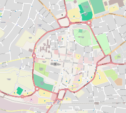
 Location of Chichester Castle
General information Architectural style Motte-and-bailey castle Town or city Chichester, West Sussex Country England Coordinates 50°50′23″N 0°46′33″W / 50.839814°N 0.775799°W Completed 11th century Demolished 1217 Chichester Castle stood in the city of the same name in West Sussex (grid reference SU863052).[1] Shortly after the Norman Conquest of England, Roger de Montgomerie, 1st Earl of Shrewsbury, ordered the construction of a castle at Chichester. The castle at Chichester was one of 11 fortified sites to be established in Sussex before 1100. The Rape of Chichester, a subdivision of Sussex, was administered from the castle and was split off from the larger Rape of Arundel; a Rape was an administrative unit originating in the Saxon era and continued by the Normans.[2] Situated in the north-east corner of Chichester, the castle was protected by the city walls. As it was an urban castle inserted into a pre-existing settlement, buildings were probably cleared to make way for the castle. Chichester Castle was of timber construction; although some timber castles were rebuilt in stone, there is no evidence that this was the case at Chichester Castle.[3]
Although originally built by the Earl of Shrewsbury, the Earls of Sussex owned the castle in the period 1154–1176, after which it passed into possession of the Crown.[1] Early in the 13th century, Chichester Castle was used as a court and jail. Chichester and Oxford Castle were some of the earliest urban castles to be used for this purpose, but gradually most urban castles were also used in this way.[4] In 1216, the castle, along with many others in southern England, such as Reigate Castle, was captured by the French. This was part of the First Barons' War against King John of England (1199–1216). The castle was recaptured by the English in the spring of 1217.[3] In the same year, Henry III ordered the castle's destruction.[1] Between 1222 and 1269, Richard, 1st Earl of Cornwall, gave the site to the order of Greyfriars for them use as the site of a friary. The remains of the motte are still visible today in Priory Park;[3] the motte is protected as a Scheduled Monument.[1][5]
See also
- Noviomagus Reginorum – the Roman town of Chichester; the castle was situated in the northern part of the Roman military settlement
References
- Notes
- ^ a b c d Chichester Castle, Pastscape.org, http://www.pastscape.org/hob.aspx?hob_id=1386089, retrieved 21 May 2009
- ^ Jones (2003), p. 173.
- ^ a b c Chichester District Council, Castle, Chichester.gov.uk, http://www.chichester.gov.uk/index.cfm?articleid=1940, retrieved 21 May 2009
- ^ Drage (1987), p. 127.
- ^ Chichester District Council, Priory Park, Chichester.gov.uk, http://www.chichester.gov.uk/index.cfm?articleid=5724, retrieved 22 May 2009
- Bibliography
- Drage, C (1987), Schofield, J & Leech, R, ed., "Urban castles", Urban archaeology in Britain: research report 61 (The Council for British Archaeology): 117–132, ISSN 0589-9036
- Jones, Richard (2003), Rudling, David, ed., "Hastings to Herstmonceux: the castles of Sussex", The Archaeology of Sussex to AD2000 (Heritage Marketing & Publications): 171–178, ISBN 0-9544456-1-9
Further reading
- Fry, Plantagenet Somerset (1980), The David & Charles Book of Castles, David & Charles, ISBN 0-7153-7976-3
- Magilton, J (1995), "Chichester Castle Reappears", The Archaeology of Chichester and District 1995 (Chichester District Council): 23–26
Categories:- Buildings and structures in Chichester
- Visitor attractions in Chichester
- Castles in West Sussex
- Scheduled Ancient Monuments in West Sussex


Wikimedia Foundation. 2010.