- Škofja Loka
Infobox Settlement
name =
official_name =Škofja Loka
native_name =
other_name =
nickname =
settlement_type =
total_type =
motto =
imagesize = 350px
image_caption =
flag_size =
image_
seal_size =
image_shield = Wappen Skofja Loka si.png
image_blank_emblem =
blank_emblem_type =
blank_emblem_size =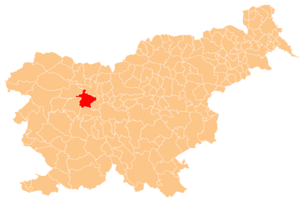
mapsize =
map_caption = Location of the Municipality of Škofja Loka in Slovenia
mapsize1 =
map_caption1 =
image_dot_
dot_mapsize =
dot_map_caption =
dot_x = |dot_y =
pushpin_
pushpin_label_position = left
pushpin_map_caption =Location of the city of Škofja Loka in Slovenia
pushpin_mapsize =
subdivision_type = Country
subdivision_name =flag|Slovenia
subdivision_type1 = Region
subdivision_name1 =
subdivision_type2 = Municipality
subdivision_name2 = Škofja Loka
subdivision_type3 =
subdivision_name3 =
subdivision_type4 =
subdivision_name4 =
seat_type =
seat =
government_footnotes =
government_type =
leader_title =Mayor
leader_name =Igor Draksler
leader_title1 =
leader_name1 =
leader_title2 =
leader_name2 =
leader_title3 =
leader_name3 =
leader_title4 =
leader_name4 =
established_title =
established_date =
established_title1 =
established_date1 =
established_title2 =
established_date2 =
established_title3 =
established_date3 =
founder =
named_for =
area_magnitude =
unit_pref =Imperial
area_footnotes =
area_total_km2 =145
area_land_km2 =
area_water_km2 =
area_total_dunam =
area_total_sq_mi =
area_land_sq_mi =
area_water_sq_mi =
area_water_percent =
area_urban_km2 =
area_urban_sq_mi =
area_metro_km2 =
area_metro_sq_mi =
area_blank1_title =
area_blank1_km2 =
area_blank1_sq_mi =
elevation_footnotes =
elevation_m =
elevation_ft =
elevation_max_m =
elevation_max_ft =
elevation_min_m =
elevation_min_ft =
population_as_of =2002
population_footnotes =
population_note =
population_total =22,093
population_density_km2 =
population_density_sq_mi =
population_metro =
population_density_metro_km2 =
population_density_metro_sq_mi =
population_urban =
population_density_urban_km2 =
population_density_urban_sq_mi =
population_blank1_title =males
population_blank1 =10,839
population_blank2_title =female
population_blank2 =11,254
population_density_blank1_km2 =
population_density_blank1_sq_mi =
timezone =
utc_offset =
timezone_DST =
utc_offset_DST =
coor_type =
latd=46 |latm=10 |lats= |latNS=N
longd=14 |longm=18|longs= |longEW=E
postal_code_type =
postal_code =
area_code =
blank_name =Average age
blank_info =39.6 years
blank1_name =Residential areas
blank1_info =convert|28.59|m2|sqft|abbr=on/person
blank2_name =Households
blank2_info =7,266
blank3_name =Families
blank3_info =6,018
website =
footnotes = Source:Statistical Office of the Republic of Slovenia , census of 2002.Škofja Loka is a town and a municipality in
Slovenia .History
The town history began in 973 when German emperor
Otto II gave the territory of Loka as a present to Abraham the bishop ofFreising inBavaria . However Loka named in that deed of donation wasn't the nowadays Škofja Loka but it was a part of the town which is now known as Stara Loka (Old Loka). The name Loka itself means grassy area by the water and Škofja comes from škof which means bishop. In the Middle Ages the locality of Loka was starting to spread around the confluence of the rivers named Selška Sora and Poljanska Sora. The name of Loka stands for grassland by the river.Later on the bishops of Freising renamed administrative and economic centre of Loka's lordship to Škofja Loka (Bischoflack). In the document from 1274 the locality was signed as the town. For major safety purposes the town was secured by town wall constructed in the beginning of the 14th century. There were five gates leading through the town wall each of them protected by guarding tower; most of the town wall is still well preserved. The history shows us that the town was many times experienced by attack, plague, fire and earthquake. The worst of the earthquakes in 1511 had badly damaged the town which was later rebuilt by bishop Filip. From that time on the image of Škofja Loka was just slightly changed so Škofja Loka is now known as the most preserved mediaeval town in Slovenia. Old town core is consisted from Upper town square called Plac and Lower town square called Lontrg both dominated by the Castle of Škofja Loka.
Loka's lordship was managed in the absence of the bishop by administrator named also chieftain and granary-man. The inhabitants of the town and its surroundings were occupied in many trades which were developed at the end of the Middle Ages into the
trade union s - guilds. Only townspeople were allowed to trade. There were many famous artists, writers and scientists who created rich cultural inheritance of Škofja Loka, as a result of constant working in an environment full of art and nature.A negro in a crown
There is a legend which tells of a feudal lord called Abraham from Bavaria who was travelling one night through the Poljanska dolina valley with his black servant (the "negro"). While walking through a dark thicket they came across a huge bear. Prince Abraham stopped, terrified; the quick-thinking servant aimed an arrow from his bow and shot the bear dead. The master embraced the servant and said: "You have saved my life, servant. I shall reward you for your heroism, so that future generations may know what a hero you were." He showed his gratitude to the servant by painting his head in the town's coat-of-arms. There is an inscription on the outer part of the 14th century seal, which says: SIGILLUM CIVITATIS LOK - the seal of the town of Škofja Loka.
Geography
The Highlands of Škofja Loka (or Loka's mountains) are typical for the region in front of Alps in river basin of Selška Sora and Poljanska Sora which unite near the town of Škofja Loka and form the river Sora.
The Highlands of Škofja Loka (in further text "region") is extended over two valleys: Selška dolina and Poljanska dolina and all the highlands above them, depression Žirovska kotlina and field Sorško polje. The town of Škofja Loka is of special value to the region - the town at the confluence of both of the rivers Sora - the town which is also economic, cultural and administrative centre of the region.Long ago - in 973 - German emperor Oton the second gave this territory as a present to the bishops of Freising and in the following centuries terminal feudal estate of Loka's lordship arose with its direction in Škofja Loka (municipal rights in 1274). Freising's lordship existed as long as 830 years and they were cancelled by the Austrian state which caused decreased significance of Škofja Loka. In January 1995 following new communities derived from former unified community of Škofja Loka:
* community of Škofja Loka (145 km, 21761 inhabitants),
* community of Železniki (162 km, 6693 inhabitants),
* community of Gorenja vas - Poljane (161 km, 6539 inhabitants) and
* community of Žiri (44 km, 4857 inhabitants) - (data from December 31, 1997).The Highlands of Škofja Loka still remains geographically closed region despite of administrative division of its territory and it is defined by its natural characteristics as well as mutual history and inner social connection up to present-day.
Natural and geographical outline of the Highlands of Škofja Loka
Central part of the Highlands is situated above the two valleys of the two rivers Sora and it is mainly of 500 to 1000 m of asl altitudes, peaks arranged in height upwards from East to West (Lubnik 1025 m, Stari vrh 1217 m, Koprivnik 1393 m, Blegoš 1562 m). Tectonic it is a part of Posavje faults which continue to the East of
Ljubljana basin . In Carboniferous period (250 million years ago) there was low sea covering the surface and the sea was constantly accumulated by the rivers from Central Alps. Reddish Carboniferous conglomerate originated from that period (sv. Andrej above Zminec). The sea withdrew in the The sea was withdrawing from North to South in Jurassic period (175 million years ago) and in low sea there was black slate of Zali log forming near Zali log. The territory became dry in Cretaceous period (80 million years ago) and later accompanied by great tectonic movements in Tertiary period there was gulf again which was accumulated by the rivers. Variegated conglomerate of Škofja Loka was formed from that accumulation at Kamnitnik and at the Castle. The surface was strongly dissected by the rivers causing obvious selective erosion; stoneware which was more resistive remained steep slopes, non-resistive stoneware like slate, conglomerate and sandstone on the other hand was strongly eroded by waters therefore surface was adjusted. Hollow depression formed in the region of nowadays Sorško polje was accumulated by the river Sava from Oligocene period (65 million years ago) onwards and the river Sora was shoved off to the South edge of depression. Clayey sediments were deposited in the foothills of Crngrob and up to Stražišče by the lagging behind waters from the Highlands of Križna Gora.Minor glacier formed under Ratitovec and the tongue of Bohinj's glacier stretched even to Sorica in the
ice age (1 million years ago). Sorško polje was continuing to be accumulated so gravelly deposits could be found today even more than 30 m thick. Sometimes the deposits were agglutinated into the conglomerate (Labore) and the Karst sinkholes named also "dobrave" (oak named dob) were also formed on that type of ground. The nowadays landscape image is created mostly of steep slopes and impermeable stoneware dissected by torrents into numerous torrential ravines.Top parts of the Highlands of Škofja Loka made of limestone are also karstic transformed; the surface is strongly ridged and there are also karstic caves (Lubniška jama and Kevderc pod Lubnikom). The karst phenomena were formed also in Oligocene conglomerate above Škofja Loka where karstic abysses can be found (Marijino brezno, Migutov brezen, Gipsova jama). There is only 10% of flat surface in the region: near both rivers Sora and mostly at Sorško polje.There could be transitive outlines indicated in the climate of the region: from moderate
continental climate on the East side to humid influence from maritime direction on the West side - direction of Baška grapa and Cerkljansko and cool Alpine influence on the Northwest from Bohinj's mountains.The climate is rather humid; annual rainfall in Škofja Loka's surroundings is about 1600 mm and on the West side of the region over 1800 mm annually. The temperatures are lower as well - especially in basins - with exception of some sunny slopes for their frequent inversions; a half of wintry temperatures in Javorje (697 m asl) is higher than the average of Brnik's temperature.
Types of soil were generated by influences of stoneware foundations and climate. Non-carbonate stoneware is predominate; under the forest which covers even 2/3 of the territory sour soil was developed on that stoneware. Humid and clayey soil was originated from clayey deposits beside the rivers; the best soil could be found in gravel deposits at Sorško polje and beside upper terraces above Sora.
The waters in the region are plentiful because there is plenty of precipitations and the earth is mainly inclined and impermeable. Drain quotient of the waters is big (70%) and the character of the rivers is torrential. Rapid and large oscillations in water level are typical of the region; there were bad floods in the years 1925, 1926, 1952 and 1990 (in 1979 there was a hundredfold difference between the lowest and the highest flux of the river Sora - 4 and 458 m/s). The biggest stock of underground water in Slovenia could be found under Sorško polje, but it is endangered by sewage from untidy gravel pits, agriculture, settlements and industry at the edges of Sorško polje.
ettlement and inhabitants of the region
The settling density of the region is 79 inhabitants/km and it is expectedly below Slovene average because of mountainous character of the landscape. Colonization started in the 10th century and onwards - when the Freisings began to rule; the West part of Selška dolina was settled by Slovene colonist but in the meantime there were Bavarians settled at Sorško polje, in the 13th century there were Tyrolese from Pusterska dolina settled below Ratitovec and in the 14th century there came
Furlans in Železniki. From the 12th to the 14th century there was in course settlement of Poljanska dolina and Žirovska kotlina and in the 16th and the 17th century mountain assarts were the last wave of settlement in the region.Regarding periods of settlements, origin of colonists and natural resources there were different types of settlements in the region. There are expansive settlements, lumpy villages and hamlets predominated in the highlands, on the other hand systematic settlement at Sorško polje resulted in long roadside villages.
The Highlands of Škofja Loka was settled denser than other highlands in front of Alps because in 1991 there were 188 settlements in whole region. The settlement in highlands is preserved as for traffic connections to the valleys as for successful economy (forestry, stockbreeding, tourism, daily migration to the valley). The tendency of settlement - 39850 inhabitants in the region - is towards the biggest settlements in particular valley (Železniki, Žiri, Gorenja vas, Poljane, Selca) and even 1/3 of all inhabitants in Škofja Loka.
The number of inhabitants in the region slowly increased for centuries but there was a powerful increase of the number of inhabitants after the world war II when expansive industrialisation began also in this region. The increase of 72% of the number of inhabitants which was in the period from 1960 to 1990 due to immigrants who were attracted by the new industry or vicinity to Ljubljana (so called sleeping settlements).
Art colony
Before the civil war in ex
Yugoslavia the town ofSmederevska Palanka and the town ofŠkofja Loka fromSlovenia had art colonyGroharijeva kolonija led by the teacher of art from elementary schoolOlga Milošević . Today, after the split ofSFR Yugoslavia , the two towns became twin citis.Twin cities
*flagicon|Serbia
Smederevska Palanka ,Serbia External links
* [http://www.skofjaloka.si/en/default.asp Škofja Loka] , official page of municipality

Wikimedia Foundation. 2010.