- Tybee Island Light Station
Infobox Lighthouse
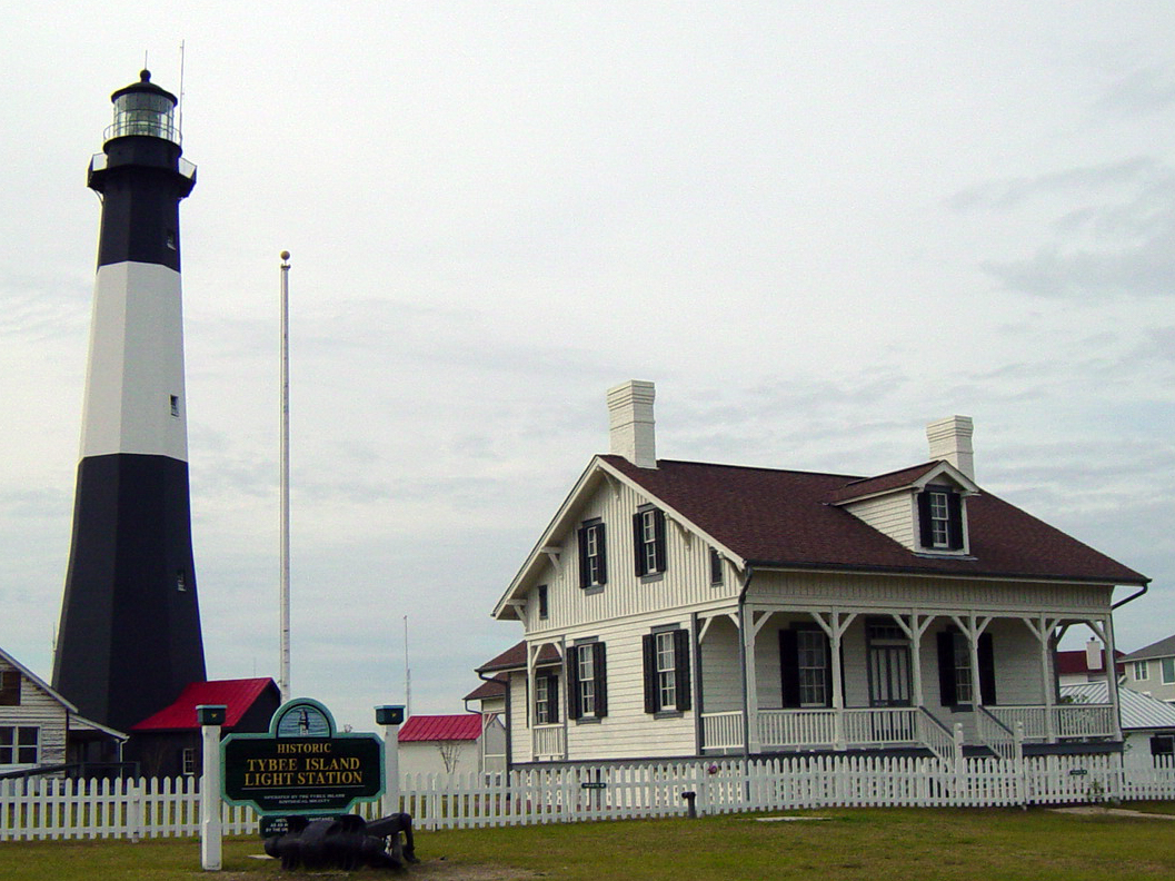
caption = Tybee Island Light Station
location =Tybee Island, Georgia
coordinates = coord|32|1|20.0|N|80|50|44.3|W|region:US_type:landmark
yearbuilt = 1736
yearlit = 1736
automated = 1933
yeardeactivated = Active
foundation =
construction =
tower shape = Octagonal pyramidal
marking = Black with white horizontal band
elevation =
height = 154 feet
currentlens =
lens = First orderFresnel lens
intensity =
range =
characteristic = Fixed whiteThe Tybee Island Light, also known simply as the Tybee Lighthouse is located on
Tybee Island, Georgia , east of Savannah at the mouth of theSavannah River . The Tybee Lighthouse is one of just a handful of 18th century lighthouses still in operation in North America.History
In 1732, General James Oglethorpe, Governor of the 13th colony ordered construction of a
lighthouse on Tybee Island to safely guide mariners into Savannah harbor. [http://www.tybeelighthouse.org/lighthouse-history.htm] The original lighthouse was first completed in 1736. It was made of brick and wood and stood 90 feet tall, making it the highest structure incolonial America at that time. Five years later the lighthouse was destroyed by a horrible storm.In 1742 a second lighthouse was finished; this version reached 94 feet tall 4 feet taller than the first lighthouse. In 1773 a third lighthouse was built which was also destroyed, this time in 1862 by Confederate troops from nearby
Fort Pulaski . Of the 100 feet of the third lighthouse only 60 feet remained which served as a rebuilding point for a fourth lighthouse.In 1869 it was decided that the lighthouse must be protected from ever increasing tides and gale force winds so it was moved 164 feet back from the shoreline. In the years from 1871 and 1886 the walls of the lighthouse became cracked by storm forces and later the light lens was broken by the
Charleston earthquake of 1886.The latest incarnation of the Tybee Island lighthouse stands at 154 feet and in 1933 became an electrically driven lighthouse. Because modern marine navigation techniques outgrew the need for such a lighthouse, the Tybee Island lighthouse became obsolete. Just three weeks after it became electrically driven it was donated to the
Tybee Island Historical Society by the U.S. government.Today the Tybee Lighthouse is a popular tourist destination, having all of its support buildings on the five-acre site historically preserved. The current black and white tower markings is a reversion to its fourth
day mark , first used in 1916ee also
*
Tybee Island, Georgia
*Tybee Island Range Front Light External links
* http://www.tybeelighthouse.org/
Wikimedia Foundation. 2010.