- Dixie County, Florida
-
Dixie County, Florida 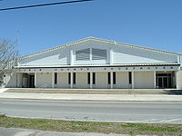 Dixie County Courthouse
Seal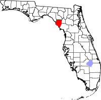
Location in the state of Florida
Florida's location in the U.S.Founded 25 April 1921 Seat Cross City Area
- Total
- Land
- Water
863.66 sq mi (2,237 km²)
704.01 sq mi (1,823 km²)
159.65 sq mi (413 km²), 18.49%Population
- (2010)
- Density
16,422
23/sq mi (9/km²)Website dixie.fl.gov Dixie County is a county located in the U.S. state of Florida. As of 2000, the population was 13,827. The U.S. Census Bureau 2005 estimate for the county is 14,647 [1]. Its county seat is Cross City, Florida[1].
Contents
History
Dixie County was created in 1921 from the southern portion of Lafayette County. "Dixie" is a common nickname for the Southern United States.
Geography
According to the 2000 census, the county has a total area of 863.66 square miles (2,236.9 km2), of which 704.01 square miles (1,823.4 km2) (or 81.51%) is land and 159.65 square miles (413.5 km2) (or 18.49%) is water.[2]
Adjacent counties
- Taylor County, Florida - northwest
- Lafayette County, Florida - north
- Gilchrist County, Florida - east
- Levy County, Florida - southeast
National protected area
Demographics
Historical populations Census Pop. %± 1930 6,419 — 1940 7,018 9.3% 1950 3,928 −44.0% 1960 4,479 14.0% 1970 5,480 22.3% 1980 7,751 41.4% 1990 10,585 36.6% 2000 13,827 30.6% 2010 16,422 18.8% [3][4] As of the census[5] of 2008, there were 14,957 people. In 2000 there were an estimated 5,205 households, and 3,659 families residing in the county. The population density was 20 people per square mile (8/km²). There were 7,362 housing units at an average density of 10 per square mile (4/km²). The racial makeup of the county was 88.80% White, 8.98% Black or African American, 0.46% Native American, 0.25% Asian, 0.03% Pacific Islander, 0.45% from other races, and 1.03% from two or more races. 1.80% of the population were Hispanic or Latino of any race.
There were 5,205 households out of which 27.40% had children under the age of 18 living with them, 54.90% were married couples living together, 10.60% had a female householder with no husband present, and 29.70% were non-families. 23.90% of all households were made up of individuals and 11.60% had someone living alone who was 65 years of age or older. The average household size was 2.44 and the average family size was 2.87.
In the county the population was spread out with 22.10% under the age of 18, 7.90% from 18 to 24, 26.60% from 25 to 44, 26.20% from 45 to 64, and 17.10% who were 65 years of age or older. The median age was 41 years. For every 100 females there were 113.90 males. For every 100 females age 18 and over, there were 117.20 males.
The median income for a household in the county was $26,082, and the median income for a family was $31,157. Males had a median income of $26,694 versus $17,863 for females. The per capita income for the county was $13,559. About 14.50% of families and 19.10% of the population were below the poverty line, including 23.90% of those under age 18 and 16.10% of those age 65 or over.
Cities and towns
Unincorporated
- Clara (shared with Taylor County)
- Eugene
- Hines
- Jonesboro
- Old Town
 Putnam Lodge, in Shamrock
- Shamrock Noted for its turpentine industry in the 1930s and 40s.
- Shired Island Noted for topping the list of America's most polluted beaches in 2008.
- Suwannee
- Yellow Jacket
Politics
In Presidential elections, Dixie County tends to vote Republican, although both Democrat Bill Clinton and Reform Party candidate Ross Perot did very well in 1992 and 1996.
Presidential elections results Year Republican Democratic Other 2008 71.2% 26.4% 2.4% 2004 68.8% 30.4% 0.8% 2000 57.8% 39.1% 3.1% 1996 36.8% 45.6% 17.6% 1992 32.0% 42.4% 25.5% 1988 59.8% 40.2% 0.0% Points of interest
- City Of Hawkinsville - sunken steamboat in the Suwannee River near Old Town, one of the Florida Underwater Archaeological Preserves
- Old Town Elementary School, now the Dixie County Cultural Center
- Old Town Methodist Church built in 1890 located behind the 1983 church building.
See also
References
- ^ "Find a County". National Association of Counties. http://www.naco.org/Counties/Pages/FindACounty.aspx. Retrieved 2011-06-07.
- ^ "Census 2000 U.S. Gazetteer Files: Counties". United States Census. http://www.census.gov/tiger/tms/gazetteer/county2k.txt. Retrieved 2011-02-13.
- ^ http://www.census.gov/population/www/censusdata/cencounts/files/fl190090.txt
- ^ http://factfinder2.census.gov/faces/tableservices/jsf/pages/productview.xhtml?pid=DEC_10_PL_QTPL&prodType=table
- ^ "American FactFinder". United States Census Bureau. http://factfinder.census.gov. Retrieved 2008-01-31.
External links
- Dixie County Advocate, local newspaper available in full-text for free from the Florida Digital Newspaper Library
- Dixie County Times, A recently started local newspaper managed by the former editor of the Dixie County Advocate.
- WZCC-AM 1240, Cross City's Community Radio Station.
Government links/Constitutional offices
- Dixie County Board of County Commissioners
- Dixie County Supervisor of Elections
- Dixie County Property Appraiser
- Dixie County Sheriff's Office
- Dixie County Tax Collector
Special districts
Judicial branch
- Dixie County Clerk of Courts
- Public Defender, 3rd Judicial Circuit of Florida serving Columbia, Dixie, Hamilton, Lafayette, Madison, Suwannee, and Taylor Counties
- Office of the State Attorney, 3rd Judicial Circuit of Florida
- Circuit and County Court for the 3rd Judicial Circuit of Florida
Tourism links

Taylor County Lafayette County 
Gilchrist County  Dixie County, Florida

Gulf of Mexico Levy County Municipalities and communities of Dixie County, Florida Towns 
Unincorporated
communitiesOld Town | Suwannee
Categories:- Florida counties
- Dixie County, Florida
- 1921 establishments in the United States
- Populated places established in 1921


Wikimedia Foundation. 2010.