- Hendry County, Florida
-
Hendry County, Florida 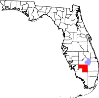
Location in the state of Florida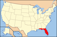
Florida's location in the U.S.Founded May 11, 1923 Seat La Belle Area
- Total
- Land
- Water
1,189.79 sq mi (3,082 km²)
1,152.53 sq mi (2,985 km²)
37.26 sq mi (97 km²), 3.13%Population
- (2010)
- Density
39,140
34/sq mi (13.11/km²)Website www.hendryfla.net Hendry County is a county located in the U.S. state of Florida. As of 2000, the population was 36,210. The U.S. Census Bureau 2007 estimate for the county is 39,611 [1]. Its county seat is La Belle[1]. The county comprises the Clewiston, Florida, Micropolitan Statistical Area.
Contents
History
Hendry County was created in 1923. It was named for Major Francis A. Hendry, one of the first settlers.
Geography
According to the 2000 census, the county has a total area of 1,189.79 square miles (3,081.5 km2), of which 1,152.53 square miles (2,985.0 km2) (or 96.87%) is land and 37.26 square miles (96.5 km2) (or 3.13%) is water.[2]
Adjacent counties
- Glades County, Florida - north
- Martin County, Florida - northeast
- Okeechobee County, Florida - northeast
- Palm Beach County, Florida - east
- Broward County, Florida - southeast
- Collier County, Florida - south
- Lee County, Florida - west
- Charlotte County, Florida - west
See also: List of counties bordering eight or more counties
Demographics
Historical populations Census Pop. %± 1930 3,492 — 1940 5,237 50.0% 1950 6,051 15.5% 1960 8,119 34.2% 1970 11,859 46.1% 1980 18,599 56.8% 1990 25,773 38.6% 2000 36,210 40.5% 2010 39,140 8.1% [3][4] As of the census[5] of 2000, there were 36,210 people, 10,850 households, and 8,137 families residing in the county. The population density was 31 people per square mile (12/km²). There were 12,294 housing units at an average density of 11 per square mile (4/km²). The racial makeup of the county was 66.08% White, 14.75% Black or African American, 0.80% Native American, 0.45% Asian, 0.03% Pacific Islander, 14.67% from other races, and 3.22% from two or more races. 39.59% of the population were Hispanic or Latino of any race.
In 2005 the population was 45.8% Latino, 39.9% non-Hispanic white, 13.4% African-American and 1.4% Native American. (Source=http://quickfacts.census.gov/qfd/states/12/12051.html)
In 2000 there were 10,850 households out of which 40.2% had children under the age of 18 living with them, 55.7% were married couples living together, 12.5% had a female householder with no husband present, and 25.0% were non-families. 18.6% of all households were made up of individuals and 7.3% had someone living alone who was 65 years of age or older. The average household size was 3.09 and the average family size was 3.44.
In the county the population was spread out with 30.0% under the age of 18, 13.3% from 18 to 24, 28.3% from 25 to 44, 18.3% from 45 to 64, and 10.1% who were 65 years of age or older. The median age was 30 years. For every 100 females there were 125.0 males. For every 100 females age 18 and over, there were 131.4 males.
The median income for a household in the county was $33,592, and the median income for a family was $34,902. Males had a median income of $25,896 versus $20,070 for females. The per capita income for the county was $13,663. About 16.9% of families and 24.1% of the population were below the poverty line, including 29.9% of those under age 18 and 15.0% of those age 65 or over.
In 2010 the population of Hendry Country was 39,140. The racial and ethnic composition of the population was 34.9% non-Hispanic white, 13.4% black or African American, 1.7% Native American, 0.7% Asian, 0.1% Pacific Islander, 0.1% non-Hispanic reporting some other race, 2.7% reprting two or more races and 49.2% Hispanic or Latino.[6]
Cities and towns
- Clewiston: largest and most populated incorporated area in the county
- Harlem (unincorporated): small community adjacent to Clewiston with a predominantely African American population
- LaBelle: the county seat
- Port La Belle (unincorporated): small community adjacent to Labelle
- Felda (unincorporated): small community with its own fire department and gas station
- Pioneer Plantatation (unincorporated): community with its own Volunteer Fire Department, Sheriff Sub Station, Post Office, Community Center, church and park. It also hosts many private businesses including a gas station, feed station, pub & grill.
- Montura Ranch Estates (unincorporated): one of the larger communities in the county
- Flaghole (unincorporated): small community adjacent to Montura Ranch Estates
- Ladeca Acres (unincorporated): small community also served by the Sheriff Sub Station and Fire Department located in Pioneer
Politics
Presidential elections results Year Republican Democratic Other 2008 52.9% 45.8% 1.3% 2004 58.9% 40.5% 0.6% 2000 58.3% 39.8% 1.9% See also
References
- ^ "Find a County". National Association of Counties. http://www.naco.org/Counties/Pages/FindACounty.aspx. Retrieved 2011-06-07.
- ^ "Census 2000 U.S. Gazetteer Files: Counties". United States Census. http://www.census.gov/tiger/tms/gazetteer/county2k.txt. Retrieved 2011-02-13.
- ^ http://www.census.gov/population/www/censusdata/cencounts/files/fl190090.txt
- ^ http://factfinder2.census.gov/faces/tableservices/jsf/pages/productview.xhtml?pid=DEC_10_PL_QTPL&prodType=table
- ^ "American FactFinder". United States Census Bureau. http://factfinder.census.gov. Retrieved 2008-01-31.
- ^ 2010 general demographic report for Hendry County
External links
Government links/constitutional offices
- Hendry County Board of County Commissioners official website
- Hendry County Economic Development Council
- Hendry County Supervisor of Elections
- Hendry County Property Appraiser
- Hendry County Sheriff's Office
- Hendry County Tax Collector
Special districts
Judicial branch
- Hendry County Clerk of Courts
- Public Defender, 20th Judicial Circuit of Florida serving Charlotte, Collier, Glades, Hendry, and Lee Counties
- Office of the State Attorney, 20th Judicial Circuit of Florida
- Circuit and County Court for the 20th Judicial Circuit of Florida
Tourism links
Museum and Library Resources
- The Caloosa Belle, the local newspaper for Hendry County, Florida fully and openly available in the Florida Digital Newspaper Library

Glades County Martin County and Okeechobee County Charlotte County and Lee County 
Palm Beach County  Hendry County, Florida

Collier County Broward County Municipalities and communities of Hendry County, Florida Cities 
CDPs Unincorporated
communityIndian reservations Categories:- Florida counties
- Hendry County, Florida
- 1923 establishments in the United States
- Micropolitan areas of Florida
- Populated places in the United States with Hispanic plurality populations


Wikimedia Foundation. 2010.