- Marília
-
Marília, São Paulo 

Flag
SealNickname(s): National Food Capital Coordinates: 22°12′50″S 49°56′45″W / 22.21389°S 49.94583°W Country Brazil State São Paulo Government – Mayor Mário Bulgarelli Area – Total 1,173 km2 (452.9 sq mi) Elevation 660 m (2,165 ft) Population (2009) – Total 225,938 Time zone Brasilia Time (UTC-3) – Summer (DST) Brasilia Summer Time (UTC-2) Website http://www.marilia.sp.gov.br Marília is a Brazilian city and municipality in the midwestern region of the state of São Paulo. Its distance from the state capital is 443 km (275 mi) by highway, 529 km (329 mi) by railway and 376 km (234 mi) in a straight line. It is located at latitude 22º 12'50 "south and longitude 49º 56'45" west, with an altitude of 675 meters. Population is approximately 225,938 inhabitants (2009 IBGE intercensal estimate)).[1]
Contents
History
 Panorama of the city from a rooftop.
 The city holds an annual festival of Japanese culture due to Brazil's large Japanese population.
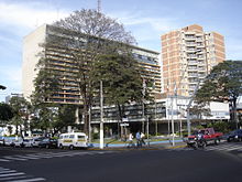 Marília's city hall.
In 1923, Antônio Pereira da Silva and his son José Pereira da Silva were the pioneers of the region, cleared land next to Feio and Peixe rivers. This land was named Alto Cafezal, or "High Coffee Plantation".
A city of Araraquara region deputy at the time, Bento de Abreu Sampaio Vidal held in 1926 a parcel of their assets.
In 1927, Colonel José Brás or Jose' da Silva Nogueira whose family had its origin in Itapetininga, arrived in Marilia. His family held 40% of the farm land named Bonfim, and the process of urbanization began with the allotment of this farm.
Companhia Paulista Railway had been advancing its tracks from São Paulo to get to the town of Lácio, and in accordance with its plan, the roads that were being opened at the branch were named in alphabetical order. The next branch should have its name beginning with the letter "M." "Maratona", "Mogúncio" and "Macau" were suggested, but Vidal was not satisfied with them. So, in one of his trips to Europe by ship, as he read Tomás Antônio Gonzaga's Marília de Dirceu, he chose the name Marília from the poetry book.
The city of Marília was created with this name by State Law No. 2161 on December 22, 1926, but remained as a borough of Cafelândia. In 1928, Marília was raised to the status of municipality by State Law No. 2320 of December 24. Its anniversary is celebrated on April 4, 1929.
At first, the economy of Marília was based on the cultivation of coffee, being replaced by cotton. Cotton proffits led to the installation of the first two industries in the city (two cotttonseed oil) in the mid-1930s. With the expansion of the industrialization in São Paulo state, rail and highways were also built, thereby linking Marilia to various regions of the state of São Paulo and northern Paraná.
In the 1940s the city established itself as a development of the West Paulista, when there was a large and growing urban population.
In the 1970s, there was a new industrial cycle in the city with the installation of new industries, specially food processing and welding. With the subsequent installation of several university courses, Marília attracted more people to the region, which accelerated the development of the city as a commercial & industrial hub.
Marília today has approximately 50 food industries in the area and it is known as the "National Capital of Food Processing."
Geography
Climate
The city's climate is tropical of altitude with the following characteristics: Average annual temperature: 20 °C Hottest month in January: 25.7 °C Coldest month in June: 15.2 °C Absolute Maximum: 39.4 °C Absolute minimum: -3.6 °C
Demography
 The Cathedral of Marília, which has a majority catholic poulation.
Data of Census of 2000: Total population: Metro: 189,719 Rural: 7623 Men: 96,502 Women: 100,840 Population density (inhabitants / km ²): 186.42 (2007) Infant mortality up to 1 year (per thousand): 15.57 Life expectancy (years): 74.37 Total Fertility rate: 2.21 Literacy rate: 95.35% Human Development Index (HDI): 0.821 HDI-R Income: 0.885 HDI-L Longevity: 0.822 HDI-E Education: 0.962
Government
 The Municipal government of Marília.
The current mayor is Mário Bulgareli (Democratic Labour Party), a former professor, first elected in 2004 and reelected in 2008, whose mandate is valid until 2012. The government receives little state funding do to high tax returns from the local tax income.
Education
The city has several courses distributed in their colleges and universities. There are three universities: two private (Unimar and UNIVEM) and one public (UNESP)) and three colleges, among them the school of medicine (Faculdade de Medicina de Marília).
Transport
 The front lobby of Marília's airport.
Marilia has one airport for regional and domestic flights named Frank Miloye Milenkowichi Airport. The city is crossed by 3 highways: the SP-294, the SP-333 and Rodovia Transbrasiliana (Transbrazilian Highway). As most cities in the region, Marilia no longer has passenger railway service.
Interesting facts
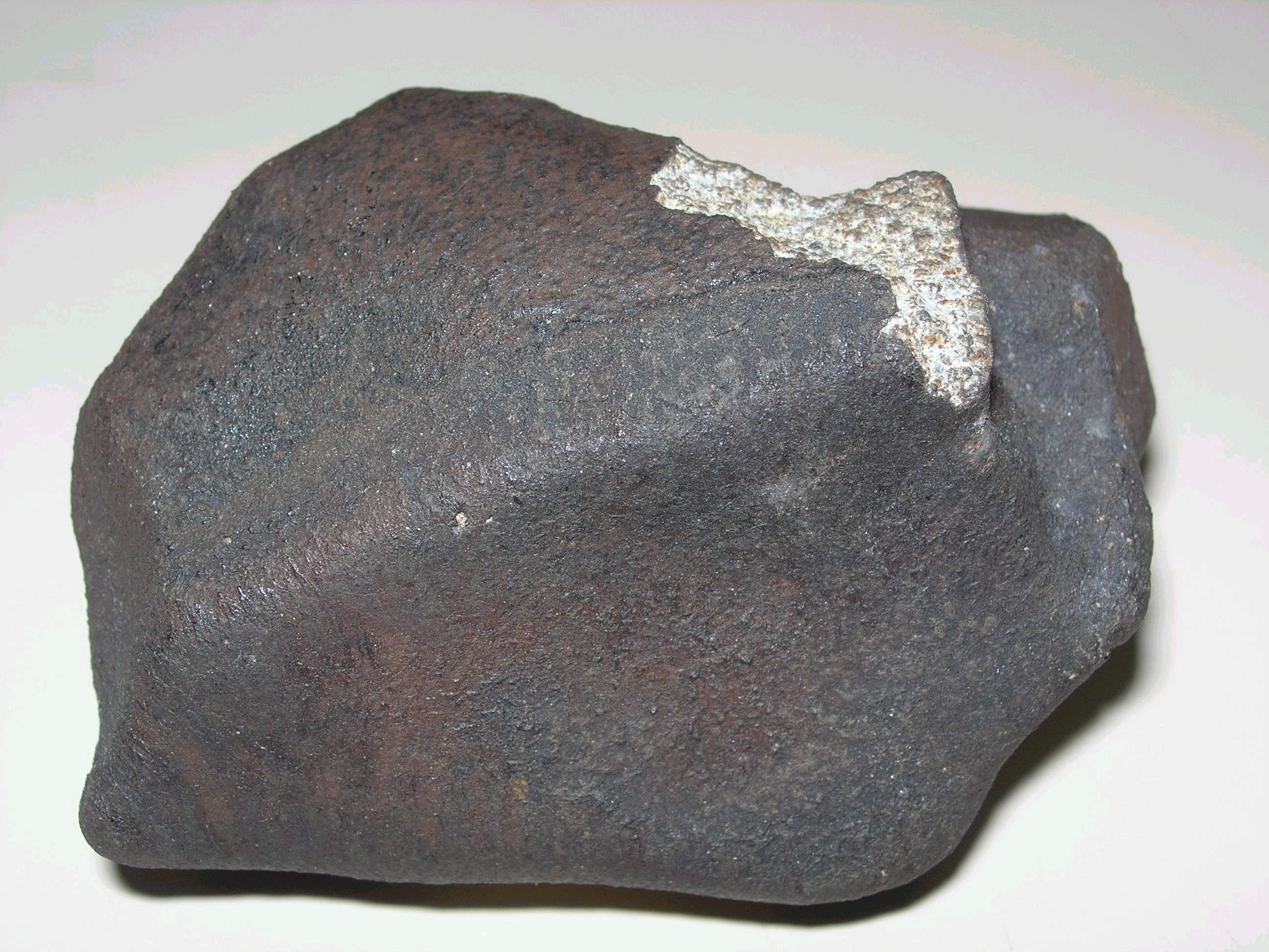
 Marília Meteorite fragment.
- Ethnic Background: Marilia's population is mainly formed by descendants of Luso-African Brazilians, Portuguese, Japanese, Italians, and Spaniards.
- The first Brazilian olympic medalist was from Marilia. Tetsuo Okamoto won a bronze medal in Helsinki in 1952, swimming 1500 m freestyle.
- The Southern Hemisphere's largest airline, TAM Brazilian Airlines, was founded in Marilia.
- Banco Bradesco was founded by Amador Aguiar on March 10, 1943, in Marilia, and it is the second largest private bank in Brazil today.
- A pre-historic crocodile, Mariliasuchus amarali, was found in Marilia and its name was a tribute to the city.
- On 5 October 1971, approximately at 5:00 pm, fell onto the city of Marília the last meteorite registered in the state of São Paulo: the Marília Meteorite. Seven fragments totaling about 2.5 kg were found, and the Marília Meteorite was subsequently classified as a chondrite H4.
Notable people
- Tetsuo Okamoto- swimmer
- Guilherme de Cássio Alves - football player
- Jurandir de Freitas- football player
- José Antônio Toffoli - lawyer and member of Supreme Federal Court (Brazil)
Coordinates: 22°12′50″S 49°56′45″W / 22.21389°S 49.94583°W
References
- (Portuguese) Marília's City Hall webpage
- (Portuguese) Marília's Municipality's Chamber
Categories:- Populated places in São Paulo (state)


Wikimedia Foundation. 2010.