- U.S. Route 209
-
U.S. Route 209

Route information Auxiliary route of US 9 Maintained by PennDOT and NYSDOT Length: 211.74 mi[2][3] (340.76 km) Existed: 1926[1] – present Major junctions South end:  PA 147 in Millersburg, PA
 I-81 near Tremont, PA

 I-476 / Penna. Tpk. near Weissport, PA
 I-80 in Stroudsburg, PA
 US 6 in Milford, PA
 I-84 in Matamoras, PA
US 6 in Port Jervis, NY
 NY 17 near Wurtsboro, NY

 US 44 / NY 55 near Kerhonkson, NY
North end: 
 US 9W / NY 199 in Ulster, NY
Location States: Pennsylvania, New York Counties: PA: Dauphin, Schuylkill, Carbon, Monroe, Pike
NY: Orange, Sullivan, UlsterHighway system United States Numbered Highways
Roads in Pennsylvania
List • Bannered • Divided • Replaced
Interstate • US • State • Legislative
Numbered highways in New York
Interstate • U.S. • N.Y.(former) • Reference • County
←  PA 208
PA PA 210  →
→←  NY 208
NY NY 210  →
→U.S. Route 209 is a 211.74-mile (340.76 km) long U.S. highway in the states of Pennsylvania and New York. Although the route is a spur of U.S. Route 9, US 209 never intersects US 9, making the connection via U.S. Route 9W instead. The southern terminus of the route is at Pennsylvania Route 147 in Millersburg, Pennsylvania. The northern terminus is at US 9W north of Kingston in Ulster, New York, where the road continues east as New York State Route 199. US 209 is one of the original highways in the 1926 U.S. Highway System plan. In Pennsylvania, the highway travels through the length of the Delaware Water Gap National Recreation Area. For part of its route in New York, US 209 runs alongside the defunct Delaware and Hudson Canal, which ran from Port Jervis to Kingston.[4]
US 209 was assigned as part of the establishment of the U.S. Highway System in 1926. The route was initially an intrastate highway contained entirely within the state of Pennsylvania. It began at an intersection with U.S. Route 11 (now US 22 / US 322) in Clarks Ferry (east of Duncannon) and ended at U.S. Route 6 in Milford.[1] US 209 was extended northward to U.S. Route 9W in Kingston, New York ca. 1935[5][6] and truncated to Millersburg, Pennsylvania, by 1938.[7] The portion of US 209 in New York north of Port Jervis was previously designated as US 6 from 1926 to 1928 and U.S. Route 6N from 1928 to 1933.[8]
US 209 was realigned onto limited-access highways in two locations along its routing during the 1960s. In Kingston, New York, construction began on a highway bypassing downtown to the northwest in the early 1960s. The highway began at US 209 south of the city and ended at US 9W north of downtown Kingston.[9][10] It opened to traffic as a realignment of US 209 by 1964.[11] In Stroudsburg, Pennsylvania, US 209 was moved onto a pair of new expressways south and east of the borough in the 1960s. US 209's former routing into Stroudsburg was redesignated as U.S. Route 209 Business.[12][13]
Contents
Route description
Lengths mi km PA 150.60[2] 242.37 NY 61.14[3] 98.40 Total 211.74 340.76 Although signed as a north–south route in both states for its entire length, 209 actually runs closer to east–west along its southern sections in Pennsylvania, only gently trending northward. Only at Stroudsburg does it begin to turn more to the north as it begins to follow the Delaware River. In New York it runs almost due northeast for its entire length.
Much of the highway in both states is a two-lane road, running through narrow mountain valleys, but there are expressway portions. In Pennsylvania, one near Stroudsburg connects concurrencies with PA 33 and Interstate 80; in New York, the north end is an expressway.
Millersburg to Jim Thorpe
From Millersburg, 209 runs alongside the Berry Mountain ridge into Schuylkill County, finally climbing a valley headwall near Tower City to intersect Interstate 81 on the other side, then continues on to Tremont. Beyond that, the generally straight route starts to curve a little more frequently into Pottsville, after which it follows the upper Schuylkill as it heads into lightly populated coal mining regions such as Port Carbon, Cumbola, New Philadelphia, and Middleport on its way to Tamaqua.
Several miles beyond, it crosses into Carbon County at Lansford, where it nestles between Nesquehoning, Sharpe and Pisgah mountains until it finally turns slightly to the north just before Nesquehoning. From there it follows the Nesquehoning Creek valley down to the Lehigh River, which 209 follows southeasterly through Jim Thorpe to Lehighton, the largest community along the route so far. At the south end of the town, it crosses the river and resumes its north-trending eastward course, which brings it presently to an interchange at Interstate 476, the Pennsylvania Turnpike's northeast extension.
Jim Thorpe to Matamoras
Once again, there are no major settlements along 209 as it heads through isolated valleys, this time with more agricultural use evident, into Monroe County and eventually to its absorption into Route 33. Business 209 leaves the road at Sciota for travelers wishing to bypass the expressway.
At the next exit, 209 takes its own short branch of expressway several miles to I-80 just outside Stroudsburg. It stays with the interstate through the city and neighboring East Stroudsburg, leaving to the north at one of the last exits before the state line.
From this point on, 209 runs much more northerly, reconnecting with Business 209 after several miles and taking its more firmly northeast bearing to eventually run along the Delaware River shortly after entering Pike County, its last in the state. This 20-mile (32 km) segment provides access to New Jersey via toll bridges at Dingman's Bridge and Milford Crossing, where US 206 comes to its northern end. Just beyond the latter bridge, the road reaches the eponymous community, where US 6 joins it.
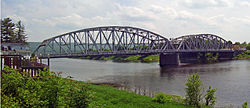 The Mid-Delaware Bridge, taking Route 209, along with Route 6, from Pennsylvania (right) into New York.
The two highways eventually start to run alongside Interstate 84, and development picks up as they approach Matamoras, the easternmost town in the state. After crossing under the interstate at its final Pennsylvania interchange, they form the borough's Main Street and cross into New York via the Mid-Delaware Bridge.
Mid-Delaware Bridge to Kingston
6 and 209 remain concurrent as they enter Port Jervis, but after less than a mile 209 strikes out to the northeast again on its own. After leaving the city, it enters the valley between the Shawangunk Ridge and the Catskill Plateau to its west, following the Neversink River until crossing it just prior to the hamlet of Cuddebackville. While the scenery is often spectacular, the settlements along the road are few, with only one blinker between Port Jervis and the Sullivan County line. At Wurtsboro, shortly after the NY 17 (future Interstate 86) interchange, the first light is finally reached.
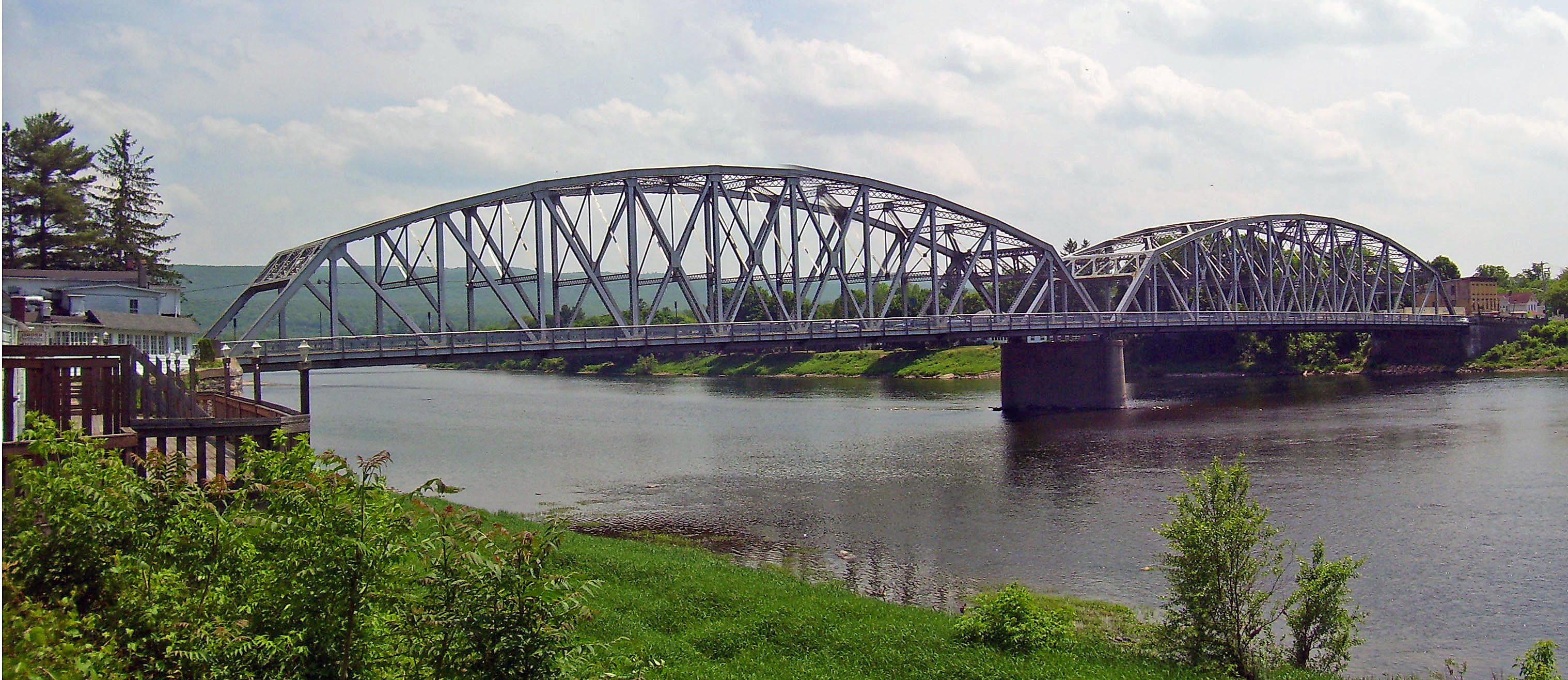
 The Delaware and Hudson Canal, seen from the highway here in New York's Sullivan County.
The road follows along some of the old Delaware and Hudson Canal, a National Historic Landmark and passes Wurtsboro Airport, out of the county into Ulster County, and eventually reaches another village, more bustling Ellenville. Just past it, in the hamlet of Napanoch, it picks up its first concurrency partner since route 6, NY 55. These two routes run together as Rondout Creek crosses and eventually runs alongside the road.
At another small hamlet, Kerhonkson, 55 leaves to join US 44 at the latter's western terminus. 44 and 55 offer access ultimately to Poughkeepsie, 30 miles (48 km) to the east. The valley begins to widen as another road, NY 213, joins for a mile before leaving at a blinker in downtown Stone Ridge. To the north, the road eventually widens into four lanes, then four divided lanes as the freeway begins just short of NY 28 just west of Kingston, just inside the Catskill Park.
After turning to the east again, 209 crosses the New York State Thruway but does not have an exit. The eastbound highway remains an expressway to the Kingston-Rhinecliff Bridge. Route 209, however, does not make it that far, becoming NY 199 where it crosses over US 9W.
History
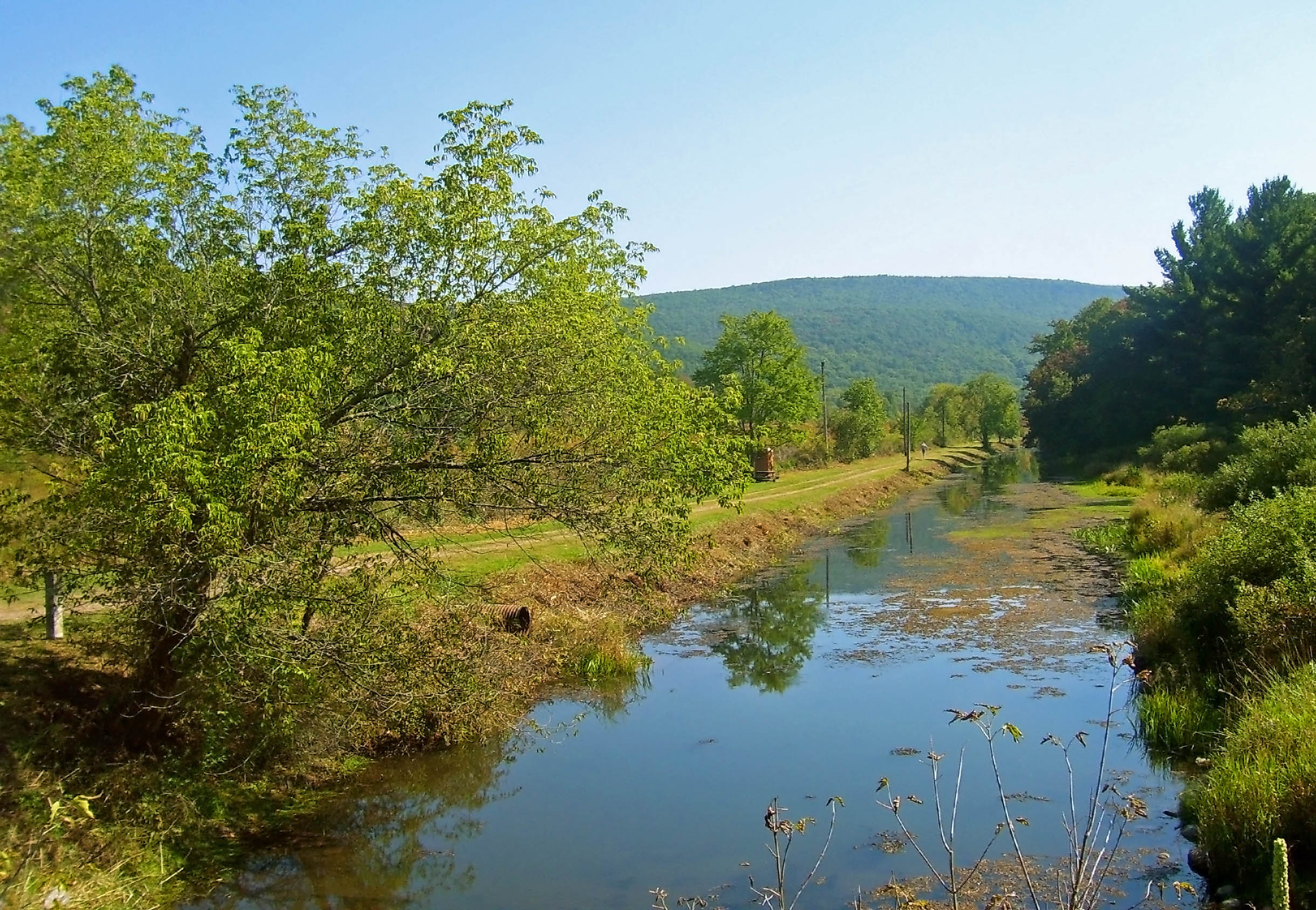
US 209 follows a straight, northeasterly course for almost its entire length within New York. This corridor, first used for long-distance transport by the Old Mine Road in colonial times and then the historic Delaware and Hudson Canal in the early 19th century, keeps it in the scenic valley between the Catskill Plateau and the Shawangunk Ridge. Except for the expressway at the northern end—the remnant of a much more ambitious plan to make the entire roadway one[14]—US 209 remains a two-lane rural road for much of its length in the state. The small communities along it are separated by great distances, and the road is a vital access link.
Pennsylvania
Before the advent of the U.S. Highway System, the alignment of US 209 in Pennsylvania carried several designations. On May 31, 1911, as part of the Sproul Road Bill,[15] the highway was assigned several Legislative Route numbers, each corresponding to a specific section of what would become US 209. The segment of the route from Duncannon north to Millersburg was part of Legislative Route 1. From Millersburg east to Pottsville, the highway was referenced as LR 199. Between Pottsville and Lehighton, the road carried LR 162. The section connecting Lehighton to Stroudsburg was given LR 164. Lastly, the segment from Stroudsburg to Milford was designated LR 167. The future US 6 / US 209 concurrency between Milford and the state line carried LR 8.[16]
The Pennsylvania portion of US 209 dates back to the formation of the U.S. Highway System in 1926. At the time, US 209 began at U.S. Route 11 (today US 22 / US 322) east of Duncannon and ended at U.S. Route 6 in Milford. Northeast of Milford, US 6 continued alone to Matamoras and across the Delaware River into New York.[1] Between Duncannon and Millersburg, US 209 was routed along the eastern banks of the Susquehanna River on what is now PA 147.[17] In the Poconos, US 209 ran along the modern U.S. Route 209 Business.[18] US 209 was extended northward to Kingston, New York, ca. 1935, creating an overlap with US 6 from Milford to the state line.[19][20] Meanwhile, US 209 was truncated by 1938 to end in Millersburg while the former routing of US 209 from Clarks Ferry to Millersburg became part of an extended U.S. Route 15.[21]
In the 1960s, the routing of US 209 was altered in the vicinity of Stroudsburg. At what is now the interchange between US 209 and U.S. Route 209 Business, US 209 broke from its previous alignment and continued east to a newly-built freeway (modern PA 33). PA 115, which was concurrent with US 209 from Brodheadsville to the freeway, continued south on the expressway while US 209 proceeded north. At the present-day split between PA 33 and US 209, US 209 followed the east fork, leaving the west fork with no designation. US 209 then followed its current alignment around Stroudsburg, running concurrent to Interstate 80 from exit 46A to exit 52 (now exits 304 and 309, respectively). It left I-80 at exit 52 and rejoined its previous alignment northeast of the borough. The old alignment through the borough was redesignated as US 209 Business. Part of US 209's new alignment east of Stroudsburg was previously part of PA 402.[22][23] By 1972, PA 115 was truncated to Brodheadsville and the length of the north–south freeway near Stroudsburg was designated PA 33, overlapping US 209 for roughly two miles.[24]
The National Park Service began the rule of no trucks along the Delaware Water Gap National Recreation Area on US 209 in August 1983. The bill was passed by President Ronald Reagan on the 1st of the month.[25] It was projected to begin in April 1983, but the bill was delayed 180 days.[26] In 1995, commercial vehicles began running in the area again, as long as they pay fee at two toll booths, one in Bushkill and one just south of downtown Milford.[27] Prices began in 1995 and charged from $3.00 for 2-axles to $18.00 for 5 or more axles.[28]
 Signage of U.S. Route 209 closed at Route 739 in Dingmans Ferry in November 2011.
After rains from Hurricane Irene in August and Tropical Storm Lee in September, the grounds under the highway were saturated and after a landslide occurred on October 21, the National Park Service closed Route 209 between Route 739 in Dingmans Ferry and the North Contact Station just south of the Milford-Montague Bridge. Due to the approach of winter, the National Park Service can only get engineering done with outside contractors.[29] The detour set in place takes motorists across the Dingmans Ferry Bridge and Old Mine Road or via Route 739 and Route 2001 (Milford Road) to access Milford.[30] Delaware Township has asked the Pennsylvania Department of Transportation to keep Route 739 near Route 209 clear of snow, due to the importance of the intersection. However, Route 209 is slated to be closed through the winter and likely into summer of 2012.[29]
Marshalls Creek Bypass
The area where US 209 intersects PA 402 has been plagued by traffic issues for over a decade. In 1990, studies were launched to investigate the possibility of constructing a bypass of the intersection, located in the hamlet of Marshalls Creek in Middle Smithfield Township. Traffic at the junction had become large enough to cause the town to consider constructing a bypass in the area. The proposal for a bypass was passed in October 2004 and was projected to cost $70 million.[31] The bypass will be 3.5 miles (5.6 km) in length and will have an asphalt surface. There will be nine new signalized intersections: seven on US 209, one on PA 402, and one on River Road (SR 2028). The constructors expect that during the six-year project, traffic will remain the same on US 209, and no detours of PA 402 and US 209 are planned. The first of three phases of construction was completed in mid-2007 and cost $14.2 million. Phase two, projected to start in late 2007, is projected to cost $17 million.[32]
New York
In the mid-1920s, a highway connecting Pennsylvania Route 7 at Port Jervis to NY 10 (now US 9W) in Kingston via Wurtsboro and Napanoch was designated as NY 50.[33][34] In 1927, the first official route log published by AASHO included the NY 50 alignment as part of US 6. A year later, AASHO modified the definition of US 6, placing the route along a new alignment further south in the state. In turn, the Port Jervis – Kingston highway was redesignated US 6N. The designation remained in place until 1933, when it was removed due to a conflict with another US 6N in Pennsylvania.[35] The former US 6N was then redesignated as NY 279.[36] Ca. 1935, the road changed designations for the final time, rejoining the U.S. Highway System and becoming part of an extended US 209.[36][37]
 US 209's exit from NY 17 (Future I-86)
The portion of US 209 south of Kingston has remained virtually unchanged, with the exception of local realignments. Two such reroutings were in the vicinity of the hamlets of Spring Glen and Napanoch, where US 209 was initially routed on Phillipsport Road and Main Street, respectively.[37] US 209 was realigned to bypass Napanoch ca. 1962,[38][39] by which time construction had begun on a bypass of Spring Glen.[40] It was opened to traffic by 1964.[41]
US 209 initially entered Kingston on what is now Old Route 209 and Hurley Avenue. Within the city, the route followed North Front Street, and Clinton, Albany, and Ulster Avenues to a terminus at East Chester Street (US 9W). At the time, US 209 had an overlap with NY 32 from Broadway to Flatbush Avenue.[42] Construction began in the early 1960s on a new limited-access highway bypassing downtown Kingston to the northwest. The highway began at US 209 south of Hurley and ended at an interchange with US 9W north of Kingston and south of Lake Katrine, where it met the western terminus of NY 199.[40][43] The new route was completed by 1964 and became a realignment of US 209.[44]
Major intersections
State County Location Mile[2][45] Destinations Notes Pennsylvania Dauphin Millersburg 0.00 PA 147 (Market Street)0.45  PA 25 (Johnson Street)
Western terminus of PA 25 Elizabethville 8.06  PA 225 (Market Street)
Schuylkill Tower City 22.87  PA 325 (10th Street)
Eastern terminus of PA 325 Tremont Township 29.04 I-81 (American Legion Memorial Highway)Exit 107 (I-81) Tremont 31.76  PA 125 north (Spring Street)
South end of PA 125 concurrency 32.05 PA 125 south (Swatara Avenue)North end of PA 125 concurrency Newtown 34.53 PA 25 (West Pine Street)Eastern terminus of PA 25 Marlin 40.66  PA 901 west (Minersville-Pottsville Highway)
South end of PA 901 concurrency Pottsville 41.52 PA 901 east (Gordon Nagle Trail)North end of PA 901 concurrency 44.33  PA 61 (Claude A. Lord Boulevard)
Tamaqua 59.90  PA 309 (North Railroad / Center Street)
Carbon Lansford 65.20  PA 902 (Spring Garden Street)
Western terminus of PA 902 Nesquehoning 69.68  PA 54 (Stock Street)
Eastern terminus of PA 54 71.27  PA 93 (Hunter Street)
Southern terminus of PA 93 Jim Thorpe 74.21  PA 903 (River Street)
Western terminus of PA 903 Lehighton 78.47  PA 443 (Blakeslee Blvd)
Eastern terminus of PA 443 Weissport 78.79  PA 248 (Parryville Bypass)
Western terminus of PA 248 Weissport East 80.54 I-476 / Penna. Tpk.Exit 74 (I-476 / Turnpike) Monroe Polk Township 90.98  PA 534 (Merriwill Lane)
Eastern terminus of PA 534 Brodheadsville 96.42  PA 115
Eastern terminus of PA 115 96.69  PA 715
Southern terminus of PA 715 Hamilton Township 100.96 


 US 209 Bus. (Hamilton East Road)
Southern terminus of US 209 Business South end of freeway section 101.88  PA 33 south – Bethlehem, Easton
US 209 joins PA 33 northbound and leaves southbound 103.55 Snydersville (Manor Drive) 104.27 PA 33 north – BartonsvillePA 33 leaves northbound and joins southbound Stroud Township 108.43 I-80 west – HazletonUS 209 joins I-80 northbound and leaves southbound, I-80 exit 304 Stroudsburg 108.80
US 209 Bus. (Main Street)I-80 exit 305 109.44 Dreher Avenue Westbound exit and eastbound entrance, I-80 exit 306 109.90 
 PA 611 (Park Avenue) to PA 191
Eastbound exit and entrance, I-80 exit 307 110.40 PA 191 (Broad Street)Westbound exit and entrance, I-80 exit 307 East Stroudsburg 111.11 East Stroudsburg (Prospect Street) I-80 exit 308 Smithfield Township 112.43 I-80 – New York CityUS 209 leaves I-80 northbound and joins southbound, I-80 exit 309 North end of freeway section 112.70  PA 447 (Independence Road)
Southern terminus of PA 447 116.25
US 209 Bus.Northern terminus of US 209 Business 116.37  PA 402 (Resica Falls Road)
Southern terminus of PA 402 Hollow Road (SR 2023) Former northern terminus of PA 945 Pike Bushkill Township Bushkill Falls Road (SR 2001) Dingmans Ferry 135.67  PA 739 (Bethany and Dingmans Choice Turnpike)
Southern terminus of PA 739 Dingman Township 143.07  US 206
Northern terminus of US 206 Milford 143.91 US 6 west (Milford Street)Southern terminus of overlap Westfall Township 149.28 I-84Exit 53 (I-84) Delaware Drive (SR 1017) Former eastern terminus of PA 963 Delaware River 150.60
0.00Mid-Delaware Bridge
Pennsyvlania – New York state lineNew York Orange Port Jervis 0.61 
 NY 42 / NY 97
Southern terminus of NY 42 and NY 97 0.86 US 6 eastNorthern terminus of US 6 / US 209 overlap Deerpark 8.91  NY 211
Hamlet of Cuddebackville; western terminus of NY 211 Sullivan Mamakating 17.60 NY 17Exit 113 (NY 17) Ulster Ellenville 30.80  NY 52
NY 52NY 52 intersects at both Canal and Center streets Wawarsing 32.54 NY 55 westHamlet of Napanoch; southern terminus of US 209 / NY 55 overlap 36.92 US 44 / NY 55 eastNorthern terminus of US 209 / NY 55 overlap; western terminus of US 44 Marbletown 47.59  NY 213 east
Southern terminus of US 209 / NY 213 overlap 48.43 NY 213 westHamlet of Stone Ridge; northern terminus of US 209 / NY 213 overlap Ulster 57.51 

 NY 28 to I-87 / Thruway
Interchange; access to I-87 / Thruway at exit 18 via NY 28 eastbound 61.14 US 9WInterchange 61.14 NY 199Continuation beyond US 9W 1.000 mi = 1.609 km; 1.000 km = 0.621 mi US 209 Business

U.S. Route 209 Business
Location: Stroudsburg, Pennsylvania Existed: 1962–present U.S. Route 209 Business is a business route of U.S. Route 209 in eastern Pennsylvania. The southern terminus of the route is at US 209 in the Hamilton Township hamlet of Sciota. The northern terminus is at US 209 in the Smithfield Township hamlet of Marshalls Creek. US 209 Business is the lone auxiliary route of US 209 in Pennsylvania.
US 209 Business was US 209 until 1962 when US 209 was moved onto Interstate 80 between Marshalls Creek and present-day I-80 exit 305 in Stroudsburg, allowing US 209 Business to occupy the former alignment of US 209. US 209 Business was extended southward to its current southern terminus in 1964 when US 209 was relocated onto a bypass paralleling its former alignment between Stroudsburg and Sciota.
References
- ^ a b c United States Department of Agriculture (November 11, 1926). United States System of Highways (Map).
- ^ a b c Calculated using DeLorme Street Atlas USA software
- ^ a b "2007 Traffic Data Report for New York State" (PDF). New York State Department of Transportation. July 25, 2008. https://www.nysdot.gov/divisions/engineering/technical-services/hds-respository/NYSDOT_Traffic_Data_Report_2007.pdf. Retrieved June 16, 2009.
- ^ Haufrecht, Herbert; Norman Studer and Norman Cazden (1982). Folk Songs of the Catskills. SUNY Press. ISBN 0873955803.
- ^ Gulf Refining Co. (1934). Rand McNally Official Road Map of New Jersey (Map).
- ^ Sun Oil Company (1935). Road Map & Historical Guide – New York (Map). Cartography by Rand McNally and Company.
- ^ Thibodeau, William A. (1938). The ALA Green Book (1938–39 ed.). Automobile Legal Association.
- ^ Richard F. Weingroff. "U.S. 6 – The Grand Army of the Republic Highway". Federal Highway Administration. http://www.fhwa.dot.gov/infrastructure/us6.htm. Retrieved June 16, 2009.
- ^ Gulf (1960). New York and New Jersey Tourgide Map (Map). Cartography by Rand McNally and Company.
- ^ Sinclair (1962). New York and Metropolitan New York (Map). Cartography by Rand McNally and Company.
- ^ United States Geological Survey (1980). Kingston West Quadrangle – New York – Ulster Co. (Map). 1:24,000. 7.5 Minute Series (Topographic). http://www.nysgis.state.ny.us/gisdata/quads/drg24/usgspreview/index.cfm?code=o41074h1. Retrieved June 16, 2009.
- ^ Pennsylvania Department of Highways (1960). Official Map of Pennsylvania (Map). ftp://ftp.dot.state.pa.us/public/pdf/BPR_pdf_files/Maps/Statewide/Historic_OTMs/1960fr.pdf. Retrieved June 15, 2009.
- ^ Pennsylvania Department of Highways (1970). Official Map of Pennsylvania (Map). ftp://ftp.dot.state.pa.us/public/pdf/BPR_pdf_files/Maps/Statewide/Historic_OTMs/1970fr.pdf. Retrieved June 15, 2009.
- ^ Anderson, Steve. "Catskill Expressway (US 209 and NY 199)". NYCRoads. http://www.nycroads.com/roads/catskill/. Retrieved March 30, 2011.
- ^ "Department of Highways". Pennsylvania Historical and Museum Commission. http://www.phmc.state.pa.us/bah/DAM/rg/sd/r12sd.htm#constructionbureau. Retrieved 2007-06-25.
- ^ Breuker and Kessler, Co. (1911) (PDF). Map of Pennsylvania showing state highways as adopted under the Sproul Road Bill (Map). Cartography by Ralph C. Benedict and Charles W. Erisman. ftp://ftp.dot.state.pa.us/public/pdf/BPR_pdf_files/Maps/Statewide/Historic_OTMs/1911.pdf. Retrieved June 15, 2009.
- ^ Automobile Blue Book (central Pennsylvania). 3. Automobile Blue Book Inc. 1929. p. 45. http://www.broermapsonline.org/members/NorthAmerica/UnitedStates/Midatlantic/Pennsylvania/bluebook1929_037.html. Retrieved June 15, 2009.
- ^ Pennsylvania Department of Highways (1930). Tourist Map of Pennsylvania (Map). ftp://ftp.dot.state.pa.us/public/pdf/BPR_pdf_files/Maps/Statewide/Historic_OTMs/1930fr.pdf. Retrieved June 15, 2009.
- ^ Gulf Refining Co. (1934). Rand McNally Official Road Map of New Jersey (Map).
- ^ Sun Oil Company (1935). Road Map & Historical Guide – New York (Map). Cartography by Rand McNally and Company.
- ^ Thibodeau, William A. (1938). The ALA Green Book (1938–39 ed.). Automobile Legal Association.
- ^ Pennsylvania Department of Highways (1960). Official Map of Pennsylvania (Map). ftp://ftp.dot.state.pa.us/public/pdf/BPR_pdf_files/Maps/Statewide/Historic_OTMs/1960fr.pdf. Retrieved June 15, 2009.
- ^ Pennsylvania Department of Highways (1970). Official Map of Pennsylvania (Map). ftp://ftp.dot.state.pa.us/public/pdf/BPR_pdf_files/Maps/Statewide/Historic_OTMs/1970fr.pdf. Retrieved June 15, 2009.
- ^ PennDOT (1972) (PDF). Monroe County Map (Map). ftp://ftp.dot.state.pa.us/public/pdf/BPR_PDF_FILES/Maps/Type_10_GHS_Historical_Scans/Monroe_1972.pdf. Retrieved 2007-07-14.
- ^ "Truck Ban Begins On US 209". Philadelphia Inquirer. August 2, 1983. http://nl.newsbank.com/nl-search/we/Archives?p_product=PI&s_site=philly&p_multi=PI&p_theme=realcities&p_action=search&p_maxdocs=200&p_topdoc=1&p_text_direct-0=0EB295EE83159EE1&p_field_direct-0=document_id&p_perpage=10&p_sort=YMD_date:D&s_trackval=GooglePM. Retrieved 2007-07-14.
- ^ "Truck ban on US 209 is delayed for 180 days". The Philadelphia Inquirer. April 21, 1983. http://nl.newsbank.com/nl-search/we/Archives?p_product=PI&s_site=philly&p_multi=PI&p_theme=realcities&p_action=search&p_maxdocs=200&p_topdoc=1&p_text_direct-0=0EB2953556A01D10&p_field_direct-0=document_id&p_perpage=10&p_sort=YMD_date:D&s_trackval=GooglePM. Retrieved 2007-07-14.
- ^ Bill would allow trucks on Route 209 in the Gap
- ^ Commercial Vehicle Fees on Rt. 209 PA
- ^ a b Brelje, Beth (November 16, 2011). "Route 209 detour in Pike County in place for at least 6 months". The Pocono Record. http://www.poconorecord.com/apps/pbcs.dll/article?AID=/20111116/NEWS/111160320. Retrieved 17 November 2011.
- ^ Becker, Peter (November 14, 2011). "Rt. 209 closure to last into Spring". The News Eagle. http://www.neagle.com/mobiletopstories/x745433489/Rt-209-closure-to-last-into-Spring. Retrieved 17 November 2011.
- ^ "Monroe County, Pa., bypass gets approval". The Morning Call. October 25, 2004. http://www.accessmylibrary.com/premium/0286/0286-7132396.html. Retrieved 2007-07-14.
- ^ "Project Fact Sheet". PennDOT. http://www.marshallscreekbypass.com/factsheet.cfm. Retrieved 2007-07-14.
- ^ "New York's Main Highways Designated by Numbers". The New York Times: p. XX9. December 21, 1924.
- ^ Automobile Blue Book: Standard Touring Guide of America. 1 (1926 ed.). Chicago: Automobile Blue Books, Inc.
- ^ Weingroff, Richard F. (July 27, 2009). "U.S. 6 – The Grand Army of the Republic Highway". Highway History. Federal Highway Administration. http://www.fhwa.dot.gov/infrastructure/us6.cfm. Retrieved July 20, 2010.
- ^ a b Gulf Refining Co. (1934). Rand McNally Official Road Map of New Jersey (Map).
- ^ a b Sun Oil Company (1935). Road Map & Historical Guide – New York (Map). Cartography by Rand McNally and Company.
- ^ Sunoco (1961). New York and Metropolitan New York (Map). Cartography by H.M. Gousha Company (1961–62 ed.).
- ^ Esso (1962). New York with Sight-Seeing Guide (Map). Cartography by General Drafting.
- ^ a b Sinclair Oil Corporation (1962). New York and Metropolitan New York (Map). Cartography by Rand McNally and Company.
- ^ Sinclair Oil Corporation (1964). New York and Metropolitan New York (Map). Cartography by Rand McNally and Company.
- ^ Thibodeau, William A. (1938). The ALA Green Book (1938–39 ed.). Automobile Legal Association.
- ^ Gulf Oil Company (1960). New York and New Jersey Tourgide Map (Map). Cartography by Rand McNally and Company.
- ^ United States Geological Survey (1980). Kingston West Quadrangle – New York – Ulster Co. (Map). 1:24,000. 7.5 Minute Series (Topographic). http://www.nysgis.state.ny.us/gisdata/quads/drg24/usgspreview/index.cfm?code=o41074h1. Retrieved June 15, 2009.
- ^ "2008 Traffic Volume Report for New York State" (PDF). New York State Department of Transportation. June 16, 2009. pp. 187–188. https://www.nysdot.gov/divisions/engineering/technical-services/hds-respository/NYSDOT%20TVR%202008%20by%20Route.pdf. Retrieved February 1, 2010.
External links
- PA Route Log - US 6/209 concurrency
- PA Route Log - US 209
- Mile by Mile travel guide
- Alps' Roads – U.S. Route 209
- New York Routes – U.S. Route 209
- New York State Highway Termini – U.S. Route 209
Roads in the Susquehanna Valley Beltway Interstate Highways U.S. Routes Limited-access Pennsylvania Routes Other Pennsylvania Routes PA 17 · PA 23 · PA 25 · PA 34 · PA 39 · PA 72 · PA 74 · PA 94 · PA 114 · PA 117 · PA 147 · PA 174 · PA 225 · PA 230 · PA 233 · PA 235 · PA 241 · PA 274 · PA 325 · PA 340 · PA 341 · PA 343 · PA 419 · PA 441 · PA 443 · PA 462 · PA 465 · PA 501 · PA 533 · PA 641 · PA 645 · PA 696 · PA 722 · PA 743 · PA 772 · PA 849 · PA 850 · PA 897 · PA 934 · PA 944 · PA 997 · PA 999Other Quadrant Routes SR 3015 · SR 3020Other notable roads Transportation infrastructure of the Lehigh Valley Interstates U.S. Routes Pennsylvania Routes New Jersey Routes County Routes Named roads/streets Bridges Albertus L. Meyers Bridge · Hill to Hill Bridge · Philip J. Fahy Memorial Bridge · Minsi Trail Bridge · Easton–Phillipsburg Toll Bridge · Northampton Street Bridge · Interstate 78 Toll Bridge
Tunnels Public transportation Lehigh and Northampton Transportation Authority (Bethlehem Loop) · Trans-Bridge Lines · NJ Transit
Airports Waterways Rail Highway transportation of Pike County, Pennsylvania Interstate Highways U.S. Highways State Routes State Route 191- State Route 390- State Route 402- State Route 434- State Route 447- State Route 507- State Route 590- State Route 739- State Route 963-
Quadrant Routes QR 2001 (PA 962)
Categories:- U.S. Highways in Pennsylvania
- Roads in the Harrisburg, Pennsylvania area
- U.S. Highways in New York
- Transportation in Orange County, New York
- Transportation in Ulster County, New York
- Limited-access roads in New York
- Transportation in Sullivan County, New York


Wikimedia Foundation. 2010.