- U.S. Route 460
Infobox U.S. Route
article_route=460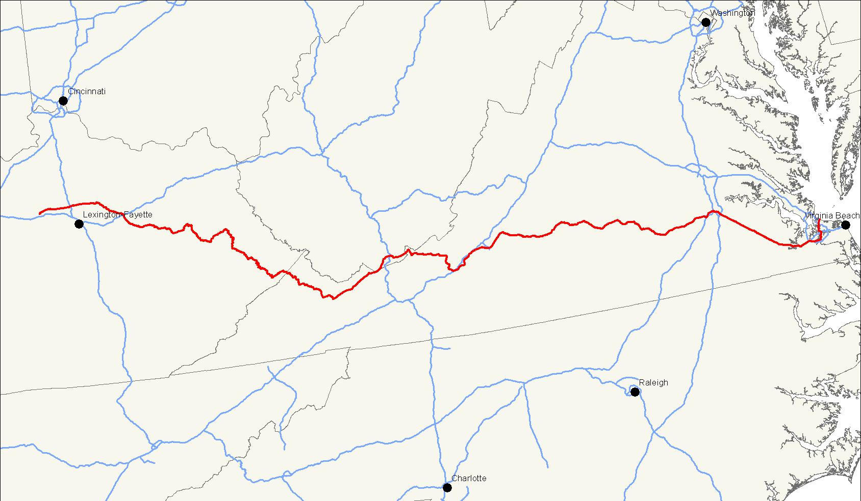
length_mi=655
length_round=0
length_ref=
yrcom=1933
direction_a=West
from=Jct|state=KY|US|60|US|421 in Frankfort, KY
junction=
direction_b=East
to=Jct|state=VA|US|60 in Norfolk, VA
spur_of=60U.S. Route 460 is a spur of
U.S. Route 60 . It currently runs for 655 miles (1,054 km) fromNorfolk, Virginia atU.S. Route 60 at Ocean View toFrankfort, Kentucky atU.S. Route 60 . It passes through the states ofVirginia ,West Virginia , andKentucky . It goes through the cities ofNorfolk, Virginia ,Portsmouth, Virginia ,Suffolk, Virginia ,Petersburg, Virginia ,Lynchburg, Virginia ,Roanoke, Virginia ,Blacksburg, Virginia ,Princeton, West Virginia ,Bluefield, West Virginia , andFrankfort, Kentucky .The section from
Interstate 81 atChristiansburg, Virginia toU.S. Highway 23 inPikeville, Kentucky is Corridor Q in theAppalachian Development Highway System . Currently the portion improved under this system is unfinished betweenGrundy, Virginia and Pikeville.US 460 is a major east-west highway in Virginia. It is a major thouroughfare through southern
Hampton Roads and connects the area to Petersburg. US 460 connects Lynchburg to Roanoke. US 460 is paired withUS 221 between Bedford and Roanoke and withUS 11 between Salem and Christiansburg. It is also the primary east-west roadway in the northern part ofSouthwest Virginia between Christiansburg and the Kentucky border; although several miles near Bluefield pass through West Virginia.Route description
Kentucky
US 460 begins by continuing straight where US 60 east turn right a few miles east of downtown Frankfort. It is a twisty two-lane road to Georgetown, KY, where it intersects
US 62 andI-75 . It proceeds to Paris, KY, where it intersectsUS 27 andUS 68 . The next major intersection is with I-64 in Mount Sterling, KY. It proceeds through several small towns before reaching Pikeville, KY. From there it enters West Virginia.Virginia and West Virginia
History
US 460 once ended in
St. Louis, Missouri after crossing the MacArthur Bridge. Between St. Louis and Frankfort, it was a major highway in the pre-Interstate era, passing throughEvansville, Indiana andLouisville, Kentucky .Interstate 64 has supplanted most of old US 460 as a more direct route, and old US 460 has become parts ofIllinois Route 15 ,Illinois Route 142 ,Illinois Route 14 , State Road 66, State Road 62, and US 60 whereInterstate 64 has not supplanted it even as a state highway in the greater Louisville area.###@@@KEYEND@@@###
Wikimedia Foundation. 2010.