- Northmoor, Oxfordshire
-
Coordinates: 51°43′23″N 1°23′31″W / 51.723°N 1.392°W
Northmoor 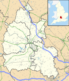
 Northmoor
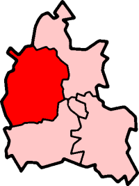
Northmoor shown within OxfordshirePopulation 363 (2001 census)[1] OS grid reference SP4202 Parish Northmoor District West Oxfordshire Shire county Oxfordshire Region South East Country England Sovereign state United Kingdom Post town Witney Postcode district OX29 Dialling code 01865 Police Thames Valley Fire Oxfordshire Ambulance South Central EU Parliament South East England UK Parliament Witney List of places: UK • England • Oxfordshire Northmoor is a village and civil parish in West Oxfordshire, 6 miles (9.7 km) west of Oxford and almost 6 miles (9.7 km) southeast of Witney. Northmoor is in the valley of the River Thames, which bounds the parish to the east and south, and is close to the River Windrush which forms part of the parish's western boundary.
Contents
History
In the 11th century the place was known simply as More or Moor, meaning marsh. The prefix North was added by the 13th century, distinguishing the village from Southmoor, then in Berkshire, on the other side of the Thames.[2]
In 1059 land at Northmoor was granted by Edward the Confessor to St Denis Abbey in Paris.[3] Northmoor was created a separate parish in the 12th century, and a parish church dedicated to Saint Denys was then built.[4] Nothing survives of this original building except the font, which is Norman.[5] The earliest part of the present Church of England parish church on the same site[6] is the Early English Gothic chancel, which was built in the 13th century.[5] The chancel's east window is a set of three lancets and it has another lancet in its south wall.[5] The present nave and north and south transepts were built early in the 14th century.[5] The bell tower over the west bay of the nave was added in the 15th century.[5] The Gothic Revival architect C.C. Rolfe carried out a sensitive restoration of building in 1887.[4] The tower has a ring of six bells.
Rectory Farm was built in the 16th century, and a date-stone over the entrance records alterations in 1629.[7] The farm has also a half-timbered granary on stone stooks and a timber-framed dovecote, both from the 16th or 17th centuries.[7]
There used to be a flash lock on the Thames on the southern edge of the parish at Hart's Weir, also known as Ridge's Weir. In 1879 Hart's Weir Footbridge was built at the site, and in 1896 the weir and flash lock were replaced with a pound lock, Northmoor Lock, southeast of the village.
There is a proposal to use 200 acres (0.81 km2) of Northmoor parish for gravel extraction.[8]
Amenities
Northmoor has a public house, the Red Lion[9] and a village hall.
Northmoor is in a part of the Upper Thames Valley that has been designated an Environmentally Sensitive Conservation Area.[citation needed] There are many bridleways and footpaths. The village is on the Oxfordshire cycle network. Pleasure boats can be hired locally.[citation needed]
The nearest village store and post office are 1.5 miles (2.4 km) away in Standlake. Stagecoach in Oxfordshire routes 18 and 18A give Northmoor an hourly link with Oxford, Eynsham, Stanton Harcourt, Aston and Bampton.[10] There is no evening or Sunday service.[10]
References
- ^ "Area selected: West Oxfordshire (Non-Metropolitan District)". Neighbourhood Statistics: Full Dataset View. Office for National Statistics. http://neighbourhood.statistics.gov.uk/dissemination/viewFullDataset.do;jsessionid=ac1f930b30d73ec370d62b6f4444bc01a4cf1c94ffa8?instanceSelection=03070&productId=779&$ph=60_61&datasetInstanceId=3070&startColumn=1&numberOfColumns=8&containerAreaId=790500&nsjs=true&nsck=true&nssvg=true&nswid=1020. Retrieved 30 March 2010.
- ^ Crossley & Currie (1996), pp150-156
- ^ Crossley & Currie (1996), pp 156-158
- ^ a b Crossley & Currie, 1996, pages 166-70
- ^ a b c d e Sherwood & Pevsner, 1974, page 722
- ^ Oxfordshire Churches & Chapels website: Northmoor
- ^ a b Sherwood & Pevsner, 1974, page 723
- ^ Stonehenge Farm
- ^ Red Lion Northmoor
- ^ a b Stagecoach in Oxfordshire, routes 18/18A
Sources
- Crossley, Alan; Currie, C.R.J., eds (1996). Victoria County History: A History of the County of Oxford, Volume 13: Bampton Hundred (Part One). pp. 150–171. http://www.british-history.ac.uk/report.aspx?compid=15970.
- Sherwood, Jennifer; Pevsner, Nikolaus (1974). The Buildings of England: Oxfordshire. Harmondsworth: Penguin Books. pp. 722–723. ISBN 0 14 071045 0.
External links
Oxfordshire • County Council elections • District Council elections • Witney County Constituency Towns Burford (Signet, Upton) • Carterton • Charlbury • Chipping Norton (Southcombe) • Witney (Cogges, Madley Park) • Woodstock (Hensington, Old Woodstock)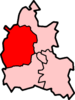
Large Villages Aston, Cote, Shifford and Chimney (Aston, Cote, Shifford, Chimney) • Bampton (Lower Haddon, Weald) • Brize Norton • Ducklington • Enstone (Church Enstone, Neat Enstone, Chalford, Cleveley, Fulwell, Gagingwell, Lidstone, Radford) • Eynsham (Barnard Gate) • Freeland • Hailey (New Yatt) • Hanborough (Church Hanborough, Long Hanborough) • Milton-under-Wychwood • Minster Lovell • North Leigh (East End, Wilcote) • Shipton-under-Wychwood • Standlake (Brighthampton) • Steeple Barton (Middle Barton) • StonesfieldOther Civil
Parishes
(Component
Villages
and Hamlets)Alvescot • Ascott-under-Wychwood (Ascott d'Oyley, Ascott Earl) • Asthall (Asthall Leigh, Worsham) • Black Bourton • Bladon • Blenheim • Broadwell • Bruern • Cassington (Worton) • Chadlington • Chastleton • Chilson (Shorthampton) • Churchill • Clanfield • Combe • Cornbury and Wychwood (Cornbury, Wychwood) • Cornwell • Crawley • Curbridge • Fawler • Fifield • Filkins and Broughton Poggs (Filkins, Broughton Poggs) • Finstock • Fulbrook • Glympton • Grafton and Radcot (Grafton, Radcot) • Great Tew • Hardwick-with-Yelford (Hardwick, Yelford) • Heythrop (Dunthrop) • Holwell • Idbury (Bould, Foscot) • Kelmscott • Kencot • Kiddington with Asterleigh (Asterleigh, Kiddington, Over Kiddington) • Kingham • Langford • Leafield • Lew • Little Faringdon • Little Tew • Lyneham • Northmoor • Over Norton • Ramsden (Mount Skippett) • Rollright (Great Rollright, Little Rollright) • Rousham • Salford • Sandford St. Martin (Ledwell) • Sarsden • Shilton • South Leigh • Spelsbury (Dean, Taston) • Stanton Harcourt • Swerford • Swinbrook and Widford (Swinbrook, Widford) • Tackley • Taynton • Westcott Barton • Westwell • Wootton (Dornford, Hordley) • Worton (Nether Worton, Over Worton)Former Districts
and BoroughsChipping Norton Rural District • Municipal Borough of Chipping Norton • Witney Urban District • Witney Rural District • Municipal Borough of Woodstock • Woodstock Rural DistrictFormer
ConstituenciesList of Parliamentary constituencies in Oxfordshire • List of places in Oxfordshire • List of civil parishes in Oxfordshire Categories:- Villages in Oxfordshire
- West Oxfordshire
- Civil parishes in Oxfordshire

Wikimedia Foundation. 2010.