- North Tawton
-
Coordinates: 50°48′N 3°54′W / 50.8°N 3.9°W
North Tawton 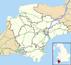
 North Tawton
North Tawton shown within DevonPopulation 1,752 (FHSA 2005) OS grid reference SX664017 District West Devon Shire county Devon Region South West Country England Sovereign state United Kingdom Post town NORTH TAWTON Postcode district EX20 Dialling code 01837 82 Police Devon and Cornwall Fire Devon and Somerset Ambulance South Western EU Parliament South West England UK Parliament Devon West and Torridge List of places: UK • England • Devon North Tawton is a small town in Devon, England, situated on the river Taw.
Contents
History
The Romans crossed the River Taw at what is now Newland Mill, a little outside the present town, and established a succession of military camps there over the years. The Roman fort is believed to have had the name Nemetostatio, meaning "The road-station of the sacred groves", and may have been located on the site of an ancient druidic sanctuary. It covered an area of roughly 600 ft (185m) east-west by 390 ft (120m), and was located adjoining the Roman road between Isca Dumnoniorum (Exeter) and Okehampton. In addition, the site of a temporary marching camp has been identified half a mile to the north.[1]


North Tawton station in 1970. By the time of the Domesday survey (1086), there were six farm / manor holdings in what is now North Tawton Parish, including that of Tawton which was the forerunner of the town we know today.
St Peter's Church is first recorded in 1257. Only the tower of the present building dates from that time, with the rest being mostly 14th and 15th century. The tower is on the west and is topped by an oak-shingled spire. There are two aisles with granite arcades and a number of old benchends.[2]

North Tawton station in 1969. North Tawton was already a market town by the end of the 12th century. Agriculture and the woollen industry provided the chief sources of employment for many centuries, but the former has much declined as a source of employment and the latter has gone altogether, the last town woollen mill closing in 1930.
The railway came to North Tawton in 1865. North Tawton railway station (now closed) lies a mile or two outside the town on the line from Exeter to Okehampton which continued on to Plymouth and Cornwall. It closed to through passenger traffic in 1968, although a shuttle service between Okehampton and Exeter continued until 1972.
Other notable buildings
The former town hall (1849) later became a cinema. Broad Hall is a house dated 1680 but it incorporates the remains of a house of the 15th century. Burton Hall is a mid-Victorian villa which was brought here from Norway. Cottles Barton is an Elizabethan manor house one mile south of the town.[3]
Modern day North Tawton
 Map of North Tawton from 1946
The town has become something of a centre for light industry. There are three significant employers in the town: the haulier Gregory Distribution, which grew from a local concern founded in the 1920s and now employs 300 locally, the Taw Valley Creamery--a cheese factory originally built by Express Dairies in 1974, employing over 100, and the pet products wholesaler Vital Pet Products, also employing over 100 people.
The population currently stands at around 1,750.[citation needed] This is small for a "town", but as a former market town North Tawton has retained this title, and is designated a Post Town by the Royal Mail.
There are a number of bus services:
- 315 - Barnstaple to Exeter
- 51/51A - Hatherleigh to Exeter
- 318 - Okehampton
Famous connections
William Budd
The doctor William Budd (1811–1880) was born in the town, son of Samuel Budd, the local surgeon. His researches into the incidence of typhoid during an epidemic in the town led to him establishing that typhoid fever was spread contagiously, and in particular that the infection was excreted and could be contracted by drinking contaminated water. This discovery contributed to national improvements in public health through improved sanitation.
Ted Hughes / Sylvia Plath / Assia Wevill
The poet Ted Hughes (1930–1998) bought a house, Court Green, in North Tawton in 1961 with his then-wife Sylvia Plath (1932–1963), who lived there briefly with him until their separation in December 1962. Ted Hughes moved his partner Assia Wevill into Court Green where Assia helped care for Hughes' and Plath's two children, Frieda and Nicholas. In due course Hughes made North Tawton his permanent home, until his fatal myocardial infarction in a Southwark, London, hospital on 28 October 1998, while undergoing treatment for colon cancer.
"Jam & Jerusalem" / Clatterford
In 2005, North Tawton was chosen as the location for the filming of Jennifer Saunders' BBC television series Jam & Jerusalem. The town represents the fictional Clatterford St Mary. The Church and Town Hall feature prominently in the series, and some of the acting 'extras' for the series were recruited locally.
John Wesley
Wednesday, 4 September, 1765 - I rode on to North Tawton, a village where several of our preachers had preached occasionally. About six I went to the door of our inn; but I had hardly ended the psalm, when a clergyman came, with two or three (by the courtesy of England called) gentlemen. After I had named my text, I said, "There may be some truths which concern some men only; but this concerns all mankind."
The minister cried out, "That is false doctrine, that is predestination."
Then the roar began; to second which they had brought a huntsman with his hounds: but the dogs were wiser than the men; for they could not bring them to make any noise at all. One of the gentlemen supplied their place. He assured us he was such, or none would have suspected it; for his language was as base, foul, and porterly, as ever was heard at Billingsgate. Dog, rascal, puppy, and the like terms, adorned almost every sentence. Finding there was no probability of a quiet hearing, I left him the field, and withdrew to my lodging."[4]
Windfarm Wars
The nearby Den Brook Wind Farm and the residents local to it were featured in a four-part BBC documentary called Windfarm Wars. Broadcast in 2011, the documentary covered the seven years of legal processes involved with the windfarm receiving planning permission.[5][6]
References
- ^ Nemetostatio at Roman-Britain.org
- ^ Pevsner, N. (1952) North Devon. Harmondsworth: Penguin Books; p. 131
- ^ Pevsner, N. (1952) North Devon. Harmondsworth: Penguin Books; p. 78, 131
- ^ "The Journal of the Reverend John Wesley, A.M., Sometime Fellow of Lincoln College, Oxford" (Carlton & Phillips) 1855 (page 218)
- ^ http://www.den-brook.co.uk/about-the-project/windfarm-wars.aspx
- ^ http://www.bbc.co.uk/blogs/tv/2011/05/windfarm-wars.shtml
Alison Baker, David Hoare & Jean Shields, The Book of North Tawton: Celebrating An Ancient Market Town (Halsgrove, 2002, ISBN 1-84114-156-9)
External links
- North Tawton Community Website
- North Tawton page on Devon County Council website
- Photo gallery on BBC website
- North Tawton at the Open Directory Project
Categories:- Towns in Devon
- Roman forts in Devon
- Sylvia Plath


Wikimedia Foundation. 2010.