- Nicoll Highway
-
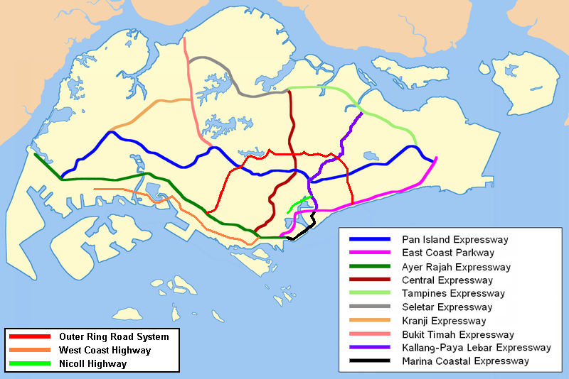
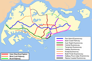 The Nicoll Highway is coloured lime green in this map.
 Nicoll Highway, towards the central business district.
Nicoll Highway (Chinese: 尼诰大道; Malay: Lebuhraya Nicoll) is a major arterial road in Singapore which links Kallang to the city. En route, it passes through the areas of Kallang, Kampong Glam and Marina Centre.
Despite what its name may suggest, the speed limit on the highway is less than that of an expressway. The highway also has traffic light junctions at some of its intersection with roads such as Bras Basah Road and Esplanade Drive, which are not found in expressways.
Contents
History
When the Merdeka Bridge was completed over the Kallang River in 1956, Nicoll Highway formed the vital link between the city centre and the rapidly growing east coast. Nicoll Highway's role is now taken over by the Benjamin Sheares Bridge on the East Coast Parkway.The highway was named after Sir John Fearns Nicoll, Governor of the Colony from 1952 to 1955.
Nicoll Highway collapse
Main article: Nicoll Highway collapseAt approximately 3:30 p.m. Singapore Time (UTC+8:00) on April 20, 2004, a section of Nicoll Highway between Ophir Road and Merdeka Bridge collapsed, due to the failure of the retaining wall of the Circle Line tunnel below it. This section of the road to be closed for several months for repairs. All bus services going through that sector of Nicoll Highway had to be redirected. The road was re-opened in December later that year.
Landmarks
Some landmarks that can be seen along the road are:
- Civilian War Memorial
- Golden Mile Complex
- Golden Mile Tower
- Merdeka Bridge
- National Stadium
- One Raffles Link
- People's Association
- Shaw Tower
- Suntec City
- The Concourse
- The Gateway
- War Memorial Park
Interchange along Nicoll Highway
Interchange with1 Type Remarks Name of interchange KPE, Sims Way, Guillemard Road and Mountbatten Road Box Start of Nicoll Highway leading westbound; end of Nicoll Highway leading eastbound - Stadium Road and links from Stadium Drive 3-way - - Stadium Road Flyover - Merdaka Bridge Crawford Road and Republic Avenue Flyover - Merdaka Bridge Java Road 3-way There is also a 3-way link from Republic Avenue - Ophir Road Flyover Ophir Road travels southbound only Ophir Flyover Rochor Road Flyover Rochor Road travels northbound only Rochor Flyover Middle Road 3-way - - Raffles Boulevard and Bras Basah Road Box Raffles Boulevard and Bras Basah Road travels eastbound only - Raffles Avenue, Esplanade Drive and Stamford Road Box Raffles Avenue and Stamford Road travels westbound only; Start of ORRS going northbound; end of ORRS going southbound - ^Note 1 : Road names are ordered in the clockwise fashion starting from the top.
See also
References
- Norman Edwards, Peter Keys (1996), Singapore - A Guide to Buildings, Streets, Places, Times Books International, ISBN 9971-65-231-5
- Victor R Savage, Brenda S A Yeoh (2003), Toponymics - A Study of Singapore Street Names, Eastern Universities Press, ISBN 981-210-205-1
Expressways and semi-expressways of Singapore Expressways Ayer Rajah Expressway · Bukit Timah Expressway · Central Expressway · East Coast Parkway · Kallang–Paya Lebar Expressway · Kranji Expressway · Marina Coastal Expressway (U/C) · North–South Expressway (planned) · Pan Island Expressway · Seletar Expressway · Tampines Expressway
Semi-expressways Major roads in Singapore Alexandra Road · Ang Mo Kio Avenue 6 · Balestier Road · Bartley Road · Beach Road · Boundary Road · Bras Basah Road · Bukit Batok Road · Bukit Panjang Road · Bukit Timah Road · Changi Road · Choa Chu Kang Road · Clementi Road · Commonwealth Avenue · Dunearn Road · East Coast Road · Eu Tong Sen Street · Geylang Road · Holland Road · Jalan Ahmad Ibrahim · Jalan Besar · Jalan Boon Lay · Jalan Bukit Merah · Jalan Kayu · Jurong Island Highway · Jurong Road · Jurong West Avenue 2 · Kallang Bahru · Kallang Road · Kallang Way · Lentor Avenue · Lim Chu Kang Road · Lorong Chuan · Loyang Avenue · Mandai Road · Marine Parade Road · New Bridge Road · New Upper Changi Road · Nicoll Highway · North Bridge Road · Orchard Road · Outer Ring Road System · Pasir Panjang Road · Pasir Ris Drive 3 · Paya Lebar Road · Punggol Road · Queensway · River Valley Road · Robinson Road · Scotts Road · Sembawang Road · Serangoon Road · Shenton Way · Simei Avenue · Sims Avenue · South Bridge Road · Sungei Road · Tampines Avenue 5 · Tampines Road · Telok Blangah Road · Thomson Road · Upper Changi Road East · Victoria Street · West Coast Road · West Coast Highway · Woodlands Road · Woodlands Avenue 3 · Yishun Avenue 2 · Yio Chu Kang Road
 Categories:
- Roads in Singapore
- Downtown Core (Singapore)
- Kallang

Wikimedia Foundation. 2010.