- Lysakerelven (station)
Infobox T-bane station
name = Lysakerelven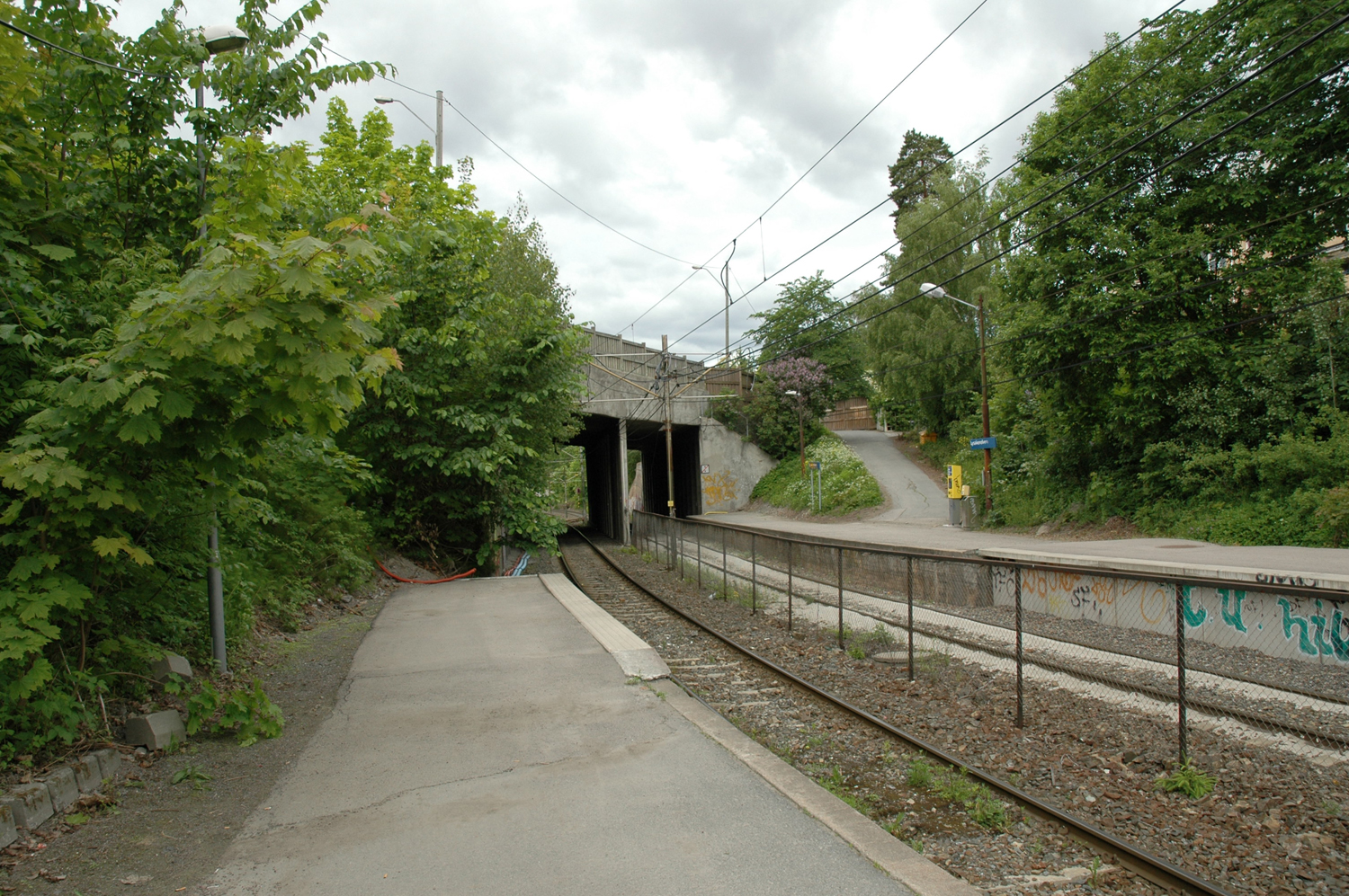
caption =
locale =Ullern
municipality =Oslo
line =Kolsås Line
distance = 8.4 km
elevation =
coordinates = coor dec|59.92599031871472|10.63103199005127
start =June 15 ,1942
type = At-grade
line1 =
line2 =
line3 =
line4 =
line5 =
line6 = yes
train =
flytoget =
tram =
bus =|Lysakerelven is a former station in western Oslo on the
Kolsås Line of theOslo T-bane network, between the stations of Bjørnsletta and Jar, 8.4 km fromStortinget . It was the last station within Oslo's boundaries before the line continues intoBærum ; taking its name from the river "Lysakerelven " that is the boundary between Oslo and Bærum.The station was opened on
June 15 1942 [cite web |url=http://www.sporveien.no/templates/Page____1033.aspx |author=Oslo Sporveier |title=Subway stations in the west] . Along with most of the line, Lysakerelven closed for upgrades sinceJuly 1 2006 and is service is temporarily provided bybus line 43 [cite web |url=http://www.sporveien.no/templates/page____1150.aspx |title=Bus replacing the Kolsås line |author=Oslo Sporveier |language=Norwegian |date=2006] .The future status of Kolsåsbanen has been debated, and one suggestion which was made was to end the line's subway service in Bærum entirely and replace it with
tram s, making Lysakerelven the end station. This option proved unpopular with passengers. [cite web |url=http://www.budstikka.no/sec_nyheter/article4428.ece |title=Kolsåsbanen stanser 1. juli (Kolsåsbanen closes July 1) |author=Asker og Bærums Budstikke |date=2005-11-03 |language=Norwegian] Instead Lysakerelven and Bjørnsletta will be merged into a new station located between them that will take the name of Bjørnsletta.References
Wikimedia Foundation. 2010.