- National Capital Region (Canada)
-
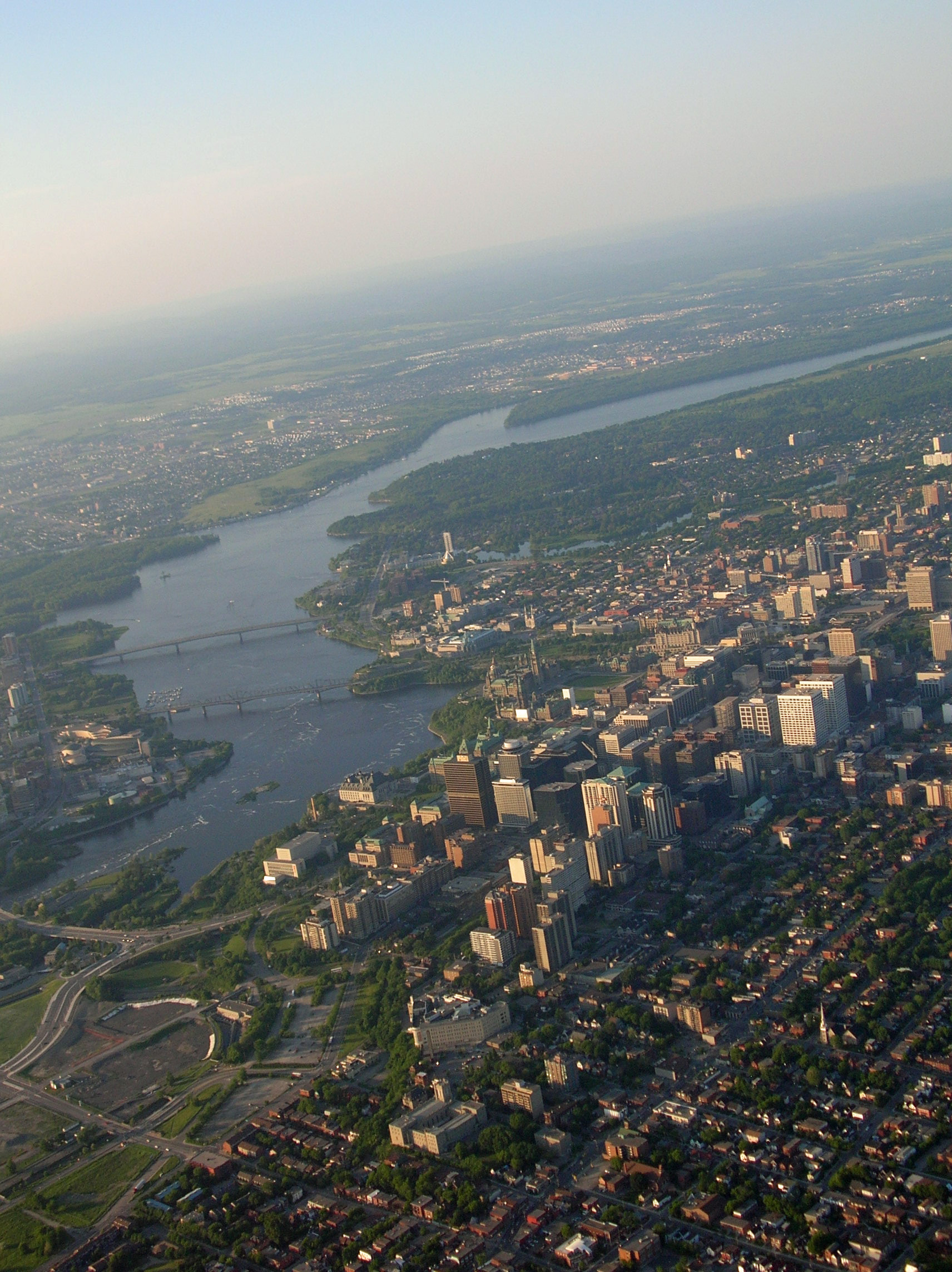
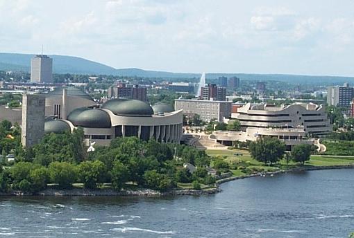
National Capital Region — Metropolitan area — In view from left to right: Gatineau the Ottawa River and Downtown Ottawa
Coordinates: 45°25′15″N 75°41′24″W / 45.42083°N 75.69°WCoordinates: 45°25′15″N 75°41′24″W / 45.42083°N 75.69°W Country  Canada
Province  Ontario
 Quebec
Elevation 70 - 556 m (230 - 1,825 ft) Population [1][2] - Metro 1,451,415 - CMA 1,130,761 Time zone EST (UTC-5) - Summer (DST) EDT (UTC-4) Area code(s) 613, 819, 343[3] The National Capital Region, also referred to as Canada's Capital Region, is an official federal designation for the Canadian capital of Ottawa, Ontario, the neighbouring city of Gatineau, Quebec, and surrounding urban and rural communities.[4]
Defined by the National Capital Act, the National Capital Region consists of an area of 4,715 km2 (1,820 sq mi) that straddles the Ottawa River,[4] which serves as the boundary between the provinces of Ontario and Quebec. This area is smaller than that of the Ottawa-Gatineau Census Metropolitan Area (CMA), which is 5,716 km2 (2,207 sq mi) in size.[2]
Ottawa-Gatineau is the only CMA in the nation to fall within two provinces.The National Capital Region also refers a larger geographic area surrounding Ottawa and Gatineau.
In addition to the Ottawa-Gatineau CMA, this larger area includes municipalities in the bordering Ontario counties of Prescott-Russell, Stormont-Dundas and Glengarry, Leeds-Grenville, Lanark, and Renfrew, as well as municipalities in Quebec's Outaouais region, due to their close economic and social ties with Ottawa.
When all these municipalities are added, the population of the National Capital Region is 1,451,415.[1]
Contents
History
The first settlement in the region was led by Philemon Wright, a New Englander from Woburn, Massachusetts who, on March 7, 1800, arrived with his own and five other families along with twenty-five labourers to start an agricultural community on the north bank of the Ottawa River (Hull, Quebec) at the portage to the Chaudière Falls.[5]
Geography
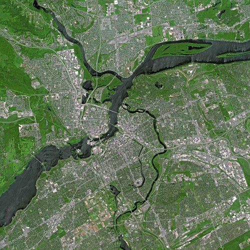
Further information: Geography of Ottawa National Capital Region by Satellite in 2003
Ottawa is located in the sub-region of Southern Ontario called Eastern Ontario. Gatineau is located in southwestern Quebec. It is situated close to where the Canadian shield and the Saint Lawrence Lowlands intersect. The area has several major fault lines[6] and small earthquakes do occur somewhat regularly, including the 2010 Central Canada earthquake that occurred in Quebec. The Gatineau Hills are the foothills of the Laurentian Mountains and located in the region. They supply great skiing and snowboarding opportunities within minutes of the city.
National Capital Commission
[Hide] [Help with translations!] The National Capital Commission (NCC) is a corporation that was established by the federal government in 1959 to oversee federal buildings and land in the federally designated National Capital Region (NCR).[7] Although the NCR is not a separate political jurisdiction, the NCC has a mandate and mission to build the NCR into a source of pride and unity for Canadians[7] through involvement in political, cultural, and land use planning matters that are typically powers reserved for the provincial government under the Constitution of Canada. In the Supreme Court of Canada case of Munro v. National Capital Commission, it was decided the NCC had the power to be involved in matters relating to zoning in the NCR.
In 2006, the NCC completed work on the long-discussed Confederation Boulevard, a ceremonial route linking key attractions in the NCR on both sides of the Ottawa River.[8]
Attractions
Further information: List of attractions in Ottawa Bluesfest in LeBreton Flats Ottawa.
 Scotiabank Place in West Ottawa.
The NCR has numerous attractions, including world famous festivals, national museums, famous buildings and architecture, sports and entertainment. Ottawa has some of the best examples of Gothic Revival architecture in North America.
Festivals
The annual music festival Bluesfest, the world renowned winter festival Winterlude,[9] the Canadian Tulip Festival,[10] Capital Pride, RCMP musical ride,[11] Gatineau Hot Air Balloon Festival, Buskers festival, the biggest Canada Day[12] celebrations in the Nation.
Built heritage
Ottawa and Gatineau have a number of national museums. The most prominent museums are the Canadian Museum of Civilization, Canadian War Museum, Canadian Museum of Nature, Canada Science and Technology Museum, National Art Gallery, National Arts Centre, Canada Aviation Museum.
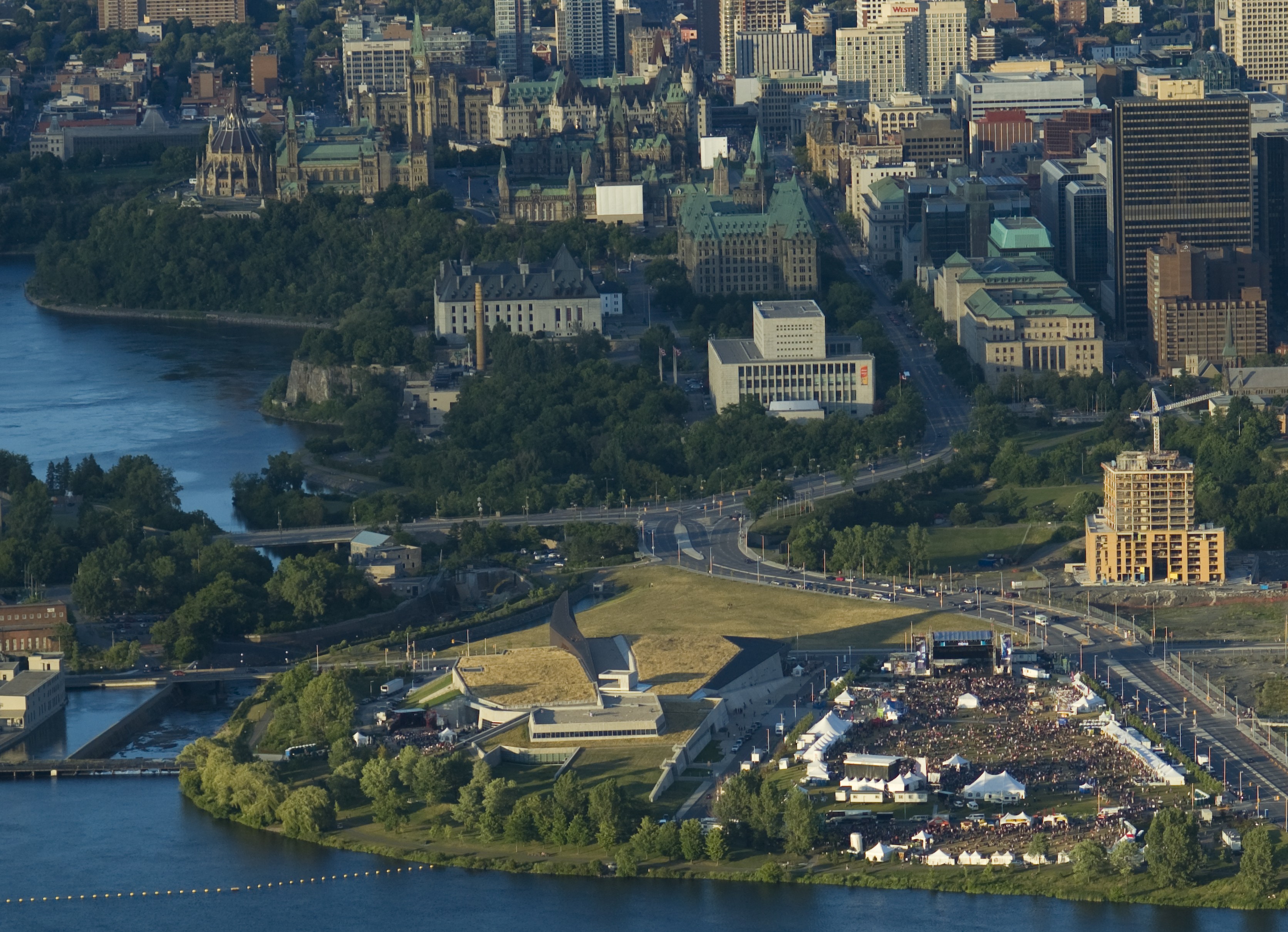
Some of the region's most famous buildings are the Parliament Hill, the Prime Minister's home 24 Sussex Drive, the Governor General's home Rideau Hall, the Canadian Museum of Civilization, the National Gallery of Canada, the Supreme Court of Canada, the Royal Canadian Mint, the American Embassy and the National Library.
There are 29 National Historic Sites of Canada within the National Capital Region: 25 sites are located in Ottawa, with the Former Almonte Post Office and Rosamond Woollen Mill in Almonte, the Gillies Grove and House in Arnprior, the Manoir Papineau in Montebello and the Symmes Hotel in the Aylmer sector of Gatineau.[13]
Sports and entertainment
The National Capital Region has many sports teams. The Ottawa Senators of the National Hockey League play in Ottawa's west end. Ottawa is also home to a successful Ontario Hockey League club, the Ottawa 67's. Gatineau is home to the 2007-2008 QMJHL champions, the Gatineau Olympiques.
The Ottawa area has two universities, Carleton University and the University of Ottawa, which compete in Canadian Interuniversity Sport. The Carleton Ravens are nationally ranked #1 in basketball, and the Ottawa Gee-Gees are nationally-ranked in football and basketball. Algonquin College has also won numerous national championships.
Transportation
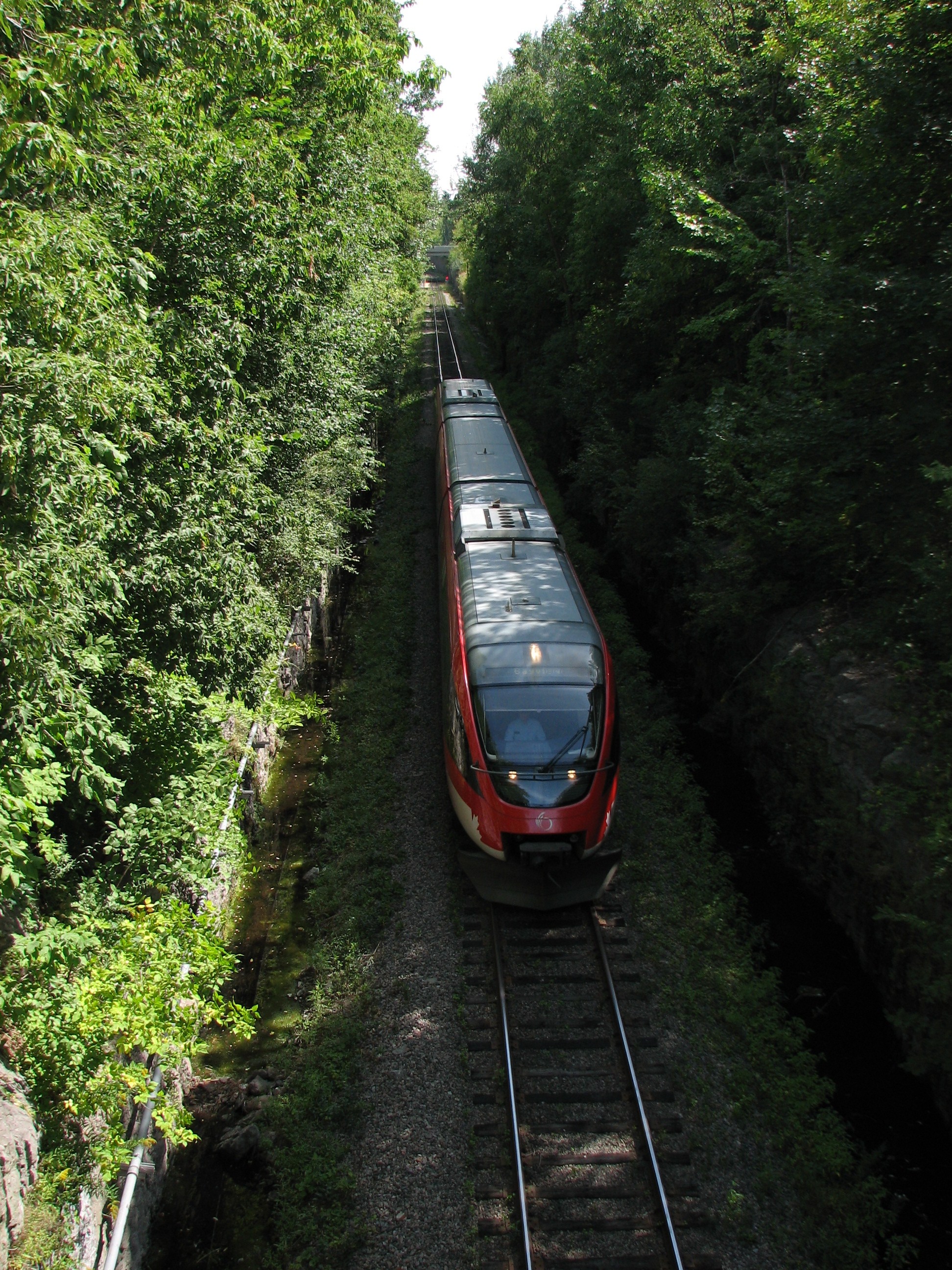
 Ottawa's O-Train
The NCR has several major freeways including the 417, 416, 5, 50, 174, 7, and the Ottawa River Parkway.
The 417 is Ottawa's major east-west commuter expressway. It begins at the Ontario-Quebec border (continuing the route of Quebec Autoroute 40), reaches the urban portion of Ottawa at the 417-174 split, bisects the urban area, and continues westward to just beyond the city boundary where it gives way to Highway 17 in Renfrew County.
The 416 starts at the 401 near the Ogdensburg-Prescott International Bridge and continues north for 75 km until it ends at the 417 in Ottawa's west end.
The freeway section of Highway 7 branches off the 417 in Ottawa's west end near Stittsville and is currently undergoing a 4-lane expansion to reach the eastern fringe of Carleton Place at McNeely Avenue. As of July 2011, the expansion was complete through to Ashton Station Road.
Public transportation is handled by OC Transpo on the Ontario side, and the STO on the Quebec side. Together they serve a population over 1,130,761 and have an estimated annual ridership of over 113.2 million.[14][15]
OC Transpo operates a Light Rail Transit (LRT) system named the O-Train, which is still in the development stages. The system uses Bombardier Talent Trains and has just over 2 million riders per year.[16] A massive LRT expansion is currently in development to link the western suburbs and the eastern suburbs to downtown, as well as to continue southward expansion.
OC Transpo has about 1,050 buses which run on city streets and an expansive Transitway. The STO has around 300 buses that serve the Quebec side of the Ottawa River, some routes crossing into downtown Ottawa.
Ottawa Macdonald-Cartier International Airport is the main international airport serving the Capital Region. It handled over 4.2 million passengers in 2009, making it Canada's 6th busiest air facility and the 2nd busiest airport in Ontario. It offers non-stop flights to and from Canada, the United States, Caribbean and Europe. It is part of the three busiest air routes in the nation, with hourly flights to/from Montreal-Pierre Elliott Trudeau International Airport and Toronto Pearson International Airport.
Area codes
The NCR uses the area codes 613 and 343 on the Ontario side of the Ottawa River, and 819 for the Quebec side.[17] A new area code, 873 overlaying area code 819 on the Quebec side, is set to begin operating in 2012.[18]
Although located in different area codes, Ottawa and Gatineau have local dialing with each other. Previously, the two cities had exchange protection in place, meaning that a local exchange code in Ottawa could not also be assigned in Gatineau, although this is no longer the case as ten-digit local dialing has been in place since 2006.
Media
Main article: Media of Ottawa-GatineauThere are three main daily local newspapers printed in Ottawa: two English newspapers, the Ottawa Citizen and the Ottawa Sun, with 900,197 and 274,628 weekly circulation respectively, and one French newspaper, Le Droit with 215,579 weekly circulation.[19]
Language
Most of the National Capital Region is recognized as a bilingual region for federal language-of-work purposes.[20].
In addition, the City of Ottawa has a Bilingualism Policy, but is not declared "officially bilingual" (which would require amendments to the provincial law). About 19 % of the population of the City of Ottawa has French as their first language, while 40 % of the total population of the city declares itself fluent in both languages.
Demographics
The National Capital Region includes the English-speaking (Ottawa) and French-speaking (Gatineau) cores. The metro region has a bilingual population of 496,025, an English-only population of 507,175, and a French-only population of 102,375.[21]
Ottawa-Gatineau CMA
Source: 2006 Census of Canada[2]
 Downtown Ottawa.
 Hull sector of Gatineau.
City or Town Population Ontario Clarence-Rockland 20,790 Ottawa 812,129 Russell 13,883 Quebec Cantley 7,926 Chelsea 6,703 Denholm 604 Gatineau 242,124 La Pêche 7,477 L'Ange-Gardien 4,348 Pontiac 5,238 Val-des-Monts 9,539 Other municipalities within National Capital Region
Municipality Population Ontario Alfred and Plantagenet 8,654 Arnprior 7,158 Beckwith 6,387 Carleton Place 9,453 Casselman 3,294 Mississippi Mills 11,734 North Dundas 11,095 North Grenville 14,198 North Stormont 6,769 The Nation 10,643 Quebec Lochaber 456 Lochaber-Partie-Ouest 477 Low 852 Montebello 1,039 Notre-Dame-de-la-Salette 706 Papineauville 2,247 Plaisance 1,004 Thurso 2,436 Capital district proposals
Proposals have sometimes been made to separate the National Capital Region from its two respective provinces, and transform it into a separate capital district, like the District of Columbia in the United States or the Australian Capital Territory. Such proposals have never come close to passage, and there does not currently appear to be any political will or necessity to pursue this option.
See also
References
- ^ a b "Ottawa Population". Ottawakiosk.com. 2008-09-10. http://www.ottawakiosk.com/population.html. Retrieved 2010-10-03.
- ^ a b c Statistics Canada (2008-11-05). "Population and dwelling counts, for Canada, census metropolitan areas, census agglomerations and census subdivisions (municipalities), 2006 and 2001 censuses - 100% data (Ottawa–Gatineau CMA)". http://www12.statcan.ca/english/census06/data/popdwell/Table.cfm?T=203&CMA=505&S=0&O=A&RPP=25. Retrieved 2010-10-02.
- ^ "Telecom Decision CRTC 2008-89". Crtc.gc.ca. 2008-09-10. http://www.crtc.gc.ca/eng/archive/2008/dt2008-89.htm. Retrieved 2010-08-20.
- ^ a b "About Canada's Capital". National Capital Commission. 2010-07-10. http://www.canadascapital.gc.ca/bins/ncc_web_content_page.asp?cid=16297-24515&lang=1. Retrieved 2010-11-06.
- ^ Keshen, Jeff; Nicole St-Onge (2001), Ottawa--making a capital, University of Ottawa Press, ISBN 9780776605210, http://books.google.com/books?id=_Q9Bb4EiAyoC&pg=PP1
- ^ "Urban Geology of the National Capital Area - Bedrock topography". Gsc.nrcan.gc.ca. 2009-04-14. http://gsc.nrcan.gc.ca/urbgeo/natcap/bed_topo_e.php. Retrieved 2010-08-20.
- ^ a b "About the NCC". National Capital Commission. 2009-02-24. http://www.canadascapital.gc.ca/bins/ncc_web_content_page.asp?cid=16302&lang=1. Retrieved 2010-11-06.
- ^ "Confederation Boulevard, National Capital Commission Web site". http://www.canadascapital.gc.ca/bins/ncc_web_content_page.asp?cid=16300-20444-20505&lang=1. Retrieved 2008-02-11.
- ^ "Winterlude - National Capital Commission ::". Canadascapital.gc.ca. 2010-08-11. http://www.canadascapital.gc.ca/bins/ncc_web_content_page.asp?cid=16297-16298-22877&lang=1&bhcp=1. Retrieved 2010-08-20.
- ^ Wednesday, 10 February 2010 13:49 (2010-02-10). "The Canadian Tulip Festival |". Tulipfestival.ca. http://www.tulipfestival.ca/. Retrieved 2010-08-20.
- ^ "RCMP Musical Ride". Rcmp-grc.gc.ca. 2007-04-18. http://www.rcmp-grc.gc.ca/mr-ce/index-eng.htm. Retrieved 2010-08-20.
- ^ "Celebrate Canada Day in Canada's Capital Region (Ottawa - Gatineau)". Canadascapital.gc.ca. http://www.canadascapital.gc.ca/bins/ncc_web_content_page.asp?cid=16297-16298-22876&lang=1&utm_source=ncc&utm_medium=cpc&utm_content=FR&utm_campaign=homeLink. Retrieved 2010-08-20.
- ^ "Directory of Designations of National Historic Significance of Canada". Parks Canada, Directory of Designations of National Historic Significance of Canada. 2008-10-10. http://www.pc.gc.ca/apps/lhn-nhs/page3_E.asp?locateinp=Ottawa&nhsprov=allprov&nhschoice=nhsdesig&list4=Generate+List. Retrieved 2011-06-08.
- ^ [1][dead link]
- ^ i4 Design. "STO - About the STO". Sto.ca. http://www.sto.ca/a_propos/donnees_statistiques_e.html. Retrieved 2010-08-20.
- ^ "Light Rail Rapid Transit". octranspo1.com. 2010. http://www.octranspo.com/train_menue.htm. Retrieved 2010-08-20.
- ^ "Hey, Ottawa, we've got your number: 343". .canada.com. 2008-01-10. http://www2.canada.com/ottawacitizen/news/story.html?id=2b91bada-4613-47c3-991c-7c78afffbca3. Retrieved 2010-08-20.
- ^ http://www.cbc.ca/news/canada/ottawa/story/2011/07/20/ottawa-areacode-819.html
- ^ "Microsoft Word - 08CIRC DATA Report draft.doc" (PDF). http://www.cna-acj.ca/en/system/files/CircDataReport08.pdf. Retrieved 2010-08-20.
- ^ Treasury Board of Canada Secretariat. "List of Bilingual Regions of Canada for Language-of-Work Purposes". http://www.tbs-sct.gc.ca/pubs_pol/hrpubs/OffLang/chap5_1-1-eng.asp. Retrieved 2009-07-19.
- ^ Statistics Canada (2010-02-05). "2006 Community Profiles - Ottawa–Gatineau (Census metropolitan area)". http://www12.statcan.ca/census-recensement/2006/dp-pd/prof/92-591/details/page.cfm?Lang=E&Geo1=CMA&Code1=505__&Geo2=PR&Code2=35&Data=Count&SearchText=ottawa&SearchType=Begins&SearchPR=01&B1=All&Custom=. Retrieved 2010-11-06.
External links
- National Capital Commission - Commission de la capitale nationale
- Canadian War Museum
- Canadian Museum of Civilization
Census metropolitan areas (CMAs) in Canada by size Toronto, ON · Montreal, QC · Vancouver, BC · Ottawa, ON · Calgary, AB · Edmonton, AB · Quebec City, QC · Winnipeg, MB · Hamilton, ON · London, ON · Cambridge-Kitchener-Waterloo, ON · St. Catharines-Niagara, ON · Halifax, NS · Oshawa, ON · Victoria, BC · Windsor, ON · Saskatoon, SK · Regina, SK · Sherbrooke, QC · St. John's, NL · Barrie, ON · Kelowna, BC · Abbotsford, BC · Greater Sudbury, ON · Kingston, ON · Saguenay, QC · Trois-Rivières, QC · Guelph, ON · Moncton, NB · Brantford, ON · Thunder Bay, ON · Saint John, NB · Peterborough, ON
Categories:- National Capital Region (Canada)
- Metropolitan areas of Canada
- Geographic regions of Ontario
- Regions of Quebec
- Divided regions


Wikimedia Foundation. 2010.