- Lake Der-Chantecoq
-
Lake Der-Chantecoq
Lac du Der-Chantecoq
Location Champagne-Ardenne Coordinates 48°34′57″N 4°45′33″E / 48.5825°N 4.75917°ECoordinates: 48°34′57″N 4°45′33″E / 48.5825°N 4.75917°E Lake type artificial lake Primary inflows River Marne Primary outflows River Marne Catchment area 2,900 km² Basin countries France Surface area 48 km² Max. depth 15 m Water volume 350 hm³ Settlements Sainte-Marie-du-Lac-Nuisement, Giffaumont-Champaubert Lake Der-Chantecoq (French: Lac du Der-Chantecoq) is situated close to the commune of Saint-Dizier in the departments of Marne and Haute-Marne. It is the largest artificial lake in Western Europe, covering 48 km² with 350 million m³ of water. The lake is named after the Der plain, in which it is located, and the submerged village Chantecoq.
The lake is fed by a 12 km long canal that branches off the river Marne in Saint-Dizier. The outflow of the lake is a canal that joins the Marne in Arrigny, 20 km downstream of Saint-Dizier. The lake is located in the communes (clockwise starting from the north) Sainte-Marie-du-Lac-Nuisement, Éclaron-Braucourt-Sainte-Livière, Giffaumont-Champaubert, Arrigny, Larzicourt and Écollemont.
Contents
History
It was created in 1974 to hold the water of the River Marne so that flooding of the Seine at Paris would stop. It is managed by Les Grands Lacs de Seine. Its construction required the destruction of three villages; Chantecoq (Marne), Champaubert-aux-Bois et Nuisement-aux-Bois.
Today, many water sports are popular here, including sailing, water skiing, jet-ski, wind surfing, fishing, rowing etc. as well as walking, rollerblading and cycling around its edges.[1]
Flora and fauna
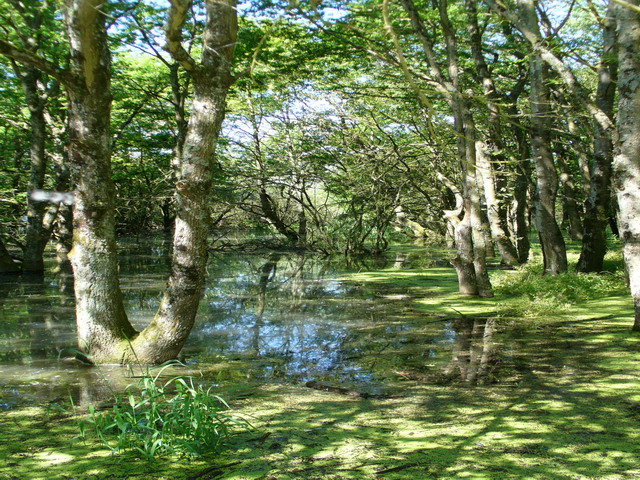
The combination of deep water, islands, and freshwater marshes make the area ideal for waterfowl, most notably the common crane. Each spring and autumn, tens of thousands of cranes assemble here in their migration between wintering grounds to the south and breeding sites in northern Europe. Other birds recorded in the area include white-tailed eagle, great egret, and various geese, ducks, loons (divers), and grebes. The surrounding area is rural, a region of farmland and forest.[2]
-

Lake Der-Chantecoq
-

A church at Châtillon-sur-Broué
-

A house at Châtillon-sur-Broué
References
- ^ "Institution Interdépartementale des Barrages-Réservoirs du Bassin de la Seine". http://www.iibrbs.fr/lacs/lac.htm. Retrieved 13 September 2009.[dead link]
- ^ Couzens, Dominic (2008). Top 100 Birding Sites of the World. University of California Press. pp. 25–26. ISBN 978-0-520-25932-4.
External links
- Lac du Der en Champagne
- (French) Yaughting Club du Der
- (French) Club Nautique
Categories:- Lakes of Champagne-Ardenne
- Haute-Marne
-


Wikimedia Foundation. 2010.