- Cookridge
-
 The Dale Parks from Moseley Wood area
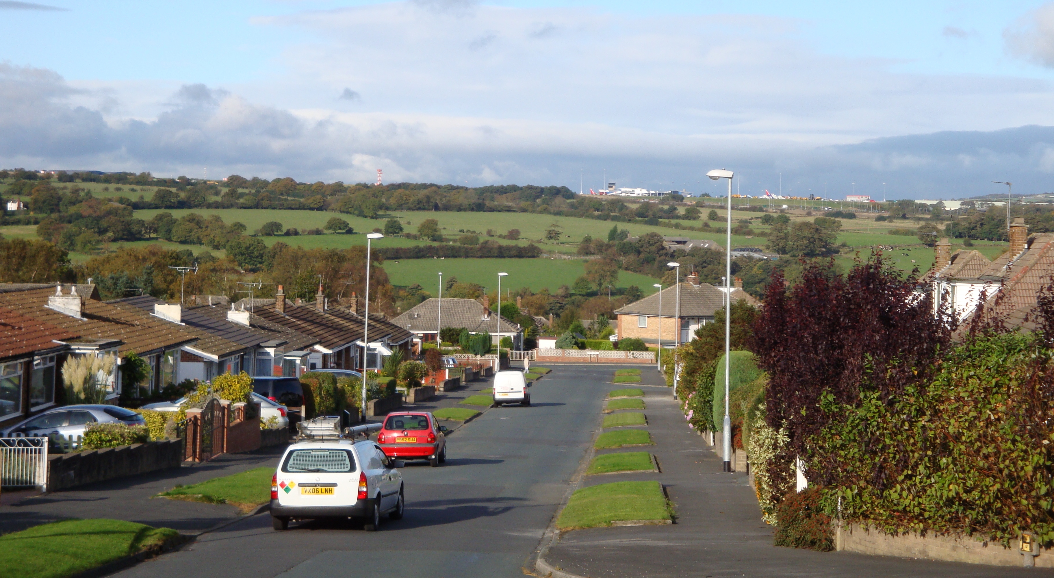
 Wrenbury Crescent looking towards the airport
 High point on Otley Old Road, showing Tinshill Water Tower (left) Cookridge Fire Station (centre) and the Tinshill BT Tower (right)
 Cookridge Hall. The building on the left is the former coach house, now the golf clubhouse
Cookridge is a suburb of north-west Leeds, West Yorkshire, England. It is a mixture of suburban, twentieth-century private housing and a very small amount of council housing bordering Tinshill. It is in the Adel and Wharfedale ward of City of Leeds metropolitan district, and the Leeds North West parliamentary constituency. Before 2004 there was a Cookridge ward; it was proposed that the present ward be called Cookridge and Wharfedale, but this was rejected and parts of the Cookridge ward were moved to other wards.[1] The southern part of the former Cookridge ward is Tinshill, and there is some crossover with names of institutions.
Nearby places include Adel, Holt Park, Tinshill, Horsforth, Bramhope, Moor Grange and Ireland Wood.
Contents
History and buildings
In 1715 Ralph Thoresby described it as a village four miles from Leeds and three from Otley, dating from 1540 and once part of the possessions of Kirkstall Abbey.[2] Thoresby noted traces of a Roman road and the interesting paths which had been created in the adjacent Moseley Wood.[2][3]
The Cookridge Estate was bought by Richard Wormald in 1820 and sold in portions by his descendant Francis Wormald in the 1920s.[4] In 1926 Cookridge became part of Leeds, and from 1927 the houses of Cookridge Village began to be built. This was largely under the direction of architect Cecil Crowther and his builder brothers, taking advantage of subsidies from the Housing Acts of 1923-1925. Mavis Lane and Mavis Avenue are named after Cecil Crowther's daughter.[4] Crowther acted as estate agent and produced a 1930 brochure entitled Cookridge - Village of Youth extolling its virtues for newly-weds.[5] This included a map showing 135 plots of an area largely bounded by Cookridge Lane to the east, Moseley Wood Lane to the south, and Cookridge Avenue to the north-west. There were six firms of builders, with different styles.[4]
In the 1950s and 1960s Moseley Wood was developed into a large private housing estate. In the 1970s further land between Tinshill Road and Green Lane was developed to create the areas known locally as 'The Dale Parks'.
Cookridge Hall is a Grade II listed building, dating from the 17th century which was formerly a country house and in 1997 was opened by the Lord Mayor of Leeds as a leisure club with a golf course.[6]
The water-tower was built in 1929 to supply Cookridge village[4] on one of the highest points in Leeds at 192m (630 feet)[7] above sea level. Near the water-tower is Tinshill BT Tower (also known as Cookridge Tower), a prominent landmark.
Sports
Cookridge has three sports clubs: Cookridge Cricket Club ,[8] Cookridge Hall Golf Club ,[9] and Old Modernians Sports Club [10] which has football, rugby and cricket teams of varying standards.
Cookridge Hospital
Cookridge Hospital specialised in the treatment of cancer but these facilities have been transferred to the new St James's Oncology Unit (Bexley Wing) of Leeds Teaching Hospitals NHS Trust.[11] The main building and the lodge, designed by Norman Shaw in 1868, are Grade II listed building, as is the lodge.
Religion
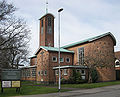
The Church of England parish church is Holy Trinity, a 1961 brick building on Green Lane. Cookridge Methodist Church is a brick building on the junction of Tinshill Road and Otley Old Road.
-
Holy Trinity Church, Cookridge
-

Cookridge Methodist Church
Education
The main primary schools in Cookridge are;
- Holy Trinity Church of England (Aided) Primary School
- Cookridge Primary School[12]
Famous people
Nick Hodgson, drummer for the Kaiser Chiefs.
Location grid

Bramhope Horsforth 
Adel  Cookridge

West Park References
- ^ Report to the Electoral Commission, July 2003 Final recommendations on the future electoral arrangements for Leeds
- ^ a b Ralph Thoresby (1715) Ducatus Leodiensis: or, the topography of the ancient and populous town and parish of Leedes,and parts adjacent in the West Riding of York, pages 157 to 163
- ^ Jack and His Eleven Brothers A web page about Moseley Wood
- ^ a b c d D. Cole (2003) An Early 20th Century Housing Estate in a Yorkshire Parish ISBN 0 9518016 94
- ^ C. H. Crowther (1930) Cookridge - Village of Youth reproduced in the booklet by Cole (above)
- ^ Leodis Cookridge Hall Country Club Opening Ceremony
- ^ http://www.streetmap.co.uk/idld.srf?x=422905&y=441255&z=120&sv=422905,441255&st=4&mapp=idld.srf&searchp=s.srf&dn=763&ax=425500&ay=440500&lm=0
- ^ "Cookridge Cricket Club website". http://cookridge.play-cricket.com/home/home.asp.
- ^ "Cookridge Hall Golf Club website". http://www.cookridgehall.co.uk.
- ^ "Old Modernians Club website". http://www.oldmods.com.
- ^ Leeds Teaching Hospitals NHS Trust (2008-01-14). "End of an era as final services transfer from Cookridge Hospital to brand new £220M cancer centre". http://www.leedsth.nhs.uk/news/newsitem.php?newsID=285. Retrieved 2008-04-07.
- ^ "Cookridge primary school website". http://www.cookridgeprimaryschool.org.uk.
External links
- "The Ancient Parish of Adel". GENUKI. http://www.genuki.org.uk/big/eng/YKS/WRY/Adel/index.html. Retrieved 2007-10-29. Cookridge was in this parish
- Details from listed building database (465864) - Cookridge Hospital. Images of England. English Heritage.
- Details from listed building database (465863) - Cookridge Hospital lodge. Images of England. English Heritage.
- Details from listed building database (466050) - Cookridge Hall. Images of England. English Heritage.
- Cookridge Hall website [1]
Leeds Topics Culture Places List of towns, villages, areas and suburbsGovernment City of Leeds • Leeds City CouncilPeople Categories:- Places in Leeds
-


Wikimedia Foundation. 2010.