- Chilton County, Alabama
-
Chilton County, Alabama 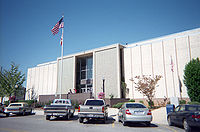 Chilton County Courthouse in Clanton, Alabama
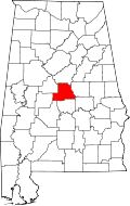
Location in the state of Alabama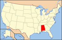
Alabama's location in the U.S.Founded December 30, 1868 Seat Clanton Largest city Clanton Area
- Total
- Land
- Water
700.76 sq mi (1,815 km²)
693.98 sq mi (1,797 km²)
6.78 sq mi (18 km²), (0.97%)Population
- (2010)
- Density
43,643
63/sq mi (24/km²)Chilton County is a county of the U.S. state of Alabama. Its name is in honor of William Parish Chilton, Sr. (1810–1871), a lawyer who became Chief Justice of the Alabama Supreme Court and later represented Montgomery County in the Congress of the Confederate States of America. On February 4, 1861, Chilton gaveled the Confederacy into existence, as acting leader of the Provisional Congress. In 1942, the U.S. Navy commissioned a new vessel, the USS Chilton, in honor of Chilton County. In 2010, the population was 43,643. The county seat is Clanton and it is a prohibition, or dry county.
The center of population of Alabama is located in Chilton County, outside of the town of Jemison, an area known as Jemison Division.[1]
The county is known for its peaches and its unique landscape. It is home to swamps, prairies and mountains due to the foothills of the Appalachians which end in the county, the Coosa River basin, and its proximity to the Black Belt Prairie.
Contents
History
Baker County was established on December 30, 1868, named for Alfred Baker, with its county seat at Grantville. Residents of the county petitioned the Alabama legislature for the renaming of their county, it was not something forced upon them. In 1874, the petitioners accepted the suggestion of Chilton County, even though the Chief Justice had not lived within its boundaries. It is not known when the county seat was moved.
Geography
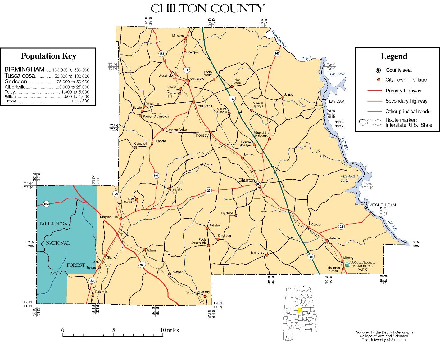
According to the 2000 census, the county has a total area of 700.76 square miles (1,815.0 km2), of which 693.98 square miles (1,797.4 km2) (or 99.03%) is land and 6.78 square miles (17.6 km2) (or 0.97%) is water.[2]
Major highways
 Interstate 65
 U.S. Highway 31
 U.S. Highway 82
 State Route 22
 State Route 139
 State Route 145
 State Route 155
Adjacent counties
- Shelby County (north)
- Coosa County (east)
- Elmore County (southeast)
- Autauga County (south)
- Perry County (southwest)
- Dallas County (southwest)
- Bibb County (northwest)
National protected area
- Talladega National Forest (part)
Demographics
Chilton County, Alabama Year Pop. ±% 1870 6,194 — 1880 10,793 +74.2% 1890 14,549 +34.8% 1900 16,522 +13.6% 1910 23,187 +40.3% 1920 22,770 −1.8% 1930 24,579 +7.9% 1940 27,955 +13.7% 1950 26,922 −3.7% 1960 25,693 −4.6% 1970 25,180 −2.0% 1980 30,612 +21.6% 1990 32,458 +6.0% 2000 39,593 +22.0% 2010 43,643 +10.2% Baker County until 1874
Sources: "American FactFinder". United States Census Bureau. http://factfinder2.census.gov/faces/nav/jsf/pages/index.xhtml. through 19602010
Whereas according to the 2010 U.S. Census Bureau:
- 84.1% White
- 9.7% Black
- 0.4% Native American
- 0.3% Asian
- 0.0% Native Hawaiian or Pacific Islander
- 1.2% Two or more races
- 7.8% Hispanic or Latino (of any race)
2000
At the 2000 census[3], there were 39,593 people, 15,287 households and 11,342 families residing in the county. The population density was 57 per square mile (22/km2). There were 17,651 housing units at an average density of 25 per square mile (10/km2). The racial makeup of the county was 86.71% White, 10.61% Black or African American, 0.28% Native American, 0.18% Asian, 0.02% Pacific Islander, 1.51% from other races, and 0.69% from two or more races. Nearly 2.91% of the population were Hispanic or Latino of any race.
There were 15,287 households of which 34.40% had children under the age of 18 living with them, 60.10% were married couples living together, 10.50% had a female householder with no husband present, and 25.80% were non-families. Nearly 22.90% of all households were made up of individuals, and 10.20% had someone living alone who was 65 years of age or older. The average household size was 2.57, and the average family size was 3.00.
25.70% of the population were under the age of 18, 9.10% from 18 to 24, 29.00% from 25 to 44, 23.40% from 45 to 64, and 12.90% who were 65 years of age or older. The median age was 36 years. For every 100 females there were 97.80 males. For every 100 females age 18 and over, there were 93.90 males.
The median household income was $32,588 and the median family income was $39,505. Males had a median income of $31,006 versus $21,275 for females. The per capita income for the county was $15,303. About 12.60% of families and 15.70% of the population were below the poverty line, including 19.40% of those under age 18 and 18.20% of those age 65 or over.
Settlements
Cities
Towns
Unincorporated communities
- Isabella
- Mountain Creek
- Stanton
See also
- National Register of Historic Places listings in Chilton County, Alabama
- Properties on the Alabama Register of Landmarks and Heritage in Chilton County, Alabama
References
- ^ http://www.census.gov/geo/www/cenpop/statecenters.txt
- ^ "Census 2000 U.S. Gazetteer Files: Counties". United States Census. http://www.census.gov/tiger/tms/gazetteer/county2k.txt. Retrieved 2011-02-13.
- ^ "American FactFinder". United States Census Bureau. http://factfinder.census.gov. Retrieved 2008-01-31.
External links
- Official Site
- Chilton County map of roads/towns (map © 2007 Univ. of Alabama).

Bibb County Shelby County 
Coosa County  Chilton County, Alabama

Perry County Autauga County Elmore County Municipalities and communities of Chilton County, Alabama County seat: Clanton Cities 
Towns Jemison | Maplesville | Thorsby | Verbena
Unincorporated
communitiesMountain Creek | Stanton
Footnotes ‡This populated place also has portions in an adjacent county or counties
Coordinates: 32°50′43″N 86°42′52″W / 32.84528°N 86.71444°W
Categories:- Alabama counties
- Chilton County, Alabama
- Birmingham–Hoover metropolitan area
- 1868 establishments


Wikimedia Foundation. 2010.