- Crystal Brook, South Australia
-
Crystal Brook
South Australia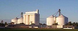
The rising sun catching the Crystal Brook grain silos on a clear winter's morning; the town sports oval in the foreground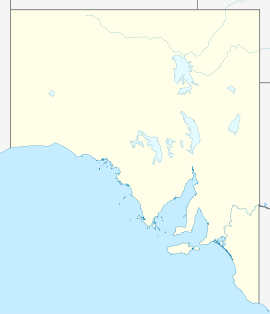
 Crystal Brook
Population: 1,185[1] Postcode: 5523 Coordinates: 33°21′S 138°12′E / 33.35°S 138.2°ECoordinates: 33°21′S 138°12′E / 33.35°S 138.2°E Location: - 197 km (122 mi) N of Adelaide
- 29 km (18 mi) SE of Port Pirie
LGA: Port Pirie Regional Council State District: Frome Federal Division: Grey Crystal Brook is a town in South Australia, named after the spring-fed creek next to which it was founded. It is 197 kilometres (122 mi) north of Adelaide and in 2006 had a population of 1,185.[1]
Crystal Brook is situated on Goyder's Line near the border of two climate systems. While apparently cold semi-arid, the town benefits from a temperate mediterranean climate zone near to the east,[2] making possible slightly more intense farming in the region. To the west and north-west lies some marginal, semi-arid farmland. The local farming community is still able to support many small businesses in the town.
Crystal Brook (or creek) supplied water to the town until 1890 when the Beetaloo Reservoir was completed, which at the time was the largest concrete dam in the southern hemisphere.[3]
The Sydney-Perth and the Adelaide-Darwin railways meet in Crystal Brook at a triangular junction.
Contents
Notable people
- Arthur Percy Sullivan - recipient of the Victoria Cross
- Rob Kerin - Premier of South Australia between 22 October 2001 and 5 March 2002
Crystal Brook Show
The Crystal Brook Show has been held annually since the early 1880's.[4]
Heysen Trail
The town lies on the Heysen Trail, a 1,200 kilometres (746 mi)-long walking trail from Cape Jervis to Parachilna Gorge.
Close to the north-south midpoint of the trail, Crystal Brook marks a change in climate. Hot, dry summers and mild winters lie to the north, and more temperate conditions to the south.[5]
Sport
Crystal Brook's sporting facilities cater for hockey, tennis, golf, lawn bowls, netball, basketball, swimming, gymnasium exercise, junior soccer, horse riding, motor-cross, football and cricket.
In regional competitions the town colours are red and white, with most teams known as 'The Roosters'.
The Crystal Brook Football Club won the Northern Areas (Australian Rules) Football Association premiership for a record 18th time in 2011[6] and the town has twice staged a round of the Australian motor-cross championships.
Broadband
Broadband became available at Crystal Brook on 16 April 2005 after lobbying from residents. Limited fibre backhaul capacity has resulted in Telstra limiting subscriber speeds to ADSL 1 speeds.
References
- ^ a b Australian Bureau of Statistics (25 October 2007). "Crystal Brook (Urban Centre/Locality)". 2006 Census QuickStats. http://www.censusdata.abs.gov.au/ABSNavigation/prenav/LocationSearch?collection=Census&period=2006&areacode=UCL406000&producttype=QuickStats&breadcrumb=PL&action=401. Retrieved 2007-11-18.
- ^ The Köppen climate classification system classifies the Crystal Brook region as BSk, or cold semi-arid, and the bordering region to the east as Csb, or temperate mediterranean
- ^ Beetaloo Reservoir SA Water
- ^ The Maitland Mercury (8 Sep 1883) quotes a Sydney 'Evening News' report that the (South Australian) Governor and Commissioner for Crown Lands departed Adelaide to attend the Crystal Brook Show
- ^ Heysen Trail The South Australian Government's Department for Environment and Heritage (includes a map)
- ^ Northern Areas Football Association List of Premiers from 1909 onwards
External links
- Crystal Brook (at GeoCities) for sporting and community group contacts, gardening tips, walking trails and photo gallery
- Crystal Brook Show (at GeoCities) has a comprehensive list of the show's judging program
Categories:- Towns in South Australia
- Mid North (South Australia)


Wikimedia Foundation. 2010.