- Orkney Springs, Virginia
-
Orkney Springs — Unincorporated community — Location within the Commonwealth of Virginia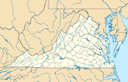
 Orkney Springs
Coordinates: 38°47′43″N 78°48′53″W / 38.79528°N 78.81472°WCoordinates: 38°47′43″N 78°48′53″W / 38.79528°N 78.81472°W Country United States State Virginia County Shenandoah Time zone Eastern (EST) (UTC-5) – Summer (DST) EDT (UTC-4) ZIP codes FIPS code GNIS feature ID Orkney Springs is an unincorporated community in western Shenandoah County, Virginia. The use of the name 'Orkney' is unknown, but believed to be tied to either the Orkney Islands off the coast of Scotland or the Earl of Orkney. The 'Springs' comes from the numerous underground mineral springs in the area. The first public hotel was built in the early 19th century, and eventually evolved into what became known as The Orkney Springs Hotel. Most of the original buildings are still standing, have been restored, and are in use today. The Virginia House is believed to be the largest wooden structure in Virginia. It dates to the 1870s and is on the National Historical Register. The Maryland House dates to the mid-1850s. The Orkney Springs Hotel was owned privately until 1979 when it was purchased by the Episcopal Diocese of Virginia and became part of their retreat center Shrine Mont. It is home to conferences and retreats from March–November, many family reunions, summer camps for children and teenagers, and is also the location of the annual Shenandoah Valley Music Festival. The Cathedral Shrine of the Transfiguration of the Episcopal Diocese of Virginia is also located at Shrine Mont. This outdoor worship space, built of native stone, was built in the 1920s and consecrated in 1925.
External links
Municipalities and communities of Shenandoah County, Virginia Towns Edinburg | Mount Jackson | New Market | Strasburg | Toms Brook | Woodstock

CDPs Unincorporated
communitiesAlonzaville | Bowmans Crossing | Calvary | Carmel | Clary | Columbia Furnace | Conicville | Detrick | Forestville | Hamburg | Hawkinstown | Lebanon Church | Mount Clifton | Oranda | Orkney Springs | Quicksburg | Saint Luke | Saumsville | Wheatfield
Categories:- Unincorporated communities in Virginia
- Populated places in Shenandoah County, Virginia
- Shenandoah Valley, Virginia geography stubs


Wikimedia Foundation. 2010.