- Coosa County, Alabama
-
Coosa County, Alabama 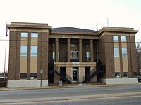 County courthouse in Rockford
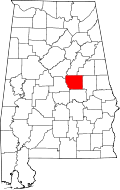
Location in the state of Alabama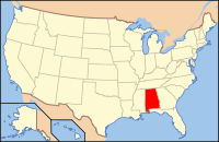
Alabama's location in the U.S.Founded December 18, 1832 Seat Rockford Largest city Goodwater Area
- Total
- Land
- Water
666.36 sq mi (1,726 km²)
652.44 sq mi (1,690 km²)
13.91 sq mi (36 km²), 2.09%Population
- (2010)
- Density
11,539
18/sq mi (6.8/km²)Coosa County is a county of the U.S. state of Alabama. Its name derives from a town of the Creek tribe. As of 2010 the population was 11,539, but since that time it has lost the most population by percentage of any Alabama county. Its county seat is Rockford.
Coosa is part of the Alexander City micropolitan area.
Contents
History
It was established on December 18, 1832.
Geography
According to the 2000 census, the county has a total area of 666.36 square miles (1,725.9 km2), of which 652.44 square miles (1,689.8 km2) (or 97.91%) is land and 13.91 square miles (36.0 km2) (or 2.09%) is water.[1]
Major Highways
 U.S. Highway 231
 U.S. Highway 280
 Alabama State Route 9
 Alabama State Route 22
Adjacent Counties
- Talladega County (north)
- Clay County (northeast)
- Tallapoosa County (east)
- Elmore County (south)
- Chilton County (west)
- Shelby County (northwest)
Demographics
Coosa County, Alabama Year Pop. ±% 1840 6,995 — 1850 14,543 +107.9% 1860 19,273 +32.5% 1870 11,945 −38.0% 1880 15,113 +26.5% 1890 15,906 +5.2% 1900 16,144 +1.5% 1910 16,634 +3.0% 1920 14,839 −10.8% 1930 12,460 −16.0% 1940 13,460 +8.0% 1950 11,766 −12.6% 1960 10,726 −8.8% 1970 10,662 −0.6% 1980 11,377 +6.7% 1990 11,063 −2.8% 2000 12,202 +10.3% 2010 11,539 −5.4% Sources: "American FactFinder". United States Census Bureau. http://factfinder2.census.gov/faces/nav/jsf/pages/index.xhtml. through 1960 From 2000 to 2003, Coosa County's growth rate of -5.8% made it the biggest percentage population loser among the state's 67 counties.[2] Annette Jones Watters of the University of Alabama's Alabama State Data Center cited Coosa as one of eight counties to lose greater than 6% of its population from 2000 to early 2007.[3] As of the census[4] of 2000, there were 12,202 people, 4,682 households, and 3,408 families residing in the county. The population density was 19 people per square mile (7/km2). There were 6,142 housing units at an average density of 9 per square mile (4/km2). The racial makeup of the county was 63.94% White, 34.19% Black or African American, 0.32% Native American, 0.04% Asian, 0.01% Pacific Islander, 0.62% from other races, and 0.88% from two or more races. 1.29% of the population were Hispanic or Latino of any race.
There were 4,682 households out of which 30.00% had children under the age of 18 living with them, 54.80% were married couples living together, 13.50% had a female householder with no husband present, and 27.20% were non-families. 24.30% of all households were made up of individuals and 9.80% had someone living alone who was 65 years of age or older. The average household size was 2.52 and the average family size was 2.98.
In the county the population was spread out with 23.70% under the age of 18, 8.60% from 18 to 24, 29.00% from 25 to 44, 24.30% from 45 to 64, and 14.40% who were 65 years of age or older. The median age was 38 years. For every 100 females there were 104.40 males. For every 100 females age 18 and over, there were 102.50 males.
The median income for a household in the county was $29,873, and the median income for a family was $36,082. Males had a median income of $25,390 versus $18,171 for females. The per capita income for the county was $14,875. About 11.80% of families and 14.90% of the population were below the poverty line, including 19.50% of those under age 18 and 13.40% of those age 65 or over.
Cities and towns
- Equality (part of Equality is in Elmore County)
- Goodwater
- Kellyton
- Rockford
See also
- National Register of Historic Places listings in Coosa County, Alabama
- Properties on the Alabama Register of Landmarks and Heritage in Coosa County, Alabama
References
- ^ "Census 2000 U.S. Gazetteer Files: Counties". United States Census. http://www.census.gov/tiger/tms/gazetteer/county2k.txt. Retrieved 2011-02-13.
- ^ "Population growth - Alabama counties". U.S. Census Bureau, ePodunk. http://www.epodunk.com/top10/countyPop/coPop1.html. Retrieved 2007-05-15.
- ^ "Shelby County Continues to Set the Pace for County Growth; Black Belt Counties Lose Population, According to UA’s State Data Center". University of Alabama. 2007-03-21. http://uanews.ua.edu/anews2007/mar07/growth032107.htm. Retrieved 2007-05-15.[dead link]
- ^ "American FactFinder". United States Census Bureau. http://factfinder.census.gov. Retrieved 2008-01-31.

Shelby County Talladega County Clay County Chilton County 
Tallapoosa County  Coosa County, Alabama

Elmore County Municipalities and communities of Coosa County, Alabama City 
Towns CDP Unincorporated
communityEquality
 State of Alabama
Topics - Index
- History
- Geography
- People
- Delegations
- Government
- Governors
- Lieutenant Governors
- Metropolitan Areas
- Visitor Attractions
- National Historic Landmarks
Regions Metros - Greater Birmingham
- Montgomery Metro Area
- Mobile Metro Area
- Huntsville Metro Area
Larger cities Counties - Autauga
- Baldwin
- Barbour
- Bibb
- Blount
- Bullock
- Butler
- Calhoun
- Chambers
- Cherokee
- Chilton
- Choctaw
- Clarke
- Clay
- Cleburne
- Coffee
- Colbert
- Conecuh
- Coosa
- Covington
- Crenshaw
- Cullman
- Dale
- Dallas
- DeKalb
- Elmore
- Escambia
- Etowah
- Fayette
- Franklin
- Geneva
- Greene
- Hale
- Henry
- Houston
- Jackson
- Jefferson
- Lamar
- Lauderdale
- Lawrence
- Lee
- Limestone
- Lowndes
- Macon
- Madison
- Marengo
- Marion
- Marshall
- Mobile
- Monroe
- Montgomery
- Morgan
- Perry
- Pickens
- Pike
- Randolph
- Russell
- Shelby
- St. Clair
- Sumter
- Talladega
- Tallapoosa
- Tuscaloosa
- Walker
- Washington
- Wilcox
- Winston
Coordinates: 32°56′11″N 86°14′47″W / 32.93639°N 86.24639°W
Categories:- Alabama counties
- Coosa County, Alabama
- Alexander City micropolitan area
- 1832 establishments in the United States
- Populated places established in 1832
- Place names in Alabama of Native American origin


Wikimedia Foundation. 2010.